Birch Wood

Wood, Forest in Staffordshire

England

Birch Wood

Old Milepost by the A454, Paddock Lane, Aldridge Cast iron post by the A454, in parish of Walsall (Walsall District), Paddock Lane, Aldridge town centre, on the verge, on North West side of road. Lathe iron casting, erected by the County Council in the 19th/20th century. 

Inscription reads:-
: ALDRIDGE ¾ / LITTLE - / ASTON 2¾ / WATFORD GAP 4 / TAMWORTH 12 : : ALDRIDGE : : WALSALL 3 :
Maker:-
: Chas. Lathe, Tipton :

Milestone Society National ID: ST_WLTM03.
Old Milepost by the A454, Paddock Lane, Aldridge Credit: Milestone Society

Birch Wood is a charming forest located in Staffordshire, England. This woodland area covers approximately 500 acres and is renowned for its natural beauty and diverse range of flora and fauna. The wood is named after the abundance of birch trees that dominate the landscape, adding to its picturesque appeal.

As visitors enter Birch Wood, they are greeted by a well-maintained network of walking trails, allowing nature enthusiasts and hikers to explore its hidden treasures. The trails meander through the forest, offering glimpses of ancient oaks, beech trees, and an array of wildflowers during the spring and summer months.

The wood is also home to a variety of wildlife, making it a haven for nature lovers. Birdwatchers can spot species such as woodpeckers, warblers, and owls among the treetops, while small mammals like foxes, rabbits, and squirrels scurry about on the forest floor. If lucky, visitors may even come across a roe deer gracefully wandering through the undergrowth.

For those seeking a peaceful retreat, Birch Wood offers several picnic areas and benches, making it an ideal spot for a leisurely lunch surrounded by nature's tranquility. The wood's breathtaking beauty is further enhanced during autumn when the leaves transform into vibrant hues of red, orange, and gold, creating a picturesque scene that enchants visitors.

Birch Wood in Staffordshire truly is a nature lover's paradise. Its idyllic setting, diverse wildlife, and well-maintained trails make it an enchanting place to explore and revel in the wonders of the great outdoors.

If you have any feedback on the listing, please let us know in the comments section below.
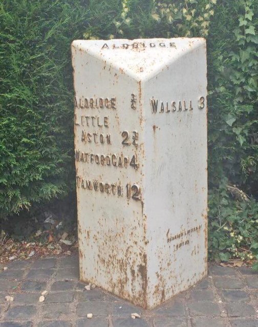
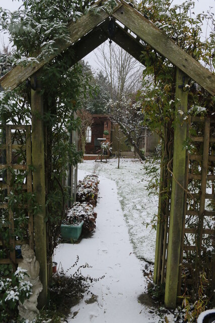
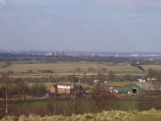
Birch Wood Images

Images are sourced within 2km of 52.5834/-1.9194774 or Grid Reference SP0598. Thanks to Geograph Open Source API. All images are credited.

Old Milepost by the A454, Paddock Lane, Aldridge Cast iron post by the A454, in parish of Walsall (Walsall District), Paddock Lane, Aldridge town centre, on the verge, on North West side of road. Lathe iron casting, erected by the County Council in the 19th/20th century. 

Inscription reads:-
: ALDRIDGE ¾ / LITTLE - / ASTON 2¾ / WATFORD GAP 4 / TAMWORTH 12 : : ALDRIDGE : : WALSALL 3 :
Maker:-
: Chas. Lathe, Tipton :

Milestone Society National ID: ST_WLTM03.
Old Milepost by the A454, Paddock Lane, Aldridge
Cast iron post by the A454, in parish of Walsall (Walsall District), Paddock Lane, Aldridge town centre, on the verge, on North West side of road. Lathe iron casting, erected by the County Council in the 19th/20th century. Inscription reads:- : ALDRIDGE ¾ / LITTLE - / ASTON 2¾ / WATFORD GAP 4 / TAMWORTH 12 : : ALDRIDGE : : WALSALL 3 : Maker:- : Chas. Lathe, Tipton : Milestone Society National ID: ST_WLTM03.
Traffic jam on Birmingham Road Early afternoon heavy traffic queued up on Birmingham Road to join the A454 Walsall Road.
Traffic jam on Birmingham Road
Early afternoon heavy traffic queued up on Birmingham Road to join the A454 Walsall Road.
Aldridge-Brownhills Conservative Party Constituency Offices The offices were opened in 1999 by the then Tory Leader William Hague. The constituency was created in 1974 from elements of the Walsall North and South constituencies. Aldridge is an affluent suburb and Brownhills is a former mining village. From 1979 after boundary changes this has had a solid Tory majority.
Aldridge-Brownhills Conservative Party Constituency Offices
The offices were opened in 1999 by the then Tory Leader William Hague. The constituency was created in 1974 from elements of the Walsall North and South constituencies. Aldridge is an affluent suburb and Brownhills is a former mining village. From 1979 after boundary changes this has had a solid Tory majority.
Gatekeeper butterfly This Gatekeeper butterfly settled on the windowledge for long enough for me to take its photo.
Gatekeeper butterfly
This Gatekeeper butterfly settled on the windowledge for long enough for me to take its photo.
Garden in the snow The first snow of winter 2022 covers the garden.
Garden in the snow
The first snow of winter 2022 covers the garden.
Snowy scene through the garden arch The first of the 2022 winter's snow seen. through the garden arch.
Snowy scene through the garden arch
The first of the 2022 winter's snow seen. through the garden arch.
A snowy garden The top of the garden in the first snow of winter 2022.
A snowy garden
The top of the garden in the first snow of winter 2022.
St Francis of Assisi Catholic Technology College The main secondary school in the area covering a catchment area of Tamworth, Lichfield, Aldridge, Walsall, Great Barr, Sandwell.  <span class="nowrap"><a title="www.stfrancis.cc" rel="nofollow ugc noopener" href="http://www.stfrancis.cc">Link</a><img style="margin-left:2px;" alt="External link" title="External link - shift click to open in new window" src="https://s1.geograph.org.uk/img/external.png" width="10" height="10"/></span>
St Francis of Assisi Catholic Technology College
The main secondary school in the area covering a catchment area of Tamworth, Lichfield, Aldridge, Walsall, Great Barr, Sandwell. LinkExternal link
St Mary Of The Angels (RC) Church, Aldridge
Near Walsall Airport This junction (seen from Longwood Lane) has been improved but that has removed some of the rural character of this area just outside town.
Near Walsall Airport
This junction (seen from Longwood Lane) has been improved but that has removed some of the rural character of this area just outside town.
View towards Pheasey On the horizon you can see Birmingham city centre.
View towards Pheasey
On the horizon you can see Birmingham city centre.
West of Barr Beacon
West of Barr Beacon
Barr Beacon In recent years the Beacon has gained something of an unsavoury reputation, but this evening I took our daughter there for the first time and it was fine: windswept and peaceful. And the views are, of course, superb.
Barr Beacon
In recent years the Beacon has gained something of an unsavoury reputation, but this evening I took our daughter there for the first time and it was fine: windswept and peaceful. And the views are, of course, superb.
View from Barr Beacon The beacon gives extensive views over north Birmingham and surrounding districts. This is looking over toward Walsall
View from Barr Beacon
The beacon gives extensive views over north Birmingham and surrounding districts. This is looking over toward Walsall
Rushall Canal Looking north from the bridge just north of the B4151. The Arboretum golf course is to the left of this stretch of the canal.
Rushall Canal
Looking north from the bridge just north of the B4151. The Arboretum golf course is to the left of this stretch of the canal.
Longwood Junction, Walsall. This is the junction of the Daw End and Rushall Canals showing Rushall top lock.  The spur on the left used to go to Hayhead Lime workings and is now used as moorings for Longwood Narrow Boat Club.
Longwood Junction, Walsall.
This is the junction of the Daw End and Rushall Canals showing Rushall top lock. The spur on the left used to go to Hayhead Lime workings and is now used as moorings for Longwood Narrow Boat Club.
The Three Crowns, Sutton Road, Walsall This is the pub at the top of Three Crowns Hill which replaced a much older one which was on the opposite side of the road.
I would like to add that the pub has now closed and is awaiting conversion (or demolition) to flats.
The Three Crowns, Sutton Road, Walsall
This is the pub at the top of Three Crowns Hill which replaced a much older one which was on the opposite side of the road. I would like to add that the pub has now closed and is awaiting conversion (or demolition) to flats.
Moat Farm, Sutton Road, Walsall. So called because there are the remains of a moat in the farm yard.
Moat Farm, Sutton Road, Walsall.
So called because there are the remains of a moat in the farm yard.
Show me another place!

Birch Wood is located at Grid Ref: SP0598 (Lat: 52.5834, Lng: -1.9194774)

Unitary Authority: Walsall

Police Authority: West Midlands

What 3 Words

///stick.turned.dome. Near Streetly, West Midlands

Nearby Locations

Potter's Wood Birch Wood

Related Wikis

Hay Head Quarry

Hay Head Quarry (grid reference SP048987) is a 5.8 hectares (14 acres) geological site of Special Scientific Interest in the West Midlands. The site was...

Barr Beacon Reservoir

Barr Beacon Reservoir is a covered, hill-top drinking water reservoir at Barr Beacon, Walsall, England, opened in 1899. It is operated by South Staffs...

Barr Beacon

Barr Beacon is a hill on the edge of Walsall, West Midlands, England, very near the border with Birmingham. It gives its name to nearby Great Barr (the...

Walsall Aerodrome

Walsall Aerodrome, also known as Walsall Airport, Walsall Municipal Airport, and later as Walsall Aldridge Airport was an airport at Aldridge, Staffordshire...

Aldridge School

Aldridge School is a mixed secondary school and sixth form with academy status located in Aldridge, in the Metropolitan Borough of Walsall in the West...

St Francis of Assisi Catholic College

St. Francis of Assisi Catholic College is a mixed Roman Catholic secondary school in Walsall, England. It was previously known as St Francis of Assisi...

St Martin's Church, Walsall

St Martin's Church is situated in the West Midlands town of Walsall on the corner of Sutton Road and Daffodil Road. St Martin's is an Anglican parish,...

Aldridge-Brownhills Urban District

Aldridge-Brownhills was an urban district in Staffordshire, England from 1966 to 1974. The district was formed in accordance with a recommendation of the...

Nearby Amenities

Located within 500m of 52.5834,-1.9194774
Barrier: stile
Lat/Long: 52.5806059/-1.9216973
Barrier: stile
Lat/Long: 52.5808083/-1.921543
Bus Stop
Sutton Rd / Barr Beacon Crossroads
NaPTANAreaCode: 43000659201
Asset Ref: 203510
Bus: yes
Lit: yes
Location: Sutton Road;Barr Beacon
Naptan AtcoCode: 43000659201
Naptan Bearing: NE
Naptan BusStopType: MKD
Naptan CommonName: Barr Beacon Crossroads
Naptan Indicator: opp
Naptan NaptanCode: nwmjatpj
Naptan PlusbusZoneRef: BHAMNWS
Naptan Status: ACT
Naptan StopType: BCT
Naptan Street: SUTTON RD
Naptan Towards: Streetly
Naptan Verified: yes
Public Transport: platform
Route Ref: 77;935
Shelter: yes
Shelter Ref: 203510
Source: WMCA
Towards: Streetly
Lat/Long: 52.5807173/-1.9139702
Bus Stop
Sutton Rd / Three Crowns Garden Centre
Bench: no
Bus: yes
Naptan AtcoCode: 43000659102
Naptan Bearing: W
Naptan BusStopType: MKD
Naptan CommonName: Three Crowns Garden Centre
Naptan Indicator: opp
Naptan NaptanCode: nwmjatpg
Naptan PlusbusZoneRef: BHAMNWS
Naptan Status: ACT
Naptan StopType: BCT
Naptan Street: SUTTON RD
Naptan Towards: Walsall
Naptan Verified: no
Public Transport: platform
Route Ref: 77;934;935
Shelter: no
Source: WMCA
Tactile Paving: no
Lat/Long: 52.5813219/-1.9248966
Bus Stop
Sutton Rd / Barr Beacon Crossroads
NaPTANAreaCode: 43000659202
Bus: yes
Lit: yes
Naptan AtcoCode: 43000659202
Naptan Bearing: SW
Naptan BusStopType: MKD
Naptan CommonName: Barr Beacon Crossroads
Naptan Indicator: adj
Naptan NaptanCode: nwmjatpm
Naptan PlusbusZoneRef: BHAMNWS
Naptan Status: ACT
Naptan StopType: BCT
Naptan Street: SUTTON RD
Naptan Towards: Walsall
Public Transport: platform
Route Ref: 77;934;935
Shelter: yes
Shelter Ref: 203502
Source: WMCA
Lat/Long: 52.5805868/-1.9138219
Bus Stop
Longwood Rd / Longwood House
Asset Ref: 0659701
Bus: yes
Lit: yes
Location: Longwood Road;Longwood House
Naptan AtcoCode: 43000659701
Naptan Bearing: N
Naptan BusStopType: MKD
Naptan CommonName: Longwood House
Naptan Indicator: opp
Naptan NaptanCode: nwmjatwt
Naptan PlusbusZoneRef: BHAMNWS
Naptan Status: ACT
Naptan StopType: BCT
Naptan Street: LONGWOOD RD
Naptan Towards: Aldridge
Naptan Verified: yes
Public Transport: platform
Route Ref: 936;997
Shelter: no
Source: WMCA
Towards: Aldridge
Lat/Long: 52.5860716/-1.9147996
Bus Stop
Longwood Rd / Longwood Rd
Asset Ref: 0659801
Bus: yes
Lit: yes
Location: Longwood Road
Naptan AtcoCode: 43000659801
Naptan Bearing: N
Naptan BusStopType: MKD
Naptan CommonName: Longwood Rd
Naptan Indicator: on
Naptan NaptanCode: nwmjawag
Naptan PlusbusZoneRef: BHAMNWS
Naptan Status: ACT
Naptan StopType: BCT
Naptan Street: LONGWOOD RD
Naptan Towards: Aldridge
Naptan Verified: yes
Public Transport: platform
Route Ref: 936;997
Shelter: no
Source: WMCA
Towards: And Opposite
Lat/Long: 52.5833989/-1.9131877
Bus Stop
Longwood Rd / Longwood Rd
Bus: yes
Lit: yes
Location: Longwood Road
Naptan AtcoCode: 43000659802
Naptan Bearing: S
Naptan BusStopType: CUS
Naptan CommonName: Longwood Rd
Naptan Indicator: on
Naptan NaptanCode: nwmjawaj
Naptan PlusbusZoneRef: BHAMNWS
Naptan Status: ACT
Naptan StopType: BCT
Naptan Street: LONGWOOD RD
Naptan Towards: Birmingham
Naptan Verified: yes
Public Transport: platform
Route Ref: 936;997
Shelter: no
Source: WMCA
Towards: And Opposite
Lat/Long: 52.5834159/-1.9130287
Bus Stop
Longwood Rd / Barr Beacon Crossroads
Bus: yes
Lit: yes
Location: Longwood Road;Barr Beacon
Naptan AtcoCode: 43006050104
Naptan Bearing: N
Naptan BusStopType: MKD
Naptan CommonName: Barr Beacon Crossroads
Naptan Indicator: after
Naptan NaptanCode: nwmpmdad
Naptan PlusbusZoneRef: BHAMNWS
Naptan Status: ACT
Naptan StopType: BCT
Naptan Street: LONGWOOD RD
Naptan Towards: Aldridge
Naptan Verified: yes
Public Transport: platform
Route Ref: 936;997
Shelter: no
Source: WMCA
Towards: Aldridge
Lat/Long: 52.5815994/-1.9127634
Post Box
Postal Code: WS9
Ref: WS9 147
Source: GPS Survey
Lat/Long: 52.5870614/-1.9155395
The data included in this document is from www.openstreetmap.org. The data is made available under ODbL.

Have you been to Birch Wood?

Leave your review of Birch Wood below (or comments, questions and feedback).