Culverthorpe

Settlement in Lincolnshire North Kesteven

England

Culverthorpe

Road from Swarby entering the hamlet of Culverthorpe
Road from Swarby entering the hamlet of Culverthorpe Credit: Tim Heaton

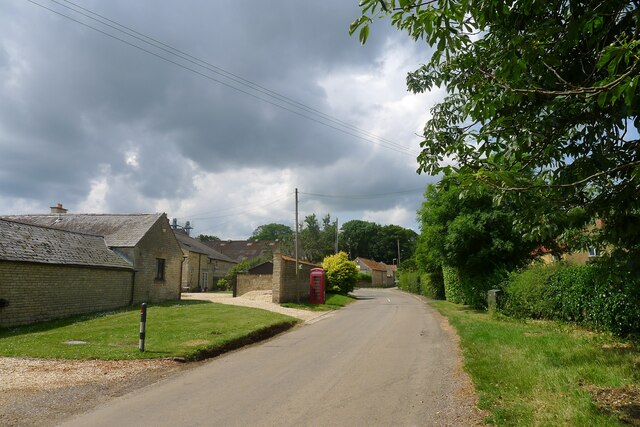
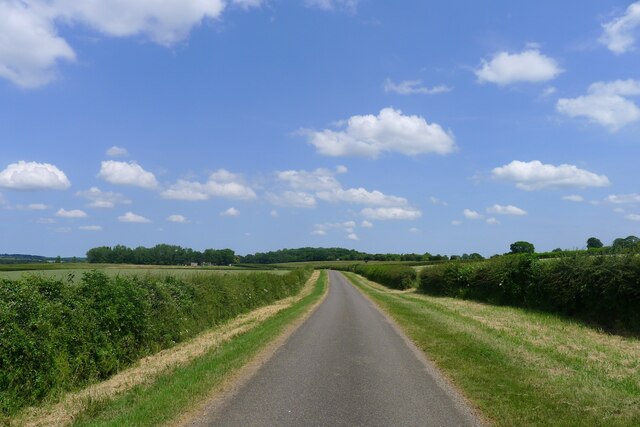
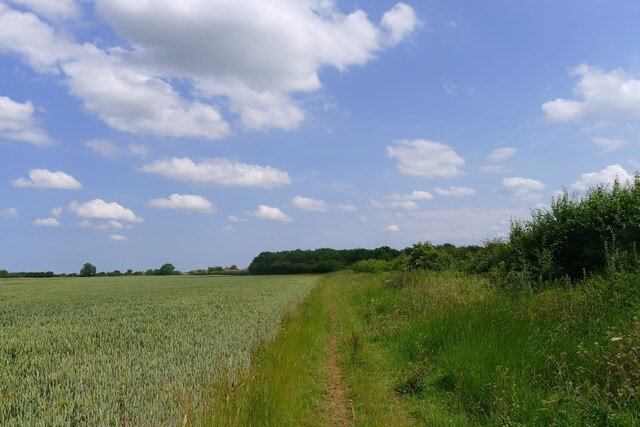
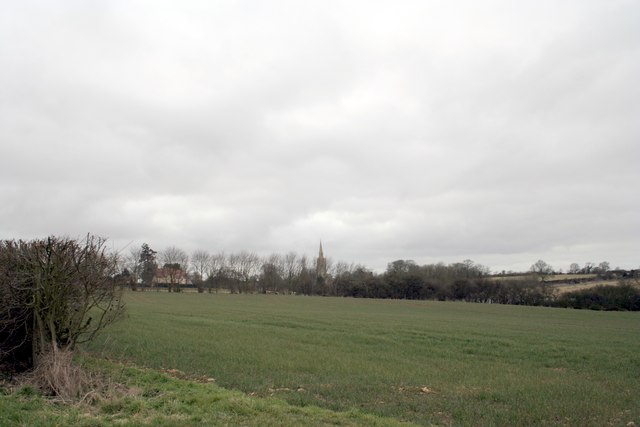
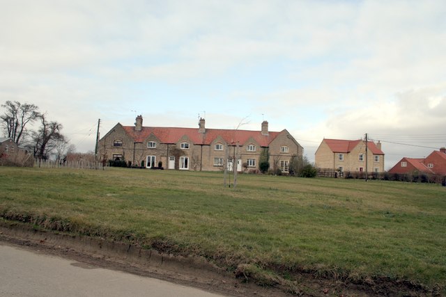
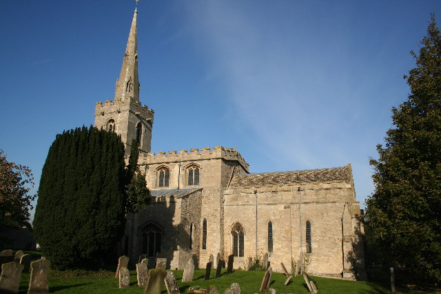
Culverthorpe is a small village located in the county of Lincolnshire, England. Situated approximately 7 miles south of the town of Sleaford, Culverthorpe is nestled amidst the picturesque countryside of the Lincolnshire Fens. The village is surrounded by open fields and farmland, offering residents and visitors a peaceful and rural setting.

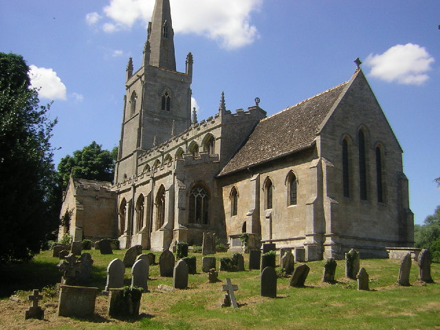
The history of Culverthorpe dates back centuries, with the first records of the village dating back to the Domesday Book in 1086. The name Culverthorpe is believed to derive from the Old Norse language, meaning "farmstead of the doves." The village has managed to retain its traditional charm, with a collection of historic buildings and cottages that showcase its rich heritage.

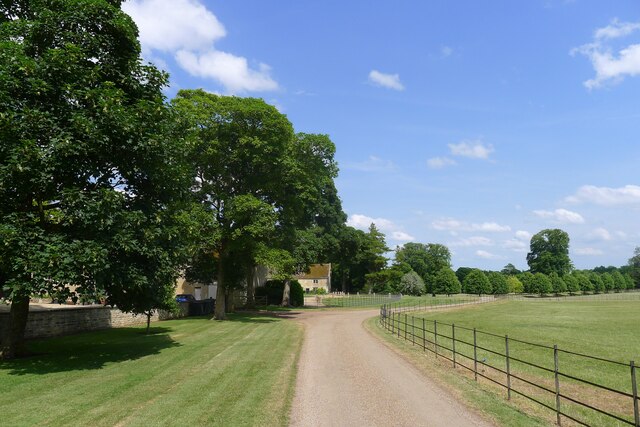
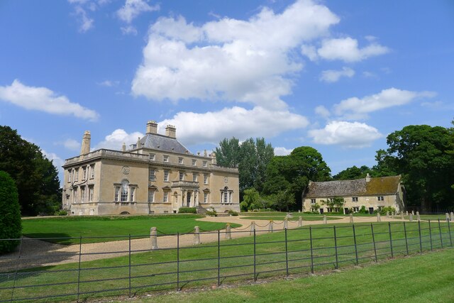
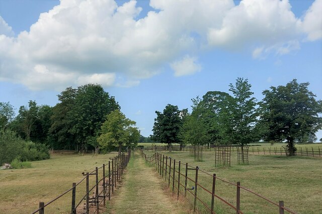
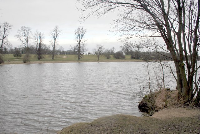
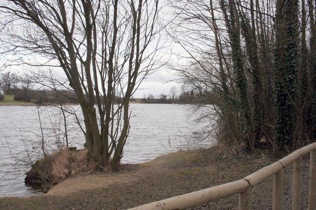
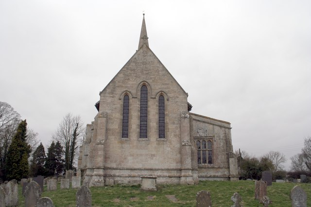
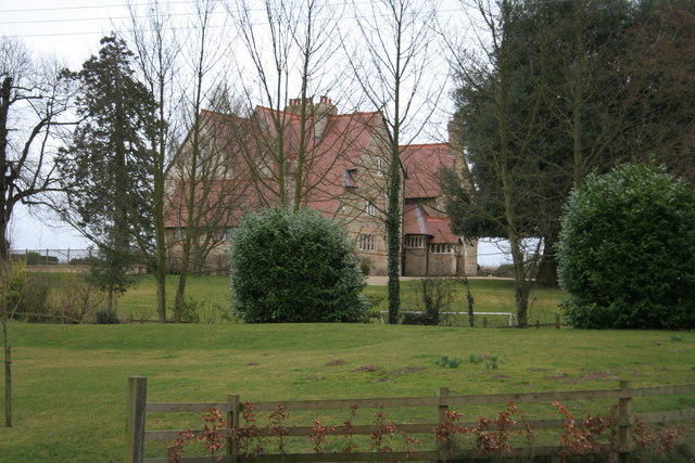
One of the notable landmarks in Culverthorpe is Culverthorpe Hall, an impressive Grade I listed country house. Built in the early 17th century, the hall is renowned for its beautiful architecture and stunning gardens. The estate also includes a lake and parkland, making it a popular destination for leisurely walks and outdoor activities.

Despite its small size, Culverthorpe has a close-knit community and a friendly atmosphere. The village is home to a local pub, providing a gathering place for residents and visitors alike. For amenities and services, the nearby town of Sleaford offers a range of shops, schools, and healthcare facilities.

Culverthorpe's idyllic location and historic charm make it a desirable place to live for those seeking a peaceful rural lifestyle in the heart of Lincolnshire.

If you have any feedback on the listing, please let us know in the comments section below.
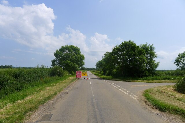
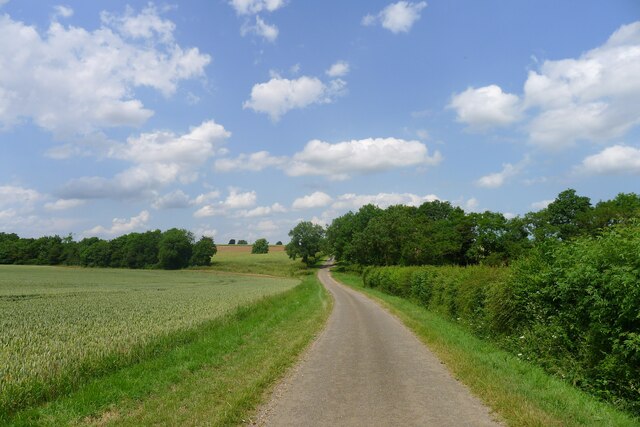
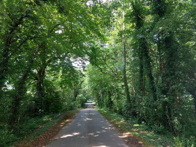
Culverthorpe Images

Images are sourced within 2km of 52.950468/-0.476679 or Grid Reference TF0240. Thanks to Geograph Open Source API. All images are credited.

Road from Swarby entering the hamlet of Culverthorpe
Telephone exchange outside Culverthorpe Offering fibre to premises in this area? <span class="nowrap"><a title="https://telephone-exchange.co.uk/Culverthorpe-EMCULVE.html" rel="nofollow ugc noopener" href="https://telephone-exchange.co.uk/Culverthorpe-EMCULVE.html">Link</a><img style="margin-left:2px;" alt="External link" title="External link - shift click to open in new window" src="https://s1.geograph.org.uk/img/external.png" width="10" height="10"/></span>
Telephone exchange outside Culverthorpe
Offering fibre to premises in this area? LinkExternal link
Warning that the Culverthorpe Road to Swarby is closed These signs often prove to be untrue, but in this case the road ahead was genuinely closed <a href="https://www.geograph.org.uk/photo/7530267">TF0440 : Culverthorpe Road into Swarby closed</a>
Warning that the Culverthorpe Road to Swarby is closed
These signs often prove to be untrue, but in this case the road ahead was genuinely closed TF0440 : Culverthorpe Road into Swarby closed
Bridleway and footpath junction at Northings wood
Road north from Culverthorpe Crossing a shallow valley of Cliff Beck
Road north from Culverthorpe
Crossing a shallow valley of Cliff Beck
Passing Kelby Plantation
Track near Kelby Farm Passing a field of green wheat
Track near Kelby Farm
Passing a field of green wheat
Road east from Kelby Heading towards Kelby Plantation
Road east from Kelby
Heading towards Kelby Plantation
Bridleway through Kelby Plantation Further on the track is classified as a byway
Bridleway through Kelby Plantation
Further on the track is classified as a byway
Byway towards Willoughby Walks
Bridleway to Culverthorpe Hall Signs indicate that the owners of the hall "are pleased to invite you to the stepping out walks". For information on the Stepping Out network <span class="nowrap"><a title="https://www.hillholtwood.co.uk/stepping-out-walks" rel="nofollow ugc noopener" href="https://www.hillholtwood.co.uk/stepping-out-walks">Link</a><img style="margin-left:2px;" alt="External link" title="External link - shift click to open in new window" src="https://s1.geograph.org.uk/img/external.png" width="10" height="10"/></span>
Bridleway to Culverthorpe Hall
Signs indicate that the owners of the hall "are pleased to invite you to the stepping out walks". For information on the Stepping Out network LinkExternal link
Culverthorpe Hall Listed Grade I. Building started in 1679, incorporating features of an earlier, 16th century building. For details see <span class="nowrap"><a title="https://en.wikipedia.org/wiki/Culverthorpe_Hall#:~:text=Rodolph%20Ladeveze%20Adlercron%20bought%20the,The%20hall%20remains%20privately%20owned" rel="nofollow ugc noopener" href="https://en.wikipedia.org/wiki/Culverthorpe_Hall#:~:text=Rodolph%20Ladeveze%20Adlercron%20bought%20the,The%20hall%20remains%20privately%20owned">Link</a><img style="margin-left:2px;" alt="External link" title="External link - shift click to open in new window" src="https://s1.geograph.org.uk/img/external.png" width="10" height="10"/></span>.
Culverthorpe Hall
Listed Grade I. Building started in 1679, incorporating features of an earlier, 16th century building. For details see LinkExternal link.
Footpath through Culverthorpe Park One of the 'Stepping Out' series of walks <span class="nowrap"><a title="https://www.alltrails.com/en-gb/trail/england/lincolnshire/culverthorpe-hall-and-gardens-walk" rel="nofollow ugc noopener" href="https://www.alltrails.com/en-gb/trail/england/lincolnshire/culverthorpe-hall-and-gardens-walk">Link</a><img style="margin-left:2px;" alt="External link" title="External link - shift click to open in new window" src="https://s1.geograph.org.uk/img/external.png" width="10" height="10"/></span>
Footpath through Culverthorpe Park
One of the 'Stepping Out' series of walks LinkExternal link
Ornamental Lake at Culverthorpe Hall
Lake at Culverthorpe Hall Looking towards the dam at Culverthorpe Hollow end
Lake at Culverthorpe Hall
Looking towards the dam at Culverthorpe Hollow end
Across the fields to the church spire at Heydour
St Michael's Church, Heydour
Heydour House
Heydour House
Show me another place!

Culverthorpe is located at Grid Ref: TF0240 (Lat: 52.950468, Lng: -0.476679)

Division: Parts of Kesteven

Administrative County: Lincolnshire

District: North Kesteven

Police Authority: Lincolnshire

What 3 Words

///sunroof.helpfully.headlight. Near Ancaster, Lincolnshire

Related Wikis

Culverthorpe

Culverthorpe is a hamlet in the civil parish of Culverthorpe and Kelby, in the North Kesteven district of Lincolnshire, England. It lies 5 miles (8 km...

Culverthorpe Hall

Culverthorpe Hall, Culverthorpe, Lincolnshire, England is an 18th-century country house. It is a Grade I listed building. == History == In the 17th century...

Heydour

Heydour is a hamlet and civil parish in the South Kesteven district of Lincolnshire, England. The parish population of 286 at the 2001 census rose to 311...

Aisby, South Kesteven

Aisby is a village in the civil parish of Heydour, in the South Kesteven district of Lincolnshire, England. It is situated 1 mile (1.6 km) north from the...

Kelby

Kelby is a hamlet in the North Kesteven district of Lincolnshire, England. It lies 5 miles (8 km) south-west from Sleaford, 9 miles (14 km) north-east...

Swarby

Swarby is a village and former civil parish in the North Kesteven district of Lincolnshire, England, approximately 3 miles (5 km) south-southwest of Sleaford...

Oasby

Oasby is a hamlet in the civil parish of Heydour, in the South Kesteven district of Lincolnshire, England. It lies 7 miles (11 km) north-east of Grantham...

Wilsford, Lincolnshire

Wilsford is a village and civil parish in the North Kesteven district of Lincolnshire, England. The population of the civil parish was 400 at the 2011...

Nearby Amenities

Located within 500m of 52.950468,-0.476679
Culverthorpe
Is In: Lincolnshire, England, UK
Place: hamlet
Source: NPE
Lat/Long: 52.9506683/-0.4771162
Bus Stop
Northern Farm
Naptan AtcoCode: 270000008977
Naptan Bearing: SW
Naptan CommonName: Northern Farm
Naptan Indicator: adj
Naptan Landmark: Northern Farm
Naptan NaptanCode: lingwjwp
Naptan Street: Culverthorpe
Naptan Verified: no
Source: naptan_import
Lat/Long: 52.9499978/-0.4765978
Bus Stop
Northern Farm
Naptan AtcoCode: 2700LC001810
Naptan Bearing: NE
Naptan CommonName: Northern Farm
Naptan Indicator: opp
Naptan Landmark: Northern Farm
Naptan NaptanCode: linampwj
Naptan Street: Culverthorpe
Naptan Verified: no
Source: naptan_import
Lat/Long: 52.9498395/-0.4768713
Culverthorpe Park
Place: locality
Source: Bing
Lat/Long: 52.9493794/-0.482011
The Old Dairy
Place: isolated_dwelling
Source: Bing
Lat/Long: 52.9536105/-0.4714728
The Hollow
Place: locality
Lat/Long: 52.9465498/-0.4773474
Barrier: yes
Lat/Long: 52.9505593/-0.4829167
Telephone
Defibrillator
Booth: K6
Covered: booth
Defibrillator Location: insideold red phone box in Culverthorpe
Emergency: defibrillator
Man Made: telephone_box
Lat/Long: 52.9505931/-0.4762697
Post Box
Post Box Type: lamp
Lat/Long: 52.9506036/-0.4774592
The data included in this document is from www.openstreetmap.org. The data is made available under ODbL.

Have you been to Culverthorpe?

Leave your review of Culverthorpe below (or comments, questions and feedback).