Mesnes Plantation

Wood, Forest in Yorkshire Richmondshire

England

Mesnes Plantation

Benchmark on gatepost on west side of track Ordnance Survey cut mark benchmark described on the Bench Mark Database at <span class="nowrap"><a title="http://www.bench-marks.org.uk/bm24522" rel="nofollow ugc noopener" href="http://www.bench-marks.org.uk/bm24522">Link</a><img style="margin-left:2px;" alt="External link" title="External link - shift click to open in new window" src="https://s1.geograph.org.uk/img/external.png" width="10" height="10"/></span>
Benchmark on gatepost on west side of track Credit: Roger Templeman

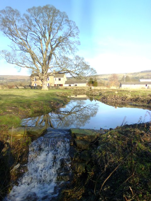
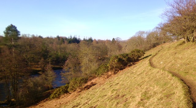
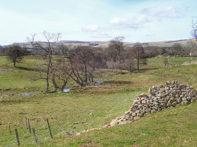
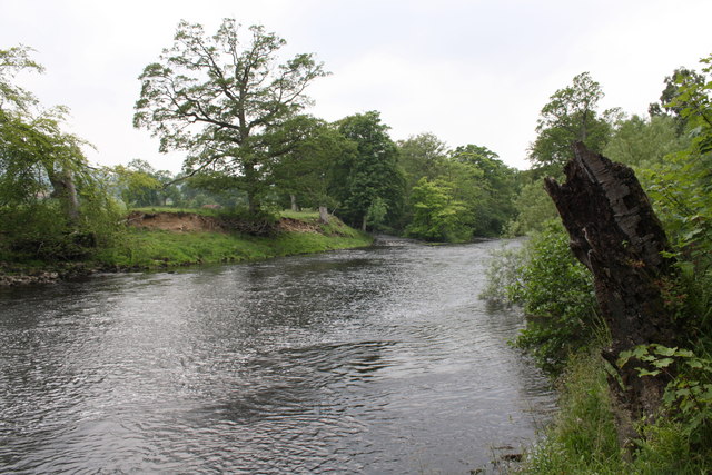
Mesnes Plantation, located in Yorkshire, England, is a picturesque woodland area known for its natural beauty and diverse flora and fauna. Spanning over a substantial area, the plantation is a popular destination for nature enthusiasts, hikers, and those seeking tranquility amidst the greenery.

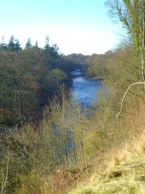
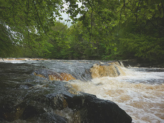
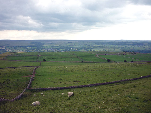
The plantation is characterized by its dense and well-preserved forest, consisting primarily of broadleaf trees such as oak, beech, and birch. These towering trees provide a magnificent canopy, creating a serene and peaceful atmosphere within the woodland. Underneath this leafy cover, a rich undergrowth of ferns, mosses, and wildflowers adds to the charm of the plantation.

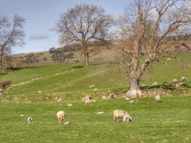
The diverse ecosystem of Mesnes Plantation supports a wide range of wildlife, making it an ideal spot for birdwatching and animal spotting. Visitors may catch glimpses of various bird species, including woodpeckers, nuthatches, and owls, while lucky observers might even spot deer or foxes roaming through the undergrowth.

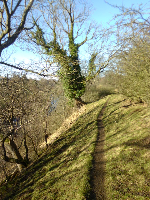
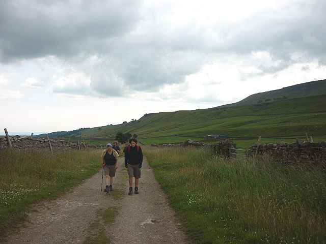
Trails and footpaths wind through the plantation, allowing visitors to explore its beauty at their own pace. These paths offer stunning views of the surrounding countryside and provide opportunities to witness the changing seasons, as the woodland bursts into vibrant hues of red and gold during autumn.

Mesnes Plantation also serves as an important habitat for many rare and protected species, contributing to the overall conservation efforts in the region. Local authorities have implemented measures to ensure the preservation and sustainable management of the woodland, making it a haven for both nature lovers and wildlife.

In summary, Mesnes Plantation in Yorkshire offers a captivating natural retreat, where visitors can immerse themselves in the beauty of a well-preserved woodland, observe diverse flora and fauna, and enjoy the tranquility that nature provides.

If you have any feedback on the listing, please let us know in the comments section below.

Mesnes Plantation Images

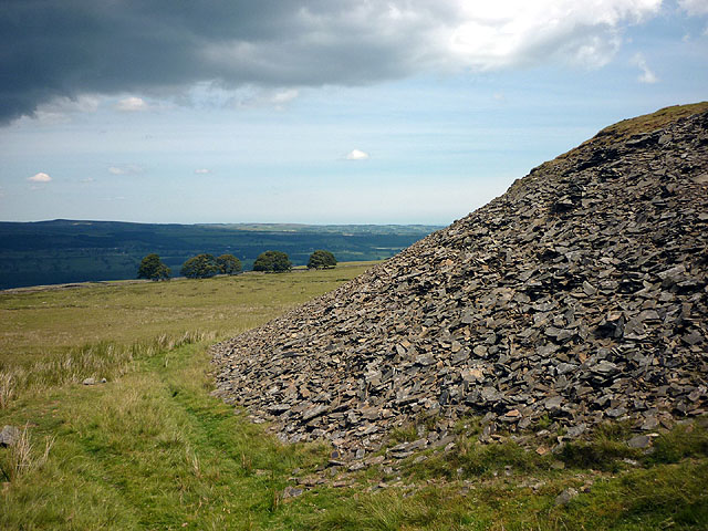
Images are sourced within 2km of 54.293435/-1.9194613 or Grid Reference SE0588. Thanks to Geograph Open Source API. All images are credited.

Benchmark on gatepost on west side of track Ordnance Survey cut mark benchmark described on the Bench Mark Database at <span class="nowrap"><a title="http://www.bench-marks.org.uk/bm24522" rel="nofollow ugc noopener" href="http://www.bench-marks.org.uk/bm24522">Link</a><img style="margin-left:2px;" alt="External link" title="External link - shift click to open in new window" src="https://s1.geograph.org.uk/img/external.png" width="10" height="10"/></span>
Benchmark on gatepost on west side of track
Ordnance Survey cut mark benchmark described on the Bench Mark Database at LinkExternal link
Barn conversion south of Mill Farm Mill Farm house up the track on the RHS of picture. There is an OS benchmark <a href="https://www.geograph.org.uk/photo/2598834">SE0490 : Benchmark on barn conversion south of Mill Farm</a> on a stone to the right of the right hand door
Barn conversion south of Mill Farm
Mill Farm house up the track on the RHS of picture. There is an OS benchmark SE0490 : Benchmark on barn conversion south of Mill Farm on a stone to the right of the right hand door
Benchmark on barn conversion south of Mill Farm Ordnance Survey cut mark benchmark described on the Bench Mark Database at <span class="nowrap"><a title="http://www.bench-marks.org.uk/bm38766" rel="nofollow ugc noopener" href="http://www.bench-marks.org.uk/bm38766">Link</a><img style="margin-left:2px;" alt="External link" title="External link - shift click to open in new window" src="https://s1.geograph.org.uk/img/external.png" width="10" height="10"/></span> with wider view at <a href="https://www.geograph.org.uk/photo/2598132">SE0490 : Barn conversion south of Mill Farm</a>
Benchmark on barn conversion south of Mill Farm
Ordnance Survey cut mark benchmark described on the Bench Mark Database at LinkExternal link with wider view at SE0490 : Barn conversion south of Mill Farm
Mill pond and Mill Farm One cannot be sure if this is the original mill pond for the former Redmire corn mill, for although it is in the right situation it does appear to be very small. There are a few bits of masonry behind the photographer on the high bank overlooking the Ure which mark the site of the mill building.
Mill pond and Mill Farm
One cannot be sure if this is the original mill pond for the former Redmire corn mill, for although it is in the right situation it does appear to be very small. There are a few bits of masonry behind the photographer on the high bank overlooking the Ure which mark the site of the mill building.
The Ure at Redmire Looking upstream along the Ure from near Mill Farm. Redmire Force can just be seen in the distance.
The Ure at Redmire
Looking upstream along the Ure from near Mill Farm. Redmire Force can just be seen in the distance.
Bank top path at Redmire Footpath running high along the bank top on the north side of the River Ure at Redmire.
Bank top path at Redmire
Footpath running high along the bank top on the north side of the River Ure at Redmire.
River bank path, Redmire Footpath on the north bank of the Ure at Redmire.
River bank path, Redmire
Footpath on the north bank of the Ure at Redmire.
Barn conversion, Redmire A field barn conversion into what appears to be a holiday cottage. Strangely the building is not shown on the 1:25000 map.
Barn conversion, Redmire
A field barn conversion into what appears to be a holiday cottage. Strangely the building is not shown on the 1:25000 map.
The middle drop, Redmire Force Redmire is like a smaller version of the much better known Aysgarth Falls. There are three small drops (the largest is the upper, which is visible just upstream).
The middle drop, Redmire Force
Redmire is like a smaller version of the much better known Aysgarth Falls. There are three small drops (the largest is the upper, which is visible just upstream).
Sheep Pasture
Sheep Pasture
Marshy Pasture
Marshy Pasture
Track through West Wood
Benchmark on Langthwaite Barn Ordnance Survey cut mark benchmark described on the Bench Mark Database at <span class="nowrap"><a title="http://www.bench-marks.org.uk/bm38516" rel="nofollow ugc noopener" href="http://www.bench-marks.org.uk/bm38516">Link</a><img style="margin-left:2px;" alt="External link" title="External link - shift click to open in new window" src="https://s1.geograph.org.uk/img/external.png" width="10" height="10"/></span>
Benchmark on Langthwaite Barn
Ordnance Survey cut mark benchmark described on the Bench Mark Database at LinkExternal link
Spoil heap, Penhill Quarry (disused) There is a long line of tips below the north flank of Penhill. The rock is a kind of fine grained sandstone that splits into thin, evenly bedded flags probably once used for roofing and building.
Spoil heap, Penhill Quarry (disused)
There is a long line of tips below the north flank of Penhill. The rock is a kind of fine grained sandstone that splits into thin, evenly bedded flags probably once used for roofing and building.
Sheep on West Witton Moor above High Lane The path from Black Crags descends through an extensive complex of grazing pastures above lower Wensleydale.
Sheep on West Witton Moor above High Lane
The path from Black Crags descends through an extensive complex of grazing pastures above lower Wensleydale.
High Lane at Gunnery Plain The steep flanks of Penhill high on the right.
High Lane at Gunnery Plain
The steep flanks of Penhill high on the right.
River Ure from its north bank
Benchmark dating from 1845 on house 'East View' Ordnance Survey cut mark benchmark described on the Bench Mark Database at <span class="nowrap"><a title="http://www.bench-marks.org.uk/bm25470" rel="nofollow ugc noopener" href="http://www.bench-marks.org.uk/bm25470">Link</a><img style="margin-left:2px;" alt="External link" title="External link - shift click to open in new window" src="https://s1.geograph.org.uk/img/external.png" width="10" height="10"/></span>
Benchmark dating from 1845 on house 'East View'
Ordnance Survey cut mark benchmark described on the Bench Mark Database at LinkExternal link
Show me another place!

Mesnes Plantation is located at Grid Ref: SE0588 (Lat: 54.293435, Lng: -1.9194613)

Division: North Riding

Administrative County: North Yorkshire

District: Richmondshire

Police Authority: North Yorkshire

What 3 Words

///clay.relief.stylists. Near Leyburn, North Yorkshire

Related Wikis

Swinithwaite

Swinithwaite is a hamlet in the Yorkshire Dales, North Yorkshire, England. It lies on the A684 road, 2 miles (3.2 km) miles east of Aysgarth.The hamlet...

St Bartholomew's Church, West Witton

St Bartholomew's Church, West Witton is a Grade II listed parish church in the Church of England: 387  in West Witton, North Yorkshire. == History == The...

West Witton

West Witton is a village and civil parish in the Richmondshire district of North Yorkshire, England. Located in Wensleydale in the Yorkshire Dales it lies...

Penhill Preceptory

Penhill Preceptory was a priory on the northern flanks of Penhill in Wensleydale, North Yorkshire, England, which functioned from about 1142 to 1308–12...

Nearby Amenities

Located within 500m of 54.293435,-1.9194613
Bus Stop
Bus: yes
Public Transport: platform
Lat/Long: 54.291248/-1.9130067
Public Transport: stop_position
Lat/Long: 54.291219/-1.9131303
Barrier: stile
Stile: stepover
Lat/Long: 54.2928547/-1.9196775
Power: pole
Lat/Long: 54.2902797/-1.9144119
Power: pole
Lat/Long: 54.2905028/-1.915175
Power: pole
Lat/Long: 54.2910664/-1.9164705
Power: pole
Lat/Long: 54.2916315/-1.9177982
Power: pole
Lat/Long: 54.2921434/-1.9189677
Power: pole
Lat/Long: 54.2927054/-1.9202712
Power: pole
Lat/Long: 54.2933254/-1.9216123
Power: pole
Lat/Long: 54.2935023/-1.9232994
Power: pole
Lat/Long: 54.2936948/-1.9248927
Power: pole
Lat/Long: 54.2941738/-1.926223
Power: substation
Lat/Long: 54.2913234/-1.9128275
Barrier: stile
Lat/Long: 54.2922755/-1.9149987
Barrier: stile
Fixme: Verify position
Foot: yes
Stile: squeezer
Lat/Long: 54.2928244/-1.9195396
Barrier: entrance
Lat/Long: 54.2954544/-1.9233776
Barrier: entrance
Lat/Long: 54.2939875/-1.9260733
Barrier: stile
Image: https://www.geograph.org.uk/photo/5864288
Stile: squeezer
Lat/Long: 54.2944775/-1.9246593
The data included in this document is from www.openstreetmap.org. The data is made available under ODbL.

Have you been to Mesnes Plantation?

Leave your review of Mesnes Plantation below (or comments, questions and feedback).