Blakemoor Plantation

Wood, Forest in Derbyshire High Peak

England

Blakemoor Plantation

Yellowslacks. Walking up to Bleaklow.
Yellowslacks. Credit: steven ruffles

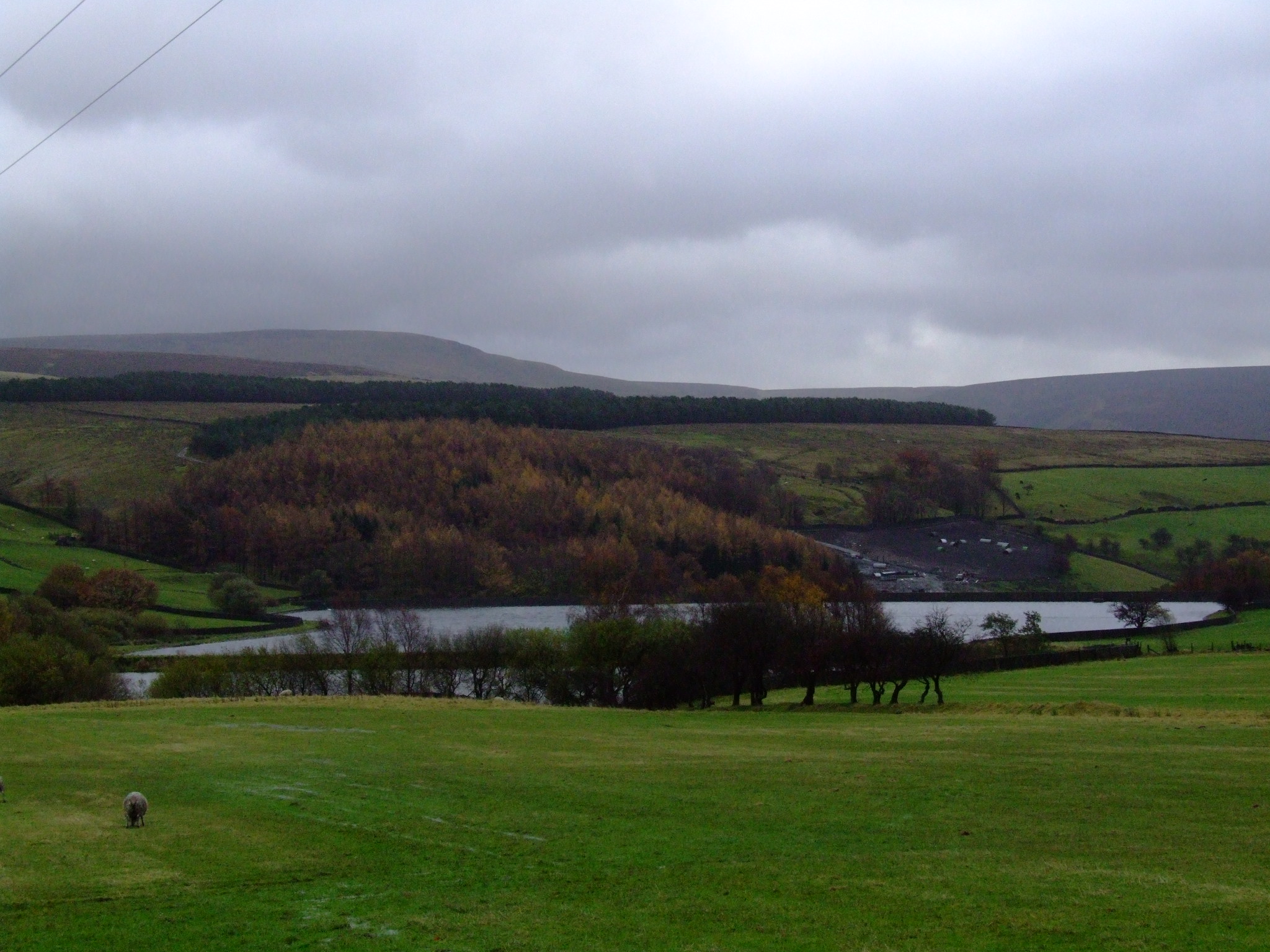
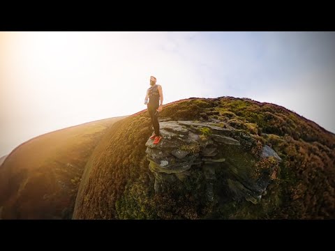
Blakemoor Plantation is a picturesque woodland located in the heart of Derbyshire, England. Situated in the serene surroundings of the Derbyshire Dales, this enchanting forest covers an expansive area of approximately 500 acres. With its dense foliage and towering trees, the plantation offers a tranquil retreat from the bustling city life.

The woodland is predominantly composed of a variety of indigenous tree species, including oak, beech, and birch. These majestic trees create a dense canopy that provides a cool, shaded atmosphere, making it a perfect destination for nature enthusiasts and hikers. The forest floor is adorned with a rich carpet of ferns, moss, and wildflowers, adding to the area's natural beauty.

Blakemoor Plantation is also home to a diverse range of wildlife, making it a haven for nature lovers. Visitors may spot various woodland creatures such as deer, rabbits, and squirrels while exploring the trails. Birdwatchers will be delighted by the numerous species of birds that call this forest their home, including woodpeckers, owls, and songbirds.

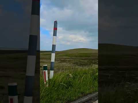
The plantation offers a network of well-maintained walking trails, allowing visitors to explore the woodland at their own pace. Along these paths, one can discover hidden streams, cascading waterfalls, and small ponds, enhancing the enchanting atmosphere of the forest.

Blakemoor Plantation is a popular destination for outdoor activities such as hiking, picnicking, and photography. Its idyllic setting and natural charm make it a must-visit location for those seeking solace in nature's embrace. Whether it's a leisurely stroll or an adrenaline-fueled adventure, this woodland sanctuary has something to offer for everyone.

If you have any feedback on the listing, please let us know in the comments section below.

Blakemoor Plantation Images

Images are sourced within 2km of 53.457155/-1.9228091 or Grid Reference SK0595. Thanks to Geograph Open Source API. All images are credited.

Yellowslacks. Walking up to Bleaklow.
Yellowslacks.
Walking up to Bleaklow.
Colin Hugh's Barn Colin Hugh's Barn on the north side of Shepley Street as it appeared in 1994.
It appears to be at Tanyard Farm and might now be part of holiday accommodation there. Notes made at the time the image was made say that it is on the Peak District National Park Boundary.
Colin Hugh's Barn
Colin Hugh's Barn on the north side of Shepley Street as it appeared in 1994. It appears to be at Tanyard Farm and might now be part of holiday accommodation there. Notes made at the time the image was made say that it is on the Peak District National Park Boundary.
Footpath Sign Footpath sign at the start of the Doctor's Gate path.

See <a href="https://www.geograph.org.uk/photo/7592205">SK0694 : Path</a>.
Footpath Sign
Footpath sign at the start of the Doctor's Gate path. See SK0694 : Path.
Path To the left, up over Shelf Moor and to the right, up the valley of Shelf Brook via The Doctor's Gate path.  For a close up of the sign, see <a href="https://www.geograph.org.uk/photo/7592204">SK0694 : Footpath Sign</a>.
Path
To the left, up over Shelf Moor and to the right, up the valley of Shelf Brook via The Doctor's Gate path. For a close up of the sign, see SK0694 : Footpath Sign.
Mossy Lea Farm Mossy Lea Farm beneath Shire Hill.
Mossy Lea Farm
Mossy Lea Farm beneath Shire Hill.
Mossy Lea Farm Barn in a field on Mossy Lea Farm.
Mossy Lea Farm
Barn in a field on Mossy Lea Farm.
The Doctors Gate path Tree This most photographed tree is on the Doctors Gate path from Old Glossop towards Snake Summit in the Dark Peak (The northern sandstone and moorland half of the Peak District).  I took the photograph again on this day because of the change in the background - a larger number of sections have been cleared of bracken - normally this would be a dark green in late summer.

A few minutes later I met Stephen Burton who mentioned Geograph. So here is my first photo submission
The Doctors Gate path Tree
This most photographed tree is on the Doctors Gate path from Old Glossop towards Snake Summit in the Dark Peak (The northern sandstone and moorland half of the Peak District). I took the photograph again on this day because of the change in the background - a larger number of sections have been cleared of bracken - normally this would be a dark green in late summer. A few minutes later I met Stephen Burton who mentioned Geograph. So here is my first photo submission
Doctors Gate tree Tree marking the start of the wilder section of the Doctors Gate Footpath. The footpath can be seen just to the right of the tree.  The Doctors Gate valley has recently been planted with thousands of young trees some of these can be seen in the lower left of the photograph. This will give the valley a completely different look in the future, maybe not to everybody’s taste.
Doctors Gate tree
Tree marking the start of the wilder section of the Doctors Gate Footpath. The footpath can be seen just to the right of the tree. The Doctors Gate valley has recently been planted with thousands of young trees some of these can be seen in the lower left of the photograph. This will give the valley a completely different look in the future, maybe not to everybody’s taste.
Longdendale The scene of strange lights, unexplained phenomena, UFOs, apparitions and so on. See <span class="nowrap"><a title="https://en.wikipedia.org/wiki/Longdendale#Longdendale_lights" rel="nofollow ugc noopener" href="https://en.wikipedia.org/wiki/Longdendale#Longdendale_lights">Link</a><img style="margin-left:2px;" alt="External link" title="External link - shift click to open in new window" src="https://s1.geograph.org.uk/img/external.png" width="10" height="10"/></span>
Longdendale
The scene of strange lights, unexplained phenomena, UFOs, apparitions and so on. See LinkExternal link
Entrance  to  Windy  Harbour  Farm  Hotel Does an excellent lunch, it also has a small caravan site
Entrance to Windy Harbour Farm Hotel
Does an excellent lunch, it also has a small caravan site
Over  fields  to  Peak  Naze From Windy Harbour Farm Hotel on Woodhead Road
Over fields to Peak Naze
From Windy Harbour Farm Hotel on Woodhead Road
Public  footpath  sign  to  Little  Padfield At the Windy Harbour Farm Hotel
Public footpath sign to Little Padfield
At the Windy Harbour Farm Hotel
All Saints Church, Glossop This is Glossop Parish Church, situated in Old Glossop.
All Saints Church, Glossop
This is Glossop Parish Church, situated in Old Glossop.
Howard Town Brewery Small brewery in Glossop. Its beers can be found fairly easily locally.
Howard Town Brewery
Small brewery in Glossop. Its beers can be found fairly easily locally.
Former quarry above Glossop This one is small compared with some of the ones higher up the hill.
Former quarry above Glossop
This one is small compared with some of the ones higher up the hill.
Southern slopes of Cock Hill From here, the whole hill appears to have been formed from spoil heaps from the former quarrying activity.
Southern slopes of Cock Hill
From here, the whole hill appears to have been formed from spoil heaps from the former quarrying activity.
Former quarry track off Cock Hill Glossop is laid out in the valley bottom ahead. A band of very rough weather can be seen approaching from the west.
Former quarry track off Cock Hill
Glossop is laid out in the valley bottom ahead. A band of very rough weather can be seen approaching from the west.
Quarry debris on Cock Hill The moorland grass is steadily reclaiming this site.
Quarry debris on Cock Hill
The moorland grass is steadily reclaiming this site.
Show me another place!

Blakemoor Plantation is located at Grid Ref: SK0595 (Lat: 53.457155, Lng: -1.9228091)

Administrative County: Derbyshire

District: High Peak

Police Authority: Derbyshire

What 3 Words

///sloping.implanted.squabbles. Near Glossop, Derbyshire

Related Wikis

Swineshaw Reservoir (Derbyshire)

For the reservoirs near Stalybridge, in Tameside, Greater Manchester, see Higher Swineshaw Reservoir and Lower Swineshaw Reservoir Swineshaw Reservoir...

Shire Hill Hospital

Shire Hill Hospital was a healthcare facility in Bute Street, Glossop, Derbyshire, England. It was managed by Tameside and Glossop Integrated Care NHS...

Mossy Lea Reservoir

Mossy Lea Reservoir is a disused reservoir near Glossop, north Derbyshire. In 1837, 50 local millowners and gentlemen, known as the "Glossop Commissioners...

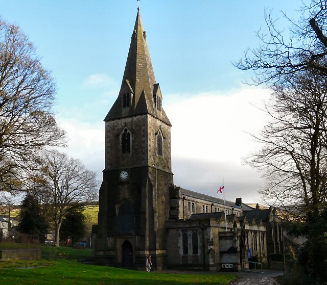
All Saints' Church, Glossop

All Saints’ Church, Glossop, is a Grade II listed parish church in the Church of England: 218  in Glossop, Derbyshire, England. == History == The first...
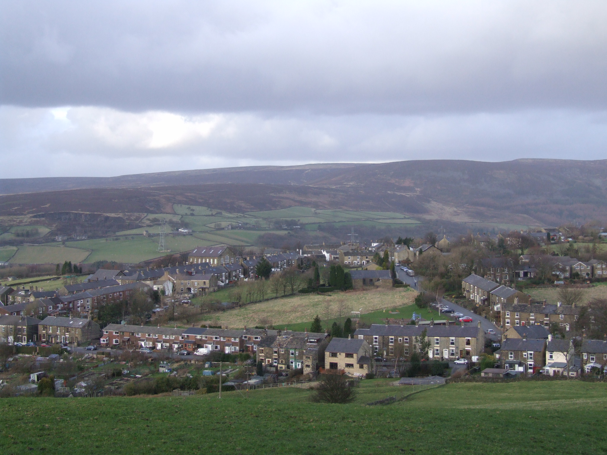
Manor Park, Glossop

Manor Park is a city park in Glossop, Derbyshire, England. == History == The park was originally part of the now demolished Glossop Hall, formerly called...
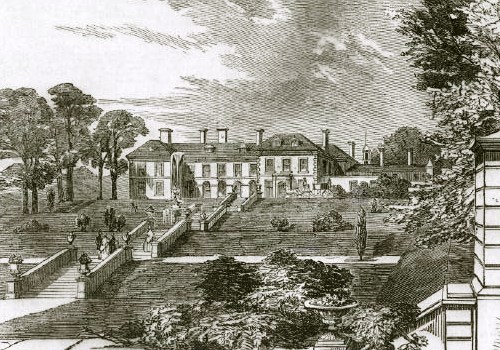
Glossop Hall

Glossop Hall was the last residential building on the site of Royle Hall in Glossop, Derbyshire. It was located south of Old Glossop at the heart of Glossop...

Hurst Reservoir

Hurst Reservoir is a former, now disused, reservoir near Glossop, north Derbyshire. == History == In 1837, 50 local millowners and gentlemen, known as...

Padfield

Padfield is a small village near Hadfield in High Peak, Derbyshire, England. The village is on the west side of the Peak District National Park, and the...

Related Videos

Thank you for this year

A quick 60 second reflection on how lucky I am to have been able to spend another year, alive and able to run ...

The Pennine Way - Day 2 - Crowden to Standedge - 15 m & 2,000 ft of ascent and SNOW SNOW SNOW

Pennine Way Day 2 Crowden to Standedge Today's walk is 15 miles, (25km) with 2000 feet (600m) of ascent, over Black Hill, ...

A walk around a UK Reservoir - Valehouse

Join us around Valehouse Reservoir in Derbyshire for our first, of many, adventures. We spot some birds and take in the beautiful ...

Nearby Amenities

Located within 500m of 53.457155,-1.9228091
Blake Moor
Place: locality
Source: local knowedge;survey
Lat/Long: 53.4584752/-1.9207906
The data included in this document is from www.openstreetmap.org. The data is made available under ODbL.

Have you been to Blakemoor Plantation?

Leave your review of Blakemoor Plantation below (or comments, questions and feedback).