Boundary Wood

Wood, Forest in Yorkshire Richmondshire

England

Boundary Wood

Benchmark on gatepost on west side of track Ordnance Survey cut mark benchmark described on the Bench Mark Database at <span class="nowrap"><a title="http://www.bench-marks.org.uk/bm24522" rel="nofollow ugc noopener" href="http://www.bench-marks.org.uk/bm24522">Link</a><img style="margin-left:2px;" alt="External link" title="External link - shift click to open in new window" src="https://s1.geograph.org.uk/img/external.png" width="10" height="10"/></span>
Benchmark on gatepost on west side of track Credit: Roger Templeman

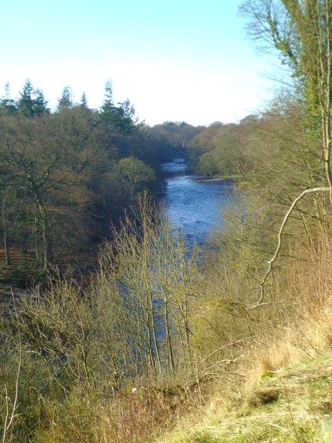
Boundary Wood is a picturesque woodland located in the county of Yorkshire, England. Covering an area of approximately 50 acres, this enchanting forest is renowned for its natural beauty, diverse wildlife, and tranquil atmosphere.

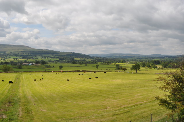
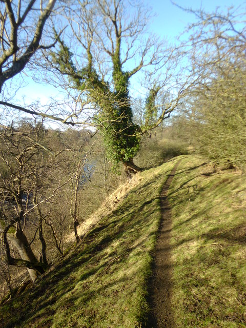
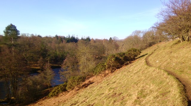
The woodland is situated on the eastern edge of the Yorkshire Dales National Park, making it a popular destination for nature enthusiasts and hikers. It is characterized by a mixture of deciduous and coniferous trees, including oak, beech, pine, and spruce, which create a rich and varied landscape.

Boundary Wood is home to a wide range of wildlife species, making it an ideal spot for birdwatchers and wildlife photographers. Visitors may have the opportunity to observe native birds such as woodpeckers, robins, and owls, as well as mammals like deer and rabbits. The forest floor is adorned with a vibrant carpet of wildflowers during the spring and summer months, further enhancing the area's natural charm.

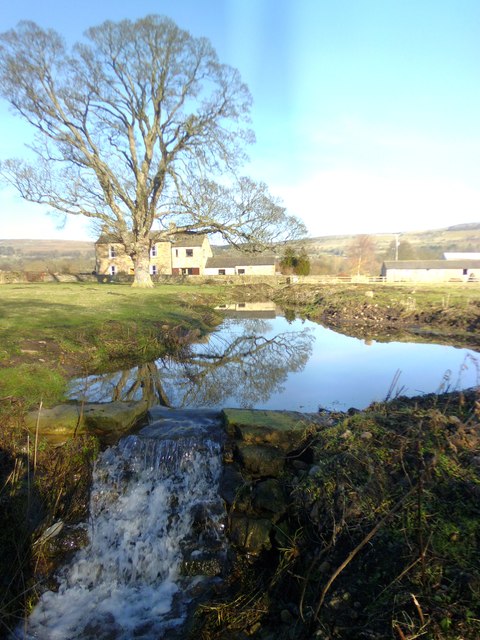
The woodland is crisscrossed by a network of walking trails, allowing visitors to explore its beauty at their own pace. These well-maintained paths lead to various points of interest, including a small pond and a viewpoint offering panoramic vistas of the surrounding countryside.

Boundary Wood is easily accessible by road, with ample parking available nearby. It provides a peaceful sanctuary for those seeking solace in nature, offering a respite from the hustle and bustle of everyday life. Whether it's a leisurely stroll, a family picnic, or a chance to reconnect with the great outdoors, Boundary Wood offers a truly unforgettable experience for all who venture within its verdant confines.

If you have any feedback on the listing, please let us know in the comments section below.

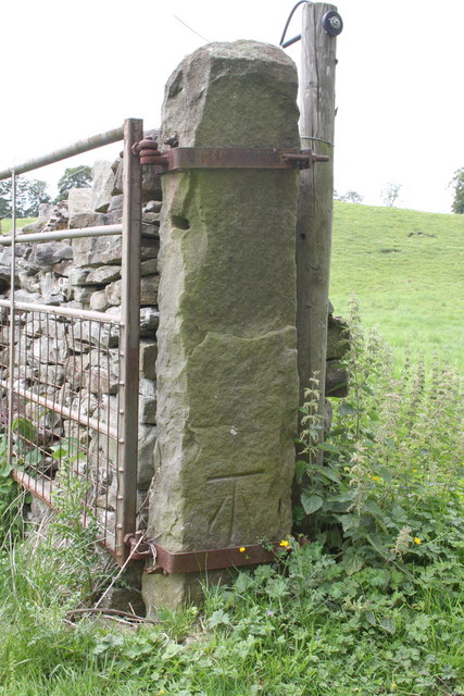
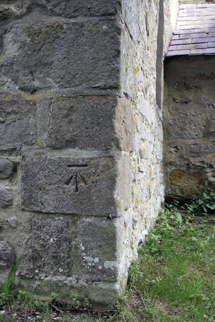
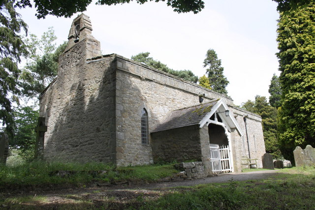
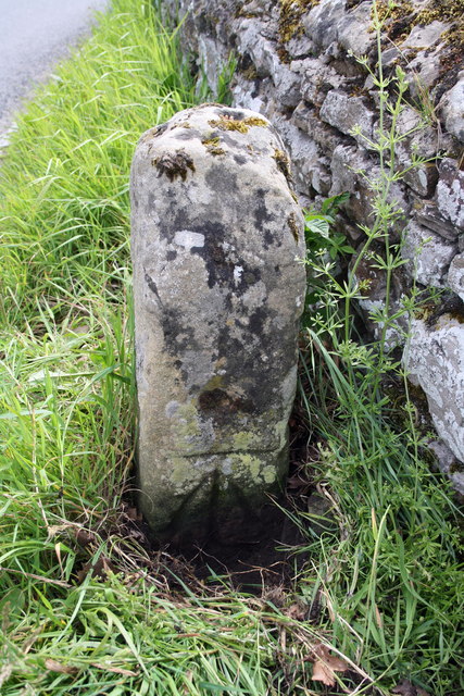
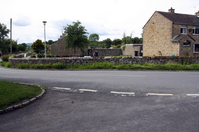
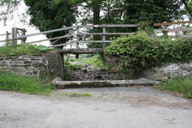
Boundary Wood Images

Images are sourced within 2km of 54.298596/-1.9225397 or Grid Reference SE0589. Thanks to Geograph Open Source API. All images are credited.

Benchmark on gatepost on west side of track Ordnance Survey cut mark benchmark described on the Bench Mark Database at <span class="nowrap"><a title="http://www.bench-marks.org.uk/bm24522" rel="nofollow ugc noopener" href="http://www.bench-marks.org.uk/bm24522">Link</a><img style="margin-left:2px;" alt="External link" title="External link - shift click to open in new window" src="https://s1.geograph.org.uk/img/external.png" width="10" height="10"/></span>
Benchmark on gatepost on west side of track
Ordnance Survey cut mark benchmark described on the Bench Mark Database at LinkExternal link
Benchmark on St Mary's Church Ordnance Survey cut mark benchmark described on the Bench Mark Database at <span class="nowrap"><a title="http://www.bench-marks.org.uk/bm26649" rel="nofollow ugc noopener" href="http://www.bench-marks.org.uk/bm26649">Link</a><img style="margin-left:2px;" alt="External link" title="External link - shift click to open in new window" src="https://s1.geograph.org.uk/img/external.png" width="10" height="10"/></span>
Benchmark on St Mary's Church
Ordnance Survey cut mark benchmark described on the Bench Mark Database at LinkExternal link
St Mary's Church
St Mary's Church
Benchmarked stone beside wall at Yoredale Cottages The Ordnance Survey cut mark benchmark is described on the Bench Mark Database at <span class="nowrap"><a title="http://www.bench-marks.org.uk/bm38381" rel="nofollow ugc noopener" href="http://www.bench-marks.org.uk/bm38381">Link</a><img style="margin-left:2px;" alt="External link" title="External link - shift click to open in new window" src="https://s1.geograph.org.uk/img/external.png" width="10" height="10"/></span>
Benchmarked stone beside wall at Yoredale Cottages
The Ordnance Survey cut mark benchmark is described on the Bench Mark Database at LinkExternal link
Road junction at Yoredale Cottages Against the wall is a stone (of unknown use) <a href="https://www.geograph.org.uk/photo/2516721">SE0490 : Benchmarked stone beside wall at Yoredale Cottages</a>
Road junction at Yoredale Cottages
Against the wall is a stone (of unknown use) SE0490 : Benchmarked stone beside wall at Yoredale Cottages
View from the Wensleydale Railway The Wensleydale railway is a preserved railway in North Yorkshire. The line currently runs 22 miles (35 km) between Northallerton on the East Coast Main Line and Redmire. This makes the line the longest heritage railway in Great Britain. Occasional freight services and excursions travel the full length of the line, however regular passenger services currently only operate between Leeming Bar and Redmire, a distance of 16.5 miles (27 km). Formerly the line ran from Northallerton to Garsdale on the Settle-Carlisle Railway. However the track between Redmire and Garsdale was lifted and several bridges and viaducts were demolished in the past. (Wikipedia)
<span class="nowrap"><a title="http://www.wensleydalerailwayassociation.com/" rel="nofollow ugc noopener" href="http://www.wensleydalerailwayassociation.com/">Link</a><img style="margin-left:2px;" alt="External link" title="External link - shift click to open in new window" src="https://s1.geograph.org.uk/img/external.png" width="10" height="10"/></span>
View from the Wensleydale Railway
The Wensleydale railway is a preserved railway in North Yorkshire. The line currently runs 22 miles (35 km) between Northallerton on the East Coast Main Line and Redmire. This makes the line the longest heritage railway in Great Britain. Occasional freight services and excursions travel the full length of the line, however regular passenger services currently only operate between Leeming Bar and Redmire, a distance of 16.5 miles (27 km). Formerly the line ran from Northallerton to Garsdale on the Settle-Carlisle Railway. However the track between Redmire and Garsdale was lifted and several bridges and viaducts were demolished in the past. (Wikipedia) LinkExternal link
Wooden Bridge over stream at Low Thoresby
Barn conversion south of Mill Farm Mill Farm house up the track on the RHS of picture. There is an OS benchmark <a href="https://www.geograph.org.uk/photo/2598834">SE0490 : Benchmark on barn conversion south of Mill Farm</a> on a stone to the right of the right hand door
Barn conversion south of Mill Farm
Mill Farm house up the track on the RHS of picture. There is an OS benchmark SE0490 : Benchmark on barn conversion south of Mill Farm on a stone to the right of the right hand door
Road from Low Thoresby
South parapet of Northgate Bridge with benchmark The Ordnance Survey cut mark benchmark is described on the Bench Mark Database at <span class="nowrap"><a title="http://www.bench-marks.org.uk/bm35842" rel="nofollow ugc noopener" href="http://www.bench-marks.org.uk/bm35842">Link</a><img style="margin-left:2px;" alt="External link" title="External link - shift click to open in new window" src="https://s1.geograph.org.uk/img/external.png" width="10" height="10"/></span>
South parapet of Northgate Bridge with benchmark
The Ordnance Survey cut mark benchmark is described on the Bench Mark Database at LinkExternal link
Benchmark on barn conversion south of Mill Farm Ordnance Survey cut mark benchmark described on the Bench Mark Database at <span class="nowrap"><a title="http://www.bench-marks.org.uk/bm38766" rel="nofollow ugc noopener" href="http://www.bench-marks.org.uk/bm38766">Link</a><img style="margin-left:2px;" alt="External link" title="External link - shift click to open in new window" src="https://s1.geograph.org.uk/img/external.png" width="10" height="10"/></span> with wider view at <a href="https://www.geograph.org.uk/photo/2598132">SE0490 : Barn conversion south of Mill Farm</a>
Benchmark on barn conversion south of Mill Farm
Ordnance Survey cut mark benchmark described on the Bench Mark Database at LinkExternal link with wider view at SE0490 : Barn conversion south of Mill Farm
Kendell Beck, Thoresby Tiny beck which joins the River Ure some 400m downstream from this point.
Kendell Beck, Thoresby
Tiny beck which joins the River Ure some 400m downstream from this point.
Low Thoresby Collection of farm buildings at Low Thoresby. The view extends towards Preston Under Scar on the distant hillside.
Low Thoresby
Collection of farm buildings at Low Thoresby. The view extends towards Preston Under Scar on the distant hillside.
Mill pond and Mill Farm One cannot be sure if this is the original mill pond for the former Redmire corn mill, for although it is in the right situation it does appear to be very small. There are a few bits of masonry behind the photographer on the high bank overlooking the Ure which mark the site of the mill building.
Mill pond and Mill Farm
One cannot be sure if this is the original mill pond for the former Redmire corn mill, for although it is in the right situation it does appear to be very small. There are a few bits of masonry behind the photographer on the high bank overlooking the Ure which mark the site of the mill building.
The Ure at Redmire Looking upstream along the Ure from near Mill Farm. Redmire Force can just be seen in the distance.
The Ure at Redmire
Looking upstream along the Ure from near Mill Farm. Redmire Force can just be seen in the distance.
Bank top path at Redmire Footpath running high along the bank top on the north side of the River Ure at Redmire.
Bank top path at Redmire
Footpath running high along the bank top on the north side of the River Ure at Redmire.
River bank path, Redmire Footpath on the north bank of the Ure at Redmire.
River bank path, Redmire
Footpath on the north bank of the Ure at Redmire.
Barn conversion, Redmire A field barn conversion into what appears to be a holiday cottage. Strangely the building is not shown on the 1:25000 map.
Barn conversion, Redmire
A field barn conversion into what appears to be a holiday cottage. Strangely the building is not shown on the 1:25000 map.
Show me another place!

Boundary Wood is located at Grid Ref: SE0589 (Lat: 54.298596, Lng: -1.9225397)

Division: North Riding

Administrative County: North Yorkshire

District: Richmondshire

Police Authority: North Yorkshire

What 3 Words

///polished.enlighten.care. Near Leyburn, North Yorkshire

Related Wikis

Swinithwaite

Swinithwaite is a hamlet in the Yorkshire Dales, North Yorkshire, England. It lies on the A684 road, 2 miles (3.2 km) miles east of Aysgarth.The hamlet...

St Bartholomew's Church, West Witton

St Bartholomew's Church, West Witton is a Grade II listed parish church in the Church of England: 387  in West Witton, North Yorkshire. == History == The...

West Witton

West Witton is a village and civil parish in the Richmondshire district of North Yorkshire, England. Located in Wensleydale in the Yorkshire Dales it lies...

Penhill Preceptory

Penhill Preceptory was a priory on the northern flanks of Penhill in Wensleydale, North Yorkshire, England, which functioned from about 1142 to 1308–12...

St Mary's Church, Redmire

St Mary's Church, Redmire is a Grade II* listed parish church in the Church of England: 289  in Redmire, North Yorkshire. == History == The church dates...

Redmire

Redmire is a village and civil parish in North Yorkshire, England. It is about 4 miles (6.4 km) west of Leyburn in Wensleydale in the Yorkshire Dales....

Redmire railway station

Redmire railway station is the current western terminus of the Wensleydale Railway and serves the village of Redmire in North Yorkshire, England. It is...

Bishopdale Beck

Bishopdale Beck is a major tributary of the River Ure in North Yorkshire, England. The beck flows down Bishopdale, a side valley of Wensleydale in the...

Nearby Amenities

Located within 500m of 54.298596,-1.9225397
Barrier: entrance
Lat/Long: 54.2954544/-1.9233776
Barrier: stile
Image: https://www.geograph.org.uk/photo/5864288
Stile: squeezer
Lat/Long: 54.2944775/-1.9246593
The data included in this document is from www.openstreetmap.org. The data is made available under ODbL.

Have you been to Boundary Wood?

Leave your review of Boundary Wood below (or comments, questions and feedback).