Dimmingsdale Wood

Wood, Forest in Staffordshire Staffordshire Moorlands

England

Dimmingsdale Wood

Old Milestone, Threapwood Head Cast iron post by the B5032, in parish of ALTON (STAFFORDSHIRE MOORLANDS District), by hedge, on North side of road. Cochrane iron casting, erected by the County Council in the 20th century.

Inscription reads:-
: ALTON 2½ / DENSTONE 4½ / ELLASTONE 6¼ / ASHBOURNE 11 : : ALTON / PARISH : : CHEADLE 2 :
Maker:- Cochrane & Co, Dudley. :

Milestone Society National ID: ST_ABCD11
Old Milestone, Threapwood Head Credit: Ivan Clare

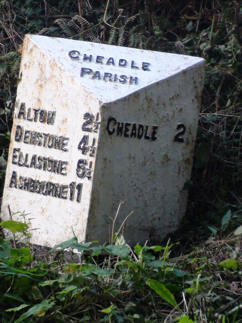
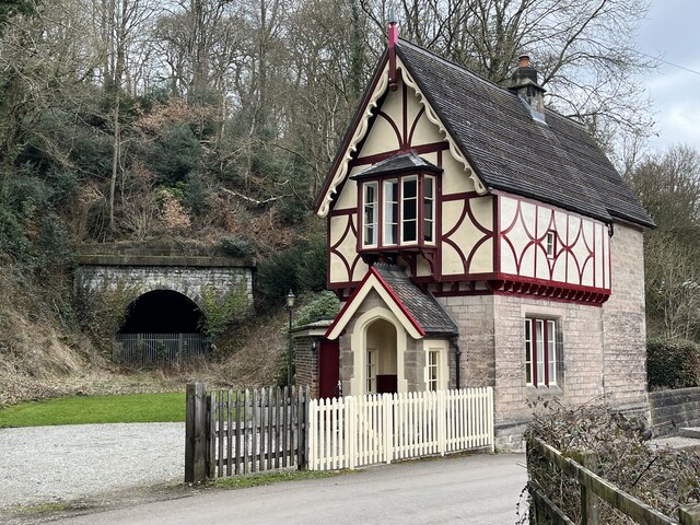
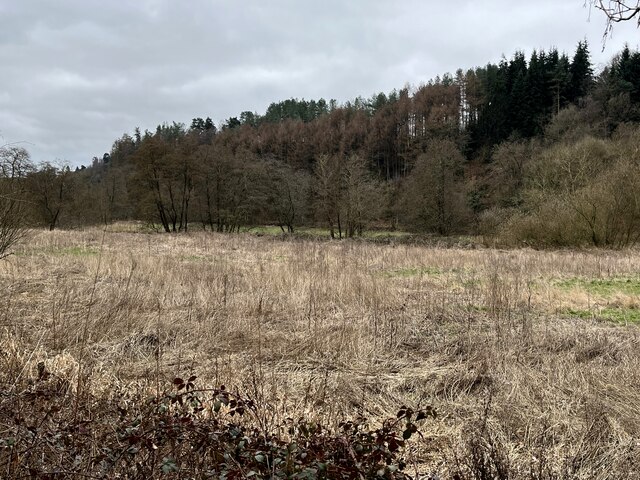
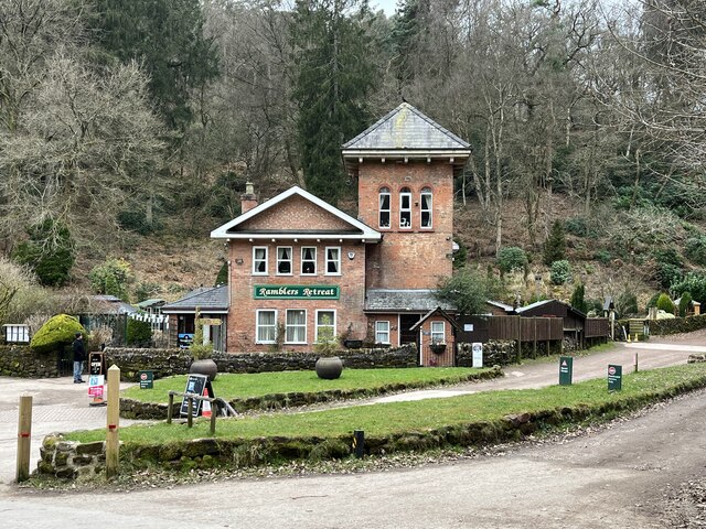
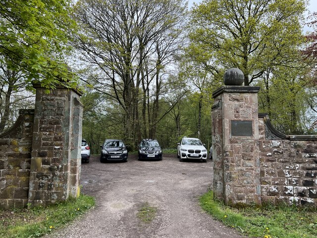
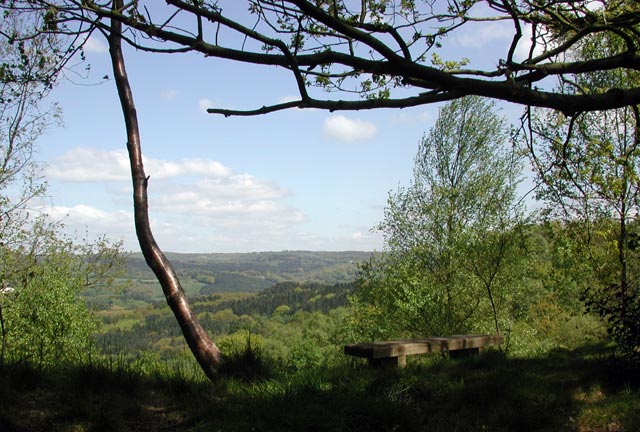
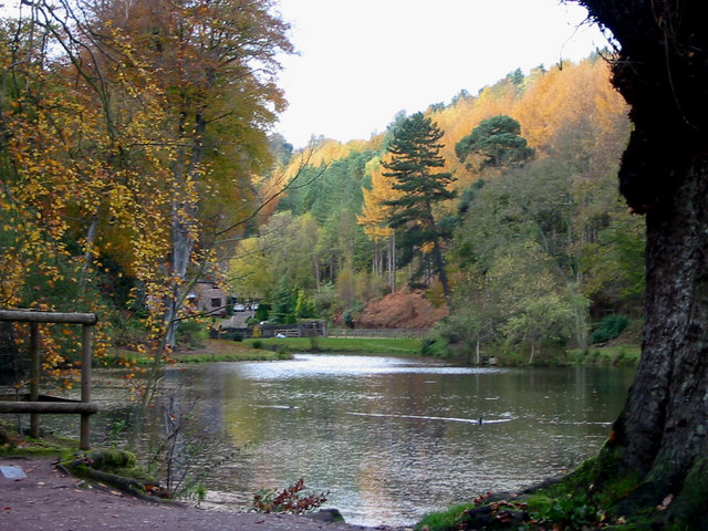
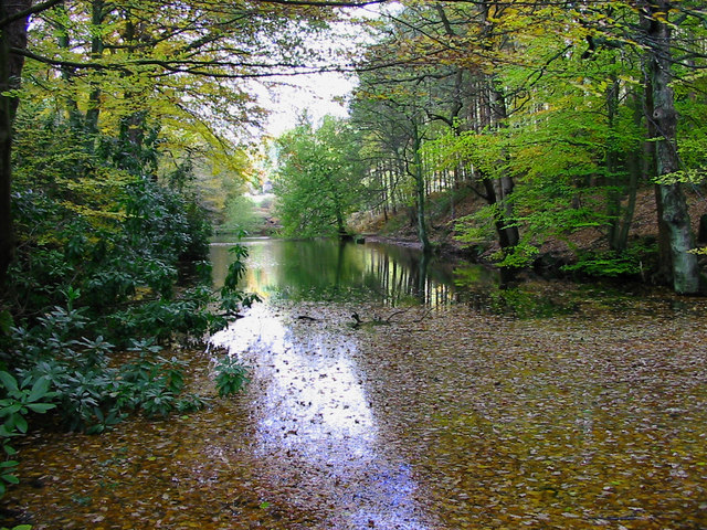
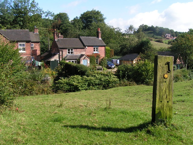
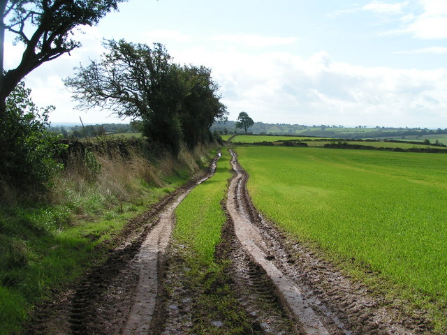
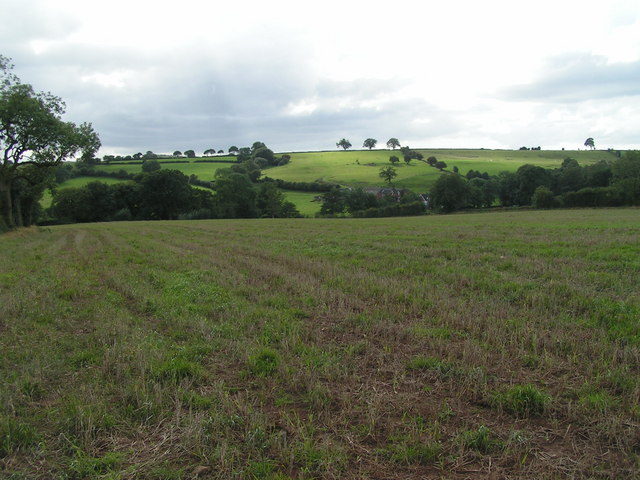
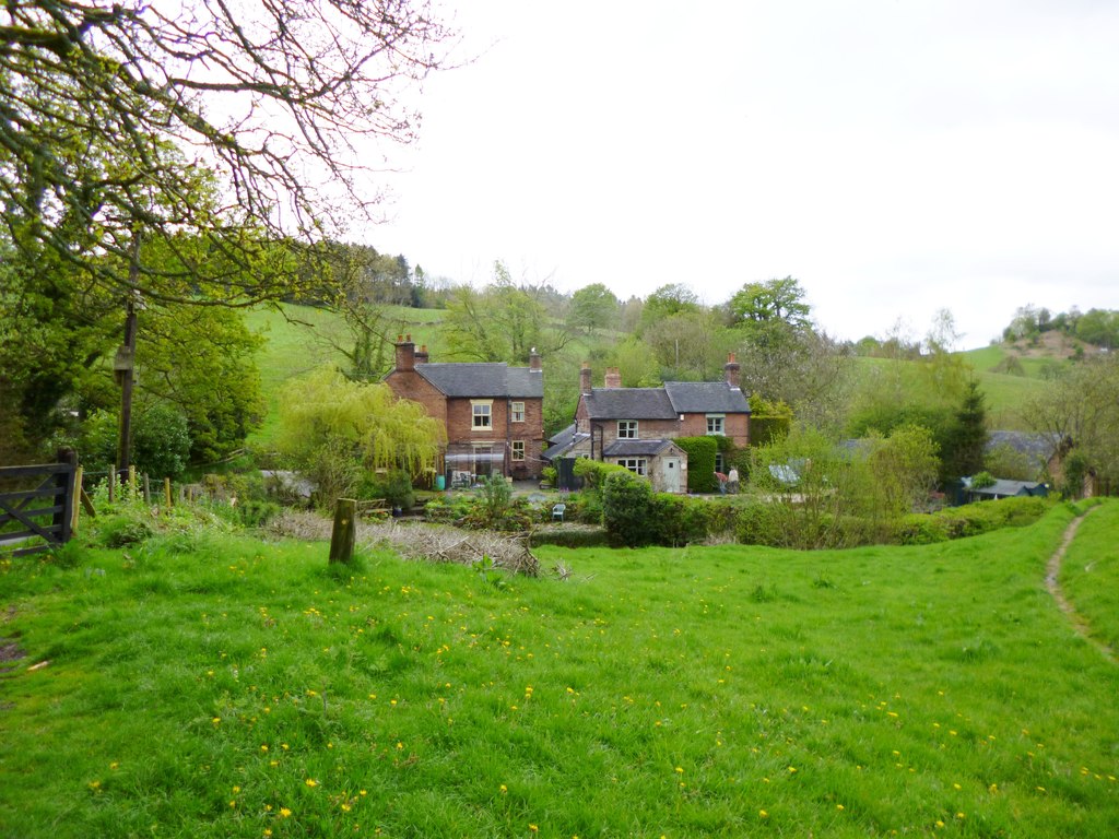
Dimmingsdale Wood is a picturesque forest located in Staffordshire, England. Covering an area of approximately 200 acres, it is known for its natural beauty and tranquil atmosphere. The wood is situated near the village of Alton, and its lush greenery and diverse wildlife make it a popular destination for nature enthusiasts and outdoor adventurers.

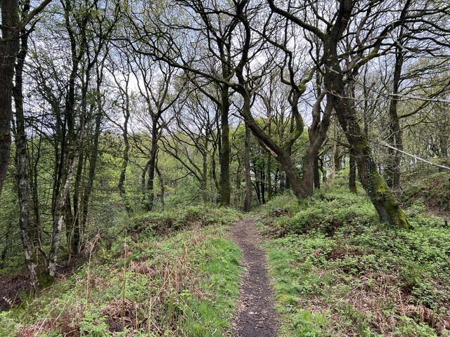
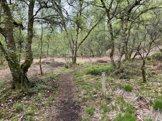
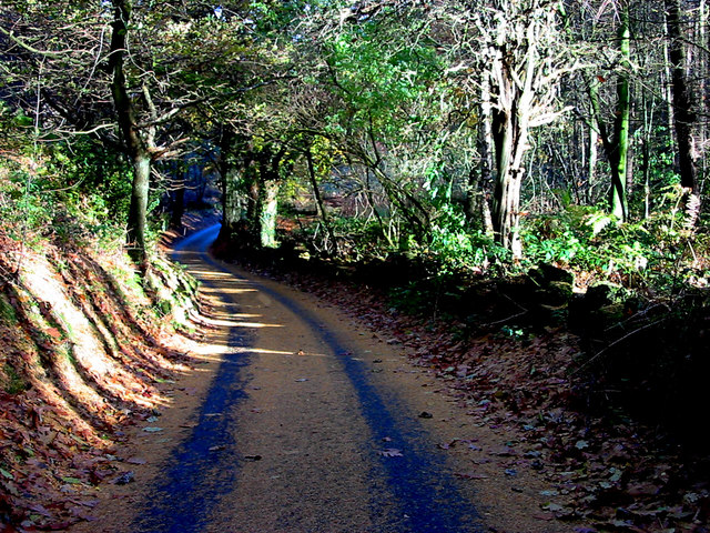
The wood is characterized by its dense canopy of towering trees, including oak, beech, and birch. These trees provide shade and create a serene environment, perfect for leisurely walks or picnics. The forest floor is carpeted with a variety of wildflowers, adding vibrant splashes of color to the landscape.

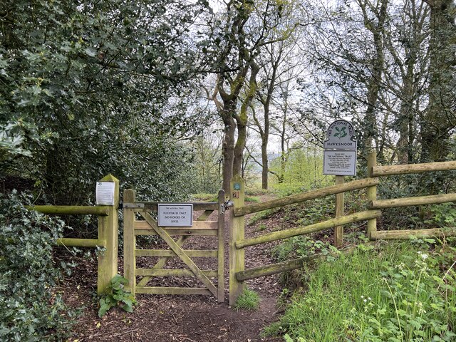
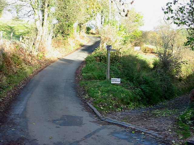
Several walking trails wind through Dimmingsdale Wood, offering visitors the opportunity to explore its scenic beauty. The trails are well-maintained and suitable for all ages and fitness levels. Along the way, there are various points of interest, such as the historic Dimmingsdale Bridge, which dates back to the 18th century. The bridge is a popular spot for photography, offering stunning views of the surrounding woodland.

The wood is home to a diverse range of wildlife, including deer, foxes, and a multitude of bird species. Birdwatchers can spot woodpeckers, owls, and even the occasional red kite soaring overhead. The tranquil atmosphere and abundance of wildlife make Dimmingsdale Wood a haven for nature lovers seeking a peaceful escape from the hustle and bustle of everyday life.

Overall, Dimmingsdale Wood in Staffordshire is a true gem of natural beauty. Its lush greenery, walking trails, and diverse wildlife make it a must-visit destination for anyone seeking a tranquil and enchanting woodland experience.

If you have any feedback on the listing, please let us know in the comments section below.

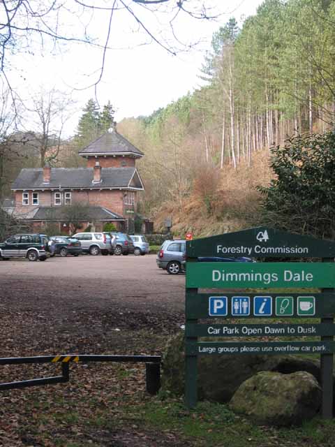
Dimmingsdale Wood Images

Images are sourced within 2km of 52.989436/-1.9320147 or Grid Reference SK0443. Thanks to Geograph Open Source API. All images are credited.

Old Milestone, Threapwood Head Cast iron post by the B5032, in parish of ALTON (STAFFORDSHIRE MOORLANDS District), by hedge, on North side of road. Cochrane iron casting, erected by the County Council in the 20th century.

Inscription reads:-
: ALTON 2½ / DENSTONE 4½ / ELLASTONE 6¼ / ASHBOURNE 11 : : ALTON / PARISH : : CHEADLE 2 :
Maker:- Cochrane & Co, Dudley. :

Milestone Society National ID: ST_ABCD11
Old Milestone, Threapwood Head
Cast iron post by the B5032, in parish of ALTON (STAFFORDSHIRE MOORLANDS District), by hedge, on North side of road. Cochrane iron casting, erected by the County Council in the 20th century. Inscription reads:- : ALTON 2½ / DENSTONE 4½ / ELLASTONE 6¼ / ASHBOURNE 11 : : ALTON / PARISH : : CHEADLE 2 : Maker:- Cochrane & Co, Dudley. : Milestone Society National ID: ST_ABCD11
Closed railway tunnel and former crossing keeper's cottage On the former Churnet Valley line in North Staffordshire.
Closed railway tunnel and former crossing keeper's cottage
On the former Churnet Valley line in North Staffordshire.
Churnet Valley flood plain
The Ramblers' Retreat A deservedly popular cafe and tea room in Dimmingsdale.
The Ramblers' Retreat
A deservedly popular cafe and tea room in Dimmingsdale.
Highshutt entrance to Hawksmoor NT Hawksmoor is an ancient steep-sided oak woodland
Highshutt entrance to Hawksmoor NT
Hawksmoor is an ancient steep-sided oak woodland
Path through Hawksmoor NT Hawksmoor is an ancient steep-sided oak woodland east of Cheadle in Staffordshire towards Oakamoor. It is managed by the National Trust. The habitat attracts specialised bird species such as Wood Warbler and Pied Flycatcher.
Path through Hawksmoor NT
Hawksmoor is an ancient steep-sided oak woodland east of Cheadle in Staffordshire towards Oakamoor. It is managed by the National Trust. The habitat attracts specialised bird species such as Wood Warbler and Pied Flycatcher.
Car parking for Hawksmoor NT 'Limited parking for approx. 6 cars' states the National Trust website, and this is it. However even more limited off-road parking is possible at Highshutt further west outside the entrance shown here <a title="https://www.geograph.org.uk/photo/7667028" href="https://www.geograph.org.uk/photo/7667028">Link</a>
Car parking for Hawksmoor NT
'Limited parking for approx. 6 cars' states the National Trust website, and this is it. However even more limited off-road parking is possible at Highshutt further west outside the entrance shown here Link
Path through Hawksmoor NT Hawksmoor is an ancient steep-sided oak woodland east of Cheadle in Staffordshire towards Oakamoor. It is managed by the National Trust. The habitat attracts specialised bird species such as Wood Warbler and Pied Flycatcher.
Path through Hawksmoor NT
Hawksmoor is an ancient steep-sided oak woodland east of Cheadle in Staffordshire towards Oakamoor. It is managed by the National Trust. The habitat attracts specialised bird species such as Wood Warbler and Pied Flycatcher.
View from Hawksmoor Reserve (NT)
Ramblers' Retreat Dimmings Dale The Ramblers' Retreat, now a popular restaurant and tea room deep in the Churnet Valley, was once a lodge for the 16th Earl of Shrewsbury's Alton Towers estate.
Ramblers' Retreat Dimmings Dale
The Ramblers' Retreat, now a popular restaurant and tea room deep in the Churnet Valley, was once a lodge for the 16th Earl of Shrewsbury's Alton Towers estate.
Dimmingsdale Dimmingsdale in all its autumnal glory showing one of the holding ponds built to hold water used in the adjacent smelting mill, now a private residence.
Dimmingsdale
Dimmingsdale in all its autumnal glory showing one of the holding ponds built to hold water used in the adjacent smelting mill, now a private residence.
Dimmingsdale in Autumn Autumnal leaves cover one of several ponds in Dimmingsdale in the Staffordshire Moorlands.
Dimmingsdale in Autumn
Autumnal leaves cover one of several ponds in Dimmingsdale in the Staffordshire Moorlands.
Country Lane The Threapwood to Oakamoor road showing the western entrance to Dimmingsdale
Country Lane
The Threapwood to Oakamoor road showing the western entrance to Dimmingsdale
Autumn Lane A country lane near Oakamoor in the Staffordshire Moorlands covered in pine needles.
Autumn Lane
A country lane near Oakamoor in the Staffordshire Moorlands covered in pine needles.
Oldfurnace Cottages at Oldfurnace from the footpath to Newton.
Oldfurnace
Cottages at Oldfurnace from the footpath to Newton.
Newton Newly renovated cottages in the local pink stone. Newton is a cluster of cottages set back from the road down a gravelled track.
Newton
Newly renovated cottages in the local pink stone. Newton is a cluster of cottages set back from the road down a gravelled track.
Ridge above Bradley Elms A footpath follows the crest of this broad ridge from Newton to Great Gate, with views to the quarries to the west and Alton Towers to the northeast.
Ridge above Bradley Elms
A footpath follows the crest of this broad ridge from Newton to Great Gate, with views to the quarries to the west and Alton Towers to the northeast.
New Farm From the footpath between Bradley in the Moors and Alton Common.
New Farm
From the footpath between Bradley in the Moors and Alton Common.
Show me another place!

Dimmingsdale Wood is located at Grid Ref: SK0443 (Lat: 52.989436, Lng: -1.9320147)

Administrative County: Staffordshire

District: Staffordshire Moorlands

Police Authority: Staffordshire

What 3 Words

///subjects.sedative.slips. Near Cheadle, Staffordshire

Related Wikis

The Old Furnace

The Old Furnace is a colloquial name given to an historic site in Oakamoor, Staffordshire, England, that supported the development of medieval and post...

Oakamoor railway station

Oakamoor railway station is a closed railway station in the Churnet Valley, Staffordshire. The station was opened in 1849 as part of the Churnet Valley...

Oakamoor Tunnel

Oakamoor Tunnel is a disused 497-yard (454 m) long tunnel located north of Oakamoor railway station on the former Uttoxeter to North Rode section of the...

Oakamoor

Oakamoor is a small village in north Staffordshire, England. Although it is now a rural area, it has an industrial past which drew on the natural resources...

Chained Oak

The Chained Oak is an oak tree, tied in chains, near to the village of Alton, Staffordshire, England. The tree, referred to as "The Old Oak", is the subject...

Submission (Alton Towers)

Submission was a theme park ride at Alton Towers in Staffordshire, England from 2001 until 2013. It was a Chance Rides double swinging inverter. ��2...

Oblivion (roller coaster)

Oblivion is a steel roller coaster located at Alton Towers in Staffordshire, England. The prototype Dive Coaster model from Bolliger & Mabillard opened...
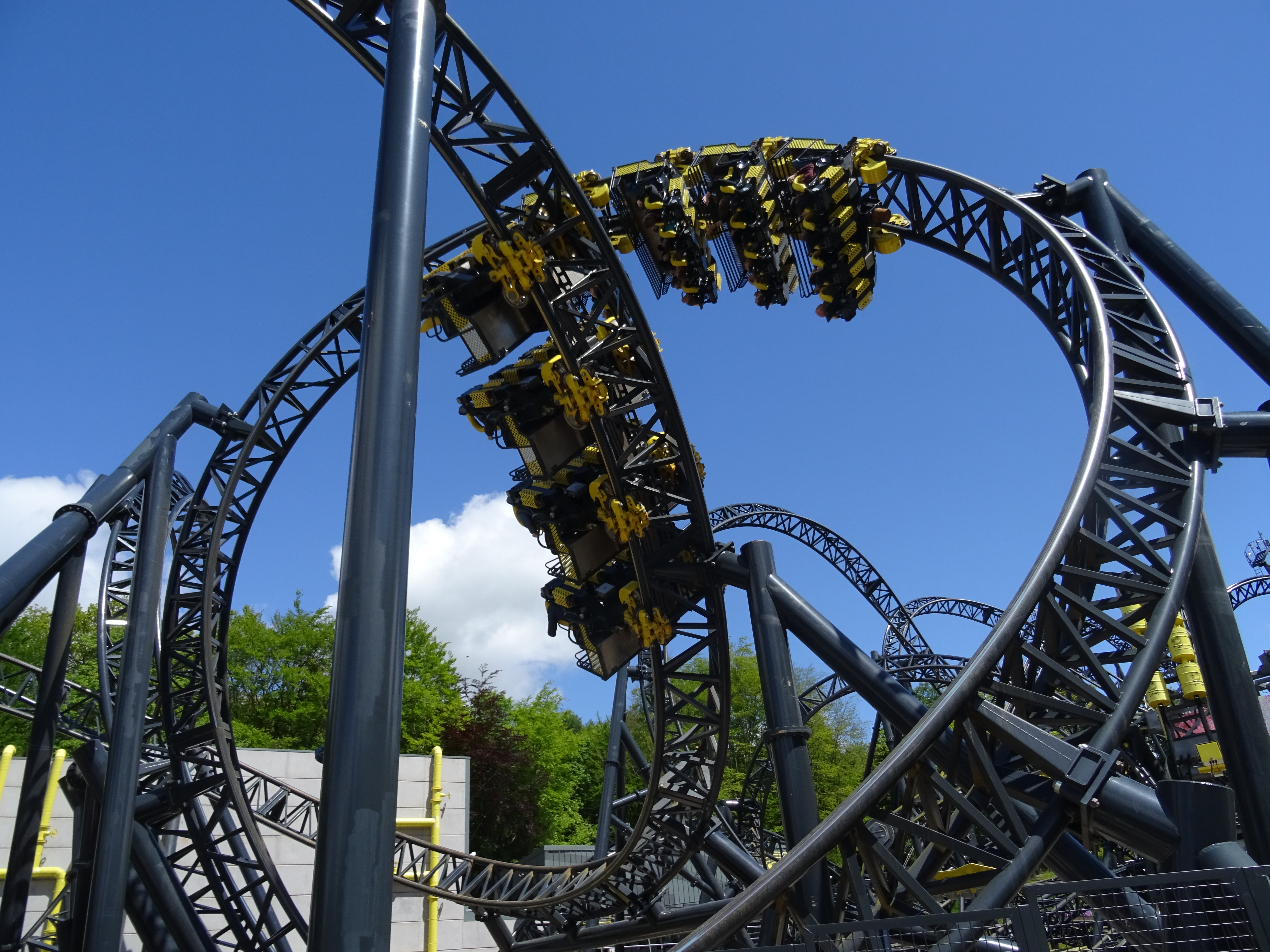
The Smiler

The Smiler is a steel roller coaster located at Alton Towers in Staffordshire, United Kingdom. It opened in 2013 as the first Infinity Coaster model from...

Nearby Amenities

Located within 500m of 52.989436,-1.9320147
Barrier: cattle_grid
Lat/Long: 52.9860469/-1.9334858
Barrier: cattle_grid
Lat/Long: 52.9914069/-1.9293889
Ford: yes
Lat/Long: 52.989373/-1.9380039
Ford: yes
Lat/Long: 52.9889041/-1.9321231
Waterway: waterfall
Lat/Long: 52.9897344/-1.9339172
Barrier: stile
Stile: stepover
Lat/Long: 52.9900277/-1.9391677
Barrier: stile
Material: stone
Source: survey;gps
Stile: squeezer
Lat/Long: 52.9911407/-1.928604
Barrier: entrance
Source: survey;gps
Lat/Long: 52.991413/-1.9293229
Barrier: stile
Material: wood
Source: survey;gps
Stile: stepover
Lat/Long: 52.9914343/-1.929406
Power: pole
Lat/Long: 52.9908833/-1.9379174
Power: pole
Lat/Long: 52.9910205/-1.9291521
Power: pole
Lat/Long: 52.9914388/-1.9279859
Power: pole
Lat/Long: 52.9918333/-1.9268898
The data included in this document is from www.openstreetmap.org. The data is made available under ODbL.

Have you been to Dimmingsdale Wood?

Leave your review of Dimmingsdale Wood below (or comments, questions and feedback).