Park Wood

Wood, Forest in Staffordshire Staffordshire Moorlands

England

Park Wood

Harston Wood Harston Wood, a nature reserve of Staffordshire Wildlife Trust. The start of the footpath through the wood.
Harston Wood Credit: David Weston

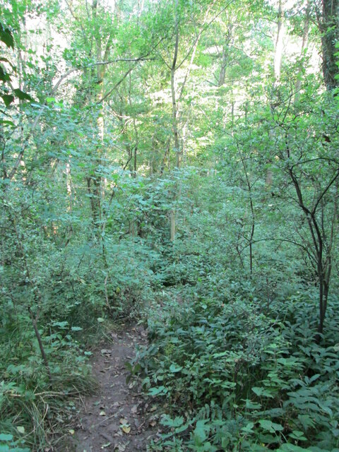
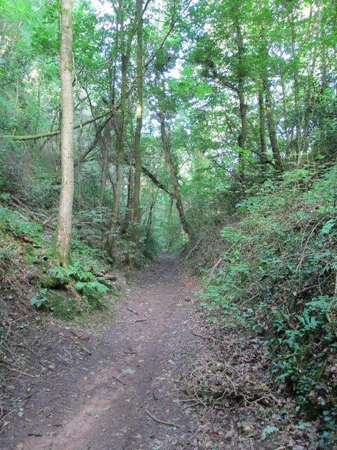
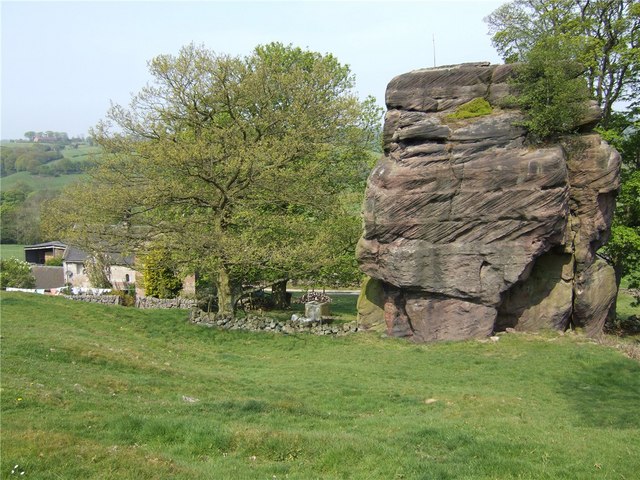
Park Wood is a picturesque woodland located in Staffordshire, England. Covering an area of approximately 100 acres, it is a diverse and vibrant forest that offers a tranquil escape from the bustling city life. The wood is primarily made up of deciduous trees such as oak, beech, and birch, creating a beautiful canopy that changes with the seasons.

The woodland is well-known for its rich biodiversity and is home to a wide array of flora and fauna. Visitors can find an abundance of wildflowers, including bluebells and primroses, carpeting the forest floor during the spring months. Various bird species can also be spotted, such as woodpeckers, owls, and nuthatches, making it a popular destination for birdwatching enthusiasts.

Park Wood offers a variety of walking trails, allowing visitors to explore the forest and take in the natural beauty at their own pace. The paths wind through the wood, leading to hidden clearings and peaceful spots perfect for picnics or simply enjoying the serenity of nature. The wood is also well-maintained, with clearly marked trails and information boards providing interesting facts about the different tree species and wildlife found within the forest.

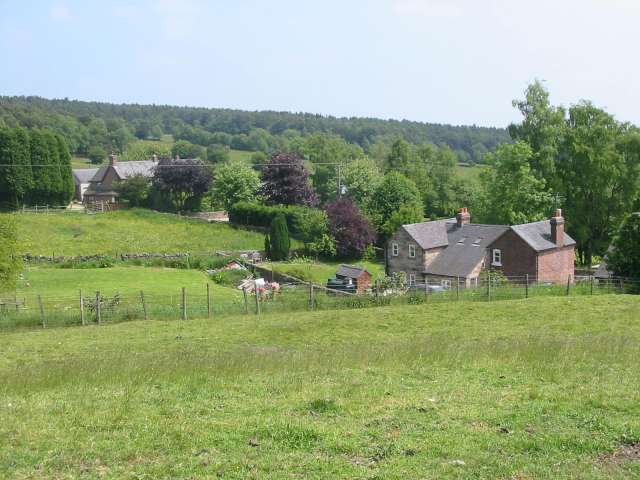
Located in close proximity to residential areas, Park Wood is a popular destination for locals and visitors alike. Its accessibility and natural beauty make it an ideal location for outdoor activities such as hiking, jogging, and nature photography. Whether one seeks solace in nature or simply wishes to immerse themselves in the beauty of a woodland, Park Wood offers a serene and enchanting experience for all who visit.

If you have any feedback on the listing, please let us know in the comments section below.

Park Wood Images

Images are sourced within 2km of 53.016414/-1.9358331 or Grid Reference SK0446. Thanks to Geograph Open Source API. All images are credited.

Harston Wood Harston Wood, a nature reserve of Staffordshire Wildlife Trust. The start of the footpath through the wood.
Harston Wood
Harston Wood, a nature reserve of Staffordshire Wildlife Trust. The start of the footpath through the wood.
Tramroad through Harston Wood The line of a former tramroad, looking west, downhill along a steady incline. The tramroad carried limestone from quarries at Caldon Low, westwards to Froghall Wharf at the end of the Caldon Canal.
Tramroad through Harston Wood
The line of a former tramroad, looking west, downhill along a steady incline. The tramroad carried limestone from quarries at Caldon Low, westwards to Froghall Wharf at the end of the Caldon Canal.
Kingsley & Froghall Station - running in board Interestingly, the Churnet Valley Railway has chosen to use replica LMS signs for the running in boards (the larger signs used at the ends of the platforms, a practice largely discontinued on the modern railway) rather than the later British Railways style. The LMS usually angled these slightly outwards and that has been done at the other end of the platform.
Kingsley & Froghall Station - running in board
Interestingly, the Churnet Valley Railway has chosen to use replica LMS signs for the running in boards (the larger signs used at the ends of the platforms, a practice largely discontinued on the modern railway) rather than the later British Railways style. The LMS usually angled these slightly outwards and that has been done at the other end of the platform.
Steam Train TKh 2944 "Hotspur" Taking On Water, Froghall Station Works Number - 2944
Build Date - 1952
Builder - Fablok, Chrzanów
Wheel Arrangement - 0-6-0T


<span class="nowrap"><a title="https://en.wikipedia.org/wiki/Fablok_TKh49" rel="nofollow ugc noopener" href="https://en.wikipedia.org/wiki/Fablok_TKh49">Link</a><img style="margin-left:2px;" alt="External link" title="External link - shift click to open in new window" src="https://s1.geograph.org.uk/img/external.png" width="10" height="10"/></span>
Steam Train TKh 2944 "Hotspur" Taking On Water, Froghall Station
Works Number - 2944 Build Date - 1952 Builder - Fablok, Chrzanów Wheel Arrangement - 0-6-0T LinkExternal link
Whiston Methodist Church The inscription over the large window reads "Primitive Methodist Centenary Church 1907 1908". The centenary being the foundation of Primitive Methodism only 30 km away on <a href="https://www.geograph.org.uk/gridref/SJ8557">SJ8557</a> Mow Cop in 1807. Not to be confused with <a href="https://www.geograph.org.uk/photo/111780">SK4489 : Whiston Methodist Church, Nr Rotherham</a> / <a href="https://www.geograph.org.uk/photo/112012">SK4489 : Methodist Church in Whiston, Nr Rotherham.</a>.
Whiston Methodist Church
The inscription over the large window reads "Primitive Methodist Centenary Church 1907 1908". The centenary being the foundation of Primitive Methodism only 30 km away on SJ8557 Mow Cop in 1807. Not to be confused with SK4489 : Whiston Methodist Church, Nr Rotherham / SK4489 : Methodist Church in Whiston, Nr Rotherham..
Whiston Hall Hotel and golf club house, in Whiston. "This fine example of a Victorian hall was built in 1850. The residence and estate was owned, founded and lovingly restored by Mr. Tom Cooper" <span class="nowrap"><a title="http://www.whistonhall.com/introduction.htm" rel="nofollow ugc noopener" href="http://www.whistonhall.com/introduction.htm">Link</a><img style="margin-left:2px;" alt="External link" title="External link - shift click to open in new window" src="https://s1.geograph.org.uk/img/external.png" width="10" height="10"/></span>
Whiston Hall
Hotel and golf club house, in Whiston. "This fine example of a Victorian hall was built in 1850. The residence and estate was owned, founded and lovingly restored by Mr. Tom Cooper" LinkExternal link
Interior of Oakamoor Church
Geocache stash and landscape This is a picture taken after finding a geocache, a new and fantastic hobby discovered after submitting pictures to this site. The picture shows the field and side of forest shown on the map. The tupperware box is what we found buried about 100 yards away. Get out there and get geo - "graphing" and "caching"!
Geocache stash and landscape
This is a picture taken after finding a geocache, a new and fantastic hobby discovered after submitting pictures to this site. The picture shows the field and side of forest shown on the map. The tupperware box is what we found buried about 100 yards away. Get out there and get geo - "graphing" and "caching"!
Great Marquess steam locomotive on Churnet Valley Railway Great Marquess steam locomotive on Churnet Valley Railway near Oakamoor. This part of the preserved railway line is not yet open to the public
Great Marquess steam locomotive on Churnet Valley Railway
Great Marquess steam locomotive on Churnet Valley Railway near Oakamoor. This part of the preserved railway line is not yet open to the public
Great Marquess steam locomotive on the Churnet Valley Railway Great Marquess steam locomotive on the Churnet Valley Railway approaching Froghall and Kingsley Station.
Great Marquess steam locomotive on the Churnet Valley Railway
Great Marquess steam locomotive on the Churnet Valley Railway approaching Froghall and Kingsley Station.
Abandoned Canal Milepost and Railway This milepost stands on a section of the former Uttoxeter Canal in the Churnet Valley. The canal was closed in 1849 to make way for the North Staffordshire Railway, pictured in the background. The railway took a straighter route, leaving isolated loops of canal at various points down the valley.
Abandoned Canal Milepost and Railway
This milepost stands on a section of the former Uttoxeter Canal in the Churnet Valley. The canal was closed in 1849 to make way for the North Staffordshire Railway, pictured in the background. The railway took a straighter route, leaving isolated loops of canal at various points down the valley.
California Lock California (or Morris's) Lock was on the Uttoxeter Canal, closed in 1849 to make way for the North Staffordshire Railway. Nearby, there were wharves for loading coal, brought by the Woodhead Tramroad from the mines around Cheadle.
California Lock
California (or Morris's) Lock was on the Uttoxeter Canal, closed in 1849 to make way for the North Staffordshire Railway. Nearby, there were wharves for loading coal, brought by the Woodhead Tramroad from the mines around Cheadle.
Morris's Bridge Morris's Bridge was on the Uttoxeter Canal, closed in 1849 to make way for the North Staffordshire Railway. It has been partially demolished or collapsed. The bolt sticking out of the stone at the top probably held a plank of wood in place to prevent damage from towing ropes.
Morris's Bridge
Morris's Bridge was on the Uttoxeter Canal, closed in 1849 to make way for the North Staffordshire Railway. It has been partially demolished or collapsed. The bolt sticking out of the stone at the top probably held a plank of wood in place to prevent damage from towing ropes.
Oldridge Oldridge / Oldridge Farm
Oldridge
Oldridge / Oldridge Farm
Whiston Village Hall The village hall looks to be quite new and has extensive views from its high location overlooking the Staffordshire moorlands towards Cheadle.
Whiston Village Hall
The village hall looks to be quite new and has extensive views from its high location overlooking the Staffordshire moorlands towards Cheadle.
Moneystone Quarry Moneystone quarry is in the process of being extended and is very busy with trucks coming and going every few seconds.
Moneystone Quarry
Moneystone quarry is in the process of being extended and is very busy with trucks coming and going every few seconds.
Moneystone Quarry Moneystone sandstone quarry is extremely busy and traffic lights control trucks and quarry vehicles crossing this access road.  All of the stone is taken out by road, and lorries thunder in and out every few seconds.  The map shows a link to the railway line in the valley below, which is now the Churnet Valley preserved railway.  This is no longer used to transport quarry goods but it would seem to be a much better way of shifting large loads of stone around.
Moneystone Quarry
Moneystone sandstone quarry is extremely busy and traffic lights control trucks and quarry vehicles crossing this access road. All of the stone is taken out by road, and lorries thunder in and out every few seconds. The map shows a link to the railway line in the valley below, which is now the Churnet Valley preserved railway. This is no longer used to transport quarry goods but it would seem to be a much better way of shifting large loads of stone around.
Moneystone Moneystone is a quiet hamlet high up on the moors near Oakamoor.  This view looks idyllic and it is hard to believe that just a short way down the road is a massive and very busy sandstone quarry with streams of trucks thundering along the little lanes.
Moneystone
Moneystone is a quiet hamlet high up on the moors near Oakamoor. This view looks idyllic and it is hard to believe that just a short way down the road is a massive and very busy sandstone quarry with streams of trucks thundering along the little lanes.
Show me another place!

Park Wood is located at Grid Ref: SK0446 (Lat: 53.016414, Lng: -1.9358331)

Administrative County: Staffordshire

District: Staffordshire Moorlands

Police Authority: Staffordshire

What 3 Words

///servants.purses.wimp. Near Cheadle, Staffordshire

Nearby Locations

Black Plantation Park Wood

Related Wikis

Whiston, Staffordshire Moorlands

Whiston is a village in the Staffordshire Moorlands district of Staffordshire, England. Population details as taken at the 2011 census can be found under...

Harston Wood

Harston Wood is a nature reserve of the Staffordshire Wildlife Trust. It is an ancient woodland, adjacent to the village of Froghall, near Cheadle, Staffordshire...

Cotton Dell

Cotton Dell is a nature reserve of the Staffordshire Wildlife Trust. It is a wooded valley area near the village of Cotton and about 0.5 miles (0.8 km...

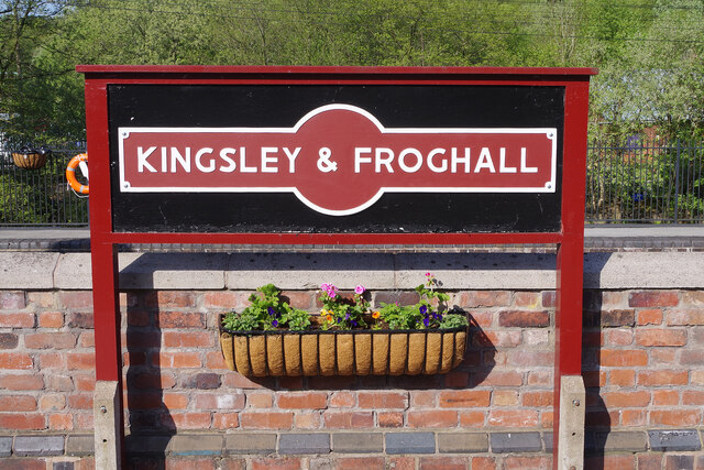
Kingsley and Froghall railway station

Kingsley and Froghall is a former railway station of the North Staffordshire Railway (NSR) that is now preserved on the Churnet Valley Railway in Staffordshire...

Nearby Amenities

Located within 500m of 53.016414,-1.9358331
Moneystone Quarry
Place: locality
Lat/Long: 53.0146366/-1.9331849
Fixme: There is a public footpath sign pointing in this direction. This isn't on OS or Staffordshires PROW map. Have registered and issue with them.
Lat/Long: 53.0154217/-1.9419105
Barrier: stile
Material: stone
Source: survey;gps
Stile: squeezer
Lat/Long: 53.0172475/-1.9424174
Barrier: stile
Material: stone
Source: survey;gps
Stile: squeezer
Lat/Long: 53.0180891/-1.9419019
Barrier: stile
Material: stone
Source: survey;gps
Stile: squeezer
Lat/Long: 53.0183206/-1.9417703
Barrier: stile
Material: stone
Source: survey;gps
Stile: squeezer
Lat/Long: 53.0192176/-1.9412849
Power: pole
Lat/Long: 53.0202257/-1.9332558
Power: pole
Lat/Long: 53.0197336/-1.9344494
Power: pole
Lat/Long: 53.0190592/-1.9360185
Power: pole
Lat/Long: 53.0184638/-1.9374239
Power: pole
Lat/Long: 53.0179749/-1.9385907
Power: pole
Lat/Long: 53.0201612/-1.9337574
Power: pole
Lat/Long: 53.0197804/-1.9346023
Power: pole
Lat/Long: 53.0190753/-1.9363162
Power: pole
Lat/Long: 53.0185671/-1.9375071
Power: pole
Lat/Long: 53.0181056/-1.9385827
Power: pole
Lat/Long: 53.0176441/-1.9396663
Power: pole
Lat/Long: 53.017536/-1.9408625
Power: pole
Lat/Long: 53.0174005/-1.9422358
Power: pole
Lat/Long: 53.0203112/-1.9336259
Power: pole
Lat/Long: 53.0198401/-1.9347176
Power: pole
Lat/Long: 53.0191302/-1.9364181
Power: pole
Lat/Long: 53.0186187/-1.937601
Power: pole
Lat/Long: 53.0181524/-1.9387007
Power: pole
Lat/Long: 53.0177587/-1.9396931
Power: pole
Lat/Long: 53.0176296/-1.9408652
Power: pole
Lat/Long: 53.0174957/-1.942319
Power: pole
Lat/Long: 53.0204742/-1.9334865
Power: pole
Lat/Long: 53.0198756/-1.9348785
Power: pole
Lat/Long: 53.0191866/-1.9365469
Power: pole
Lat/Long: 53.0186994/-1.9376788
Power: pole
Lat/Long: 53.0179894/-1.9392908
Power: pole
Lat/Long: 53.0177216/-1.940825
Power: pole
Lat/Long: 53.0173989/-1.9398728
Power: pole
Lat/Long: 53.0169648/-1.9409752
Power: pole
Lat/Long: 53.0164404/-1.9421741
Power: pole
Lat/Long: 53.0175554/-1.9425872
Barrier: stile
Foot: yes
Stile: stepover
Lat/Long: 53.0177589/-1.9296271
Barrier: stile
Foot: yes
Material: stone
Stile: squeezer
Lat/Long: 53.0190968/-1.9326696
Barrier: stile
Foot: yes
Material: stone
Stile: stepover
Lat/Long: 53.0202621/-1.9363537
Barrier: stile
Material: stone
Source: survey;gps
Stile: stepover
Lat/Long: 53.0180034/-1.9302103
The data included in this document is from www.openstreetmap.org. The data is made available under ODbL.

Have you been to Park Wood?

Leave your review of Park Wood below (or comments, questions and feedback).