Culham

Settlement in Oxfordshire South Oxfordshire

England

Culham

Drayton Road at Sutton Courtenay village boundary
Drayton Road at Sutton Courtenay village boundary Credit: Colin Pyle

The requested URL returned error: 429 Too Many Requests

If you have any feedback on the listing, please let us know in the comments section below.
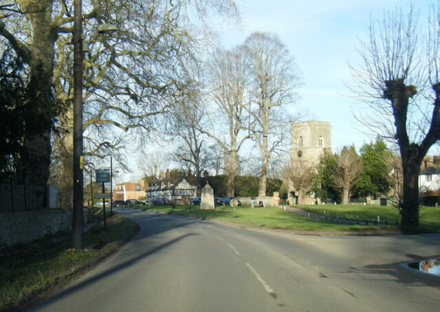
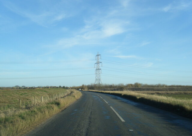
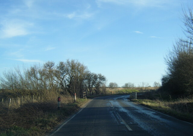
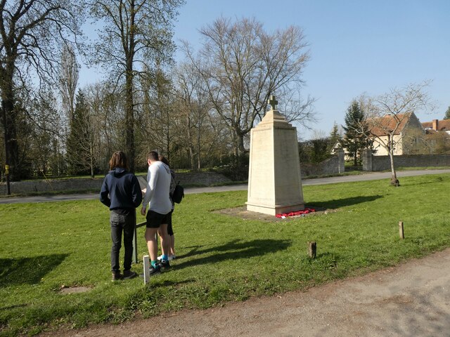
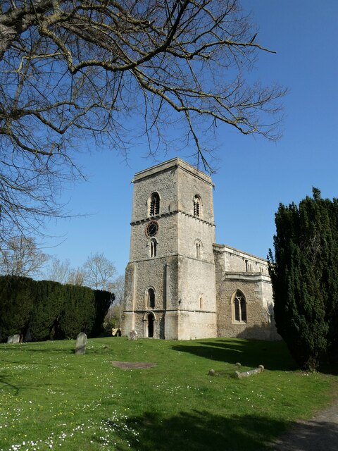
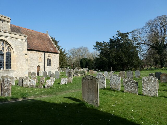
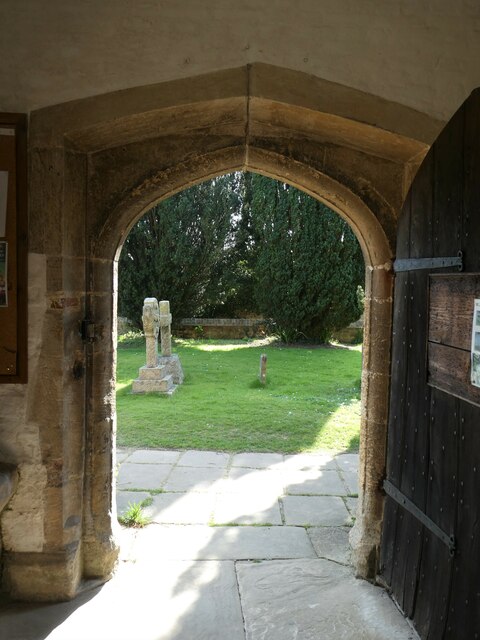
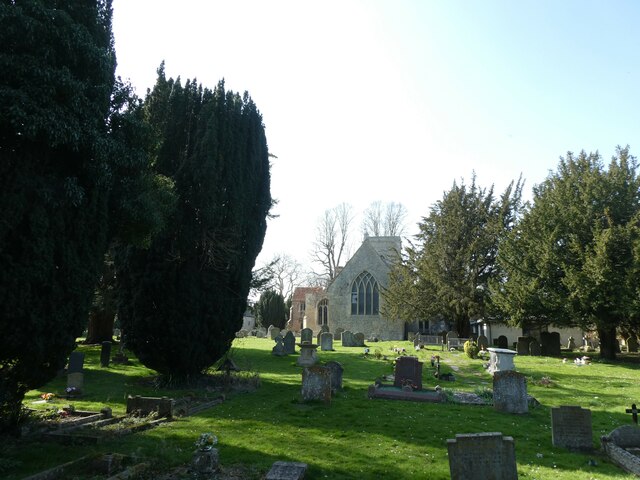
Culham Images

Images are sourced within 2km of 51.65194/-1.268115 or Grid Reference SU5095. Thanks to Geograph Open Source API. All images are credited.

Drayton Road at Sutton Courtenay village boundary
Church Street, The Green and All Saints Church
B4016 Appleford Road nearing power lines
B4016 Appleford Road
Sutton Courtenay War Memorial: late March 2022
Sutton Courtenay Post Office: late March 2022
All Saints, Sutton Courtenay: late March 2022
All Saints, Sutton Courtenay: churchyard (a)
All Saints, Sutton Courtenay: churchyard (b)
All Saints, Sutton Courtenay: churchyard (c)
All Saints, Sutton Courtenay: churchyard (d) For more about Sir Reginald see <span class="nowrap"><a title="https://en.wikipedia.org/wiki/Reginald_Kennedy-Cox" rel="nofollow ugc noopener" href="https://en.wikipedia.org/wiki/Reginald_Kennedy-Cox">Link</a><img style="margin-left:2px;" alt="External link" title="External link - shift click to open in new window" src="https://s1.geograph.org.uk/img/external.png" width="10" height="10"/></span>
All Saints, Sutton Courtenay: churchyard (d)
For more about Sir Reginald see LinkExternal link
All Saints, Sutton Courtenay: churchyard (e) The tomb memorial for Sir Reginald Kennedy Cox and his adopted son: for his son's service record see <span class="nowrap"><a title="https://www.cwgc.org/find-records/find-war-dead/casualty-details/2437292/rising,-john-james/" rel="nofollow ugc noopener" href="https://www.cwgc.org/find-records/find-war-dead/casualty-details/2437292/rising,-john-james/">Link</a><img style="margin-left:2px;" alt="External link" title="External link - shift click to open in new window" src="https://s1.geograph.org.uk/img/external.png" width="10" height="10"/></span>
All Saints, Sutton Courtenay: churchyard (e)
The tomb memorial for Sir Reginald Kennedy Cox and his adopted son: for his son's service record see LinkExternal link
All Saints, Sutton Courtenay: churchyard (f) Also see <span class="nowrap"><a title="https://en.wikipedia.org/wiki/Thomas_FitzGerald,_Earl_of_Offaly" rel="nofollow ugc noopener" href="https://en.wikipedia.org/wiki/Thomas_FitzGerald,_Earl_of_Offaly">Link</a><img style="margin-left:2px;" alt="External link" title="External link - shift click to open in new window" src="https://s1.geograph.org.uk/img/external.png" width="10" height="10"/></span>
All Saints, Sutton Courtenay: churchyard (f)
Also see LinkExternal link
All Saints, Sutton Courtenay: churchyard (g) Better known as George Orwell <span class="nowrap"><a title="https://en.wikipedia.org/wiki/George_Orwell" rel="nofollow ugc noopener" href="https://en.wikipedia.org/wiki/George_Orwell">Link</a><img style="margin-left:2px;" alt="External link" title="External link - shift click to open in new window" src="https://s1.geograph.org.uk/img/external.png" width="10" height="10"/></span>
All Saints, Sutton Courtenay: churchyard (g)
Better known as George Orwell LinkExternal link
All Saints, Sutton Courtenay: churchyard (h) The tomb of Herbert Asquith <span class="nowrap"><a title="https://en.wikipedia.org/wiki/H._H._Asquith" rel="nofollow ugc noopener" href="https://en.wikipedia.org/wiki/H._H._Asquith">Link</a><img style="margin-left:2px;" alt="External link" title="External link - shift click to open in new window" src="https://s1.geograph.org.uk/img/external.png" width="10" height="10"/></span>
All Saints, Sutton Courtenay: churchyard (h)
The tomb of Herbert Asquith LinkExternal link
Inside All Saints, Sutton Courtenay (A) For more about Orwell see <span class="nowrap"><a title="https://en.wikipedia.org/wiki/George_Orwell" rel="nofollow ugc noopener" href="https://en.wikipedia.org/wiki/George_Orwell">Link</a><img style="margin-left:2px;" alt="External link" title="External link - shift click to open in new window" src="https://s1.geograph.org.uk/img/external.png" width="10" height="10"/></span>
Inside All Saints, Sutton Courtenay (A)
For more about Orwell see LinkExternal link
Inside All Saints, Sutton Courtenay (B)
Inside All Saints, Sutton Courtenay (C)
Show me another place!

Culham is located at Grid Ref: SU5095 (Lat: 51.65194, Lng: -1.268115)

Administrative County: Oxfordshire

District: South Oxfordshire

Police Authority: Thames Valley

What 3 Words

///joined.backup.wipe. Near Sutton Courtenay, Oxfordshire

Nearby Locations

Culham Claypit Covert

Related Wikis

Culham

Culham is a village and civil parish in a bend of the River Thames, 1 mile (1.6 km) south of Abingdon in Oxfordshire. The parish includes Culham Science...
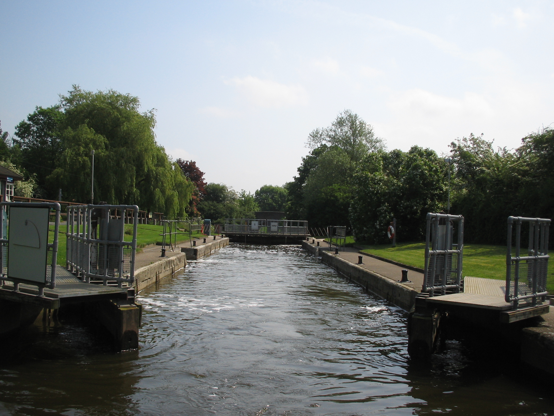
Culham Lock

Culham Lock is a lock on the River Thames in England close to Culham, Oxfordshire. It is on a lock cut to the north of the main stream, which approaches...

Culham Court, Oxfordshire

Culham Court is a Grade II listed house in Culham, Oxfordshire, England. == History == It was built in the mid-18th century, the south front in about 1816...

Sutton Bridge, Oxfordshire

Sutton Bridge is a road bridge across the River Thames near the village of Sutton Courtenay, Oxfordshire, England. It is a stone structure built in 1807...

Nearby Amenities

Located within 500m of 51.65194,-1.268115
Traffic Signals
Source: local_knowledge
Lat/Long: 51.6547301/-1.2652275
Culham
Is In: Oxfordshire, England, UK
Name Ur: کلہیم
Place: village
Lat/Long: 51.6536871/-1.2731948
Traffic Signals
Source: local_knowledge
Traffic Signals Direction: backward
Lat/Long: 51.6489539/-1.2657198
Traffic Signals
Source: local_knowledge
Lat/Long: 51.6507964/-1.2661306
Bus Stop
The Lion PH
Naptan AtcoCode: 340000572OPP
Naptan Bearing: E
Naptan CommonName: The Lion PH
Naptan Indicator: Opposite
Naptan Landmark: The Lion
Naptan NaptanCode: oxfapjwp
Naptan Street: High Street
Naptan Verified: no
Public Transport: platform
Source: naptan_import
Lat/Long: 51.6521645/-1.2728496
Bus Stop
The Lion PH
Bus: yes
Naptan AtcoCode: 340000572OUT
Naptan Bearing: W
Naptan CommonName: The Lion PH
Naptan Indicator: Outside
Naptan Landmark: The Lion
Naptan NaptanCode: oxfapjwm
Naptan Street: High Street
Naptan Verified: yes
Public Transport: platform
Source: naptan_import
Lat/Long: 51.6521011/-1.2733343
Bus Stop
The Glebe
Bus: yes
Naptan AtcoCode: 340001500CNR
Naptan Bearing: E
Naptan CommonName: The Glebe
Naptan Indicator: Corner
Naptan Landmark: The Glebe
Naptan NaptanCode: oxfagpwg
Naptan Street: High Street
Naptan Verified: no
Public Transport: platform
Shelter: no
Source: naptan_import
Lat/Long: 51.6520196/-1.2685322
Bus Stop
The Glebe
Bus: yes
Naptan AtcoCode: 340001500OPP
Naptan Bearing: W
Naptan CommonName: The Glebe
Naptan Indicator: Opposite
Naptan Landmark: The Glebe
Naptan NaptanCode: oxfagpwd
Naptan Street: High Street
Naptan Verified: no
Public Transport: platform
Source: naptan_import
Lat/Long: 51.651924/-1.2674328
Information: board
Tourism: information
Lat/Long: 51.6506332/-1.2668745
Historic: bunker
Lat/Long: 51.6508443/-1.2611773
Building: bunker
Military: bunker
Lat/Long: 51.6483397/-1.2691354
Turning Circle
Lat/Long: 51.653332/-1.2675263
Turning Circle
Lat/Long: 51.6527046/-1.2676876
Access: yes
Barrier: yes
Height: 6'6"
Lat/Long: 51.651074/-1.2662163
Power: pole
Source: Bing
Lat/Long: 51.6506305/-1.2638925
Power: pole
Source: Bing
Lat/Long: 51.6506272/-1.2630227
Crossing
Bicycle: yes
Button Operated: no
Crossing: traffic_signals
Crossing Island: yes
Segregated: no
Source: survey
Lat/Long: 51.6547307/-1.2650549
Power: pole
Lat/Long: 51.6506251/-1.2613234
Bench
Lat/Long: 51.6506464/-1.2666799
Traffic Calming: island
Lat/Long: 51.6547344/-1.2654621
Direction: 185
Generator Method: photovoltaic
Generator Output Electricity: yes
Generator Solar Modules: 7
Generator Source: solar
Generator Type: solar_photovoltaic_panel
Location: roof
Power: generator
Lat/Long: 51.6525846/-1.2662594
Direction: 95
Generator Method: photovoltaic
Generator Output Electricity: yes
Generator Solar Modules: 3
Generator Source: solar
Generator Type: solar_photovoltaic_panel
Location: roof
Power: generator
Lat/Long: 51.6526275/-1.2661332
Fixme: solar panels?
Lat/Long: 51.6526257/-1.2663484
Direction: 100
Generator Method: photovoltaic
Generator Output Electricity: yes
Generator Solar Modules: 18
Generator Source: solar
Generator Type: solar_photovoltaic_panel
Location: roof
Power: generator
Lat/Long: 51.6524963/-1.2662592
Direction: 185
Generator Method: photovoltaic
Generator Output Electricity: yes
Generator Solar Modules: 9
Generator Source: solar
Generator Type: solar_photovoltaic_panel
Location: roof
Power: generator
Lat/Long: 51.6517313/-1.2675686
Generator Method: photovoltaic
Generator Output Electricity: yes
Generator Solar Modules: 8
Generator Source: solar
Generator Type: solar_photovoltaic_panel
Location: roof
Power: generator
Tilted: no
Lat/Long: 51.6517042/-1.2674453
Direction: 185
Generator Method: photovoltaic
Generator Output Electricity: yes
Generator Solar Modules: 8
Generator Source: solar
Generator Type: solar_photovoltaic_panel
Location: roof
Power: generator
Lat/Long: 51.6517595/-1.2683235
Direction: 85
Generator Method: photovoltaic
Generator Output Electricity: yes
Generator Solar Modules: 18
Generator Source: solar
Generator Type: solar_photovoltaic_panel
Location: roof
Power: generator
Lat/Long: 51.6514417/-1.2733017
Direction: 240
Generator Method: photovoltaic
Generator Output Electricity: yes
Generator Solar Modules: 13
Generator Source: solar
Generator Type: solar_photovoltaic_panel
Location: roof
Power: generator
Lat/Long: 51.6535067/-1.2671087
Direction: 240
Generator Method: photovoltaic
Generator Output Electricity: yes
Generator Solar Modules: 15
Generator Source: solar
Generator Type: solar_photovoltaic_panel
Location: roof
Power: generator
Lat/Long: 51.6535763/-1.2672078
Post Box
Collection Times: Mo-Fr 09:00; Sa 07:00
Operator: Royal Mail
Operator Wikidata: Q638098
Ref: OX14 1044
Lat/Long: 51.6524596/-1.2744649
Post Box
Collection Times: Mo-Fr 09:00; Sa 07:00
Operator: Royal Mail
Ref: OX14 1198
Lat/Long: 51.651956/-1.2680551
Power: pole
Lat/Long: 51.6515152/-1.266167
Power: pole
Lat/Long: 51.6511418/-1.2645945
Power: pole
Lat/Long: 51.6511229/-1.2674571
The data included in this document is from www.openstreetmap.org. The data is made available under ODbL.

Have you been to Culham?

Leave your review of Culham below (or comments, questions and feedback).