Àird Mhidhinis

Settlement in Inverness-shire

Scotland

Àird Mhidhinis

Loch Ob The north shore, near Bogach.
Loch Ob Credit: M J Richardson

Àird Mhidhinis, also known as Ardmaddy, is a small rural settlement located in Inverness-shire, Scotland. Situated approximately 10 miles northwest of Inverness, it is nestled within the picturesque Scottish Highlands, offering stunning views of the surrounding countryside.

The settlement is characterized by its tranquil and peaceful atmosphere, making it an ideal destination for those seeking a retreat from the hustle and bustle of city life. The area is known for its untouched natural beauty, with rolling hills, lush green landscapes, and nearby Loch Ness adding to its charm.

Despite its remote location, Àird Mhidhinis is not isolated from modern amenities. The nearby town of Inverness provides access to healthcare facilities, schools, and shopping centers, ensuring residents have all the necessary conveniences within reach.

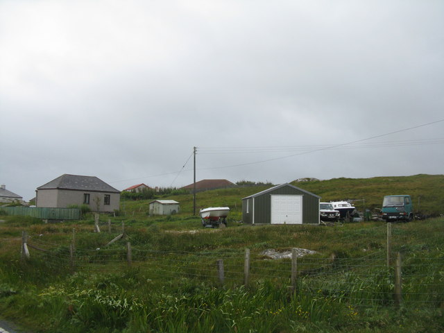
The settlement is primarily residential, with a small population of locals who enjoy the serenity and natural beauty of the area. The community is tight-knit, with a strong sense of camaraderie among residents.

Outdoor enthusiasts will find plenty of opportunities for recreation in Àird Mhidhinis. The surrounding area offers excellent hiking and cycling trails, as well as fishing and boating opportunities in the nearby lochs and rivers. Wildlife enthusiasts can also enjoy spotting various species of birds and mammals that inhabit the region.

In conclusion, Àird Mhidhinis is a peaceful and picturesque settlement situated in the heart of the Scottish Highlands. Its stunning natural beauty and close proximity to Inverness make it an attractive destination for those seeking a tranquil and idyllic rural lifestyle.

If you have any feedback on the listing, please let us know in the comments section below.

Àird Mhidhinis Images

Images are sourced within 2km of 57.000506/-7.4206625 or Grid Reference NF7103. Thanks to Geograph Open Source API. All images are credited.

Loch Ob The north shore, near Bogach.
Loch Ob
The north shore, near Bogach.
Northbay House at Bogach At the head of Loch Ob.
Northbay House at Bogach
At the head of Loch Ob.
Concrete barn on Barra By the A888 at Buaile nam Bodach.
Concrete barn on Barra
By the A888 at Buaile nam Bodach.
Telephone box at Buaile nam Bodach On the day I was here it was not beyond belief that the door could have been taken off by the wind. Looking along the A888 towards Northbay.
Telephone box at Buaile nam Bodach
On the day I was here it was not beyond belief that the door could have been taken off by the wind. Looking along the A888 towards Northbay.
Buaile nam Bodach A small group of houses by the A888 in Barra.
Buaile nam Bodach
A small group of houses by the A888 in Barra.
Sheep by Loch an Ail The loch margins are being colonised by reeds, leaning in the wind.
Sheep by Loch an Ail
The loch margins are being colonised by reeds, leaning in the wind.
Heathbank Hotel At Bogach, near Northbay.
Heathbank Hotel
At Bogach, near Northbay.
House at Bruairnis/Bruarnish Boarded-up, but looking reasonably sound.
House at Bruairnis/Bruarnish
Boarded-up, but looking reasonably sound.
Electricity supply pole at Bruernish Supporting transformer and cables.
Electricity supply pole at Bruernish
Supporting transformer and cables.
Inlet of Bàgh Thiarabhagh With a rather fragile-looking jetty.
Inlet of Bàgh Thiarabhagh
With a rather fragile-looking jetty.
Looking out to Bàgh Thiarabhagh From the road at Heathbank Hotel, Thiarabhagh.
Looking out to Bàgh Thiarabhagh
From the road at Heathbank Hotel, Thiarabhagh.
Moored at Àird Mhòr The 'SY' boat registration is for Stornoway.
Moored at Àird Mhòr
The 'SY' boat registration is for Stornoway.
Rocky foreshore at Àird Mhòr
The Barra to Eriskay ferry Standing just offshore between services.
The Barra to Eriskay ferry
Standing just offshore between services.
Departing from Barra On the Àird Mhòr to Eriskay ferry
Departing from Barra
On the Àird Mhòr to Eriskay ferry
Port Hand Channel Marker This marker emits a flashing red light every four seconds at night.  It marks a rocky area north-west of Lingeigh Fhada.
Port Hand Channel Marker
This marker emits a flashing red light every four seconds at night. It marks a rocky area north-west of Lingeigh Fhada.
Approaching Ardmhor View from the Eriskay ferry towards the harbour and ramp as the ferry approaches Ardmhor on Barra.
Approaching Ardmhor
View from the Eriskay ferry towards the harbour and ramp as the ferry approaches Ardmhor on Barra.
Whitehouse at Aird Mhidhinis The 'whitehouse' replaced the old drystone built and thatched 'blackhouse' in the Highlands and Islands.
Whitehouse at Aird Mhidhinis
The 'whitehouse' replaced the old drystone built and thatched 'blackhouse' in the Highlands and Islands.
Show me another place!

Àird Mhidhinis is located at Grid Ref: NF7103 (Lat: 57.000506, Lng: -7.4206625)

Unitary Authority: Na h-Eileanan an Iar

Police Authority: Highlands and Islands

Also known as: Ardveenish

What 3 Words

///novel.clogging.fended. Near CastleBay, Na h-Eileanan Siar

Related Wikis

Ardveenish

Ardveenish (Scottish Gaelic: Àird Mhèanais) is a village on Barra in the Western Isles, Scotland. Ardveenish is also within the parish of Barra. ��2�...

Bogach

Bogach (Scottish Gaelic: A' Bhogach) is a village on the island of Barra in the Outer Hebrides, Scotland. Bogach is also within the parish of Barra, and...

Northbay

Northbay (Scottish Gaelic: Am Bàgh a Tuath) is a township and community in the north of Barra in the Outer Hebrides, off the west coast of Scotland. Northbay...

Ardmore, Barra

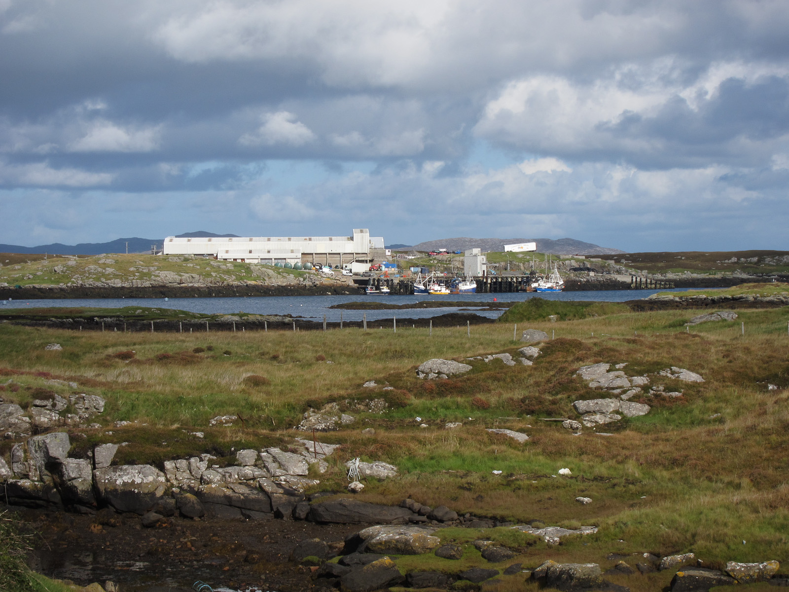
Ardmhor (Scottish Gaelic: Aird Mhòr) is a small village in the north east of the Isle of Barra in the Outer Hebrides, Scotland. In 2002 a small ferry port...

Traigh Mhòr

The Tràigh Mhòr, in English 'Big Beach', is a large expanse of sand forming a magnificent white beach at the northern end of the island of Barra in the...
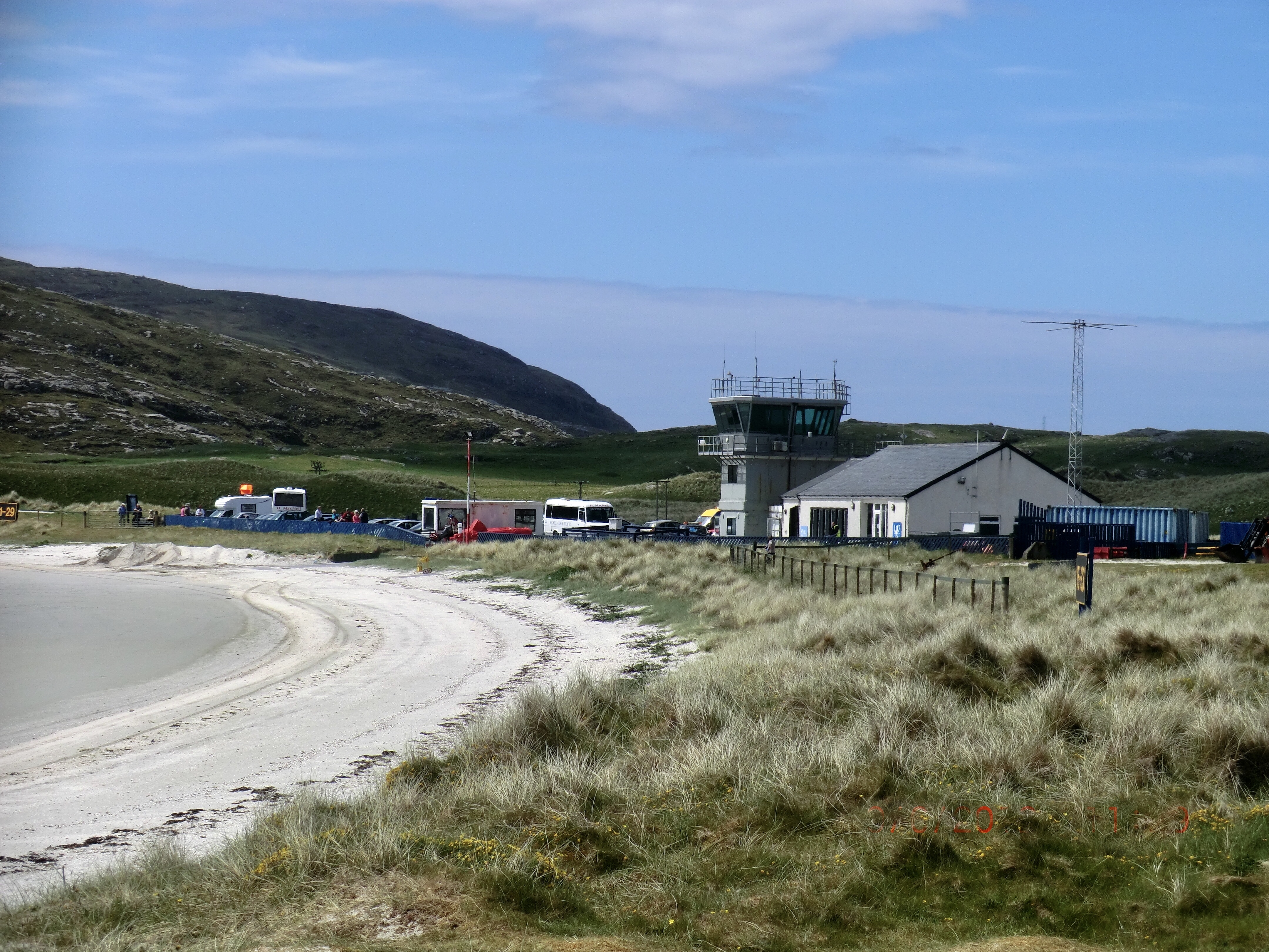
Barra Airport

Barra Airport (Scottish Gaelic: Port-adhair Bharraigh) (IATA: BRR, ICAO: EGPR) (also known as Barra Eoligarry Airport) is a short-runway airport (or STOLport...
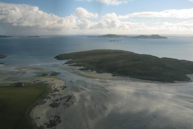
Orosay

Orosay (Scottish Gaelic: Orasaigh) is a small uninhabited tidal island in the Sound of Barra lying at the north end of Traigh Mhòr, the "big beach" on...

Fuiay

Fuiay (Scottish Gaelic: Fùidheigh) is an island in Scotland. It is one of ten islands in the Sound of Barra, a Site of Community Importance for conservation...

Related Videos

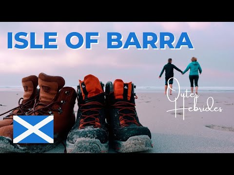
Isle of Barra | Outer Hebrides Road Trip

Welcome to the first video in our Outer Hebrides Road Trip series and to our first stop, the beautiful Isle of Barra! We arrived on ...

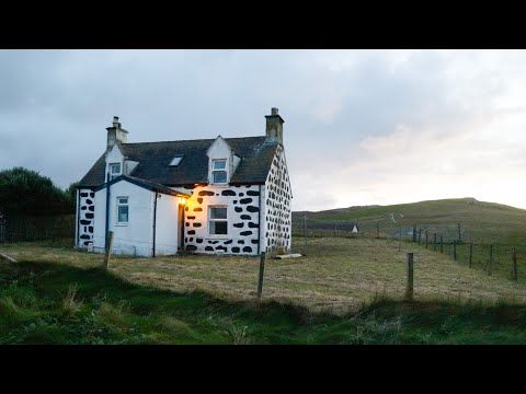
OUR SIMPLE LIFE ON A TINY SCOTTISH ISLAND | long sandy beaches, an abandoned village & lots of cows

Today I'd love to share with you a glimpse into our life on a tiny Scottish Island in the Outer Hebrides. Last Autumn we spent an ...

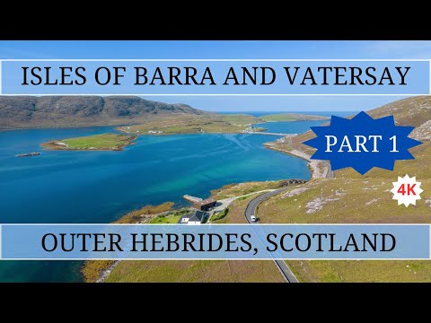
Touring the Outer Hebrides, Isles of Barra and Vatersay - Part 1

This video is filmed in 4K and is part of a series touring the beautiful Outer Hebrides, Scotland in our little white motorhome. In Part ...

Scotland's Outer Hebrides | Barra, Vatersay & Mingulay (film + guide)

BARRA TRAVEL GUIDE https://www.goingthewholehogg.com/best-things-to-do-on-barra-and-vatersay ➤ BECOME OUR ...

Nearby Amenities

Located within 500m of 57.000506,-7.4206625
Bus Stop
Northbay
Bus: yes
Naptan AtcoCode: 6010731769
Naptan Bearing: W
Naptan CommonName: Northbay
Naptan Indicator: Village
Naptan Landmark: Village
Naptan NaptanCode: 94723256
Naptan Street: Village
Naptan Verified: no
Public Transport: platform
Shelter: yes
Source: naptan_import
Lat/Long: 57.0007773/-7.4258714
Bus Stop
Bogach
Naptan AtcoCode: 6010731890
Naptan Bearing: N
Naptan CommonName: Bogach
Naptan Indicator: Village
Naptan Landmark: Village
Naptan NaptanCode: 94724367
Naptan Street: Village
Naptan Verified: no
Source: naptan_import
Lat/Long: 56.996803/-7.4191077
Turning Circle
Lat/Long: 57.0000661/-7.4247827
Leisure: slipway
Lat/Long: 57.0014001/-7.4264336
Barrier: cattle_grid
Lat/Long: 57.0034269/-7.4162467
Post Box
Operator: Royal Mail
Post Box Type: lamp
Ref: HS9 1
Lat/Long: 56.9998703/-7.4220533
Heathbank Hotel
Addr City: Eilean Bharraigh
Addr City En: Isle of Barra
Addr Country: GB
Addr Postcode: HS9 5YQ
Facebook: https://www.facebook.com/Heathbank-Hotel-224557494335608/
Fhrs Id: 806707
Tourism: hotel
Website: https://www.barrahotel.co.uk/
Lat/Long: 56.9977977/-7.4202824
Pub
Lat/Long: 56.9978715/-7.4203294
Bàgh a Tuath
Alt Name En: Bayherivagh
Alt Name Gd: Thiarabhagh
Name En: Northbay
Name Gd: Bàgh a Tuath
Place: village
Wikidata: Q7057698
Wikipedia: en:Northbay
Lat/Long: 57.0008295/-7.4256199
Statue of St Barr
Artwork Type: statue
Tourism: artwork
Lat/Long: 57.0021185/-7.4275768
Power: pole
Lat/Long: 56.9972768/-7.4209388
Power: pole
Lat/Long: 56.9967998/-7.4208596
Power: pole
Lat/Long: 56.9965975/-7.418042
Power: pole
Lat/Long: 56.996786/-7.4187152
Power: pole
Lat/Long: 56.9970029/-7.4194501
Power: pole
Lat/Long: 56.9972812/-7.4204332
Power: pole
Lat/Long: 56.9977531/-7.4210313
Power: pole
Lat/Long: 56.9985734/-7.4211748
Power: pole
Lat/Long: 56.9992009/-7.4228659
Power: pole
Lat/Long: 56.9994061/-7.4239066
Power: pole
Lat/Long: 56.9995895/-7.424899
Power: pole
Lat/Long: 56.9998641/-7.4262884
Power: pole
Lat/Long: 57.0000861/-7.4274713
Power: pole
Lat/Long: 57.0003118/-7.4286447
Power: pole
Lat/Long: 57.004643/-7.4226051
Power: pole
Lat/Long: 57.0043719/-7.4217503
Power: pole
Lat/Long: 57.003943/-7.4203719
Power: pole
Lat/Long: 57.0036817/-7.4186817
Power: pole
Lat/Long: 57.0035831/-7.4178864
Power: pole
Lat/Long: 57.0034159/-7.4165792
Power: pole
Lat/Long: 57.003237/-7.4151241
Power: pole
Lat/Long: 57.0032614/-7.4143985
Bus Stop
Bus: yes
Naptan AtcoCode: 60101008
Naptan NaptanCode: 94727498
Public Transport: platform
Shelter: yes
Lat/Long: 57.0000379/-7.4225198
Tòrr Gormlaig
Place: locality
Lat/Long: 57.0032847/-7.422155
Power: pole
Lat/Long: 57.0039642/-7.4177683
Power: pole
Lat/Long: 57.0043034/-7.4176416
Power: pole
Lat/Long: 57.0033586/-7.4191133
Power: pole
Lat/Long: 57.0035159/-7.4188956
Power: pole
Lat/Long: 57.0038354/-7.4200439
Power: pole
Lat/Long: 57.003775/-7.4237514
Power: pole
Lat/Long: 57.0038215/-7.4242846
Power: pole
Lat/Long: 57.0040237/-7.4249825
Power: pole
Lat/Long: 57.0008461/-7.424608
Power: pole
Lat/Long: 57.0006531/-7.4246891
Power: pole
Lat/Long: 57.000203/-7.4249258
Power: pole
Lat/Long: 56.9999741/-7.4249384
Power: pole
Lat/Long: 57.000723/-7.4269546
Power: pole
Lat/Long: 57.0008373/-7.4283849
Power: pole
Lat/Long: 57.0007839/-7.4275926
Power: pole
Lat/Long: 57.0006441/-7.425747
Power: pole
Lat/Long: 57.000439/-7.425171
Power: pole
Lat/Long: 56.9994957/-7.4211417
Power: pole
Lat/Long: 56.9996004/-7.4218142
Power: pole
Lat/Long: 56.9996774/-7.4223939
Power: pole
Lat/Long: 56.9998154/-7.4232892
Power: pole
Lat/Long: 56.9998683/-7.4238594
Power: pole
Lat/Long: 56.9967943/-7.4176091
Telephone
Booth: K6
Covered: booth
Operator: BT
Phone: +44 1871 890343
Lat/Long: 56.9996176/-7.4213936
Passing Place
Lat/Long: 57.0036917/-7.4158696
Passing Place
Lat/Long: 57.0039514/-7.4170604
Barrier: cattle_grid
Lat/Long: 56.9999752/-7.4247155
Power: pole
Lat/Long: 57.0006899/-7.4264484
Barrier: cattle_grid
Lat/Long: 57.0009614/-7.4254482
Charging Station
Access: yes
Capacity: 2
Fee: yes
Operator: ChargePlace Scotland
Operator Wikidata: Q105359316
Ref: 60472
Socket Chademo Output: 17 kW
Socket Type2 Output: 15 kW
Socket Type2 Combo Output: 17 kW
Website: https://chargeplacescotland.org/cpmap/chargepoint/2372965/
Lat/Long: 57.0011558/-7.4242867
Passing Place
Lat/Long: 57.0003269/-7.4263521
The data included in this document is from www.openstreetmap.org. The data is made available under ODbL.

Have you been to Àird Mhidhinis?

Leave your review of Àird Mhidhinis below (or comments, questions and feedback).