Harston Wood

Wood, Forest in Staffordshire Staffordshire Moorlands

England

Harston Wood

Harston Wood Harston Wood, a nature reserve of Staffordshire Wildlife Trust. The start of the footpath through the wood.
Harston Wood Credit: David Weston

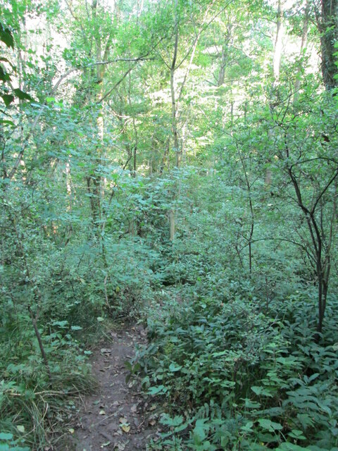
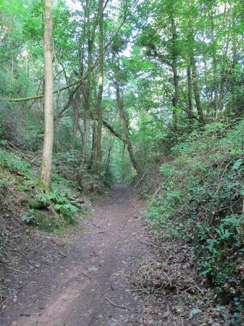
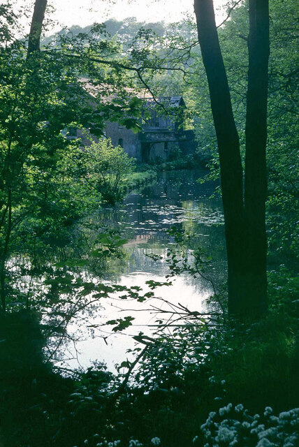
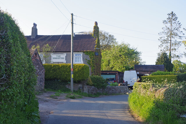
Harston Wood is a picturesque forest located in the county of Staffordshire, England. Covering an area of approximately 200 acres, it is a popular destination for nature enthusiasts and walkers alike. The wood is situated near the village of Harston, which is known for its tranquil surroundings and beautiful landscapes.

The wood is predominantly composed of broadleaf trees, including oak, beech, and birch, which create a dense canopy overhead. The forest floor is adorned with an array of wildflowers and ferns, adding to its natural beauty. The diverse ecosystem supports a variety of wildlife, including deer, squirrels, and numerous species of birds.

There are several well-maintained footpaths that wind their way through the wood, offering visitors the opportunity to explore the area and enjoy its peaceful ambiance. These paths are suitable for both casual strolls and more challenging hikes, catering to different levels of fitness and ability.

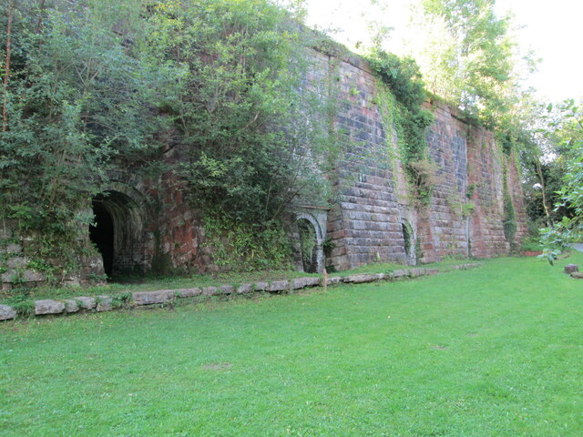
Harston Wood is also home to a number of historic features, such as remnants of ancient boundary walls and old stone structures. These remnants provide insight into the wood's rich history and add an element of intrigue to the overall experience.

Visitors to Harston Wood can expect to immerse themselves in a serene and tranquil environment, surrounded by the sights and sounds of nature. Whether it is observing wildlife, enjoying a leisurely walk, or simply finding solace in the peaceful surroundings, this enchanting forest in Staffordshire offers a delightful escape from the hustle and bustle of everyday life.

If you have any feedback on the listing, please let us know in the comments section below.

Harston Wood Images

Images are sourced within 2km of 53.027479/-1.9527097 or Grid Reference SK0347. Thanks to Geograph Open Source API. All images are credited.
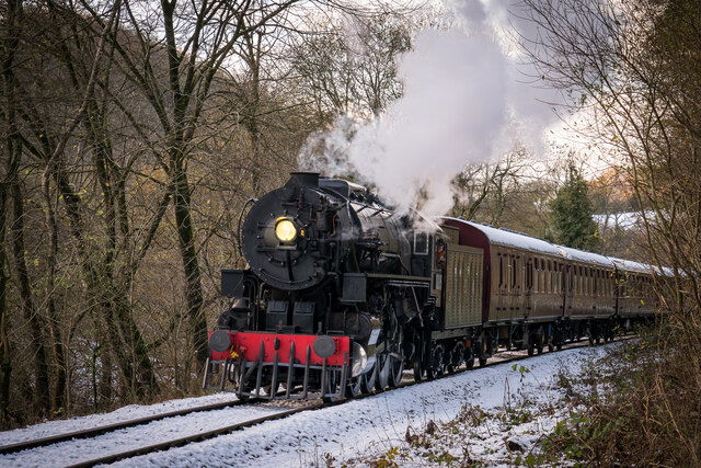
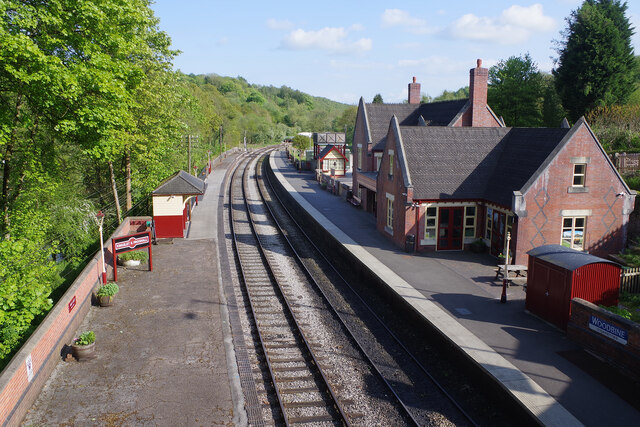
Harston Wood Harston Wood, a nature reserve of Staffordshire Wildlife Trust. The start of the footpath through the wood.
Harston Wood
Harston Wood, a nature reserve of Staffordshire Wildlife Trust. The start of the footpath through the wood.
Tramroad through Harston Wood The line of a former tramroad, looking west, downhill along a steady incline. The tramroad carried limestone from quarries at Caldon Low, westwards to Froghall Wharf at the end of the Caldon Canal.
Tramroad through Harston Wood
The line of a former tramroad, looking west, downhill along a steady incline. The tramroad carried limestone from quarries at Caldon Low, westwards to Froghall Wharf at the end of the Caldon Canal.
Froghall Wharf The end of the Caldon Canal. The lock in the foreground leads to the canal basin.
Froghall Wharf
The end of the Caldon Canal. The lock in the foreground leads to the canal basin.
Lime kilns at Froghall Wharf Lime kilns, long disused, near the canal wharf.
Lime kilns at Froghall Wharf
Lime kilns, long disused, near the canal wharf.
End of Caldon Canal, Froghall Wharf, 1978 Looking from the extreme end back towards the partly derelict warehouse. This was later restored with some alteration, it is a grade II listed building.
End of Caldon Canal, Froghall Wharf, 1978
Looking from the extreme end back towards the partly derelict warehouse. This was later restored with some alteration, it is a grade II listed building.
Churnet Valley 2021 Christmas Polar Express
Kingsley & Froghall trains A preserved railway line near Leek in Staffordshire, running from Froghall up the valley to Cheddleton with one intermediate stop at Consall, and (since 2011) on an extension to a former quarry at Cauldon Low, where as of 2012 there is no station.  The society has plans to connect to the national network at Stoke-on-Trent.

The lines were originally constructed by the North Staffordshire Railway (the "Knotty").  According to one writer, "the buildings on the Churnet Valley line are of local stone, straightforwardly neo-Tudor, and effective" [Lloyd & Insall, "Railway Station Architecture", David & Charles 1978, p.17].
Kingsley & Froghall trains
A preserved railway line near Leek in Staffordshire, running from Froghall up the valley to Cheddleton with one intermediate stop at Consall, and (since 2011) on an extension to a former quarry at Cauldon Low, where as of 2012 there is no station. The society has plans to connect to the national network at Stoke-on-Trent. The lines were originally constructed by the North Staffordshire Railway (the "Knotty"). According to one writer, "the buildings on the Churnet Valley line are of local stone, straightforwardly neo-Tudor, and effective" [Lloyd & Insall, "Railway Station Architecture", David & Charles 1978, p.17].
Cherryeye Bridge, Caldon Canal Presumably the Cherryeye name comes from the unusual shape of the bridgehole. This furthest stretch of the Caldon Canal east of Flint Mill Lock is exceptionally narrow and is similar in some respects to the Llangollen Canal west of Trevor.
Cherryeye Bridge, Caldon Canal
Presumably the Cherryeye name comes from the unusual shape of the bridgehole. This furthest stretch of the Caldon Canal east of Flint Mill Lock is exceptionally narrow and is similar in some respects to the Llangollen Canal west of Trevor.
Caldon Canal, Froghall Lattice Cottage overlooks the Caldon Canal, near its end just west of Froghall Tunnel.
Caldon Canal, Froghall
Lattice Cottage overlooks the Caldon Canal, near its end just west of Froghall Tunnel.
Froghall Tunnel, Caldon Canal Froghall Tunnel is only 76 yards (69 metres) long but its very low profile means that it is an impenetrable obstacle to most modern narrowboats. To ensure boats do not enter and then get stuck there is a profile gauge hanging over the tunnel mouth. Another gauge is provided at Flint Mill Lock to give boaters forewarning so oversized boats should not get this far.
Froghall Tunnel, Caldon Canal
Froghall Tunnel is only 76 yards (69 metres) long but its very low profile means that it is an impenetrable obstacle to most modern narrowboats. To ensure boats do not enter and then get stuck there is a profile gauge hanging over the tunnel mouth. Another gauge is provided at Flint Mill Lock to give boaters forewarning so oversized boats should not get this far.
Kingsley & Froghall Station The southern terminus of the Churnet Valley Railway looks immaculate in the late afternoon sunshine although things are not quite what they seem. Firstly, although this might look like a country station, it was built to serve an area of heavy industry with limekilns and a copper works nearby (the latter did not close until 2014). After closure, the station buildings were demolished in 1968 and the new building is a replica using some original material. It was opened in 2004 by Pete Waterman, the well-known record producer and railway enthusiast.
Kingsley & Froghall Station
The southern terminus of the Churnet Valley Railway looks immaculate in the late afternoon sunshine although things are not quite what they seem. Firstly, although this might look like a country station, it was built to serve an area of heavy industry with limekilns and a copper works nearby (the latter did not close until 2014). After closure, the station buildings were demolished in 1968 and the new building is a replica using some original material. It was opened in 2004 by Pete Waterman, the well-known record producer and railway enthusiast.
Kingsley & Froghall Station - running in board Interestingly, the Churnet Valley Railway has chosen to use replica LMS signs for the running in boards (the larger signs used at the ends of the platforms, a practice largely discontinued on the modern railway) rather than the later British Railways style. The LMS usually angled these slightly outwards and that has been done at the other end of the platform.
Kingsley & Froghall Station - running in board
Interestingly, the Churnet Valley Railway has chosen to use replica LMS signs for the running in boards (the larger signs used at the ends of the platforms, a practice largely discontinued on the modern railway) rather than the later British Railways style. The LMS usually angled these slightly outwards and that has been done at the other end of the platform.
Kingsley & Froghall Station This second platform at Kingsley & Froghall was restored by the Churnet Valley Railway in 2008 to include the replica waiting shelter. The overall effect has been to create an authentic period feel. Perhaps only the 'volunteers needed' banner could not have been part of the scene 70 years ago.
Kingsley & Froghall Station
This second platform at Kingsley & Froghall was restored by the Churnet Valley Railway in 2008 to include the replica waiting shelter. The overall effect has been to create an authentic period feel. Perhaps only the 'volunteers needed' banner could not have been part of the scene 70 years ago.
Woodcutters Row, Foxt Adjacent to the steep road up from Froghall to Foxt is a terrace of cottages called Woodcutters Row including, at the east end, the former pub seen here. See also <a href="https://www.geograph.org.uk/photo/3666275">SK0248 : The Woodcutters' Arms and Woodcutters Row</a> which suggests the pub ceased to be operational sometime in the 1960s.
Woodcutters Row, Foxt
Adjacent to the steep road up from Froghall to Foxt is a terrace of cottages called Woodcutters Row including, at the east end, the former pub seen here. See also SK0248 : The Woodcutters' Arms and Woodcutters Row which suggests the pub ceased to be operational sometime in the 1960s.
Entering Foxt The Staffordshire village of Foxt, high above the Churnet Valley, has an unusual name of Olde English origin. This is the approach heading up the hill from Froghall.
Entering Foxt
The Staffordshire village of Foxt, high above the Churnet Valley, has an unusual name of Olde English origin. This is the approach heading up the hill from Froghall.
New Cottages, Foxt These terraced houses look as they should belong in an industrial town rather than on the edge of a tiny village in the Staffordshire hills. Still, they enjoy a spectacular view down into the valley.
New Cottages, Foxt
These terraced houses look as they should belong in an industrial town rather than on the edge of a tiny village in the Staffordshire hills. Still, they enjoy a spectacular view down into the valley.
The Fox & Goose, Foxt The Fox & Goose seems an appropriate name for this attractive pub in the village of Foxt. It has spectacular views across the Churnet valley.
The Fox & Goose, Foxt
The Fox & Goose seems an appropriate name for this attractive pub in the village of Foxt. It has spectacular views across the Churnet valley.
Moorings at Froghall Some things defy understanding. Here at Froghall a canal basin has been restored capable of taking several full sized boats on the tiny stretch of what remains of the Uttoxeter canal. The moorings are excellent. But there is a huge snag. The only way boats can get here is to navigate the height restricted Froghall Tunnel - so it is only accessible to a small proportion of the craft currently using the canal network. Unsurprisingly on this May morning there was not a boat in site.
Moorings at Froghall
Some things defy understanding. Here at Froghall a canal basin has been restored capable of taking several full sized boats on the tiny stretch of what remains of the Uttoxeter canal. The moorings are excellent. But there is a huge snag. The only way boats can get here is to navigate the height restricted Froghall Tunnel - so it is only accessible to a small proportion of the craft currently using the canal network. Unsurprisingly on this May morning there was not a boat in site.
Show me another place!

Harston Wood is located at Grid Ref: SK0347 (Lat: 53.027479, Lng: -1.9527097)

Administrative County: Staffordshire

District: Staffordshire Moorlands

Police Authority: Staffordshire

What 3 Words

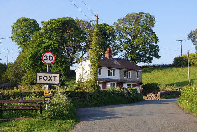
///swooned.left.soggy. Near Cheadle, Staffordshire

Nearby Locations

Leys Whiston Harston Wood

Related Wikis

Harston Wood

Harston Wood is a nature reserve of the Staffordshire Wildlife Trust. It is an ancient woodland, adjacent to the village of Froghall, near Cheadle, Staffordshire...
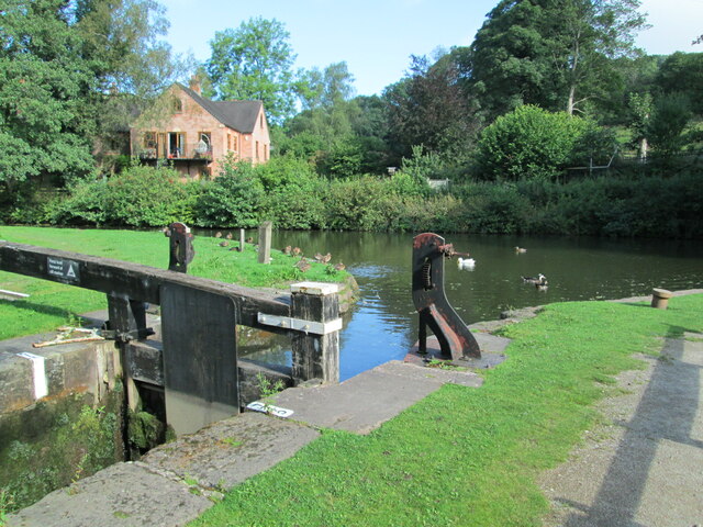
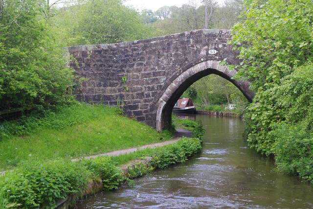
Uttoxeter Canal

The Uttoxeter Canal was a thirteen-mile extension of the Caldon Canal running from Froghall as far as Uttoxeter in Staffordshire, England. It was authorised...

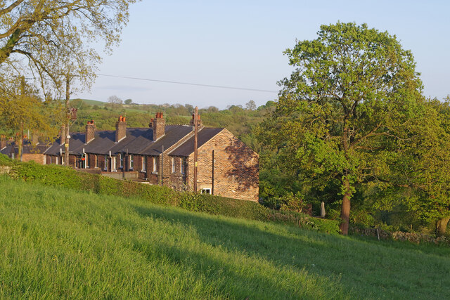
Whiston, Staffordshire Moorlands

Whiston is a village in the Staffordshire Moorlands district of Staffordshire, England. Population details as taken at the 2011 census can be found under...
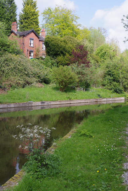
Froghall

Froghall is a village situated approximately ten miles to the east of Stoke-on-Trent and two miles north of Cheadle in Staffordshire, England. Population...

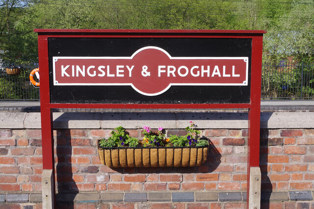
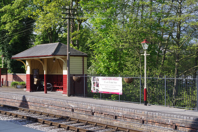
Kingsley and Froghall railway station

Kingsley and Froghall is a former railway station of the North Staffordshire Railway (NSR) that is now preserved on the Churnet Valley Railway in Staffordshire...

Kingsley, Staffordshire

Kingsley is a small village in the Staffordshire Moorlands near to Cheadle, and situated on the A52 from Stoke on Trent to Ashbourne. The civil parish...

Ipstones

Ipstones is a village and civil parish in the north of the English county of Staffordshire. Ipstones is part of the Staffordshire Moorlands district; within...

Broomyshaw

Broomyshaw is a village in Staffordshire, England. Population details for the 2011 census can be found under Waterhouses, Staffordshire

Nearby Amenities

Located within 500m of 53.027479,-1.9527097
Barrier: stile
Material: stone
Steps: 2
Stile: stepover
Lat/Long: 53.025421/-1.9568521
Barrier: stile
Material: wood
Source: survey;gps
Stile: stepover
Lat/Long: 53.0306566/-1.9533126
Barrier: stile
Material: stone
Source: survey;gps
Stile: squeezer
Lat/Long: 53.0246189/-1.9488086
Barrier: stile
Material: stone
Source: survey;gps
Stile: stepover
Lat/Long: 53.0252363/-1.9498351
Barrier: stile
Material: wood
Source: survey
Stile: stepover
Lat/Long: 53.0264362/-1.9548541
Barrier: stile
Material: stone
Source: survey;gps
Stile: squeezer
Lat/Long: 53.0265849/-1.9525581
Barrier: stile
Material: wood
Source: survey
Stile: stepover
Lat/Long: 53.0265076/-1.9549467
Barrier: stile
Material: wood
Source: survey
Stile: stepover
Lat/Long: 53.0264362/-1.9548541
Information: board
Tourism: information
Lat/Long: 53.0279125/-1.9561905
The data included in this document is from www.openstreetmap.org. The data is made available under ODbL.

Have you been to Harston Wood?

Leave your review of Harston Wood below (or comments, questions and feedback).