Cuddesdon

Settlement in Oxfordshire South Oxfordshire

England

Cuddesdon

Farmland, Great Milton A crop of beans with a building on the Wheatley campus of Oxford Brookes University seen in the background.
Farmland, Great Milton Credit: Andrew Smith

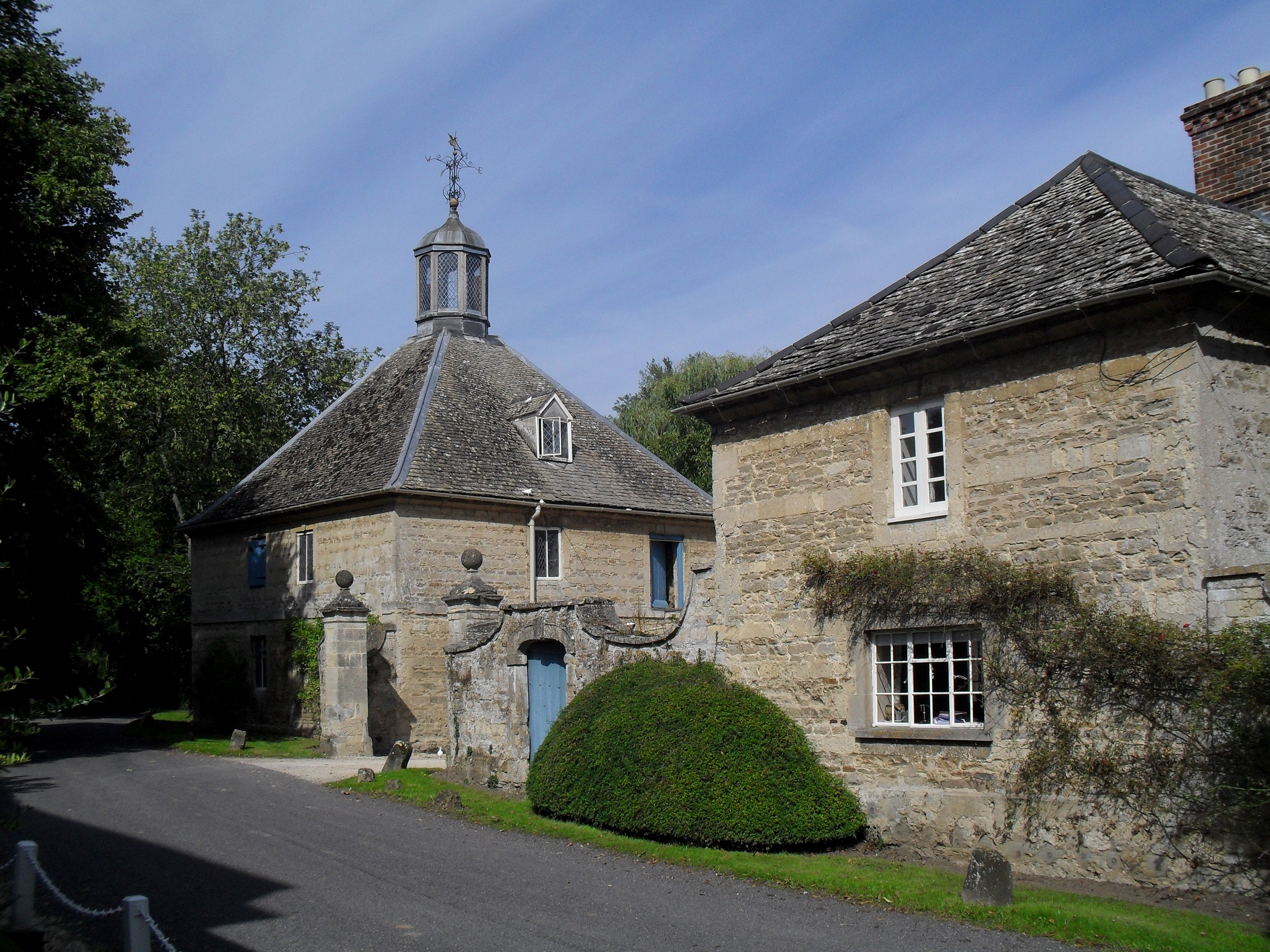
Cuddesdon is a picturesque village located in the county of Oxfordshire, England. Situated approximately 5 miles east of the city of Oxford, it is nestled in the scenic countryside of the Chiltern Hills. With a population of around 600 residents, Cuddesdon maintains a peaceful and rural atmosphere.

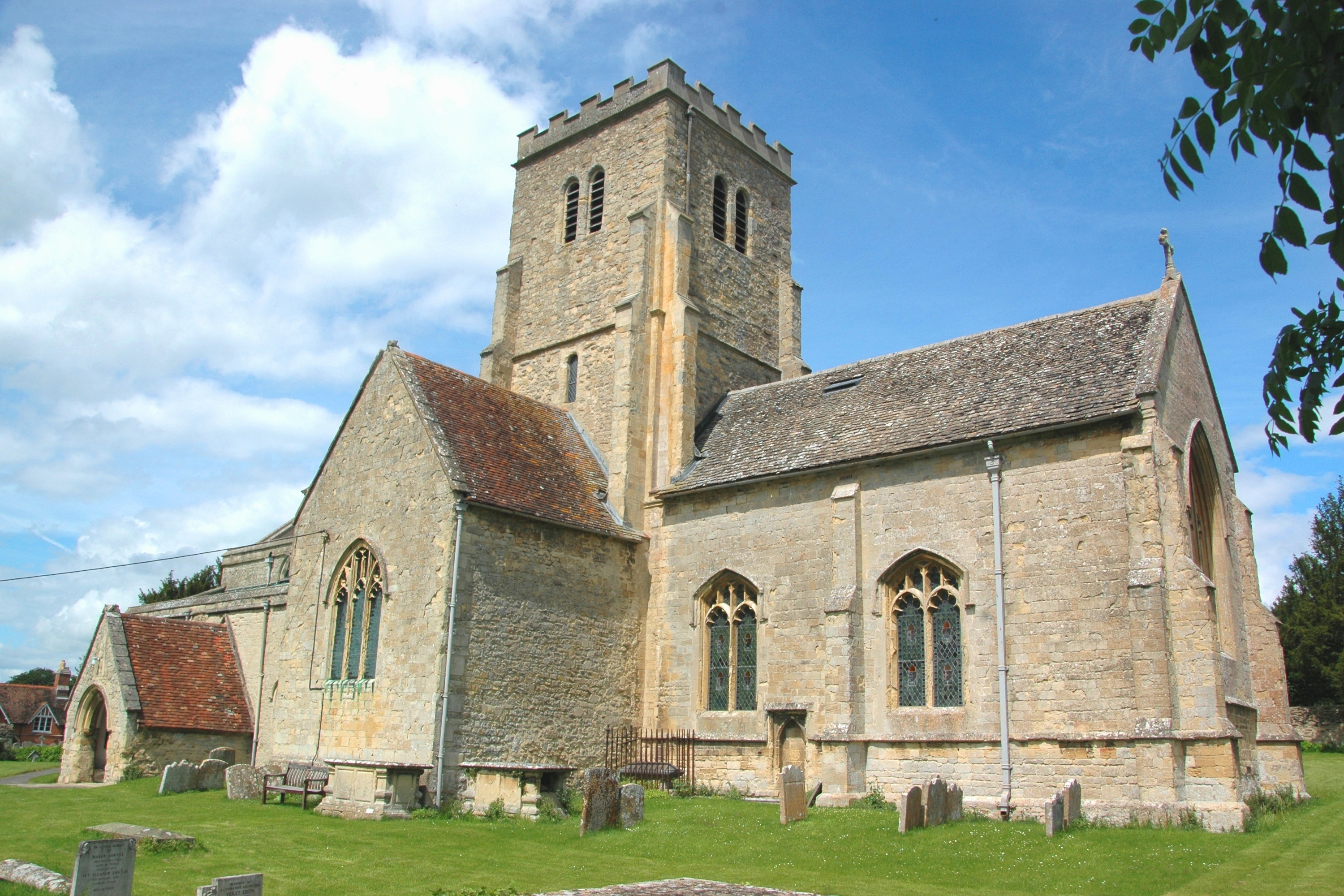
The village is known for its historical significance, as it was once home to Cuddesdon Palace, a grand residence of the Bishops of Oxford. The palace, built in the 15th century, was a notable landmark until its demolition in the 19th century. However, the Church of All Saints, a medieval church built in the 13th century, still stands and adds to the village's charm.

Cuddesdon is also renowned for its theological college, Ripon College Cuddesdon, which was established in 1854. The college is affiliated with the University of Oxford and provides training for Anglican clergy. Its beautiful buildings, including a chapel and a library, are set within extensive grounds, creating a serene and academic environment.

The village offers a range of amenities for both residents and visitors. These include a village hall, a primary school, a post office, and a local pub. The surrounding countryside provides ample opportunities for outdoor activities, such as walking and cycling, with numerous trails and footpaths to explore.

Overall, Cuddesdon is a charming village that seamlessly blends history, natural beauty, and educational institutions, making it an attractive place to live or visit in Oxfordshire.

If you have any feedback on the listing, please let us know in the comments section below.

Cuddesdon Images

Images are sourced within 2km of 51.723397/-1.1332188 or Grid Reference SP5903. Thanks to Geograph Open Source API. All images are credited.

Farmland, Great Milton A crop of beans with a building on the Wheatley campus of Oxford Brookes University seen in the background.
Farmland, Great Milton
A crop of beans with a building on the Wheatley campus of Oxford Brookes University seen in the background.
Pasture, Great Milton A footpath crosses damp grassland beside the River Thame with arable land rising beyond.
Pasture, Great Milton
A footpath crosses damp grassland beside the River Thame with arable land rising beyond.
Farmland, Cuddesdon A footpath descending through wheat to the east of the village.  The mast at Stokenchurch can be seen in the background atop the Chilterns.
Farmland, Cuddesdon
A footpath descending through wheat to the east of the village. The mast at Stokenchurch can be seen in the background atop the Chilterns.
Farmland, Cuddesdon A crop of barley to the south of the village is close to coming into flower.
Farmland, Cuddesdon
A crop of barley to the south of the village is close to coming into flower.
Farmland, Little Milton Broadwater Planting and fields of wheat on ground rising to the east of the River Thame.
Farmland, Little Milton
Broadwater Planting and fields of wheat on ground rising to the east of the River Thame.
River Thame from Cuddesdon Mill Bridge
Farmland, Little Milton Fields of wheat to the south and west of Broadwater Planting.
Farmland, Little Milton
Fields of wheat to the south and west of Broadwater Planting.
Field boundary south of Wheatley There are a couple of deer in the field on the right.
Field boundary south of Wheatley
There are a couple of deer in the field on the right.
Farm track to Wheatley The track leads eventually to the centre of the village. You can just see a blockage ahead caused by a fallen tree. The evidence there is that pedestrians have been walking over the blockage for some time, which means it is a while since a vehicle came down here.
Farm track to Wheatley
The track leads eventually to the centre of the village. You can just see a blockage ahead caused by a fallen tree. The evidence there is that pedestrians have been walking over the blockage for some time, which means it is a while since a vehicle came down here.
Path by an oat field The path will climb onto the ridge of Castle Hill as it leaves the valley of the River Thame, but all gradients are gentle here.
Path by an oat field
The path will climb onto the ridge of Castle Hill as it leaves the valley of the River Thame, but all gradients are gentle here.
Clover field near New Barn The land slopes imperceptibly towards the valley of the River Thame.
Clover field near New Barn
The land slopes imperceptibly towards the valley of the River Thame.
Path up to New Barn You definitely know you are climbing here. The path is undefined but follows the left field edge.
Path up to New Barn
You definitely know you are climbing here. The path is undefined but follows the left field edge.
Looking North
Looking North
Cuddesdon Mill
Cuddesdon Mill
All Saints Church, Cuddesdon
Castle Hill Farm
Castle Hill Farm
Castle Hill Easterly view across Asda complex
Castle Hill
Easterly view across Asda complex
Entering Cuddesdon village Lane from Cuddesdon Mill up into Cuddesdon village
Entering Cuddesdon village
Lane from Cuddesdon Mill up into Cuddesdon village
Show me another place!

Cuddesdon is located at Grid Ref: SP5903 (Lat: 51.723397, Lng: -1.1332188)

Administrative County: Oxfordshire

District: South Oxfordshire

Police Authority: Thames Valley

What 3 Words

///bottled.florists.puzzle. Near Garsington, Oxfordshire

Nearby Locations

Cuddesdon

Related Wikis

Cuddesdon

Cuddesdon is a mainly rural village and former civil parish, now in the parish of Cuddesdon and Denton, in the South Oxfordshire district, in the county...

Cuddesdon Palace

Cuddesdon Palace was the episcopal palace for the Bishop of Oxford, located near the village of Cuddesdon, Oxfordshire, England. == History == Cuddesdon...

Bishop Edward King Chapel

Bishop Edward King Chapel is the chapel of Ripon College Cuddesdon, a Church of England theological college near Oxford, and of the Sisters of the Communities...

Waterstock House Training Centre

Waterstock House Training Centre (WHTC) is situated in the village of Waterstock in Oxfordshire, England. It is a well used venue for local and national...

Oxford Centre for Ecclesiology and Practical Theology

The Oxford Centre for Ecclesiology and Practical Theology (OxCEPT) is a research centre based at Ripon College Cuddesdon. == Overview == OxCEPT was founded...

Ripon College Cuddesdon

Ripon College Cuddesdon is a Church of England theological college in Cuddesdon, a village 5.5 miles (8.9 km) outside Oxford, England. The College trains...

Denton, Oxfordshire

Denton is a hamlet and former civil parish, now in the parish of Cuddesdon and Denton, in the South Oxfordshire district, in Oxfordshire, England. Denton...

Cuddesdon and Denton

Cuddesdon and Denton is a civil parish in the county of Oxfordshire, England. Forming part of South Oxfordshire district its main settlements are Cuddesdon...

Nearby Amenities

Located within 500m of 51.723397,-1.1332188
Cuddesdon
Place: village
Wikidata: Q3915452
Wikipedia: en:Cuddesdon
Lat/Long: 51.722757/-1.1333223
Turning Circle
Turning Circle: hammer
Lat/Long: 51.7246387/-1.1312389
Post Box
Created By: Potlatch 0.10f
Ref: OX44 27
Source: photograph
Lat/Long: 51.7236002/-1.133403
Pub
Bat and Ball
Accommodation: yes
Food: yes
Source: photograph
Lat/Long: 51.7219619/-1.1346098
Note: sign marking boundary of place
Source: photograph;gps_survey
Lat/Long: 51.7207683/-1.1358003
Post Box
Brand: Royal Mail
Brand Wikidata: Q638098
Collection Times: Mo-Fr 16:30; Sa 09:30
Mapillary: 770611217178398
Operator: Royal Mail
Operator Wikidata: Q638098
Post Box Mounting: pier
Post Box Type: lamp
Ref: OX44 235
Source: photograph
Survey Date: 2020-10-25
Lat/Long: 51.7215973/-1.1357329
Phone: +44 1865 874386
Removed Amenity: telephone
Source: photograph
Lat/Long: 51.7219625/-1.1351541
Barrier: stile
Lat/Long: 51.7223463/-1.1308437
Barrier: stile
Lat/Long: 51.7228142/-1.1290155
Barrier: stile
Lat/Long: 51.7228568/-1.1289726
Barrier: stile
Lat/Long: 51.7229206/-1.128758
Bus Stop
Park Side
Bus: yes
Naptan AtcoCode: 340003283CNR
Naptan Bearing: S
Naptan CommonName: Parkside
Naptan Indicator: Corner
Naptan Landmark: Bus Shelter
Naptan NaptanCode: oxfawtat
Naptan Street: Village Road
Public Transport: platform
Shelter: yes
Source: naptan_import;survey
Lat/Long: 51.7264234/-1.1336349
Bus Stop
High Street
Bus: yes
Naptan AtcoCode: 340001975GRN
Naptan Bearing: SW
Naptan CommonName: High Street
Naptan Indicator: The Green Corner
Naptan Landmark: The Green
Naptan NaptanCode: oxfgjtdt
Naptan Street: High Street
Public Transport: platform
Route Ref: 103;104
Source: naptan_import;survey
Lat/Long: 51.722562/-1.1335636
Barrier: lytch_gate
Lat/Long: 51.7227761/-1.132682
Bench
Created By: Potlatch 0.10f
Lat/Long: 51.7229409/-1.1315233
Bench
Created By: Potlatch 0.10f
Lat/Long: 51.7228133/-1.1319954
Bus Stop
Cuddeston Green
Bus: yes
Naptan AtcoCode: 340001975VHL
Naptan Bearing: NE
Naptan CommonName: High Street
Naptan Indicator: Opp Village Hall
Naptan Landmark: The Green
Naptan NaptanCode: oxfawtdg
Naptan Street: High Street
Public Transport: platform
Route Ref: 103;104
Source: naptan_import
Lat/Long: 51.7219314/-1.1352477
Parkside
Naptan AtcoCode: 340003283OPP
Naptan Bearing: N
Naptan BusStopType: CUS
Naptan CommonName: Parkside
Naptan Indicator: Opposite
Naptan Landmark: Opp Bus Shelter
Naptan NaptanCode: oxfawptm
Naptan Street: Village Road
Shelter: no
Source: naptan_import
Lat/Long: 51.7263702/-1.1337542
Barrier: entrance
Lat/Long: 51.7250082/-1.1337537
Barrier: stile
Lat/Long: 51.7208378/-1.136307
Grit Bin
Lat/Long: 51.7232703/-1.1331032
Bench
Lat/Long: 51.7228051/-1.1332119
Bench
Lat/Long: 51.7228745/-1.133291
Cuddesdon War Memorial
Historic: memorial
Memorial: war_memorial
Wikidata: Q26299863
Lat/Long: 51.7227732/-1.133289
Direction: 160
Generator Method: photovoltaic
Generator Output Electricity: yes
Generator Solar Modules: 34
Generator Source: solar
Generator Type: solar_photovoltaic_panel
Location: roof
Power: generator
Lat/Long: 51.7238371/-1.1325702
Leisure: playground
Lat/Long: 51.7215299/-1.1354644
The data included in this document is from www.openstreetmap.org. The data is made available under ODbL.

Have you been to Cuddesdon?

Leave your review of Cuddesdon below (or comments, questions and feedback).