Kilmond Wood

Wood, Forest in Yorkshire

England

Kilmond Wood

Rutherford Bridge over the River Greta
Rutherford Bridge over the River Greta Credit: Stanley Howe

Kilmond Wood is a picturesque forest located in Yorkshire, England. Covering an area of approximately 100 acres, it is known for its stunning natural beauty and tranquil atmosphere. The wood is primarily composed of deciduous trees, including oak, beech, and ash, which create a dense canopy that provides shade and shelter for various wildlife.

The forest is crisscrossed by a network of well-maintained walking trails, allowing visitors to explore the enchanting woodlands at their own pace. These trails offer breathtaking views of the surrounding countryside, with rolling hills and meandering streams adding to the area's charm. Kilmond Wood is a popular destination for nature enthusiasts, hikers, and families seeking a peaceful retreat.

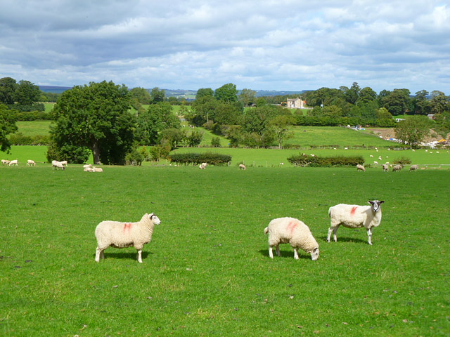
The diverse ecosystem of Kilmond Wood supports a wide range of flora and fauna. Wildflowers, such as bluebells and primroses, carpet the forest floor during the spring months, creating a vibrant display of colors. Deer, foxes, and squirrels are among the wildlife that can be spotted in the wood, adding to the sense of wilderness and natural harmony.

For those interested in birdwatching, Kilmond Wood is home to various species, including woodpeckers, owls, and songbirds. The forest's peaceful ambiance and rich biodiversity make it an ideal habitat for these feathered creatures.

Kilmond Wood is a true gem of Yorkshire, offering visitors a chance to immerse themselves in the beauty of nature. Whether it's a leisurely stroll, a picnic, or simply enjoying the tranquility of the surroundings, this forest provides a serene escape from the hustle and bustle of everyday life.

If you have any feedback on the listing, please let us know in the comments section below.

Kilmond Wood Images

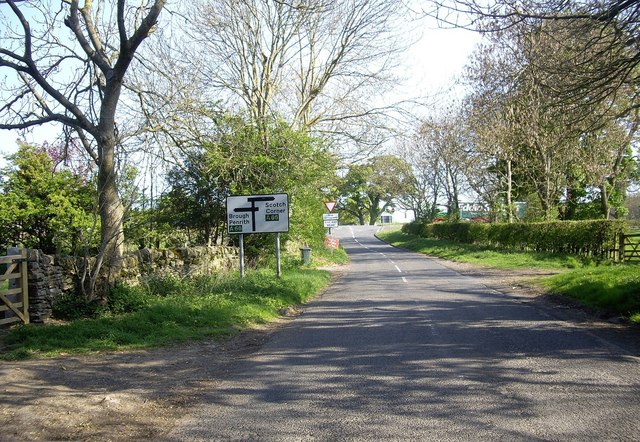
Images are sourced within 2km of 54.516485/-1.9538267 or Grid Reference NZ0313. Thanks to Geograph Open Source API. All images are credited.

Rutherford Bridge over the River Greta
The River Greta Just downstream of Rutherford Bridge.
The River Greta
Just downstream of Rutherford Bridge.
Bowfield Cottage
Bowfield Cottage
Entrance to Hundah Farm From the Barnard Castle-Reeth road.
Entrance to Hundah Farm
From the Barnard Castle-Reeth road.
Approach to the dual carriageway (A66) At North Bitts.
Approach to the dual carriageway (A66)
At North Bitts.
Eastbound lane of the A66 At the junction with the B6277
Eastbound lane of the A66
At the junction with the B6277
Rutherford Bridge over the River Greta
Footpath from Rutherford Lane to Green Gill Farm and beyond
Rutherford Bridge over the River Greta
Farmland, Brignall Arable land to the west of Moorhouse Lane.
Farmland, Brignall
Arable land to the west of Moorhouse Lane.
Pasture, Brignall A view towards Cross Lanes from the drive (footpath) to Dent House Farm.
Pasture, Brignall
A view towards Cross Lanes from the drive (footpath) to Dent House Farm.
Barn and pasture, Boldron Cattle and a modern building to the east of the village.
Barn and pasture, Boldron
Cattle and a modern building to the east of the village.
A66 east near Kilmonds
Approaching junction at North Bitts A66 eastbound
Approaching junction at North Bitts
A66 eastbound
Approaching end of dual carriageway A66 eastbound
Approaching end of dual carriageway
A66 eastbound
A66 near North Bitts The A66 is a major road in northern England running from near Middlesbrough to Workington. The section between Scotch Corner and Penrith is a Trans-Pennine route between the A1 and M6, following an old Roman Road.
Wikipedia: <span class="nowrap"><a title="http://en.wikipedia.org/wiki/A66_road" rel="nofollow ugc noopener" href="http://en.wikipedia.org/wiki/A66_road">Link</a><img style="margin-left:2px;" alt="External link" title="External link - shift click to open in new window" src="https://s1.geograph.org.uk/img/external.png" width="10" height="10"/></span>
A66 near North Bitts
The A66 is a major road in northern England running from near Middlesbrough to Workington. The section between Scotch Corner and Penrith is a Trans-Pennine route between the A1 and M6, following an old Roman Road. Wikipedia: LinkExternal link
North Bitts
North Bitts
A66, westbound The A66 is a major road in northern England running from near Middlesbrough to Workington. The section between Scotch Corner and Penrith is a Trans-Pennine route between the A1 and M6, following an old Roman Road.
Wikipedia: <span class="nowrap"><a title="http://en.wikipedia.org/wiki/A66_road" rel="nofollow ugc noopener" href="http://en.wikipedia.org/wiki/A66_road">Link</a><img style="margin-left:2px;" alt="External link" title="External link - shift click to open in new window" src="https://s1.geograph.org.uk/img/external.png" width="10" height="10"/></span>
A66, westbound
The A66 is a major road in northern England running from near Middlesbrough to Workington. The section between Scotch Corner and Penrith is a Trans-Pennine route between the A1 and M6, following an old Roman Road. Wikipedia: LinkExternal link
Show me another place!

Kilmond Wood is located at Grid Ref: NZ0313 (Lat: 54.516485, Lng: -1.9538267)

Division: North Riding

Unitary Authority: County Durham

Police Authority: Durham

What 3 Words

///baseless.grumbles.legal. Near Startforth, Co. Durham

Nearby Locations

Kilmond Wood

Related Wikis

Kilmond Scar

Kilmond Scar is a Site of Special Scientific Interest in the County Durham district of south-west County Durham, England. It lies just south of the A66...

Boldron

Boldron is a village in the Pennines of England, situated close to Barnard Castle. It was historically located in the North Riding of Yorkshire, but along...

Gilmonby

Gilmonby is a village in the Pennines in County Durham, England. it is situated a short distance to the south of Bowes, in the vicinity of Barnard Castle...

Startforth

Startforth is a village on the Pennines end of south Teesdale, England. The population of Startforth taken at the 2011 Census was 1,361. It was in the...

Nearby Amenities

Located within 500m of 54.516485,-1.9538267
Kilmond Scars
Place: locality
Wikidata: Q6408035
Wikipedia: en:Kilmond Scar
Lat/Long: 54.5156731/-1.9576734
Kilmonds
Place: locality
Lat/Long: 54.517504/-1.9593042
The data included in this document is from www.openstreetmap.org. The data is made available under ODbL.

Have you been to Kilmond Wood?

Leave your review of Kilmond Wood below (or comments, questions and feedback).