Dog Kennel Piece Plantation

Wood, Forest in Gloucestershire Cotswold

England

Dog Kennel Piece Plantation

Road junction near Rendcomb
Road junction near Rendcomb Credit: Vieve Forward

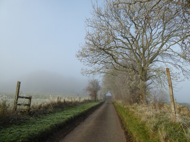
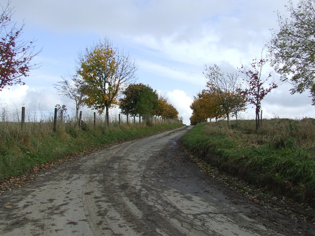
Dog Kennel Piece Plantation is a woodland area located in Gloucestershire, England. It is situated near the village of Wood, within the Forest of Dean district. Covering an approximate area of 200 acres, the plantation is a popular destination for nature enthusiasts, walkers, and dog owners alike.

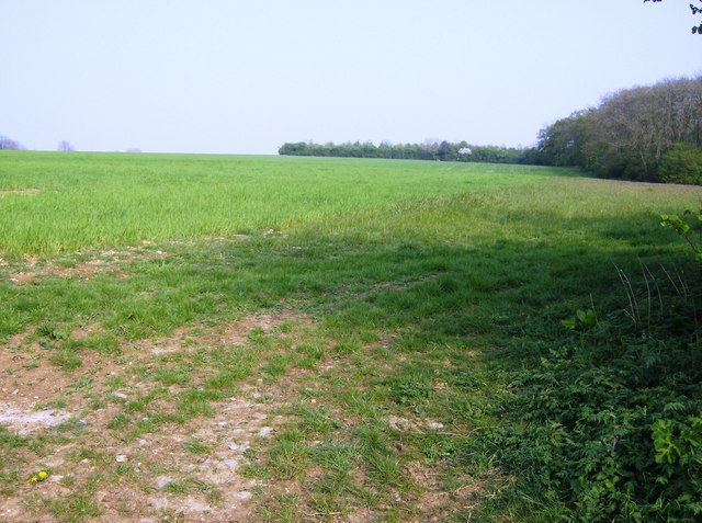
The plantation is characterized by its diverse range of tree species, including oak, beech, ash, and birch. These trees provide a picturesque backdrop and create a tranquil atmosphere within the woodland. The forest floor is adorned with a carpet of bluebells during the springtime, creating a breathtaking display of vibrant colors.

Visitors to Dog Kennel Piece Plantation can enjoy a network of well-maintained footpaths that wind through the woodland. These paths offer opportunities for leisurely strolls, jogging, or dog walking, allowing visitors to immerse themselves in the natural beauty of the area. The plantation is also home to a variety of wildlife, including deer, squirrels, and a wide range of bird species, making it an ideal spot for birdwatching and wildlife photography.

Additionally, the plantation offers several picnic areas, where visitors can relax and enjoy a meal amidst the serene surroundings. The site is well-equipped with benches and trash bins, ensuring a pleasant and clean environment for all visitors.

Overall, Dog Kennel Piece Plantation in Gloucestershire is a stunning woodland area that provides a peaceful retreat for nature lovers. With its scenic beauty, diverse flora, and abundant wildlife, it offers a captivating experience for individuals of all ages.

If you have any feedback on the listing, please let us know in the comments section below.

Dog Kennel Piece Plantation Images

Images are sourced within 2km of 51.7858/-1.9620286 or Grid Reference SP0209. Thanks to Geograph Open Source API. All images are credited.

Road junction near Rendcomb
Lane above Rencomb
Lane above Rencomb
Lane to Aycote/Eycot
A shed at Northmoor Farm
Green fields and barns near Rendcomb The barns are so new that they are not on current OS maps.
Green fields and barns near Rendcomb
The barns are so new that they are not on current OS maps.
Entrance to sports fields belonging to Rendcomb College.
Dead tree in the pasture.
Cottages by lane to Chittlegrove
Towards Newman's Covert An area of flat arable land at the north western part of this square, just cut by a footpath.  The woodland on the right is Newman's Covert.
Towards Newman's Covert
An area of flat arable land at the north western part of this square, just cut by a footpath. The woodland on the right is Newman's Covert.
Permissive path near Chittlegrove This is a section of track that for about 200 yards is not technically a right of way.  The footpath goes across the field on the other side of the wall.  However, everyone follows this clear track; most people are probably completely unaware that they have left the footpath.  An example of where a path diversion should be applied for to bring the legal route in line with practical route?
Permissive path near Chittlegrove
This is a section of track that for about 200 yards is not technically a right of way. The footpath goes across the field on the other side of the wall. However, everyone follows this clear track; most people are probably completely unaware that they have left the footpath. An example of where a path diversion should be applied for to bring the legal route in line with practical route?
Field south of Chittlegrove A large field of wheat south of Chittlegrove, from the byway running across the southern part of the square.  Chittlegrove (a farm) can be seen on the right horizon.  The line of trees is on the north-south road called White Way.
Field south of Chittlegrove
A large field of wheat south of Chittlegrove, from the byway running across the southern part of the square. Chittlegrove (a farm) can be seen on the right horizon. The line of trees is on the north-south road called White Way.
Scots pines on the White Way This is the White Way, a minor Roman road from Cirencester to Chedworth villa.  Yes, apparently even the Romans had "B" roads.  The pines are an interest in an otherwise very flat landscape.
Scots pines on the White Way
This is the White Way, a minor Roman road from Cirencester to Chedworth villa. Yes, apparently even the Romans had "B" roads. The pines are an interest in an otherwise very flat landscape.
Green Meadow Farm The name is fairly apt, but it is a wheat field not a meadow.  Looking north west from the minor road between Rendcomb and the White Way.  At the trees the land falls away rapidly into a minor north-south valley.
Green Meadow Farm
The name is fairly apt, but it is a wheat field not a meadow. Looking north west from the minor road between Rendcomb and the White Way. At the trees the land falls away rapidly into a minor north-south valley.
Shawswell road.
Shawswell road.
Rendcomb college playing field and pavilion.
Green Meadow Farm.
Green Meadow Farm.
Pastures, Rendcomb The valley south of Shawswell.
Pastures, Rendcomb
The valley south of Shawswell.
Farm track, Rendcomb The Macmillan Way to the east of Chittlegrove.
Farm track, Rendcomb
The Macmillan Way to the east of Chittlegrove.
Show me another place!

Dog Kennel Piece Plantation is located at Grid Ref: SP0209 (Lat: 51.7858, Lng: -1.9620286)

Administrative County: Gloucestershire

District: Cotswold

Police Authority: Gloucestershire

What 3 Words

///poet.kind.mavericks. Near Stratton, Gloucestershire

Related Wikis

Rendcomb

Rendcomb is a village in the Cotswold local authority area of the English county of Gloucestershire. It is about five miles north of Cirencester in the...

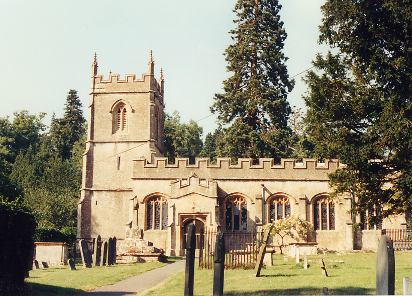
Church of St Peter, Rendcomb

The Anglican Church of St Peter within the grounds of Rendcomb College at Rendcomb in the Cotswold District of Gloucestershire, England was rebuilt in...

Rendcomb College

Rendcomb College is a public school (English private boarding and day school) for pupils aged 3–18, located in the village of Rendcomb five miles north...

North Cerney

North Cerney is a village and civil parish in the English county of Gloucestershire, and lies within the Cotswolds, a range of hills designated an Area...

Woodmancote, Cirencester

Woodmancote is a Cotswolds village near Cirencester, Gloucestershire, England. The village lies just off the A435. The village is 0.2 square miles (52...

Foss Cross Quarry

Foss Cross Quarry (grid reference SP056092) is a 0.67-hectare (1.7-acre) geological Site of Special Scientific Interest in Gloucestershire, notified in...

Cotswold Hills Geopark

A swathe of the Cotswold Hills almost 60 miles long has been proposed as the Cotswold Hills Geopark. The Geopark project offers educational resources on...

Foss Cross railway station

Foss Cross railway station was on the Midland and South Western Junction Railway in Gloucestershire. The station opened on 1 August 1891 with the section...

Nearby Amenities

Located within 500m of 51.7858,-1.9620286
Power: pole
Source: bing
Lat/Long: 51.7894228/-1.9657156
Power: pole
Source: bing
Lat/Long: 51.7888869/-1.9661853
Power: pole
Source: bing
Lat/Long: 51.7883826/-1.9666442
Power: pole
Source: bing
Lat/Long: 51.7878975/-1.967039
Power: pole
Source: bing
Lat/Long: 51.7873627/-1.9675343
Power: pole
Source: bing
Lat/Long: 51.7868448/-1.9680132
Power: pole
Source: bing
Lat/Long: 51.7863032/-1.9685196
Power: pole
Source: bing
Lat/Long: 51.785739/-1.9689912
Power: pole
Source: bing
Lat/Long: 51.7857164/-1.9690058
Power: pole
Source: bing
Lat/Long: 51.7842317/-1.9686713
Power: pole
Source: bing
Lat/Long: 51.7852053/-1.9683642
Power: pole
Source: bing
Lat/Long: 51.784684/-1.9676586
Power: pole
Source: bing
Lat/Long: 51.7841491/-1.9670244
Power: pole
Source: bing
Lat/Long: 51.7839026/-1.9661945
Power: pole
Source: bing
Lat/Long: 51.7836403/-1.9653774
Power: pole
Source: bing
Transformer: distribution
Lat/Long: 51.782791/-1.9579315
Power: pole
Source: bing
Lat/Long: 51.7827288/-1.9591571
Power: pole
Source: bing
Lat/Long: 51.7826553/-1.9604256
Power: pole
Source: bing
Lat/Long: 51.7825909/-1.9616887
Power: pole
Source: bing
Lat/Long: 51.7825151/-1.9629536
Power: pole
Source: bing
Lat/Long: 51.7833938/-1.9645914
Power: pole
Source: bing
Lat/Long: 51.7824507/-1.964213
Power: pole
Source: bing
Lat/Long: 51.7818751/-1.9644068
The data included in this document is from www.openstreetmap.org. The data is made available under ODbL.

Have you been to Dog Kennel Piece Plantation?

Leave your review of Dog Kennel Piece Plantation below (or comments, questions and feedback).