Long Covert

Wood, Forest in Staffordshire Stafford

England

Long Covert

Ford at the Wolseley Centre Footbridges are available nearby. The Wolseley Centre is the HQ of the Staffordshire Wildlife Trust, with extensive grounds, two lakes and a cafe and gift shop.
Ford at the Wolseley Centre Credit: Christine Johnstone

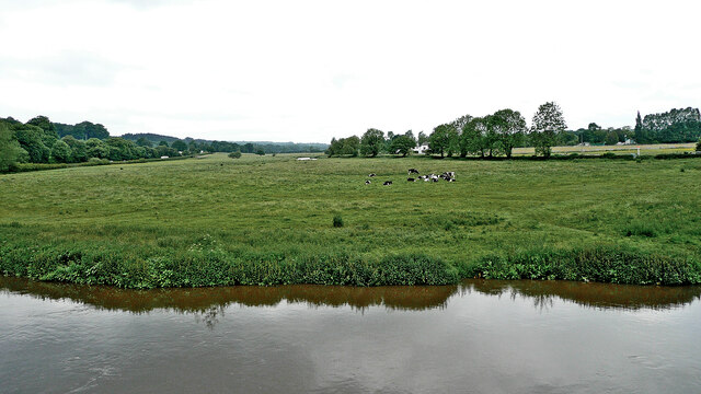
Long Covert is a picturesque woodland located in Staffordshire, England. Situated in the heart of the county, this forested area covers a vast expanse of approximately 200 acres. The name "Long Covert" aptly describes the long and dense coverage of trees that dominate the landscape.

The woodland is characterized by a diverse range of tree species, including oak, beech, birch, and fir, which provide a rich and varied habitat for a wide array of wildlife. The forest floor is adorned with an assortment of flora, such as bluebells, wild garlic, and ferns, adding to the natural beauty of the area.

Long Covert is not only a haven for nature enthusiasts but also a popular destination for outdoor activities. It boasts a network of well-maintained trails that wind their way through the forest, allowing visitors to explore the area on foot, bike, or horseback. These trails offer stunning views of the surrounding countryside and provide an opportunity to spot local wildlife, including deer, foxes, and various bird species.

The forest is managed by the local authorities, who ensure the preservation of the woodland and its inhabitants. They have implemented measures to protect the ecosystem, such as controlled logging and the conservation of rare and endangered species that call Long Covert their home.

Overall, Long Covert is a remarkable woodland that offers a tranquil escape from the hustle and bustle of everyday life. Its natural beauty, diverse wildlife, and recreational opportunities make it a cherished destination for both locals and visitors alike.

If you have any feedback on the listing, please let us know in the comments section below.

Long Covert Images

Images are sourced within 2km of 52.772331/-1.9677335 or Grid Reference SK0219. Thanks to Geograph Open Source API. All images are credited.

Ford at the Wolseley Centre Footbridges are available nearby. The Wolseley Centre is the HQ of the Staffordshire Wildlife Trust, with extensive grounds, two lakes and a cafe and gift shop.
Ford at the Wolseley Centre
Footbridges are available nearby. The Wolseley Centre is the HQ of the Staffordshire Wildlife Trust, with extensive grounds, two lakes and a cafe and gift shop.
Swan Lake, the Wolseley Centre Despite the name of the lake, it's Canada geese that are flying in. The Wolseley Centre is the HQ of the Staffordshire Wildlife Trust, with extensive grounds, two lakes and a cafe and gift shop.
Swan Lake, the Wolseley Centre
Despite the name of the lake, it's Canada geese that are flying in. The Wolseley Centre is the HQ of the Staffordshire Wildlife Trust, with extensive grounds, two lakes and a cafe and gift shop.
Path in the 'Wet Meadow', the Wolseley Centre The Wolseley Centre is the HQ of the Staffordshire Wildlife Trust, with extensive grounds, two lakes, a cafe and a gift shop.
Path in the 'Wet Meadow', the Wolseley Centre
The Wolseley Centre is the HQ of the Staffordshire Wildlife Trust, with extensive grounds, two lakes, a cafe and a gift shop.
Footbridge at the Wolseley Centre Funded by a Rotary Club. The Wolseley Centre is the HQ of the Staffordshire Wildlife Trust, with extensive grounds, two lakes, a cafe and a gift shop.
Footbridge at the Wolseley Centre
Funded by a Rotary Club. The Wolseley Centre is the HQ of the Staffordshire Wildlife Trust, with extensive grounds, two lakes, a cafe and a gift shop.
Canada geese on Swan Lake, the Wolseley Centre The Wolseley Centre is the HQ of the Staffordshire Wildlife Trust, with extensive grounds, two lakes, a cafe and a gift shop.
Canada geese on Swan Lake, the Wolseley Centre
The Wolseley Centre is the HQ of the Staffordshire Wildlife Trust, with extensive grounds, two lakes, a cafe and a gift shop.
The fernery at the Wolseley Centre A plaque reads 'Planted in memory of Margaret Kingston (1934 - 2011) from dionations given to Friends of Cannock Chase in her memory'. The Wolseley Centre is the HQ of the Staffordshire Wildlife Trust, with extensive grounds, two lakes, a cafe and a gift shop.
The fernery at the Wolseley Centre
A plaque reads 'Planted in memory of Margaret Kingston (1934 - 2011) from dionations given to Friends of Cannock Chase in her memory'. The Wolseley Centre is the HQ of the Staffordshire Wildlife Trust, with extensive grounds, two lakes, a cafe and a gift shop.
Spider's web artwork at the Wolseley Centre The Wolseley Centre is the HQ of the Staffordshire Wildlife Trust, with extensive grounds, two lakes, a cafe and a gift shop.
Spider's web artwork at the Wolseley Centre
The Wolseley Centre is the HQ of the Staffordshire Wildlife Trust, with extensive grounds, two lakes, a cafe and a gift shop.
Half-buried structure at the Wolseley Centre Possibly the remains of an ice house? The Wolseley Centre is the HQ of the Staffordshire Wildlife Trust, with extensive grounds, two lakes, a cafe and a gift shop.
Half-buried structure at the Wolseley Centre
Possibly the remains of an ice house? The Wolseley Centre is the HQ of the Staffordshire Wildlife Trust, with extensive grounds, two lakes, a cafe and a gift shop.
Canal south-east of Colwich in Staffordshire This is the Trent and Mersey Canal approaching Wolseley Bridge, No 70.
Canal south-east of Colwich in Staffordshire
This is the Trent and Mersey Canal approaching Wolseley Bridge, No 70.
Canal south-east of Colwich in Staffordshire This is the Trent and Mersey Canal approaching Wolseley Bridge, No 70.
Canal south-east of Colwich in Staffordshire
This is the Trent and Mersey Canal approaching Wolseley Bridge, No 70.
Wolseley Bridge near Colwich in Staffordshire Wolseley Bridge is No 70 across the Trent and Mersey Canal. It carries the A51 between Stone and Rugeley.
Wolseley Bridge near Colwich in Staffordshire
Wolseley Bridge is No 70 across the Trent and Mersey Canal. It carries the A51 between Stone and Rugeley.
Trent and Mersey Canal near Colwich, Staffordshire Looking east on a dull morning from near Wolseley Bridge as the canal meanders towards Rugeley.
Trent and Mersey Canal near Colwich, Staffordshire
Looking east on a dull morning from near Wolseley Bridge as the canal meanders towards Rugeley.
Moored narrowboats near Colwich in Staffordshire This is the Trent and Mersey Canal on a dull morning north-west of Wolseley Bridge, between Great Haywood and Rugeley.
Moored narrowboats near Colwich in Staffordshire
This is the Trent and Mersey Canal on a dull morning north-west of Wolseley Bridge, between Great Haywood and Rugeley.
Moored narrowboats near Colwich in Staffordshire This is the Trent and Mersey Canal north-west of Wolseley Bridge, between Great Haywood and Rugeley.
Moored narrowboats near Colwich in Staffordshire
This is the Trent and Mersey Canal north-west of Wolseley Bridge, between Great Haywood and Rugeley.
London Road near Little Haywood, Staffordshire This is the A51 London Road, looking south-east towards the A513 junction, and Rugeley. The bridge ahead crosses the River Trent.
London Road near Little Haywood, Staffordshire
This is the A51 London Road, looking south-east towards the A513 junction, and Rugeley. The bridge ahead crosses the River Trent.
River Trent near Little Haywood in Staffordshire Looking downstream, north-west from London Road (A51) at Wolseley Bridge.
River Trent near Little Haywood in Staffordshire
Looking downstream, north-west from London Road (A51) at Wolseley Bridge.
Pasture by the River Trent in Staffordshire Looking across the River Trent from Wolseley Bridge, south-east of Colwich. The lin of trees beyond the grazing cattle is by the Trent and Mersey Canal.
Pasture by the River Trent in Staffordshire
Looking across the River Trent from Wolseley Bridge, south-east of Colwich. The lin of trees beyond the grazing cattle is by the Trent and Mersey Canal.
The Wolseley Arms near Colwich in Staffordshire Looking west-north-west along the A51 London Road, this is at the junction with the A513 to Stafford, off to the left.
The Wolseley Arms near Colwich in Staffordshire
Looking west-north-west along the A51 London Road, this is at the junction with the A513 to Stafford, off to the left.
Show me another place!

Long Covert is located at Grid Ref: SK0219 (Lat: 52.772331, Lng: -1.9677335)

Administrative County: Staffordshire

District: Stafford

Police Authority: Staffordshire

What 3 Words

///pitching.marketing.pony. Near Colwich, Staffordshire

Nearby Locations

Long Covert

Related Wikis

Wolseley Hall

Wolseley Hall was a stately home near the village of Colwich, in Staffordshire, England. It was demolished in 1966; the former gardens are now a nature...

Wolseley Centre

The Wolseley Centre is a visitor centre and nature reserve of the Staffordshire Wildlife Trust, in Staffordshire, England, about 2 miles (3 km) north-west...

Etchinghill, Staffordshire

Etchinghill, also known as Etching Hill, was once a singular village, until it was engulfed by the simultaneous growth of Rugeley, Staffordshire. It is...

Colwich, Staffordshire

Colwich is a civil parish and village in Staffordshire, England. It is situated off the A51 road, about 3 miles (5 km) north-west of Rugeley and 7 miles...

The Hart School

The Hart School is a secondary education academy in Rugeley, England, UK. The school is divided across two sites, and was formed in September 2016 following...

Colwich Junction

Colwich Junction is a rail junction near the village of Little Haywood, in the county of Staffordshire, England. It is the junction between two routes...

Fair Oak Academy

Fair Oak Academy was a mixed secondary school located in Rugeley in the English county of Staffordshire.Previously known as Fair Oak High School, the school...

Slitting Mill

Slitting Mill is a small village on the outskirts of Rugeley, Staffordshire. At the 2001 census, it had a population of 265.The village is within Rugeley...

Nearby Amenities

Located within 500m of 52.772331,-1.9677335
Barrier: stile
Lat/Long: 52.7761734/-1.965011
Barrier: stile
Lat/Long: 52.7728752/-1.9619963
The data included in this document is from www.openstreetmap.org. The data is made available under ODbL.

Have you been to Long Covert?

Leave your review of Long Covert below (or comments, questions and feedback).