Barrack Wood
Wood, Forest in Yorkshire Richmondshire
England
Barrack Wood

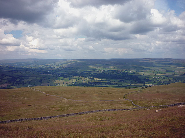
Barack Wood is a picturesque forest located in the county of Yorkshire, England. It covers an area of approximately 100 acres and is characterized by its dense foliage and diverse range of flora and fauna. The wood is situated near the village of Wood and is easily accessible from nearby towns and cities.
The forest is known for its ancient oak trees, some of which are believed to be hundreds of years old. These majestic trees create a canopy that provides shade and shelter for a variety of wildlife species. The woodland floor is carpeted with a rich layer of leaf litter, creating a vibrant ecosystem that supports numerous plant and animal species.
Visitors to Barrack Wood can enjoy a network of well-maintained walking trails that meander through the forest, offering stunning views of the surrounding countryside. The paths are suitable for all levels of fitness and provide a peaceful retreat for nature enthusiasts and hikers alike. The wood also features several picnic areas, allowing visitors to relax and enjoy the tranquil surroundings.
Birdwatchers will delight in the diverse avian population that calls Barrack Wood home. Species such as woodpeckers, owls, and various songbirds can often be spotted among the treetops. Additionally, the forest is home to small mammals like squirrels, rabbits, and foxes, making it a popular destination for wildlife enthusiasts.
Overall, Barrack Wood in Yorkshire is a captivating natural haven, offering visitors a chance to immerse themselves in the beauty of nature and experience the tranquility of a thriving woodland ecosystem.
If you have any feedback on the listing, please let us know in the comments section below.
Barrack Wood Images
Images are sourced within 2km of 54.277964/-1.9668084 or Grid Reference SE0286. Thanks to Geograph Open Source API. All images are credited.


Barrack Wood is located at Grid Ref: SE0286 (Lat: 54.277964, Lng: -1.9668084)
Division: North Riding
Administrative County: North Yorkshire
District: Richmondshire
Police Authority: North Yorkshire
What 3 Words
///develops.failed.take. Near Leyburn, North Yorkshire
Nearby Locations
Related Wikis
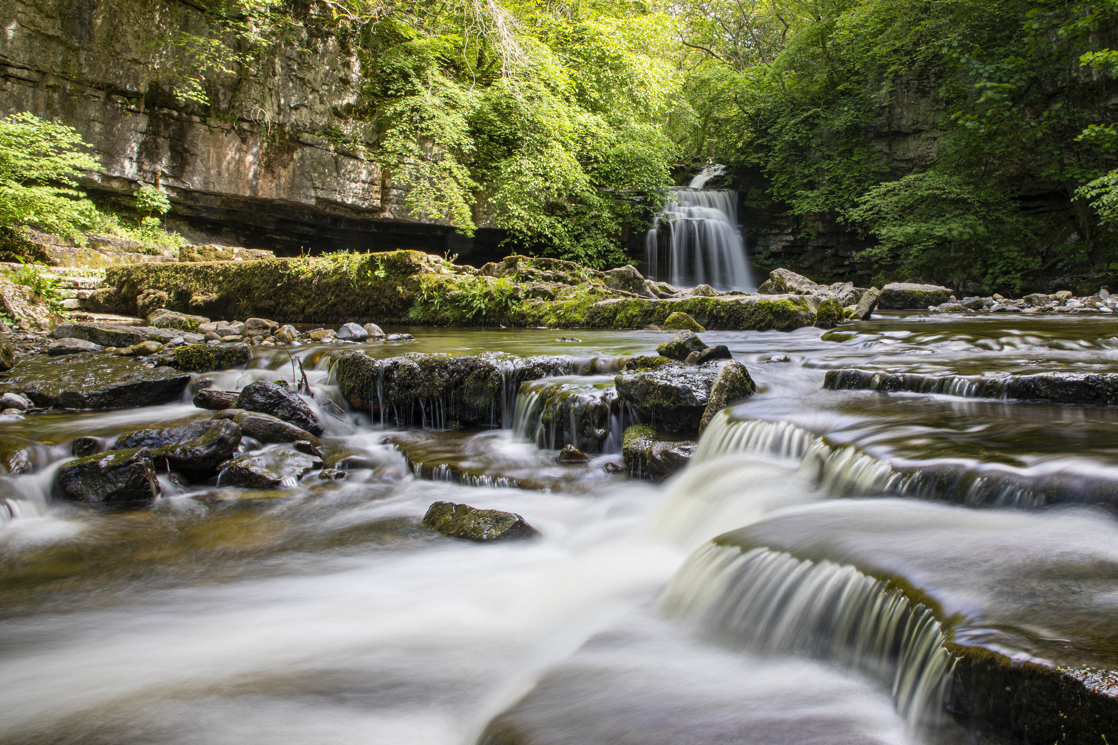
Cauldron Falls (North Yorkshire)
Cauldron Falls (also known as West Burton falls), is a series of waterfalls on Walden Beck in the village of West Burton, North Yorkshire, England. It...

West Burton, North Yorkshire
West Burton is a village in Bishopdale, a side valley of Wensleydale, in the Yorkshire Dales, North Yorkshire, England. It lies 6.2 miles (10 km) south...

St Andrew's Church, Aysgarth
St Andrew's Church, Aysgarth, is a Grade II* listed parish church in the Church of England: 66 in Aysgarth, North Yorkshire. It is located on the south...

Aysgarth Falls
Aysgarth Falls are a triple flight of waterfalls, surrounded by woodland and farmland, carved out by the River Ure over an almost one-mile (two-kilometre...

Penhill
Penhill (526 metres (1,726 ft) high at the trig point, 553 metres (1,814 ft) at Height of Hazely) is a prominent hill, 5.5 miles (9 km) south west of Leyburn...

Thoralby
Thoralby is a village and civil parish in the Richmondshire district of North Yorkshire, England. It lies south of Aysgarth, is within a mile of both Newbiggin...
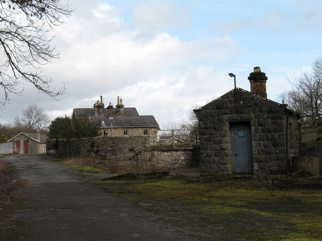
Aysgarth railway station
Aysgarth railway station is a disused railway station in North Yorkshire, England, near Aysgarth Falls. It was part of the Hawes Branch of the North Eastern...

Aysgarth
Aysgarth is a village and civil parish in Wensleydale, in North Yorkshire, England. The village is in the Yorkshire Dales National Park, about 16 miles...
Nearby Amenities
Located within 500m of 54.277964,-1.9668084Have you been to Barrack Wood?
Leave your review of Barrack Wood below (or comments, questions and feedback).