Bings Wood

Wood, Forest in Derbyshire High Peak

England

Bings Wood

Bothams Hall bridges, Peak Forest Canal, 1984 A lift bridge and a footbridge. They seem to be numbered 34 taken together.
Bothams Hall bridges, Peak Forest Canal, 1984 Credit: Robin Webster

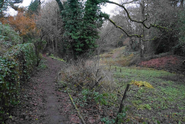
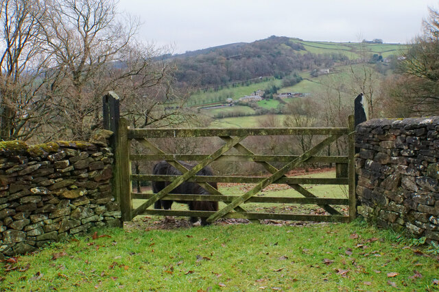
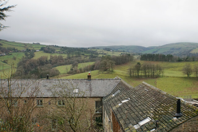
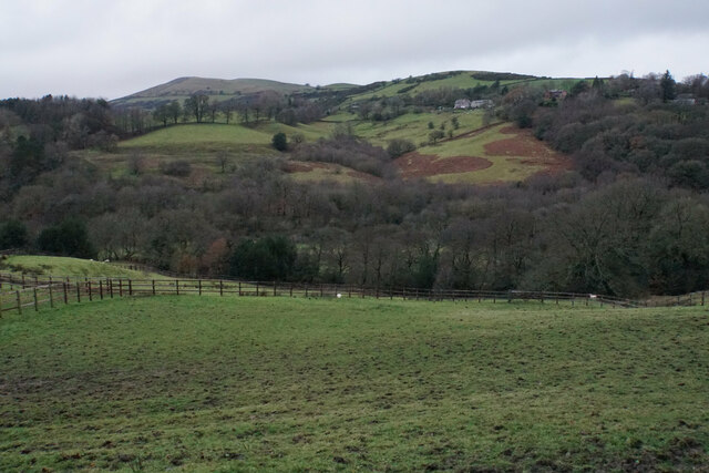
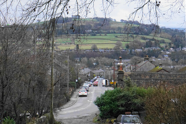
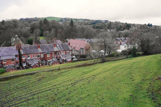
Bings Wood is a stunning forest located in the county of Derbyshire, England. Covering an area of approximately 77 hectares, it presents visitors with a picturesque landscape that is a haven for nature enthusiasts and outdoor lovers alike.

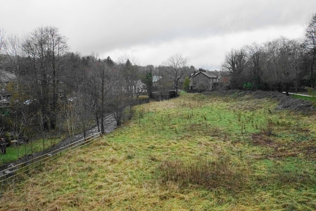
The forest boasts a diverse range of tree species, including oak, birch, beech, and conifers, which provide a rich and vibrant display of colors throughout the year. In spring, the woodland floor is adorned with a carpet of bluebells, creating a breathtaking sight. Bings Wood is also home to a variety of wildlife, including deer, foxes, badgers, and numerous bird species, making it a popular spot for birdwatching.

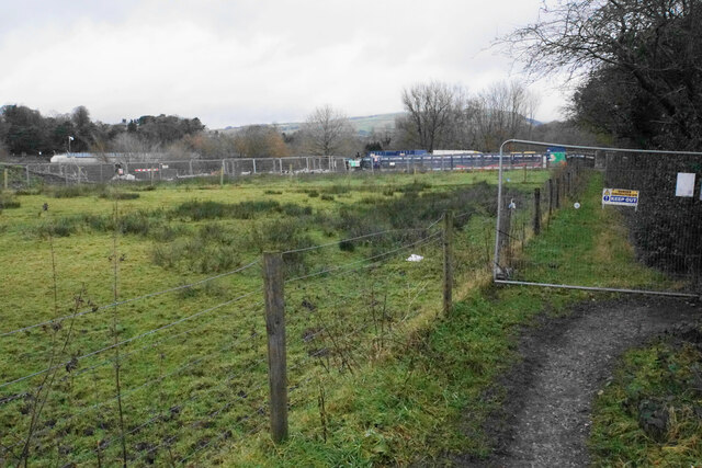
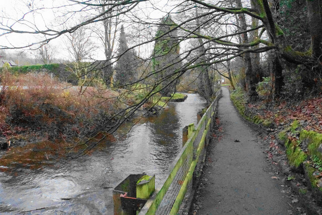
There are several well-maintained walking trails that wind their way through the forest, offering visitors the opportunity to explore its natural beauty. These trails vary in length and difficulty, catering to both casual strollers and more adventurous hikers. Along the way, visitors can enjoy the peace and tranquility of the forest, immersing themselves in the soothing sounds of bird songs and rustling leaves.

Bings Wood is a cherished recreational area, attracting locals and tourists alike. It offers amenities such as picnic areas and benches, making it an ideal place for families to enjoy a day out in nature. The forest is also managed sustainably, with conservation efforts in place to preserve its natural beauty for future generations.

In conclusion, Bings Wood in Derbyshire is a captivating woodland that offers visitors a chance to escape the hustle and bustle of everyday life. With its diverse flora and fauna, well-marked trails, and peaceful atmosphere, it provides an enjoyable experience for nature lovers and those seeking a peaceful retreat.

If you have any feedback on the listing, please let us know in the comments section below.
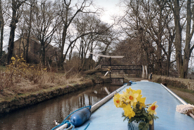
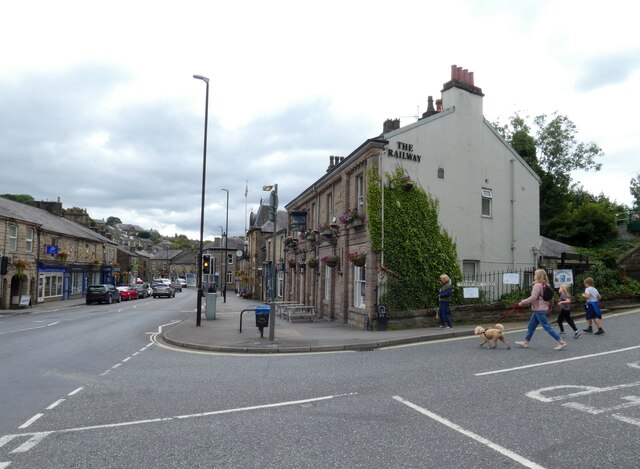
Bings Wood Images

Images are sourced within 2km of 53.330134/-1.9810264 or Grid Reference SK0181. Thanks to Geograph Open Source API. All images are credited.

Bothams Hall bridges, Peak Forest Canal, 1984 A lift bridge and a footbridge. They seem to be numbered 34 taken together.
Bothams Hall bridges, Peak Forest Canal, 1984
A lift bridge and a footbridge. They seem to be numbered 34 taken together.
The Railway, Whaley Bridge The pub on Market Street (A5004) is currently owned by Inglenook Inns & Taverns.

<a href="https://www.geograph.org.uk/photo/6991071">SK0181 : Sign of The Railway</a>.
The Railway, Whaley Bridge
The pub on Market Street (A5004) is currently owned by Inglenook Inns & Taverns. SK0181 : Sign of The Railway.
Sign of The Railway 
Sign for The Railway <a href="https://www.geograph.org.uk/photo/6991029">SK0181 : The Railway, Whaley Bridge</a>.
Sign of The Railway
Sign for The Railway SK0181 : The Railway, Whaley Bridge.
Posts on Reservoir Road These two posts are found at the bottom of Reservoir Road outside The Railway <a href="https://www.geograph.org.uk/photo/6991029">SK0181 : The Railway, Whaley Bridge</a>.  Historic Streetview images shows that these have been restored and repainted in the last few years. 

What exactly the information refers to I haven't been able to ascertain. Whilst I assume they refer to Stockport Corporation Water Works, that Corporation doesn't appear to have had any connection with Toddbrook Reservoir.
Posts on Reservoir Road
These two posts are found at the bottom of Reservoir Road outside The Railway SK0181 : The Railway, Whaley Bridge. Historic Streetview images shows that these have been restored and repainted in the last few years. What exactly the information refers to I haven't been able to ascertain. Whilst I assume they refer to Stockport Corporation Water Works, that Corporation doesn't appear to have had any connection with Toddbrook Reservoir.
Bugsworth Basin, Whaley Bridge Bugsworth Basin is situated at the head of navigation of the Peak Forest Canal, in the village of Buxworth. The Basin was once the largest inland port on the narrow canal system; a busy interchange between tramway and canal where boats were loaded with limestone.

Bugsworth Basin closed in 1927 and by the 1960s was dry and overgrown. In 1968 volunteers from the Inland Waterways Protection Society began restoration and Bugsworth Basin was finally re-opened to navigation in March 2005.

Today it is unique as the only surviving canal and tramway interchange in the UK. It is recognised as an internationally important industrial heritage site, designated as a scheduled ancient monument and is protected under the Ancient Monuments and Archaeological Areas Act, 1979.
Bugsworth Basin, Whaley Bridge
Bugsworth Basin is situated at the head of navigation of the Peak Forest Canal, in the village of Buxworth. The Basin was once the largest inland port on the narrow canal system; a busy interchange between tramway and canal where boats were loaded with limestone. Bugsworth Basin closed in 1927 and by the 1960s was dry and overgrown. In 1968 volunteers from the Inland Waterways Protection Society began restoration and Bugsworth Basin was finally re-opened to navigation in March 2005. Today it is unique as the only surviving canal and tramway interchange in the UK. It is recognised as an internationally important industrial heritage site, designated as a scheduled ancient monument and is protected under the Ancient Monuments and Archaeological Areas Act, 1979.
Canal basin at Whaley Bridge The basin is at the southern end of the short Whaley Bridge branch of the Peak Forest Canal.
Canal basin at Whaley Bridge
The basin is at the southern end of the short Whaley Bridge branch of the Peak Forest Canal.
Iron bridge over the River Goyt This was once the route of the Cromford & High Peak Railway.
Iron bridge over the River Goyt
This was once the route of the Cromford & High Peak Railway.
Outflow from Toddbrook Reservoir The level of this reservoir has been kept much lower than normal since a national incident in August 2019 when the dam was in danger of breaking. Remedial works are now in course but will take several years to complete. The footpath across the dam has been closed.
Outflow from Toddbrook Reservoir
The level of this reservoir has been kept much lower than normal since a national incident in August 2019 when the dam was in danger of breaking. Remedial works are now in course but will take several years to complete. The footpath across the dam has been closed.
Hurst Clough The path on the left follows the clough up from Toddbrook Reservoir to Start Lane.
Hurst Clough
The path on the left follows the clough up from Toddbrook Reservoir to Start Lane.
Field entrance off Start Lane This point gives a view over the Todd Brook valley, with Taxal Edge climbing behind.
Field entrance off Start Lane
This point gives a view over the Todd Brook valley, with Taxal Edge climbing behind.
Rooftops by Start Lane From here there is a view across the Todd Brook valley in the direction of Kettleshulme.
Rooftops by Start Lane
From here there is a view across the Todd Brook valley in the direction of Kettleshulme.
Grazing land by Walker Brow Farm The land is mainly used for equestrianism. It is overlooking the valley of Todd Brook.
Grazing land by Walker Brow Farm
The land is mainly used for equestrianism. It is overlooking the valley of Todd Brook.
Macclesfield Road The B5470 descends steadily towards Whaley Bridge. The valley ahead holds the River Goyt.
Macclesfield Road
The B5470 descends steadily towards Whaley Bridge. The valley ahead holds the River Goyt.
Footpath to Whaley Bridge The route also incorporates part of the Midshires Way. The path has been diverted because of remedial works being undertaken around the Toddbrook Reservoir.
Footpath to Whaley Bridge
The route also incorporates part of the Midshires Way. The path has been diverted because of remedial works being undertaken around the Toddbrook Reservoir.
Path by the River Goyt One of several paths in the Memorial Park which occupies much of the western side of the River Goyt in Whaley Bridge.
Path by the River Goyt
One of several paths in the Memorial Park which occupies much of the western side of the River Goyt in Whaley Bridge.
Scrubby grass at Horwich End Randal Carr Brook flows to the left, shortly before meeting the River Goyt. The land here is not open to the public but does not appear to be being used.
Scrubby grass at Horwich End
Randal Carr Brook flows to the left, shortly before meeting the River Goyt. The land here is not open to the public but does not appear to be being used.
Field above Whaley Bridge Looking down from Old Road. The more major road, Buxton Road, runs in the bottom of the valley here. The centre of Whaley Bridge is off to the right.
Field above Whaley Bridge
Looking down from Old Road. The more major road, Buxton Road, runs in the bottom of the valley here. The centre of Whaley Bridge is off to the right.
Toddbrook Reservoir dam About to be repaired. The current spillway that partially collapsed is to be grassed over as part of the repair work following the almost disastrous breach on 1st August 2019. A new spillway is to be constructed.
Toddbrook Reservoir dam
About to be repaired. The current spillway that partially collapsed is to be grassed over as part of the repair work following the almost disastrous breach on 1st August 2019. A new spillway is to be constructed.
Show me another place!

Bings Wood is located at Grid Ref: SK0181 (Lat: 53.330134, Lng: -1.9810264)

Administrative County: Derbyshire

District: High Peak

Police Authority: Derbyshire

What 3 Words

///panicking.newsreel.dame. Near Whaley Bridge, Derbyshire

Nearby Locations

Whaley Bridge Bings Wood

Related Wikis

Whaley Bridge

Whaley Bridge () is a town and civil parish in the High Peak district of Derbyshire, England. It is situated on the River Goyt, 16 miles (26 km) south...

Whaley Bridge railway station

Whaley Bridge railway station serves the Peak District town of Whaley Bridge in Derbyshire, England. The station is on the Manchester-Buxton Line 16+1...

Buxton Road Bridge

Buxton Road Bridge is a railway bridge over the A5004 road in Whaley Bridge, in the High Peak district, in the county of Derbyshire, England. It carries...
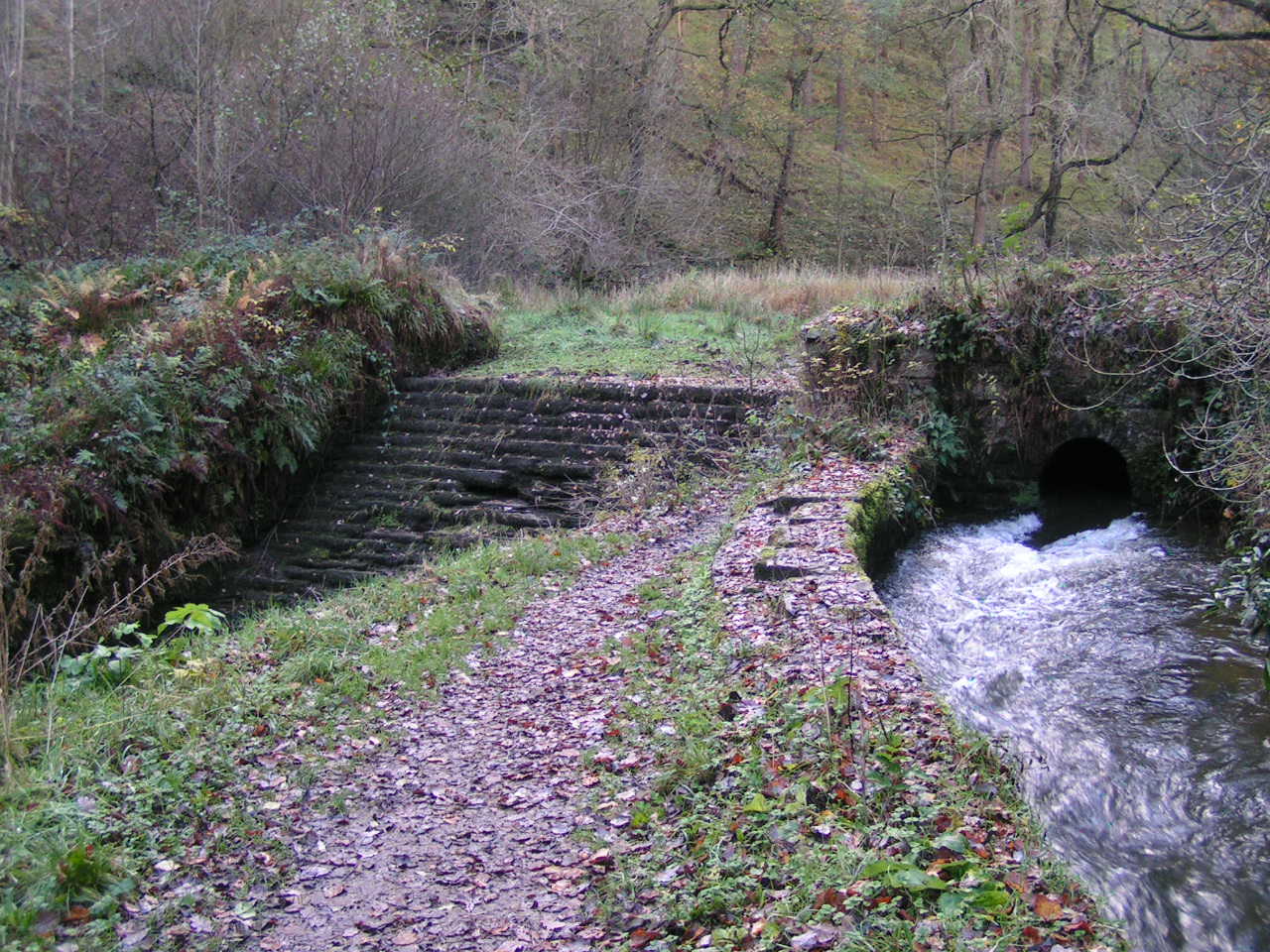
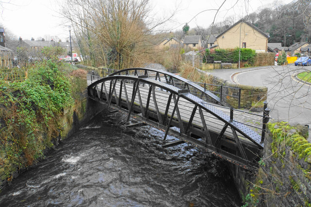
Todd Brook

Todd Brook is a small river running through the English counties of Cheshire and Derbyshire. The Brook rises beneath Shining Tor on the border between...

St. James' Church, Buxworth

St. James' Church, Buxworth is a 19th-century Church of England church in the village of Buxworth, Derbyshire. The church dates back to 1874 and is a Grade...
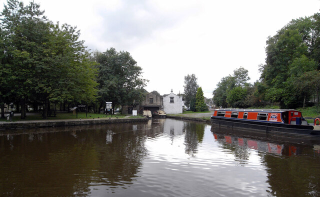
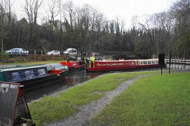
Bugsworth Basin

Bugsworth Basin is a canal basin at the terminus of the Peak Forest Canal at Buxworth (formerly Bugsworth) in the valley of the Black Brook, close to Whaley...

Peak Forest Tramway

The Peak Forest Tramway was an early horse- and gravity-powered industrial railway (or tramway) system in Derbyshire, England. Opened for trade on 31 August...
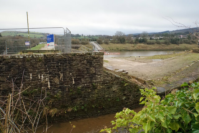
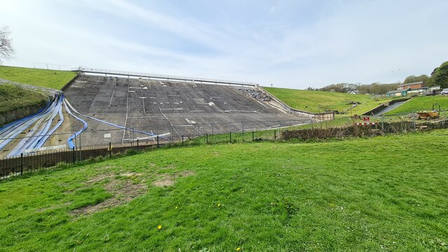
Toddbrook Reservoir

Toddbrook Reservoir, a feeder for the Peak Forest Canal, opened in 1838. It is above the town of Whaley Bridge in the High Peak area of Derbyshire, England...

Nearby Amenities

Located within 500m of 53.330134,-1.9810264
Whaley Bridge
Place: town
Population: 6455
Population Date: 2011
Source Name: local knowledge
Source Population: wikipedia
Wikidata: Q652597
Wikipedia: en:Whaley Bridge
Lat/Long: 53.3300532/-1.9834471
Jodrell Arms
Historic Amenity: pub
Lat/Long: 53.3304154/-1.9842125
Public Transport: stop_position
Railway: stop
Train: yes
Lat/Long: 53.3303405/-1.9847263
Fast Food
Ikram
Addr City: High Peak
Addr Country: GB
Addr Housenumber: 37
Addr Postcode: SK23 7AA
Addr Street: Market Street
Addr Suburb: Whaley Bridge
Cuisine: indian
Fhrs Id: 1259178
Old Name: Balti Cottage
Source Addr: FHRS Open Data
Lat/Long: 53.3299195/-1.9844093
Place Of Worship
Uniting Curch
Denomination: methodist;united_reformed
Religion: christian
Source Name: local knowledge
Lat/Long: 53.3273914/-1.9839052
Restaurant
Memories of India
Cuisine: indian
Lat/Long: 53.3275736/-1.9840386
Library
Whaley Bridge Library
Restaurant
Bailey's
Addr City: High Peak
Addr Country: GB
Addr Housenumber: 29
Addr Postcode: SK23 7AA
Addr Street: Market Street
Addr Suburb: Whaley Bridge
Fhrs Id: 1258728
Note: wine bar & restaurant
Source Addr: FHRS Open Data
Lat/Long: 53.3296008/-1.9841547
Fast Food
Pizza Hot Express
Addr City: High Peak
Addr Country: GB
Addr Housenumber: 31
Addr Postcode: SK23 7AA
Addr Street: Market Street
Addr Suburb: Whaley Bridge
Cuisine: pizza
Fhrs Id: 1259039
Note: name sic
Source Addr: FHRS Open Data
Lat/Long: 53.3297129/-1.9841922
Pub
The Railway
Operator: Robinsons
Lat/Long: 53.3297883/-1.984206
Pharmacy
Well Pharmacy
Addr City: High Peak
Addr Country: GB
Addr Housenumber: 40
Addr Postcode: SK23 7LP
Addr Street: Market Street
Addr Suburb: Whaley Bridge
Brand: Well Pharmacy
Brand Wikidata: Q7726524
Brand Wikipedia: en:Well Pharmacy
Dispensing: yes
Healthcare: pharmacy
Old Name: co-operative pharmacy
Operator: well
Website: https://finder.well.co.uk/store/whaley-bridge-market-street
Lat/Long: 53.3299776/-1.9838949
Fast Food
Al Madina
Addr City: High Peak
Addr Country: GB
Addr Housenumber: 38
Addr Postcode: SK23 7LP
Addr Street: Market Street
Addr Suburb: Whaley Bridge
Cuisine: indian
Fhrs Id: 1259041
Source Addr: FHRS Open Data
Lat/Long: 53.3298797/-1.9838785
Pub
The Goyt Inn
Lat/Long: 53.3302394/-1.983407
Doctors
Goyt Valley Medical Practice
Healthcare: doctor
Lat/Long: 53.3304923/-1.983038
Edwin Wild
Addr City: High Peak
Addr Country: GB
Addr Housenumber: 18
Addr Postcode: SK23 7HR
Addr Street: Old Road
Addr Suburb: Whaley Bridge
Fhrs Id: 1259043
Phone: +44 1663 732180
Shop: butcher
Source: survey
Source Addr: FHRS Open Data
Lat/Long: 53.3283579/-1.9828983
Fast Food
Babka
Addr City: High Peak
Addr Country: GB
Addr Housenumber: 2
Addr Postcode: SK23 7HR
Addr Street: Old Road
Addr Suburb: Whaley Bridge
Cuisine: sandwich
Fhrs Id: 1259044
Source: survey
Source Addr: FHRS Open Data
Lat/Long: 53.3286008/-1.9830281
Fast Food
The Fryery
Addr City: High Peak
Addr Country: GB
Addr Housenumber: 5
Addr Postcode: SK23 7LS
Addr Street: Canal Street
Addr Suburb: Whaley Bridge
Cuisine: fish_and_chips
Fhrs Id: 1259197
Source: survey
Source Addr: FHRS Open Data
Lat/Long: 53.3305088/-1.983745
Barrier: bollard
Lat/Long: 53.3295513/-1.9857785
Barrier: bollard
Lat/Long: 53.3291124/-1.9860467
Public Transport: stop_position
Railway: stop
Train: yes
Lat/Long: 53.3303381/-1.9847683
Whaley Bridge
Public Transport: stop_position
Railway: stop
Ref: 2
Train: yes
Lat/Long: 53.3309194/-1.9847651
Bus Stop
Whaley Bridge, Buxton Road / opposite Railway Station
Bus: yes
Naptan AtcoCode: 1000DWBB2151
Naptan NaptanCode: dbsdgpjm
Network: Derbyshire County Council
Operator: Derbyshire County Council
Public Transport: platform
Lat/Long: 53.3304497/-1.9839832
Give Way
Direction: backward
Lat/Long: 53.3301866/-1.9839328
Crossing
Button Operated: yes
Crossing: traffic_signals
Crossing Island: no
Crossing Markings: dots
Tactile Paving: yes
Lat/Long: 53.3297233/-1.9840052
Crossing
Lat/Long: 53.3263636/-1.9847461
Barrier: stile
Material: wood
Source: survey 18 June 2015
Stile: ladder
Lat/Long: 53.328027/-1.9783822
Barrier: stile
Material: wood
Source: survey 18 June 2015
Stile: ladder
Lat/Long: 53.3295378/-1.9783908
Barrier: stile
Material: wood
Source: survey 18 June 2015
Stile: stepover
Lat/Long: 53.3308285/-1.9772723
Atm
Fee: no
Operator: Co-op
Lat/Long: 53.3286728/-1.9834231
Addr Housenumber: 28
Addr Street: Market Street
Atm: yes
Fixme: Martin's closed in November 2022 McColls list of closures. Needs a survey. https://www.talkingretail.com/news/industry-news/full-list-of-closing-mccolls-stores-announced-02-11-2022/
Shop: newsagent
Lat/Long: 53.3296612/-1.9838578
Cafe
The Bridge Bakehouse
Addr City: High Peak
Addr Country: GB
Addr Housenumber: 42a
Addr Postcode: SK23 7LP
Addr Street: Market Street
Addr Suburb: Whaley Bridge
Contact Facebook: https://www.facebook.com/TheBridgeBakehouse/
Cuisine: coffee_shop
Fhrs Id: 1258639
Operator: Camilla & Courtney Dignan
Phone: +44 1663 734113
Lat/Long: 53.3300726/-1.9837801
Phone: +44 1663 733644
Shop: pet
Lat/Long: 53.3300882/-1.9837801
Toilets
Lat/Long: 53.3301401/-1.9841043
Goyt Wine
Shop: alcohol
Lat/Long: 53.3302634/-1.9837127
Cafe
The Village Kitchen
Addr City: High Peak
Addr Country: GB
Addr Housenumber: 30
Addr Postcode: SK23 7LP
Addr Street: Market Street
Addr Suburb: Whaley Bridge
Fhrs Id: 1258926
Phone: +44 1663 719122
Lat/Long: 53.3297317/-1.9838552
Bicycle Parking
Lat/Long: 53.3304217/-1.9846129
Waste Basket
Lat/Long: 53.3298209/-1.9841061
Waste Basket
Lat/Long: 53.3287594/-1.9832624
Post Box
Operator: Royal Mail
Ref: SK23 890
Lat/Long: 53.3289047/-1.9836902
Waste Basket
Lat/Long: 53.3299731/-1.9841792
Bench
Lat/Long: 53.3299795/-1.9841819
Telephone
Art Box
Booth: K6
Colour: red
Covered: booth
Man Made: telephone_box
Lat/Long: 53.3299695/-1.984202
Barrier: cycle_barrier
Bicycle: yes
Foot: yes
Horse: yes
Motor Vehicle: no
Lat/Long: 53.3335764/-1.984064
Booth: K6
Covered: booth
Disused Amenity: telephone
Man Made: telephone_box
Note: adopted by Whaley Bridge Town Council in 2011
Operator: Whaley Bridge Town Council
Phone: +44 1663 732378
Postal Code: SK23 7ND
Lat/Long: 53.3319189/-1.9782888
Roosdyche
Place: locality
Source: OS_OpenData_StreetView
Lat/Long: 53.3276495/-1.9774481
Throstledale
Place: locality
Source: OS_OpenData_StreetView
Lat/Long: 53.3264961/-1.9797548
Public Transport: stop_position
Railway: stop
Train: yes
Lat/Long: 53.3305743/-1.9847385
Post Box
Note Ref: ref not visible in ground survey
Operator: Royal Mail
Lat/Long: 53.330367/-1.9838316
Fast Food
Yoyo Chinese
Addr City: High Peak
Addr Country: GB
Addr Housenumber: 6
Addr Postcode: SK23 7HT
Addr Street: Buxton Road
Addr Suburb: Whaley Bridge
Cuisine: chinese
Delivery: no
Fhrs Id: 1258723
Takeaway: yes
Website: https://take-a-way.co.uk/menu/5956/YOYO%20Chinese%20-%20High%20Peak/
Lat/Long: 53.3282964/-1.9832956
Barrier: motorcycle_barrier
Bicycle: yes
Foot: yes
Horse: yes
Motor Vehicle: no
Lat/Long: 53.3276313/-1.9827389
Access: yes
Barrier: motorcycle_barrier
Lat/Long: 53.3300381/-1.9827007
Power: pole
Source: Bing
Lat/Long: 53.3334558/-1.9759928
Bar
Whaley Tap House
Addr City: High Peak
Addr Country: GB
Addr Housenumber: 20
Addr Postcode: SK23 7HR
Addr Street: Old Road
Addr Suburb: Whaley Bridge
Brewery: yes
Craft: brewery
Opening Hours: We-Fr 17:00-22:30; Sa-Su 15:30-22:30
Operator: Whaley Bridge Brewery
Smoking: outside
Lat/Long: 53.3282784/-1.9828583
Whaley Bridge
Public Transport: stop_position
Railway: stop
Ref: 1
Train: yes
Lat/Long: 53.3299065/-1.984665
Jack Hallam and Sons
Addr City: High Peak
Addr Country: GB
Addr Housenumber: 35
Addr Postcode: SK23 7HT
Addr Street: Buxton Road
Addr Suburb: Whaley Bridge
Opening Hours: Mo 10:00-17:00, Tu 10:00-17:00, We closed, Th 10:00-17:00, Fr 10:00-17:00, Sa 10:00-15:00, Su closed
Shop: weapons
Lat/Long: 53.3279129/-1.9837451
Waterway: weir
Lat/Long: 53.3277033/-1.9855964
Fixme: further route to canal unclear
Lat/Long: 53.3268074/-1.9844484
Fast Food
Casa di Pizza
Addr City: High Peak
Addr Country: GB
Addr Housenumber: 5
Addr Postcode: SK23 7AA
Addr Street: Market Street
Addr Suburb: Whaley Bridge
Cuisine: pizza
Fhrs Id: 1259160
Source Addr: FHRS Open Data
Lat/Long: 53.3289942/-1.9838448
Fast Food
Phoenix
Addr City: High Peak
Addr Country: GB
Addr Housenumber: 16
Addr Postcode: SK23 7LP
Addr Street: Market Street
Addr Suburb: Whaley Bridge
Cuisine: chinese
Fhrs Id: 1259042
Source Addr: FHRS Open Data
Lat/Long: 53.3294299/-1.9837992
Whaley Bridge
Addr City: High Peak
Addr Country: GB
Addr Postcode: SK23 7AA
Addr Street: Market Street
Addr Suburb: Whaley Bridge
Naptan AtcoCode: 9100WHALYBG
Network: National Rail
Network Website: https://www.nationalrail.co.uk/stations/wbr/
Network Wikidata: Q26334
Operator: Northern Rail
Operator Website: https://www.northernrailway.co.uk/stations/whaley-bridge
Operator Wikidata: Q85789775
Public Transport: station
Railway: station
Ref Crs: WBR
Start Date: 1857
Train: yes
Wikidata: Q2111822
Wikipedia: en:Whaley Bridge railway station
Lat/Long: 53.3302649/-1.9847378
Generator Method: photovoltaic
Generator Output Electricity: yes
Generator Source: solar
Generator Type: solar_photovoltaic_panel
Location: roof
Power: generator
Lat/Long: 53.3315759/-1.9813166
Restaurant
Memories of India
Cuisine: indian
Phone: +44 1663 734141
Website: https://memoriesofindiauk.com/menu/
Lat/Long: 53.3278493/-1.9838593
Bicycle Parking
Bicycle Parking: stands
Capacity: 4
Lat/Long: 53.3263256/-1.9846372
Bicycle Parking
Bicycle Parking: stands
Capacity: 4
Lat/Long: 53.3297858/-1.9841661
Bicycle Parking
Bicycle Parking: stands
Capacity: 8
Lat/Long: 53.3302271/-1.9845691
Bicycle Parking
Bicycle Parking: stands
Capacity: 3
Lat/Long: 53.3302379/-1.9839549
Bicycle Parking
Bicycle Parking: stands
Capacity: 6
Lat/Long: 53.3306183/-1.9828606
Bus Stop
Whaley Bridge, Buxton Road / adjacent Primary School
Bus: yes
Network: Derbyshire County Council
Operator: Derbyshire County Council
Public Transport: platform
Lat/Long: 53.3267001/-1.984764
Bus Stop
Whaley Bridge, Buxton Road / adjacent Railway Station
Bus: yes
Naptan AtcoCode: 1000DWBB2150
Naptan NaptanCode: dbsdgpjg
Network: Derbyshire County Council
Operator: Derbyshire County Council
Public Transport: platform
Lat/Long: 53.3302702/-1.9841721
Water Point
Whaley Bridge Water Point
Access: customers
Centralkey: crt_watermate
Drinking Water: yes
Man Made: water_tap
Operator: Canal and River Trust
Url: http://canalrivertrust.org.uk/
Waterway: water_point
Lat/Long: 53.3320986/-1.9836335
Sanitary Dump Station
Whaley Bridge Elsan Point
Access: customers
Centralkey: crt_watermate
Operator: Canal and River Trust
Sanitary Dump Station: yes
Sanitary Dump Station Accepted: black_water
Sanitary Dump Station Basin: yes
Sanitary Dump Station Pump-out: no
Waste: toilet
Waterway: sanitary_dump_station
Lat/Long: 53.3321982/-1.9834337
Toilets
Whaley Bridge Toilet
Access: customers
Centralkey: crt_watermate
Operator: Canal and River Trust
Lat/Long: 53.3322397/-1.9834831
Waste Disposal
Whaley Bridge Rubbish Disposal
Access: permissive
Centralkey: no
Operator: Canal and River Trust
Waste: trash
Lat/Long: 53.3321323/-1.9833642
Bench
Lat/Long: 53.3300365/-1.984124
Give Way
Direction: forward
Lat/Long: 53.3298983/-1.9840795
Traffic Signals
Traffic Signals: crossing
Traffic Signals Direction: forward
Lat/Long: 53.329694/-1.984004
Traffic Signals
Traffic Signals: crossing
Traffic Signals Direction: backward
Lat/Long: 53.3297565/-1.9840061
The data included in this document is from www.openstreetmap.org. The data is made available under ODbL.

Have you been to Bings Wood?

Leave your review of Bings Wood below (or comments, questions and feedback).