Breakheart Plantation

Wood, Forest in Gloucestershire Tewkesbury

England

Breakheart Plantation

Path and field near Winchcombe The land is part of the valley of the Isbourne with the Cotswold escarpment circling round.
Path and field near Winchcombe Credit: Bill Boaden

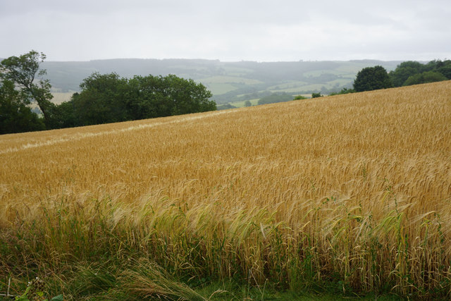
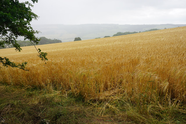
Breakheart Plantation is a stunning woodland area located in Gloucestershire, England. Spread over a vast expanse, this plantation is truly a nature-lover's paradise. The plantation is part of the larger Forest of Dean, which encompasses a rich history and diverse wildlife.

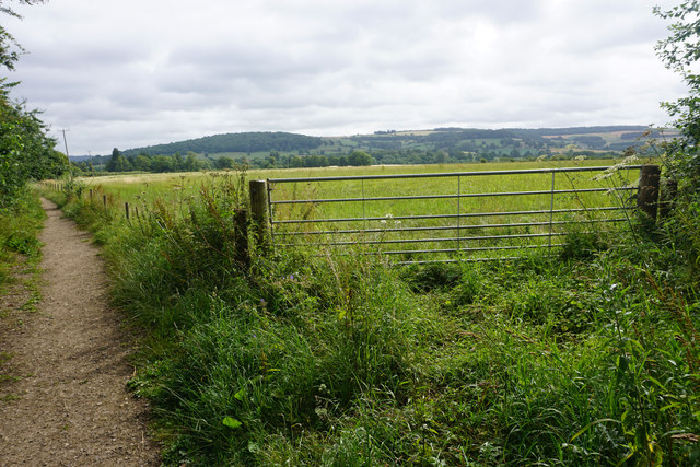
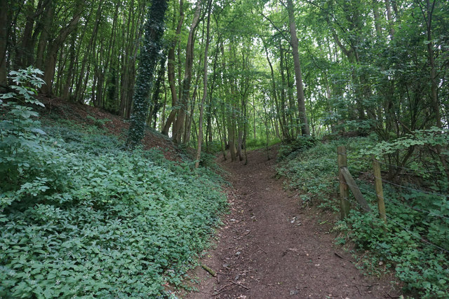
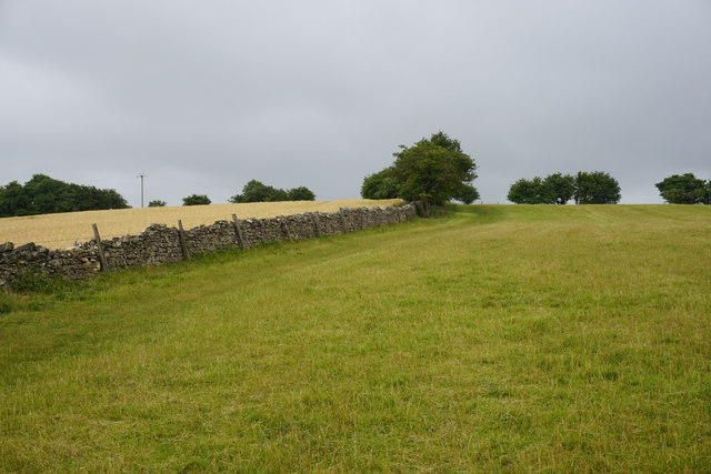
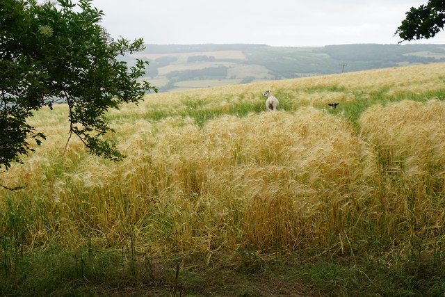
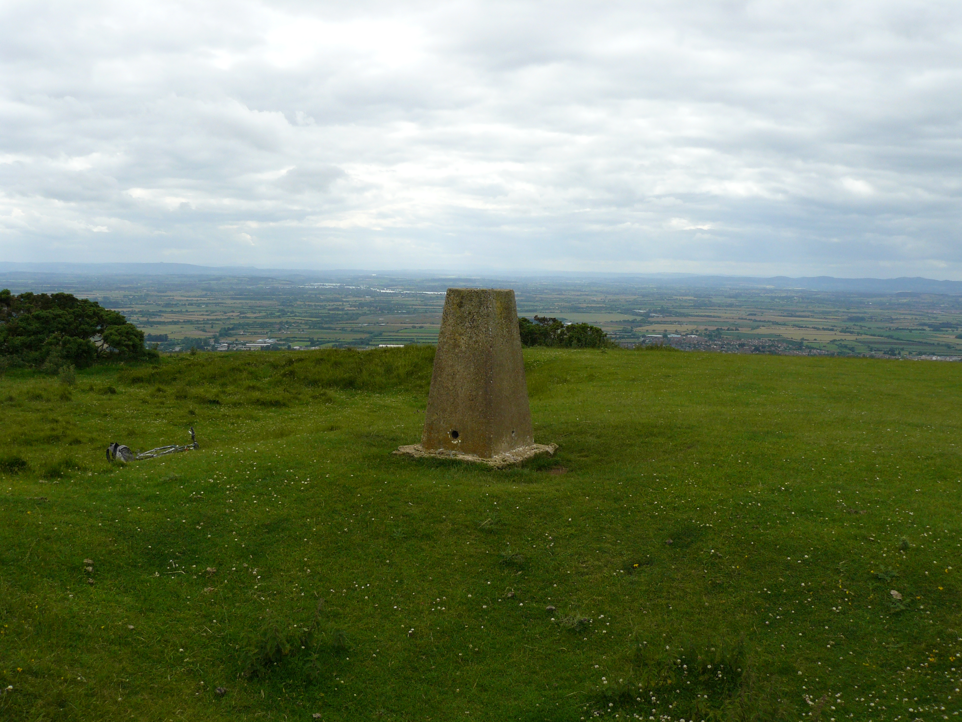
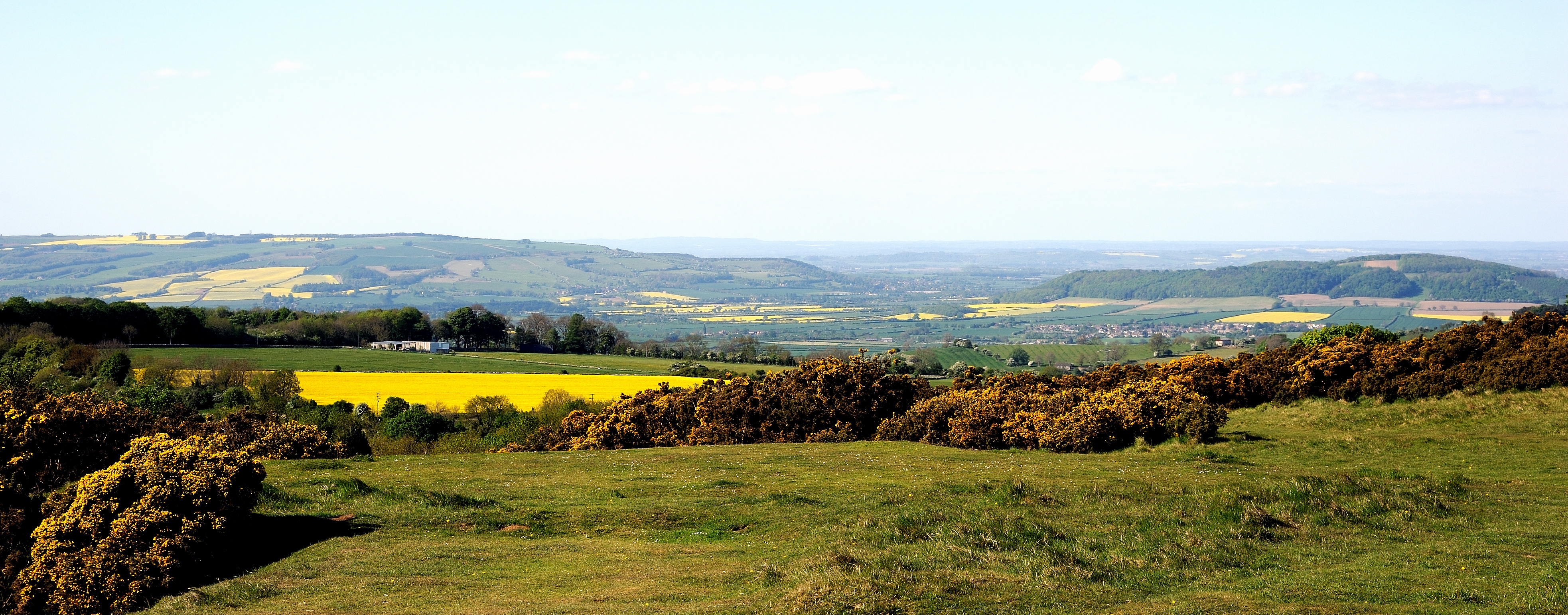
The landscape of Breakheart Plantation is characterized by its dense and ancient woodland. Towering oak and beech trees dominate the area, creating a picturesque and serene environment. The forest floor is covered in a lush carpet of ferns, mosses, and wildflowers, adding to the enchanting atmosphere.

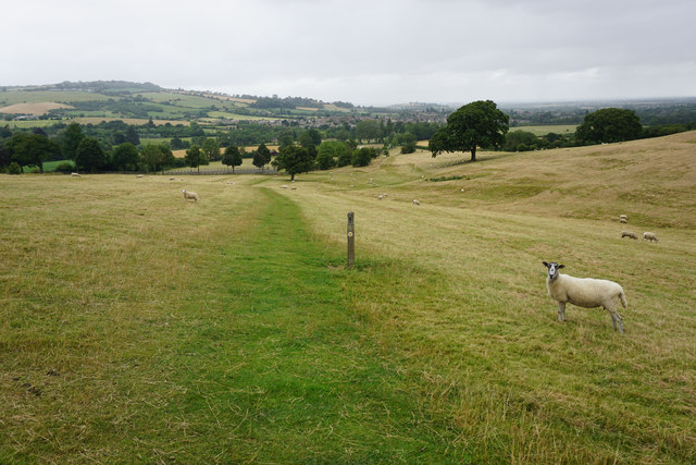
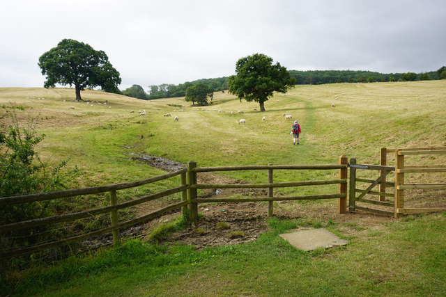
Visitors to Breakheart Plantation can enjoy a variety of activities. There are numerous walking trails, ranging from easy strolls to more challenging hikes, allowing visitors to explore the plantation at their own pace. The trails offer breathtaking views of the surrounding countryside and provide opportunities for birdwatching and wildlife spotting.

Breakheart Plantation is also home to a diverse range of wildlife. It is a haven for bird species, with sightings of woodpeckers, owls, and various songbirds being common. The woodland is also inhabited by mammals such as deer, badgers, and foxes. Nature enthusiasts can immerse themselves in the natural beauty of the plantation and observe these creatures in their natural habitat.

With its tranquil atmosphere, stunning scenery, and abundant wildlife, Breakheart Plantation is a must-visit destination for anyone seeking to escape the hustle and bustle of everyday life and reconnect with nature. Whether you are a seasoned hiker, a birdwatching enthusiast, or simply someone looking for a peaceful retreat, Breakheart Plantation is sure to captivate your senses.

If you have any feedback on the listing, please let us know in the comments section below.

Breakheart Plantation Images

Images are sourced within 2km of 51.932196/-1.9847549 or Grid Reference SP0125. Thanks to Geograph Open Source API. All images are credited.

Path and field near Winchcombe The land is part of the valley of the Isbourne with the Cotswold escarpment circling round.
Path and field near Winchcombe
The land is part of the valley of the Isbourne with the Cotswold escarpment circling round.
Winchcombe Cricket Club It appears to be part of the Corndean estate, a little out of the town.
Winchcombe Cricket Club
It appears to be part of the Corndean estate, a little out of the town.
Private road on the edge of Winchcombe All the houses go by name only.
Private road on the edge of Winchcombe
All the houses go by name only.
The Cotswold Way above Winchcombe The path is on the slope of the escarpment, with Winchcombe visible ahead. The sheep are on the Corndean estate.
The Cotswold Way above Winchcombe
The path is on the slope of the escarpment, with Winchcombe visible ahead. The sheep are on the Corndean estate.
The Cotswold Way leaving the Isbourne valley There is a steady climb through a large sheep field which belongs to the Corndean estate.
The Cotswold Way leaving the Isbourne valley
There is a steady climb through a large sheep field which belongs to the Corndean estate.
Woodland path near Corndean Hall Continuing the steady climb up from Winchcombe along the Cotswold Way.
Woodland path near Corndean Hall
Continuing the steady climb up from Winchcombe along the Cotswold Way.
Private woodland near Corndean Hall The Cotswold way has to do some sharp angles to negotiate this part of the climb from Winchcombe, avoiding private land.
Private woodland near Corndean Hall
The Cotswold way has to do some sharp angles to negotiate this part of the climb from Winchcombe, avoiding private land.
Hillside barley field A rain shower is passing in the valley beyond.
Hillside barley field
A rain shower is passing in the valley beyond.
Barley field above Humblebee Cottages Seen during a rain shower.
Barley field above Humblebee Cottages
Seen during a rain shower.
The Cotswold Way near Belas Knap This is almost the top of the hill after quite a long climb from Winchcombe.
The Cotswold Way near Belas Knap
This is almost the top of the hill after quite a long climb from Winchcombe.
Sheep in a barley field near Belas Knap You feel that they weren't supposed to be there.
Sheep in a barley field near Belas Knap
You feel that they weren't supposed to be there.
Woodland path near Belas Knap Part of the Cotswold Way. It runs along the top of the escarpment which falls away to the right through the woods.
Woodland path near Belas Knap
Part of the Cotswold Way. It runs along the top of the escarpment which falls away to the right through the woods.
Belas Knap A neolithic long barrow. The remains of 31 people were found in it during the Victorian excavations.
Belas Knap
A neolithic long barrow. The remains of 31 people were found in it during the Victorian excavations.
Field of oats near Belas Knap The long barrow can be seen straight ahead. the path incorporates the Cotswold Way and the Winchcombe Way.
Field of oats near Belas Knap
The long barrow can be seen straight ahead. the path incorporates the Cotswold Way and the Winchcombe Way.
Sheep in long grass Near 300m above sea level, part of a large plateau around Cleeve Hill.
Sheep in long grass
Near 300m above sea level, part of a large plateau around Cleeve Hill.
Ramshackle gate and a field of oats As the fields have got larger, fewer gates are needed. This is a large plateau of farmland, but it falls away to the right towards West Wood.
Ramshackle gate and a field of oats
As the fields have got larger, fewer gates are needed. This is a large plateau of farmland, but it falls away to the right towards West Wood.
Track to Wontley Farm This used to be part of the Cotswold Way, but that has now been diverted through Breakheart Plantation instead.
Track to Wontley Farm
This used to be part of the Cotswold Way, but that has now been diverted through Breakheart Plantation instead.
Track nearly at Wontley Farm Formerly part of the Cotswold Way. One of the farm buildings can be seen in the indentation ahead.
Track nearly at Wontley Farm
Formerly part of the Cotswold Way. One of the farm buildings can be seen in the indentation ahead.
Show me another place!

Breakheart Plantation is located at Grid Ref: SP0125 (Lat: 51.932196, Lng: -1.9847549)

Administrative County: Gloucestershire

District: Tewkesbury

Police Authority: Gloucestershire

What 3 Words

///hamper.corporate.dogs. Near Winchcombe, Gloucestershire

Nearby Locations

Breakheart Plantation

Related Wikis

Sudeley

Sudeley is a civil parish in the district of Tewkesbury, in the county of Gloucestershire, England. The parish includes the village of Charlton Abbots...

Belas Knap

Belas Knap is a neolithic, chambered long barrow situated on Cleeve Hill, near Cheltenham and Winchcombe, in Gloucestershire, England.It is a type of monument...

Cleeve Hill, Gloucestershire

Cleeve Hill (also known as Cleeve Cloud) is the highest point both of the Cotswolds hill range and of the county of Gloucestershire, at 330 m (1,080 ft...

Cleeve Common

Cleeve Common (grid reference SO990260) is a 455-hectare (1,120-acre) biological and geological Site of Special Scientific Interest in Gloucestershire...

Winchcombe meteorite

The Winchcombe meteorite is a carbonaceous chondrite meteorite that was observed entering the Earth's atmosphere as a fluorescent green fireball over Gloucestershire...

Winchcombe Castle

Winchcombe Castle was a castle in the town of Winchcombe in Gloucestershire, England. The motte and bailey castle was built during the chaos of the Anarchy...

Winchcombeshire

Winchcombeshire was an ancient county in the South West of England, in the Anglo-Saxon period, with Winchcombe as its county town. The county originated...

Winchcombe Rural District

Winchcombe was, from 1894 to 1935, a rural district in the Cotswolds area of England. It included parts of two administrative counties: Gloucestershire...

Related Videos

Hiking to The Cotswold's Highest Peak (IN WINTER!)

I climbed to the highest Peak In the Cotwolds National park and it was amazing! MY GEAR LIST , SOCIALS & LINKs to the ...

Afternoon walk exploring Winchcombe in The Cotswolds, UK | Relaxing Nature Walking Video | 4K HD

Enjoy this lovely walk through the historical town of Winchcombe in the Cotswolds, England The place name literally means ...

4 Cotswold Round long distance hiking trail Tarp Wild camping Cleeve Hill Hungry Horse Crickley Hill

Day four on The Cotswold Round a 349 km / 217 miles long distance footpath circuit in South central England covering parts of 6 ...

Explore Sudeley Castle With Me

Explore Sudeley Castle with Me and soak up the Tudor history!

Nearby Amenities

Located within 500m of 51.932196,-1.9847549
Power: tower
Source: bing
Lat/Long: 51.9307019/-1.9842978
Power: tower
Source: bing
Lat/Long: 51.9365473/-1.9861334
Power: tower
Source: bing
Lat/Long: 51.9280154/-1.9859306
Power: tower
Source: bing
Lat/Long: 51.9323084/-1.9847755
Barrier: stile
Lat/Long: 51.9345124/-1.987412
Woodbine Cottages
Power: pole
Transformer: distribution
Voltage Primary: 11000
Lat/Long: 51.9333738/-1.9902203
Power: pole
Lat/Long: 51.9338953/-1.9898482
Power: pole
Lat/Long: 51.9346732/-1.9888829
Briarwood House
Power: pole
Transformer: distribution
Voltage Primary: 11000
Lat/Long: 51.9328446/-1.9873234
Power: pole
Lat/Long: 51.9332557/-1.9869279
Power: pole
Lat/Long: 51.9339309/-1.986874
Power: pole
Lat/Long: 51.9344871/-1.987504
Power: pole
Lat/Long: 51.9349363/-1.9882966
Power: pole
Lat/Long: 51.9353691/-1.9890627
The data included in this document is from www.openstreetmap.org. The data is made available under ODbL.

Have you been to Breakheart Plantation?

Leave your review of Breakheart Plantation below (or comments, questions and feedback).