Brach Copse

Wood, Forest in Dorset

England

Brach Copse

Rolling farmland near Hinton Parva Farmland to the east of the hamlet of Hinton Parva.
Rolling farmland near Hinton Parva Credit: Peter Kazmierczak

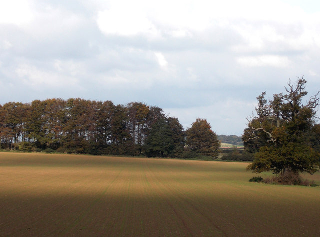
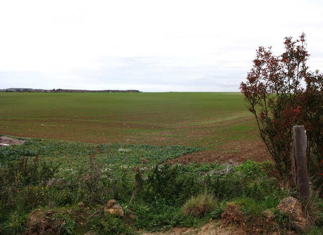
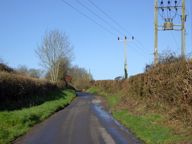
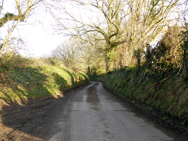
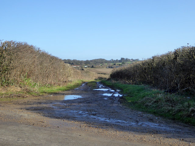
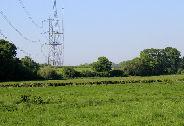
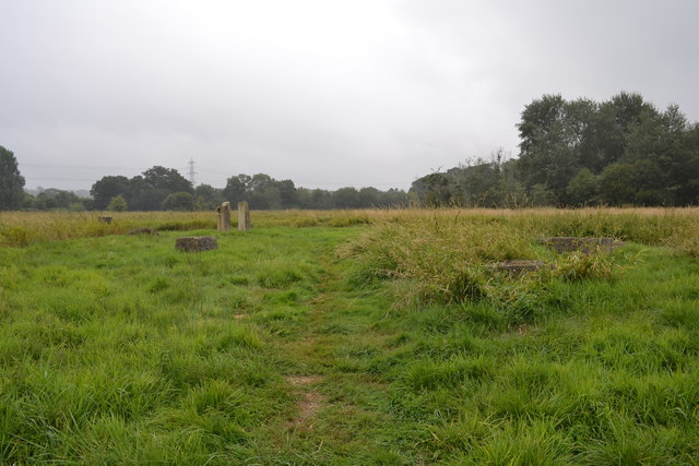
Brach Copse is a picturesque woodland located in Dorset, England. Stretching over an area of approximately 50 acres, it is a popular destination for nature enthusiasts and hikers alike. The copse is situated within the larger Brach Forest, which covers a total area of around 500 acres.

The woodland is characterized by a diverse range of tree species, including oak, beech, and ash. These majestic trees create a dense canopy that provides shade and shelter for a variety of wildlife. The forest floor is covered in a thick layer of leaf litter, which supports a rich ecosystem of small mammals, insects, and fungi.

Walking through Brach Copse, visitors are treated to a tranquil and serene environment. The sound of birdsong fills the air, as numerous species of birds, such as woodpeckers and owls, call the copse their home. The woodland is also home to several species of deer, including roe deer and fallow deer, which can often be spotted grazing in the open meadows within the forest.

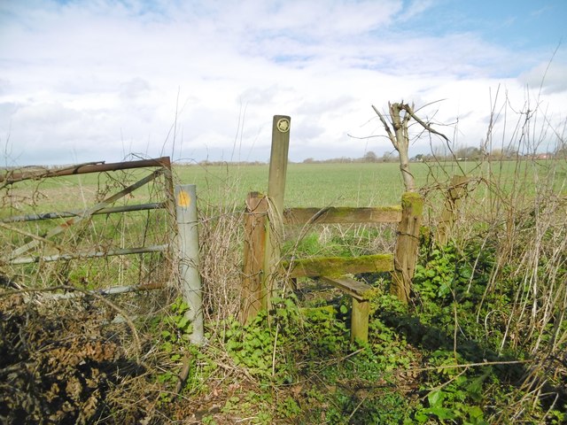
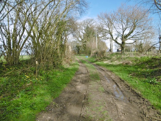
The copse is crisscrossed with a network of well-maintained footpaths, allowing visitors to explore the woods and discover its hidden treasures. In the spring, the forest comes alive with vibrant displays of bluebells and wildflowers, creating a breathtaking spectacle that attracts photographers and nature enthusiasts from far and wide.

Brach Copse is not only a haven for wildlife but also a place of tranquility and beauty. Its timeless charm and natural splendor make it a must-visit destination for those seeking solace in nature.

If you have any feedback on the listing, please let us know in the comments section below.

Brach Copse Images

Images are sourced within 2km of 50.832275/-1.9909742 or Grid Reference SU0003. Thanks to Geograph Open Source API. All images are credited.

Rolling farmland near Hinton Parva Farmland to the east of the hamlet of Hinton Parva.
Rolling farmland near Hinton Parva
Farmland to the east of the hamlet of Hinton Parva.
Farmland north of Hinton Parva The open landscape north of Hinton Parva.
Farmland north of Hinton Parva
The open landscape north of Hinton Parva.
The Stocks Inn, Furzehill One of the boards advertises Quiz Night on 'Bank Holiday Sunday'. An odd one - is that Easter Day?
The Stocks Inn, Furzehill
One of the boards advertises Quiz Night on 'Bank Holiday Sunday'. An odd one - is that Easter Day?
River Allen at Fitche's Bridge Looking upstream.
River Allen at Fitche's Bridge
Looking upstream.
Lane from King Down to Clapgate Nobody seems to have let on what this lane is called.
Lane from King Down to Clapgate
Nobody seems to have let on what this lane is called.
Houses on Petersham Lane, Gaunt's Common The last houses going south.
Houses on Petersham Lane, Gaunt's Common
The last houses going south.
Woodcutts Lane Heading towards Witchampton.
Woodcutts Lane
Heading towards Witchampton.
Woodcutts Lane Heading towards Witchampton.
Woodcutts Lane
Heading towards Witchampton.
Track towards Hinton Martell The Woodcutts Lane end. It is mapped with some sort of public rights.
Track towards Hinton Martell
The Woodcutts Lane end. It is mapped with some sort of public rights.
Powerlines near Higher Honeybrook Farm These pylons are on the powerline that crosses the minor road leading from Wimborne west towards High Hall and Lower Barnsley Farm
Powerlines near Higher Honeybrook Farm
These pylons are on the powerline that crosses the minor road leading from Wimborne west towards High Hall and Lower Barnsley Farm
Meadows Beside the River Allen The river is in the trees on the right. This picture is take from just east of Fitches bridge where the lane from Wimborne crosses the river.
Meadows Beside the River Allen
The river is in the trees on the right. This picture is take from just east of Fitches bridge where the lane from Wimborne crosses the river.
Meadows Near The River Allen These fields are on the west side of the river just north of High Hall.
Meadows Near The River Allen
These fields are on the west side of the river just north of High Hall.
The Baker's Dozen A modern stone circle that has been constructed on Honeybrook Farm Park
The Baker's Dozen
A modern stone circle that has been constructed on Honeybrook Farm Park
Old Bridge Marker on Fitche's Bridge, west of Clapgate Bridge Weight Plate by the UC road, in parish of Pamphill (East Dorset District), Fitche's Bridge, mid-bridge.

Inscription reads:- : NOTICE / TO OWNERS AND DRIVERS / OF TRACTION ENGINES / THIS BRIDGE IS INSUFFICIENT / TO CARRY WEIGHTS BEYOND / THE ORDINARY TRAFFIC OF / THE DISTRICT :
 
Surveyed

Milestone Society National ID: DO_WEIFITbr.
Old Bridge Marker on Fitche's Bridge, west of Clapgate
Bridge Weight Plate by the UC road, in parish of Pamphill (East Dorset District), Fitche's Bridge, mid-bridge. Inscription reads:- : NOTICE / TO OWNERS AND DRIVERS / OF TRACTION ENGINES / THIS BRIDGE IS INSUFFICIENT / TO CARRY WEIGHTS BEYOND / THE ORDINARY TRAFFIC OF / THE DISTRICT : Surveyed Milestone Society National ID: DO_WEIFITbr.
Old Direction Sign - Signpost by Stocks Cross, Furzehill Annulus and bar finial - 4 arms; Dorset halo with NGR by the UC road, in parish of Holt (East Dorset District), Furzehill, Stocks Cross, at junction of UC roads to Clapgate and Colehill, on verge.

Surveyed

Milestone Society National ID: DO_SU0102
Old Direction Sign - Signpost by Stocks Cross, Furzehill
Annulus and bar finial - 4 arms; Dorset halo with NGR by the UC road, in parish of Holt (East Dorset District), Furzehill, Stocks Cross, at junction of UC roads to Clapgate and Colehill, on verge. Surveyed Milestone Society National ID: DO_SU0102
Hinton Martell, stile At the beginning of a path from Woodcutts Lane across farmland to Gaunt's Common.
Hinton Martell, stile
At the beginning of a path from Woodcutts Lane across farmland to Gaunt's Common.
Hinton Martell, path Path and farmtrack from Woodcutts to Hinton Martell and Chalbury.
Hinton Martell, path
Path and farmtrack from Woodcutts to Hinton Martell and Chalbury.
St James' Church of England First School, Gaunt's Common Apostrophe placement as per school website.
St James' Church of England First School, Gaunt's Common
Apostrophe placement as per school website.
Show me another place!

Brach Copse is located at Grid Ref: SU0003 (Lat: 50.832275, Lng: -1.9909742)

Unitary Authority: Dorset

Police Authority: Dorset

What 3 Words

///broadens.activity.crystal. Near Wimborne Minster, Dorset

Nearby Locations

Brach Copse The Withy Bed

Related Wikis

Hinton Parva

Hinton Parva is a hamlet and former civil parish, now in the civil parish of Hinton, in east Dorset, England, three miles north of Wimborne Minster. The...

Badbury Hundred

Badbury Hundred was a hundred in the county of Dorset, England, which took its name from the earthwork of Badbury Rings. It contained the following parishes...

East Dorset

East Dorset was a local government district in Dorset, England. Its council met in Wimborne Minster between 2016 and 2019.The district (as Wimborne) was...

Furzehill Wood

Furzehill Wood is a woodland near Colehill in Dorset, England. It covers a total area of 0.84 hectares (2.08 acres). It is owned and managed by the Woodland...

Related Videos

Wilksworth caravan park

https://linktr.ee/Tsnitsbradandlewisshow.

Honeybrook Farm - 7th July 2019

Beautiful day at Honeybrook Farm just outside Wimborne, Dorset.

Sisyphus II - Dance Interpretation/Concept Video

Dance video filmed in a brief break between national lockdowns! The song is Sisyphus II by Ibrahim. Videography & Editing by ...

Refurbishment Opportunity Wimborne

Rare chance to buy a good sized bungalow on great sized plot. Enhance / Extend and Love £425000.

Nearby Amenities

Located within 500m of 50.832275,-1.9909742
Stanbridge
Is In: Dorset, England, UK
Place: village
Source: npe
Lat/Long: 50.8340971/-1.9947485
Post Box
Description: Victorian
Fixme: Identify church in whose wall ths lies. Determine which side of road. Determine royal_cypher
Post Box Type: wall
Ref: BH21 11
Ref GB Uprn: 10015427592
Lat/Long: 50.8336828/-1.9953252
St. Kenelm
Building: church
Wikidata: Q26590894
Lat/Long: 50.8338704/-1.9950249
The data included in this document is from www.openstreetmap.org. The data is made available under ODbL.

Have you been to Brach Copse?

Leave your review of Brach Copse below (or comments, questions and feedback).