Little Covert

Wood, Forest in Staffordshire Stafford

England

Little Covert

Pasture and housing near Little Haywood in Staffordshire Looking north-north-east from the Trent and Mersey Canal, across the railway, towards Haywood House and other buildings in Main Road.
Pasture and housing near Little Haywood in Staffordshire Credit: Roger Kidd

Little Covert is a small village located in the county of Staffordshire, England. Situated within the heart of the countryside, it is known for its lush woodlands and serene atmosphere, making it an ideal destination for nature lovers and those seeking tranquility.

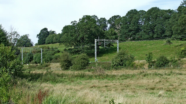
The village is surrounded by a dense forest that covers a significant portion of the area, providing a picturesque backdrop for residents and visitors alike. The forest is home to a diverse range of flora and fauna, including oak, ash, and birch trees, as well as various species of birds and small mammals. This natural habitat offers numerous opportunities for outdoor activities such as hiking, birdwatching, and photography.

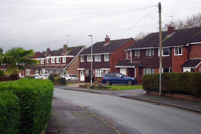
The village itself is quaint and charming, with a small population of friendly and welcoming residents. Its historic buildings and traditional architecture add to its appeal, giving it a distinct character and a sense of heritage. The village also boasts a local pub, where visitors can enjoy traditional British cuisine and experience the warm hospitality of the locals.

Little Covert is well-connected to neighboring towns and cities, with good road links and public transportation options. This allows for convenient access to amenities and services, ensuring that residents have easy access to essential facilities.

Overall, Little Covert, Staffordshire, is a hidden gem nestled within a beautiful forest. Its natural beauty, peaceful ambiance, and friendly community make it an attractive place for those seeking a countryside escape.

If you have any feedback on the listing, please let us know in the comments section below.

Little Covert Images

Images are sourced within 2km of 52.807727/-1.9906418 or Grid Reference SK0023. Thanks to Geograph Open Source API. All images are credited.

Pasture and housing near Little Haywood in Staffordshire Looking north-north-east from the Trent and Mersey Canal, across the railway, towards Haywood House and other buildings in Main Road.
Pasture and housing near Little Haywood in Staffordshire
Looking north-north-east from the Trent and Mersey Canal, across the railway, towards Haywood House and other buildings in Main Road.
Pasture and housing near Little Haywood in Staffordshire Looking north from the Trent and Mersey Canal, across the railway, towards Haywood House and other buildings in Main Road.
Pasture and housing near Little Haywood in Staffordshire
Looking north from the Trent and Mersey Canal, across the railway, towards Haywood House and other buildings in Main Road.
The Red Lion in Little Haywood, Staffordshire A friendly Marston's pub on Main Road in the village.
The Red Lion in Little Haywood, Staffordshire
A friendly Marston's pub on Main Road in the village.
The Lamb and Flag in Little Haywood, Staffordshire This pub is in Main Road at the junction with Meadow Lane.
The Lamb and Flag in Little Haywood, Staffordshire
This pub is in Main Road at the junction with Meadow Lane.
Milestone in Little Haywood, Staffordshire This is in Main Road opposite the Lamb and Flag public house.
Milestone in Little Haywood, Staffordshire
This is in Main Road opposite the Lamb and Flag public house.
Pasture and railway near Little Haywood in Staffordshire Looking north-north-west from the canal. A long stretch of pasture is between the canal and the railway embankment, with more on the slopes beyond.
Pasture and railway near Little Haywood in Staffordshire
Looking north-north-west from the canal. A long stretch of pasture is between the canal and the railway embankment, with more on the slopes beyond.
Little Haywood
Little Haywood
Canal and pasture near Little Haywood in Staffordshire Looking north-west on a dull autumn afternoon by the Trent and Mersey Canal near Meadow Lane Bridge, No 72.
The West Coast Main Line (Trent Valley) is on an embankment, heading for Stoke-on-Trent.
Canal and pasture near Little Haywood in Staffordshire
Looking north-west on a dull autumn afternoon by the Trent and Mersey Canal near Meadow Lane Bridge, No 72. The West Coast Main Line (Trent Valley) is on an embankment, heading for Stoke-on-Trent.
Narrowboats on the Trent and Mersey Canal in Staffordshire Looking north-west towards Great Haywood on a dull autumn afternoon, north-west of Meadow Lane Bridge, No 72.
Narrowboats on the Trent and Mersey Canal in Staffordshire
Looking north-west towards Great Haywood on a dull autumn afternoon, north-west of Meadow Lane Bridge, No 72.
Hazeldene, Great Haywood Somewhat confusingly, the name Hazeldene is used for two separate but parallel streets leading off Little Tixall Lane. The houses in this view are on the more westerly of the two and this road leads to Uplands. The name derives from Hazeldene House which was once occupied by the village doctor but was demolished in 1975. To add to the confusion there is now a Hazeldene House Surgery in Great Haywood but that is not on either of the Hazeldenes.
Hazeldene, Great Haywood
Somewhat confusingly, the name Hazeldene is used for two separate but parallel streets leading off Little Tixall Lane. The houses in this view are on the more westerly of the two and this road leads to Uplands. The name derives from Hazeldene House which was once occupied by the village doctor but was demolished in 1975. To add to the confusion there is now a Hazeldene House Surgery in Great Haywood but that is not on either of the Hazeldenes.
Oldfields Crescent, Great Haywood Parts of Great Haywood are quite suburban in appearance including this street of semi-detached houses on the northern edge of the village.
Oldfields Crescent, Great Haywood
Parts of Great Haywood are quite suburban in appearance including this street of semi-detached houses on the northern edge of the village.
The old Farmhouse at Moreton Farm This old Farmhouse has been empty for many years. It was owned by the Tabernor family until the 1970's when it was sold to a property developer, all the other buildings have been developed and this old Farmhouse is due for demolition in the near future.     Link  <a title="https://www.geograph.org.uk/photo/4759526" href="https://www.geograph.org.uk/photo/4759526">Link</a>
The old Farmhouse at Moreton Farm
This old Farmhouse has been empty for many years. It was owned by the Tabernor family until the 1970's when it was sold to a property developer, all the other buildings have been developed and this old Farmhouse is due for demolition in the near future. Link Link
Route of the HS2 rail track near Moreton House Looking along the proposed route of the HS2 rail line, everything to the left of the house will disappear and be made into a large cutting for the train to run through, effectively cutting this farm in half.
Route of the HS2 rail track near Moreton House
Looking along the proposed route of the HS2 rail line, everything to the left of the house will disappear and be made into a large cutting for the train to run through, effectively cutting this farm in half.
Trent & Mersey Canal A 94 mile long canal joining the River Trent and River Mersey. Built by James Brindley and opened in 1777.
Wikipedia: <span class="nowrap"><a title="http://en.wikipedia.org/wiki/Trent_and_Mersey_Canal" rel="nofollow ugc noopener" href="http://en.wikipedia.org/wiki/Trent_and_Mersey_Canal">Link</a><img style="margin-left:2px;" alt="External link" title="External link - shift click to open in new window" src="https://s1.geograph.org.uk/img/external.png" width="10" height="10"/></span>
Trent & Mersey Canal
A 94 mile long canal joining the River Trent and River Mersey. Built by James Brindley and opened in 1777. Wikipedia: LinkExternal link
Grassland near Little Haywood
House on the edge of Little Haywood
Canal east of Little Haywood in Staffordshire Looking north-west towards Great Haywood Junction.
Canal east of Little Haywood in Staffordshire
Looking north-west towards Great Haywood Junction.
Trent & Mersey Canal A 94 mile long canal joining the River Trent and River Mersey. Built by James Brindley and opened in 1777.
Wikipedia: <span class="nowrap"><a title="http://en.wikipedia.org/wiki/Trent_and_Mersey_Canal" rel="nofollow ugc noopener" href="http://en.wikipedia.org/wiki/Trent_and_Mersey_Canal">Link</a><img style="margin-left:2px;" alt="External link" title="External link - shift click to open in new window" src="https://s1.geograph.org.uk/img/external.png" width="10" height="10"/></span>
Trent & Mersey Canal
A 94 mile long canal joining the River Trent and River Mersey. Built by James Brindley and opened in 1777. Wikipedia: LinkExternal link
Show me another place!

Little Covert is located at Grid Ref: SK0023 (Lat: 52.807727, Lng: -1.9906418)

Administrative County: Staffordshire

District: Stafford

Police Authority: Staffordshire

What 3 Words

///patching.cars.dream. Near Great Haywood, Staffordshire

Nearby Locations

Little Covert

Related Wikis

Great Haywood

Great Haywood is a village in central Staffordshire, England, just off the A51 and about 4.5 miles (7.2 km) northwest of Rugeley and 7.1 miles (11.4 km...

Black country ring

The Black Country Ring is a UK canal ring composed of the Staffordshire and Worcestershire Canal, Birmingham Main Line, Birmingham and Fazeley Canal, Coventry...

Haywood Junction

Haywood Junction (grid reference SJ994229), or Great Haywood Junction, is the name of the canal junction where the Staffordshire and Worcestershire Canal...

Great Haywood railway station

Great Haywood railway station is a disused railway station in Staffordshire, England. The railway line between Stone and Colwich, England, was opened by...

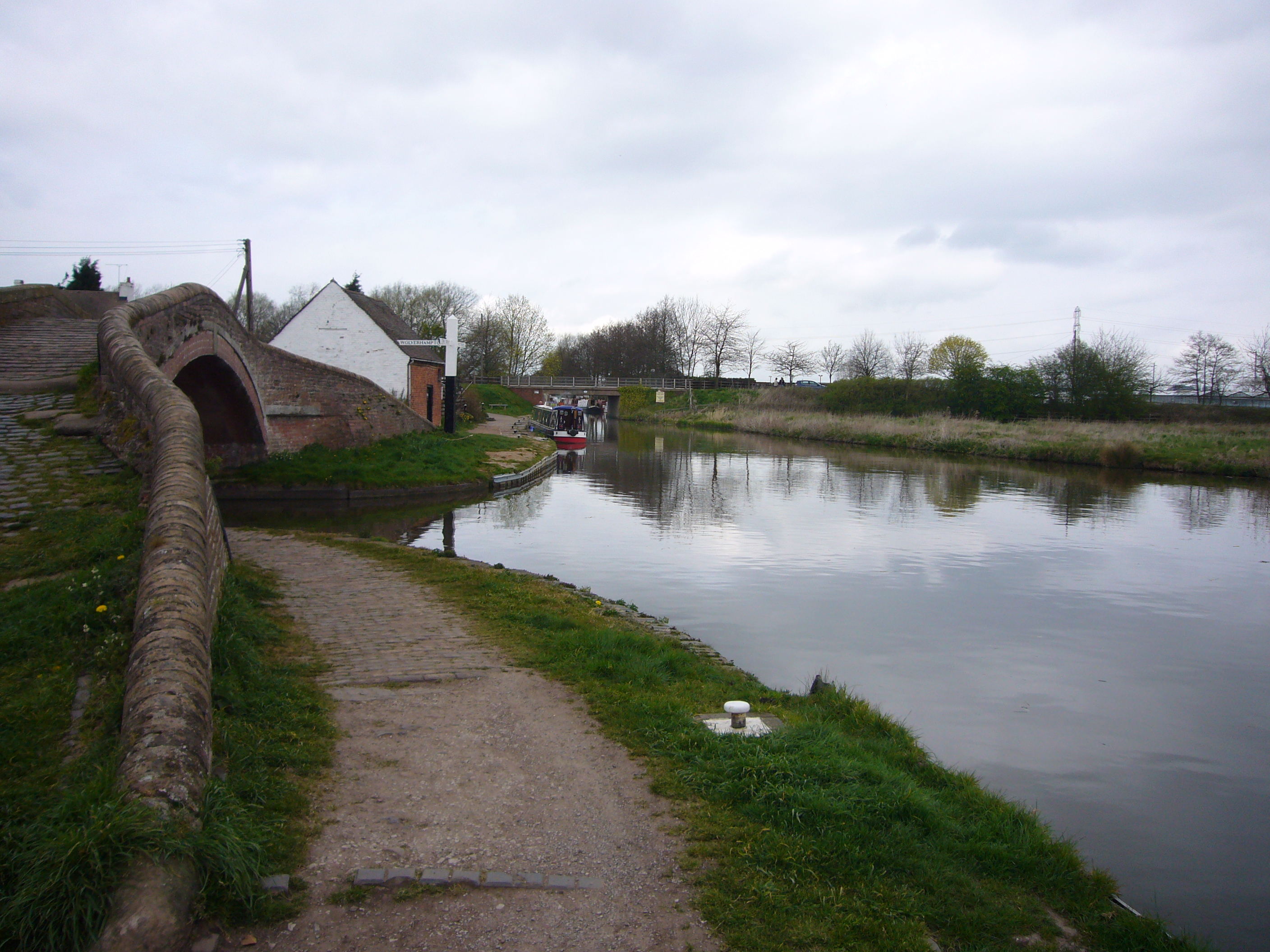
Essex Bridge, Staffordshire

Essex Bridge (grid reference SJ995225) is a Grade I listed packhorse bridge over the River Trent near Great Haywood, Staffordshire, England. Spanning the...

River Sow

The River Sow is a tributary of the River Trent in Staffordshire, England, and is the river that flows through Stafford. == Course == The river rises...

Shugborough inscription

The Shugborough Inscription is a sequence of letters – O U O S V A V V, between the letters D M on a lower plane – carved on the 18th-century Shepherd...

Shugborough Hall

Shugborough Hall is a stately home near Great Haywood, Staffordshire, England. The hall is situated on the edge of Cannock Chase, about 5.8 miles (9.3...

Nearby Amenities

Located within 500m of 52.807727,-1.9906418
Power: tower
Source: Bing
Lat/Long: 52.8044412/-1.9886538
Power: tower
Source: Bing
Lat/Long: 52.8058032/-1.9938144
The data included in this document is from www.openstreetmap.org. The data is made available under ODbL.

Have you been to Little Covert?

Leave your review of Little Covert below (or comments, questions and feedback).