Birk Park Wood

Wood, Forest in Yorkshire Richmondshire

England

Birk Park Wood

Bleaberry Gill Ford This is Bleaberry Gill Ford shown under a Hunter Moon.
Bleaberry Gill Ford Credit: John Walton

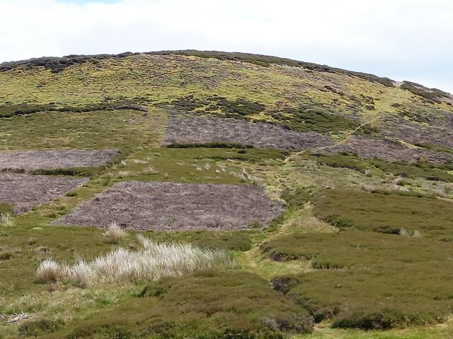
Birk Park Wood is a picturesque forest located in the county of Yorkshire, England. This woodland is nestled in the heart of the countryside, offering visitors a tranquil escape from the hustle and bustle of city life.

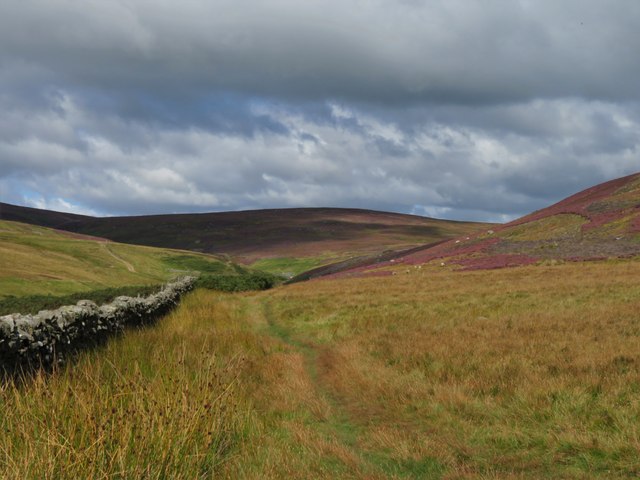
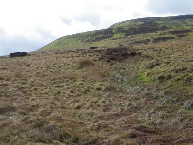
Covering an area of approximately 100 acres, Birk Park Wood is predominantly composed of mature oak and beech trees, creating a rich and diverse ecosystem. The forest floor is adorned with a carpet of bluebells during the spring, adding a burst of color to the landscape.

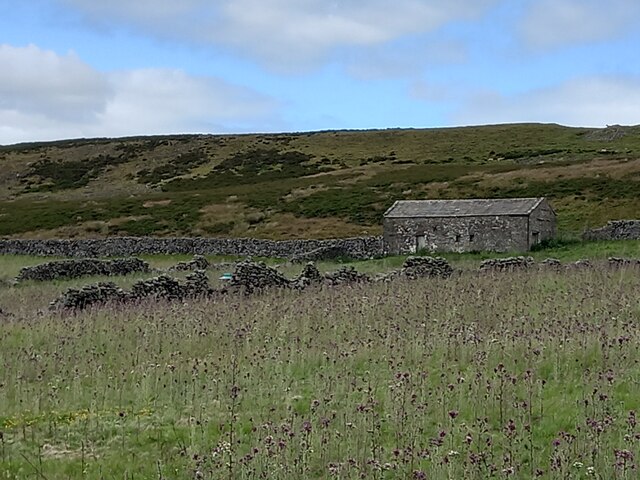
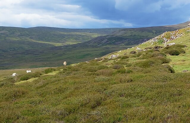
The wood is crisscrossed by a network of well-maintained footpaths, allowing visitors to explore its hidden treasures. There are several designated trails of varying lengths, catering to different levels of fitness and interests. As visitors venture deeper into the wood, they may stumble upon a small pond, providing a habitat for various species of wildlife, including ducks and frogs.

Birk Park Wood is not only a haven for nature enthusiasts but also a popular spot for birdwatchers. The forest is home to a multitude of bird species, including woodpeckers, owls, and finches. Visitors can bring their binoculars and try to catch a glimpse of these feathered creatures perched among the tree branches.

For those seeking a peaceful retreat, Birk Park Wood offers several picnic areas dotted throughout the forest, where visitors can relax and enjoy the serene surroundings. There are also benches strategically placed at different viewpoints, allowing visitors to appreciate the breathtaking vistas.

Overall, Birk Park Wood in Yorkshire is a captivating woodland that offers a sanctuary for wildlife, a haven for birdwatchers, and a tranquil escape for all who venture into its lush embrace.

If you have any feedback on the listing, please let us know in the comments section below.

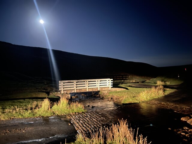
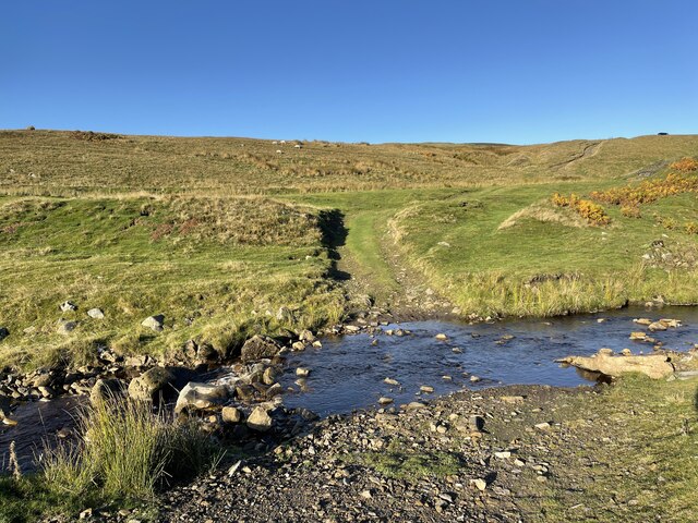
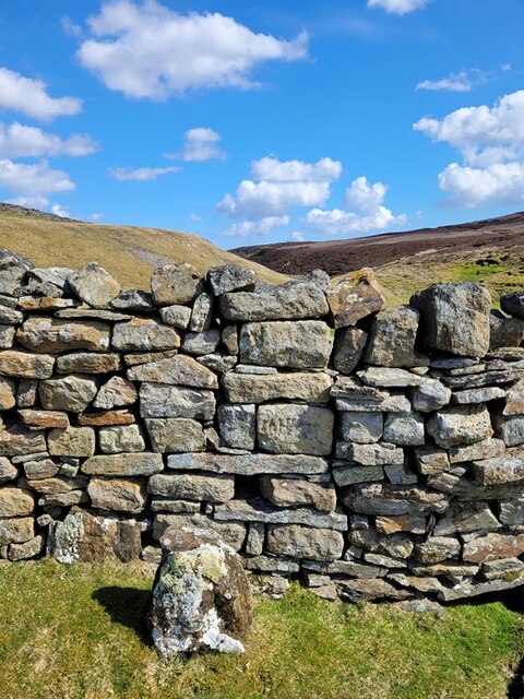
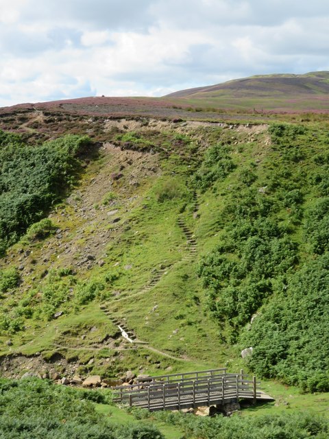
Birk Park Wood Images

Images are sourced within 2km of 54.39135/-1.9947919 or Grid Reference SE0099. Thanks to Geograph Open Source API. All images are credited.

Bleaberry Gill Ford This is Bleaberry Gill Ford shown under a Hunter Moon.
Bleaberry Gill Ford
This is Bleaberry Gill Ford shown under a Hunter Moon.
Cringley Ford This is another ford on Blueberry Gill.
Cringley Ford
This is another ford on Blueberry Gill.
Surrender Smelt Mill, old chimney The ruin is that of the original chimney where the flue terminated having carried fumes from the lead smelting process in the Surrender Mill, below in the valley. The flue was extended at a later time to at least one other chimney higher on the moor.
Surrender Smelt Mill, old chimney
The ruin is that of the original chimney where the flue terminated having carried fumes from the lead smelting process in the Surrender Mill, below in the valley. The flue was extended at a later time to at least one other chimney higher on the moor.
Old Boundary Marker at Fore Gill Gate Parish Boundary Marker on the east side of the minor road at Fore Gill Gate between Langthwaite and Feetham. Before 1866 this might have marked the boundary of Grinton and Arkengarthdate parishes, but now on the boundary of Arkengarthdale and Reeth, Fremington and Healaugh parishes.

Milestone Society National ID: YN_REEARK05pb
Old Boundary Marker at Fore Gill Gate
Parish Boundary Marker on the east side of the minor road at Fore Gill Gate between Langthwaite and Feetham. Before 1866 this might have marked the boundary of Grinton and Arkengarthdate parishes, but now on the boundary of Arkengarthdale and Reeth, Fremington and Healaugh parishes. Milestone Society National ID: YN_REEARK05pb
Bridge and steps at Cringley Bottom The bridge replaces one first erected some 12 years ago. On the far side are some 82 steps which make the ascent to the moor edge rather easier. There could be further improvements here using new funding, as the Coast to Coast path is now designated as an official long distance path.
Bridge and steps at Cringley Bottom
The bridge replaces one first erected some 12 years ago. On the far side are some 82 steps which make the ascent to the moor edge rather easier. There could be further improvements here using new funding, as the Coast to Coast path is now designated as an official long distance path.
Moorland in late summer The view along the wallside above Cringley Bottom, looking towards Fore Gill Gate. On the fellsides the heather is in full bloom.
Moorland in late summer
The view along the wallside above Cringley Bottom, looking towards Fore Gill Gate. On the fellsides the heather is in full bloom.
Calver Hill Prominent hill between Swaledale and Arkengarthdale reaching 1598 ft. high with evidence of mining and quarrying on the summit plateau.
Calver Hill
Prominent hill between Swaledale and Arkengarthdale reaching 1598 ft. high with evidence of mining and quarrying on the summit plateau.
A prickly field Part of the old intake land at Cleasby, which appears to have been abandoned to the thistles.
A prickly field
Part of the old intake land at Cleasby, which appears to have been abandoned to the thistles.
Moorland with sheep On the moor to the west of Calver, with the valley of Mill Gill in the distance.
Moorland with sheep
On the moor to the west of Calver, with the valley of Mill Gill in the distance.
Old spoil heap below Cringley Hill Old maps show a limestone quarry above the spoil heap, and also a lime kiln, so maybe I should have investigated the site.
Old spoil heap below Cringley Hill
Old maps show a limestone quarry above the spoil heap, and also a lime kiln, so maybe I should have investigated the site.
Path to Calver Hill A thin path through heather leads from the high point of the BW that crosses between Calver and Cringley Hill. This isn't a public right of way, but is on access land. There's evidence of grouse moor management here with patches of heather having been burnt off to promote new growth. The OS map shows the area to the east as Calver Hill, but locals would simply regard it as 'Calver'.
Path to Calver Hill
A thin path through heather leads from the high point of the BW that crosses between Calver and Cringley Hill. This isn't a public right of way, but is on access land. There's evidence of grouse moor management here with patches of heather having been burnt off to promote new growth. The OS map shows the area to the east as Calver Hill, but locals would simply regard it as 'Calver'.
Ford And Footbridge Food as seen in the title sequence of All Creatures Great And Small near to Kearton, North Yorkshire.
Ford And Footbridge
Food as seen in the title sequence of All Creatures Great And Small near to Kearton, North Yorkshire.
Calver Hill
Calver Hill
Grouse butts on Reeth Low Moor Heather moors need to be managed, as when left heather grows into a dense mass of long woody stems that support very little wildlife, has no grazing or economic value, and is a serious fire risk. When managed, the result is patchwork effect we see in this area of the moor.  The oldest heather providing cover and the new shoots providing food both for birds and sheep. 

The butts stretch across the hillside and at this time of the year they provide shelter for ewes with their lambs.
Grouse butts on Reeth Low Moor
Heather moors need to be managed, as when left heather grows into a dense mass of long woody stems that support very little wildlife, has no grazing or economic value, and is a serious fire risk. When managed, the result is patchwork effect we see in this area of the moor. The oldest heather providing cover and the new shoots providing food both for birds and sheep. The butts stretch across the hillside and at this time of the year they provide shelter for ewes with their lambs.
Cattle grid at Fore Gill Gate The road heads across Turf Moor towards the CB Inn.
Cattle grid at Fore Gill Gate
The road heads across Turf Moor towards the CB Inn.
The ford at Fore Gill Gate The beck will empty into Barney Beck which will join the River Swale south of Healaugh.
The ford at Fore Gill Gate
The beck will empty into Barney Beck which will join the River Swale south of Healaugh.
Footbridge at Fore Gill Gate The ford is to the left.
Footbridge at Fore Gill Gate
The ford is to the left.
Fore Gill Gate View of the ford, footbridge and cattle grid from the south. It was a popular stopping point on this warm, sunny Sunday.
Fore Gill Gate
View of the ford, footbridge and cattle grid from the south. It was a popular stopping point on this warm, sunny Sunday.
Show me another place!

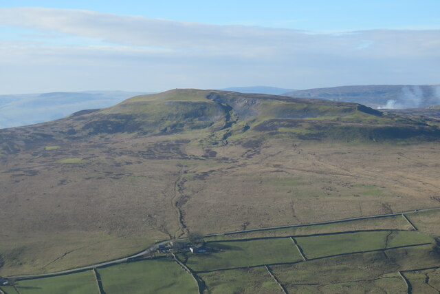
Birk Park Wood is located at Grid Ref: SE0099 (Lat: 54.39135, Lng: -1.9947919)

Division: North Riding

Administrative County: North Yorkshire

District: Richmondshire

Police Authority: North Yorkshire

What 3 Words

///enable.swooned.nourished. Near Barningham, Co. Durham

Related Wikis

Kearton

Kearton is a hamlet in the Yorkshire Dales, North Yorkshire, England. Kearton is situated near Low Row and Reeth. == References == == External links... ==

Calver Hill

Calver Hill is a fell in the Yorkshire Dales National Park in North Yorkshire, England. It is composed of limestone and is situated at grid reference NZ012003...

Healaugh, Richmondshire

Healaugh (pronounced "hee-law") is a small village in the civil parish of Reeth, Fremington and Healaugh, in Swaledale in the Yorkshire Dales. It is in...

Feetham

Feetham is a hamlet opposite Low Row in the Yorkshire Dales, North Yorkshire, England. The origin of the place-name is from Old Norse and means place at...

Maiden Castle, North Yorkshire

Maiden Castle is a settlement in Grinton, North Yorkshire (grid reference SE02189808) which probably dates from the Iron Age. It is listed as a Scheduled...

Arkle Town

Arkle Town is a hamlet in Arkengarthdale in the Richmondshire district of North Yorkshire, England. It is situated 0.4 miles (0.64 km) to the south of...

Low Row

Low Row is a village in Swaledale, in the Yorkshire Dales, North Yorkshire, England. It lies about 3 miles west of Reeth and is between Healaugh and Gunnerside...

Langthwaite

Langthwaite is one of the few villages in Arkengarthdale, North Yorkshire, England. It is 3.5 miles (5.6 km) north of Reeth and sits 870 feet (270 m) above...

Related Videos

The Swale Trail of Swaledale

Went on a five hour walk in Swaledale in England. It was amazing, even in the biting chill.

mountain biking: tour of Swaledale

A relaxing tour of Swaledale, North Yorkshire. The Specialized Stumpjumpers dusted off and given a good 25 mile round in the ...

Yorkshire and County Durham, Barnard Castle, Darlington and Swaledale

Journey to Swaledale, Yorkshire from the Lake District via Barnard Castle and Darlington. A re-edit to reposition the titles.

Swaledale Camping: Hazel Brow Farm Campsite, Low Row - Yorkshire Dales Off Grid

We visit Hazel Brow Farm Campsite in Low Row in the beautiful Swaledale. While we're there we take a walk to the Punch Bowl ...

Nearby Amenities

Located within 500m of 54.39135,-1.9947919
Source: gps survey
Lat/Long: 54.3943318/-1.991944
Source: gps survey
Lat/Long: 54.3942376/-1.991762
Source: gps survey
Lat/Long: 54.3941726/-1.9915968
Power: pole
Lat/Long: 54.3869373/-1.9947085
Power: pole
Lat/Long: 54.3869686/-1.9963929
The data included in this document is from www.openstreetmap.org. The data is made available under ODbL.

Have you been to Birk Park Wood?

Leave your review of Birk Park Wood below (or comments, questions and feedback).