Crowgutter Wood
Wood, Forest in Staffordshire Staffordshire Moorlands
England
Crowgutter Wood
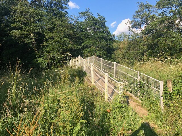
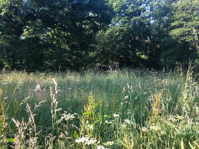
Crowgutter Wood is a charming woodland located in Staffordshire, England. Covering an area of approximately 100 hectares, this beautiful forest is a haven of tranquility and natural beauty. It is situated within close proximity to the town of Stafford, making it easily accessible for both locals and tourists.
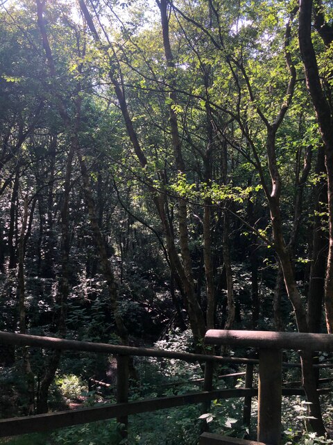
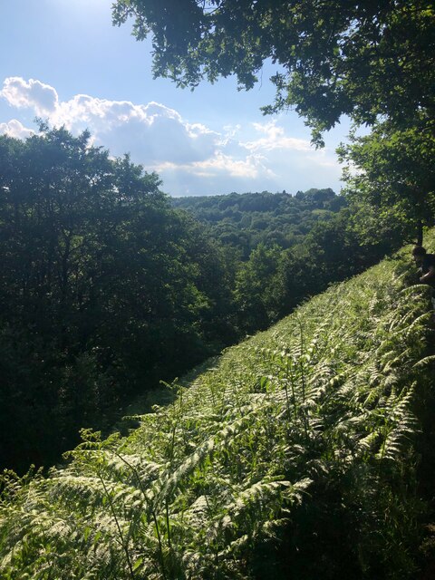
The woodland is characterized by its dense canopy of tall trees, predominantly consisting of oak, beech, and birch. The lush greenery provides a soothing and refreshing atmosphere, making it a popular destination for nature enthusiasts and hikers. The forest floor is adorned with a carpet of wildflowers, adding bursts of vibrant colors to the landscape during the spring and summer seasons.
Crowgutter Wood is home to a diverse range of wildlife, offering a unique opportunity for visitors to observe and connect with nature. Visitors may catch a glimpse of deer, foxes, badgers, and a variety of bird species that inhabit the area. The forest also boasts a network of trails and pathways, allowing visitors to explore its beauty at their own pace.
Additionally, the wood boasts a rich history, with evidence of ancient settlements and human activity dating back centuries. Archaeological finds such as pottery shards and tools have been unearthed, providing insights into the lives of past inhabitants.
Overall, Crowgutter Wood is a hidden gem within Staffordshire, offering a peaceful retreat from the bustling city life. Whether it is for a leisurely stroll, birdwatching, or simply enjoying the serenity of nature, this enchanting forest provides a memorable experience for all who visit.
If you have any feedback on the listing, please let us know in the comments section below.
Crowgutter Wood Images
Images are sourced within 2km of 53.037232/-1.9968273 or Grid Reference SK0048. Thanks to Geograph Open Source API. All images are credited.
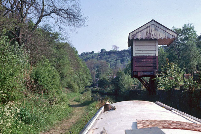

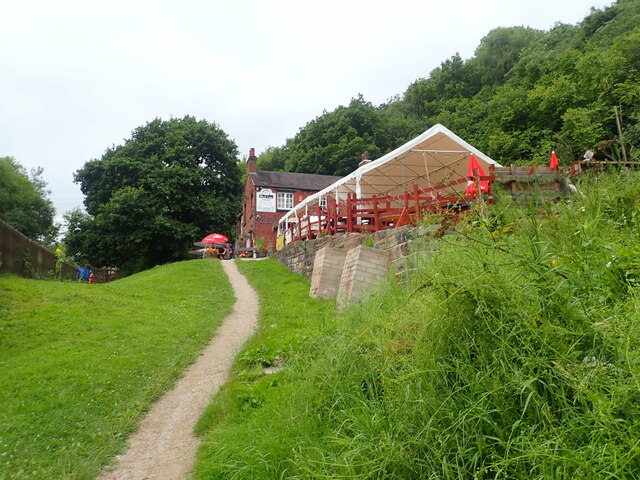
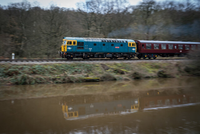
![Consall Station from the Caldon Canal towpath A preserved railway line near Leek in Staffordshire, running from Froghall up the valley to Cheddleton with one intermediate stop at Consall, and (since 2011) on an extension to a former quarry at Cauldon Low, where as of 2012 there is no station. The society has plans to connect to the national network at Stoke-on-Trent.
The lines were originally constructed by the North Staffordshire Railway (the &quot;Knotty&quot;). According to one writer, &quot;the buildings on the Churnet Valley line are of local stone, straightforwardly neo-Tudor, and effective&quot; [Lloyd &amp; Insall, &quot;Railway Station Architecture&quot;, David &amp; Charles 1978, p.17].](https://s1.geograph.org.uk/geophotos/07/51/43/7514373_0f9ef3fb.jpg)
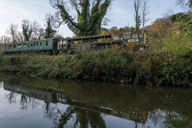
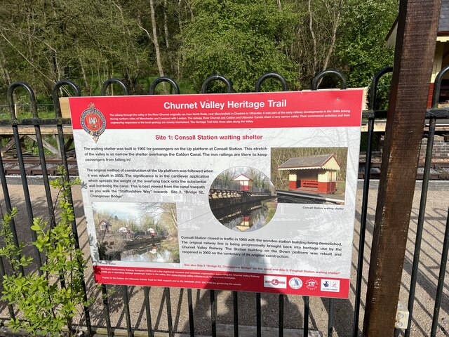
![Consall Station A preserved railway line near Leek in Staffordshire, running from Froghall up the valley to Cheddleton with one intermediate stop at Consall, and (since 2011) on an extension to a former quarry at Cauldon Low, where as of 2012 there is no station. The society has plans to connect to the national network at Stoke-on-Trent.
The lines were originally constructed by the North Staffordshire Railway (the &quot;Knotty&quot;). According to one writer, &quot;the buildings on the Churnet Valley line are of local stone, straightforwardly neo-Tudor, and effective&quot; [Lloyd &amp; Insall, &quot;Railway Station Architecture&quot;, David &amp; Charles 1978, p.17].](https://s0.geograph.org.uk/geophotos/07/66/70/7667004_978b380e.jpg)
Crowgutter Wood is located at Grid Ref: SK0048 (Lat: 53.037232, Lng: -1.9968273)
Administrative County: Staffordshire
District: Staffordshire Moorlands
Police Authority: Staffordshire
What 3 Words
///agreeable.signs.alright. Near Cheddleton, Staffordshire
Nearby Locations
Related Wikis

Consall railway station
Consall railway station is a former passenger railway station of the North Staffordshire Railway (NSR) and is now a preserved station on the Churnet Valley...

Kingsley, Staffordshire
Kingsley is a small village in the Staffordshire Moorlands near to Cheadle, and situated on the A52 from Stoke on Trent to Ashbourne. The civil parish...

Above Church
Above Church is a hamlet about 0.6 kilometers (0.4 mi) northwest of Ipstones in the English county of Staffordshire. It is located at grid reference SK016504...

Ipstones
Ipstones is a village and civil parish in the north of the English county of Staffordshire. Ipstones is part of the Staffordshire Moorlands district; within...

Consall
Consall is a small village situated in the Staffordshire Moorlands, Staffordshire, England. It is approximately 6 miles south of the market town of Leek...

Uttoxeter Canal
The Uttoxeter Canal was a thirteen-mile extension of the Caldon Canal running from Froghall as far as Uttoxeter in Staffordshire, England. It was authorised...

Froghall
Froghall is a village situated approximately ten miles to the east of Stoke-on-Trent and two miles north of Cheadle in Staffordshire, England. Population...
Kingsley and Froghall railway station
Kingsley and Froghall is a former railway station of the North Staffordshire Railway (NSR) that is now preserved on the Churnet Valley Railway in Staffordshire...
Nearby Amenities
Located within 500m of 53.037232,-1.9968273Have you been to Crowgutter Wood?
Leave your review of Crowgutter Wood below (or comments, questions and feedback).