Bot Wood

Wood, Forest in Derbyshire High Peak

England

Bot Wood

Monk's Road The road descends steeply to Charlesworth. In brighter weather, Manchester would be seen clearly on the plain.
Monk's Road Credit: Bill Boaden

Bot Wood is a small village located in the district of Derbyshire, England. Situated in the heart of the county, it is nestled in the beautiful landscape of the Derbyshire Dales. Bot Wood is renowned for its picturesque setting, surrounded by lush green forests and rolling hills.

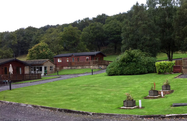
The village itself is characterized by its quaint charm and tranquility. With a population of just over 100 residents, it offers a close-knit community atmosphere. The houses in Bot Wood are predominantly traditional stone cottages, adding to the area's rustic appeal.

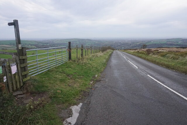
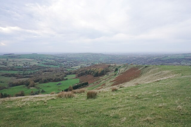
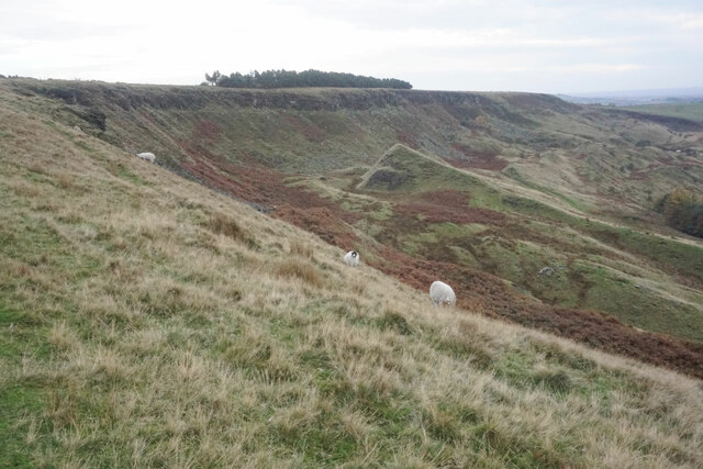
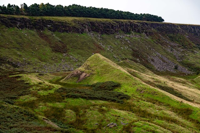
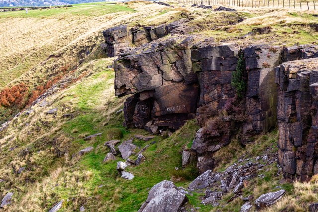
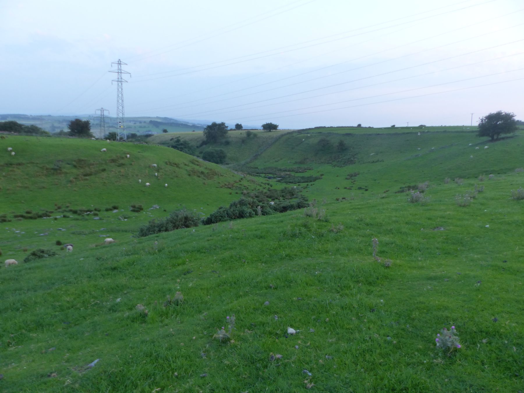
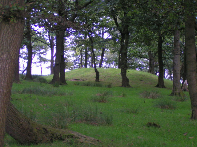
Bot Wood is particularly beloved by nature enthusiasts and outdoor adventurers. The village is surrounded by a dense forest, aptly named Bot Wood Forest, providing ample opportunities for hiking, cycling, and wildlife spotting. The forest is home to a diverse range of flora and fauna, including oak, birch, and beech trees, as well as various species of birds and mammals.

One of the standout features of Bot Wood is its proximity to several notable attractions. Just a short distance away is the historic Chatsworth House, a grand stately home with magnificent gardens and a rich heritage. Additionally, the Peak District National Park is within easy reach, offering stunning landscapes, hiking trails, and outdoor activities.

Overall, Bot Wood is a charming village that offers a peaceful retreat in the heart of Derbyshire. Its natural beauty, community spirit, and close proximity to notable attractions make it an appealing destination for both locals and visitors alike.

If you have any feedback on the listing, please let us know in the comments section below.

Bot Wood Images

Images are sourced within 2km of 53.424587/-1.9995547 or Grid Reference SK0091. Thanks to Geograph Open Source API. All images are credited.

Monk's Road The road descends steeply to Charlesworth. In brighter weather, Manchester would be seen clearly on the plain.
Monk's Road
The road descends steeply to Charlesworth. In brighter weather, Manchester would be seen clearly on the plain.
Coombes Edge The land slopes down towards Charlesworth and Broadbottom. Manchester is also visible beyond Werneth Low though a bit grey on this day.
Coombes Edge
The land slopes down towards Charlesworth and Broadbottom. Manchester is also visible beyond Werneth Low though a bit grey on this day.
Coombes Edge The edge forms a big curve. It is thought to be created by a natural landslip, though people have certainly used the exposed rocks. A dull day, the day after the clocks changed to GMT.
Coombes Edge
The edge forms a big curve. It is thought to be created by a natural landslip, though people have certainly used the exposed rocks. A dull day, the day after the clocks changed to GMT.
Path above Coombes Edge This section is part of the Cown Edge Way. It was the day after the clocks changed  to GMT and I was caught out by how gloomy it was.
Path above Coombes Edge
This section is part of the Cown Edge Way. It was the day after the clocks changed to GMT and I was caught out by how gloomy it was.
Exposed rocks on Cown Edge The remains of former small scale quarrying.
Exposed rocks on Cown Edge
The remains of former small scale quarrying.
Former quarry on Cown Edge At the top of the ridge.
Former quarry on Cown Edge
At the top of the ridge.
Old Wayside Cross near Ludworth Moor Farm Robin Hood's Picking Rods or The Maiden Stones, the old base and stumps of two shafts of a wayside cross. Set beside a bridleway, part of the Cown Edge Way, north of Ludworth Moor Farm. On the former boundary of Ludworth and Chisworth Township, Beard, Thornsett, Ottersett and Whittle Township and Mellor Chapelry, all three in Glossop Parish until 1866. A Scheduled Monument, details <span class="nowrap"><a title="https://historicengland.org.uk/listing/the-list/list-entry/1008595" rel="nofollow ugc noopener" href="https://historicengland.org.uk/listing/the-list/list-entry/1008595">Link</a><img style="margin-left:2px;" alt="External link" title="External link - shift click to open in new window" src="https://s1.geograph.org.uk/img/external.png" width="10" height="10"/></span>. Reference also “Crosses of the Peak District” by Neville T Sharpe, Landmark Publishing Ltd.

Milestone Society National ID: DEHP_CHI01
Old Wayside Cross near Ludworth Moor Farm
Robin Hood's Picking Rods or The Maiden Stones, the old base and stumps of two shafts of a wayside cross. Set beside a bridleway, part of the Cown Edge Way, north of Ludworth Moor Farm. On the former boundary of Ludworth and Chisworth Township, Beard, Thornsett, Ottersett and Whittle Township and Mellor Chapelry, all three in Glossop Parish until 1866. A Scheduled Monument, details LinkExternal link. Reference also “Crosses of the Peak District” by Neville T Sharpe, Landmark Publishing Ltd. Milestone Society National ID: DEHP_CHI01
Crown Edge Disused quarry on Crown Edge.
Crown Edge
Disused quarry on Crown Edge.
On The Edge! Sure footed sheep on the edge of Coombes Rocks.
On The Edge!
Sure footed sheep on the edge of Coombes Rocks.
Rocks Farm
Rocks Farm
View from Coombes Rocks
Coombes Rocks
Coombes Rocks
Mares Back Mares Back beneath Coombes Edge.
Mares Back
Mares Back beneath Coombes Edge.
Crown Edge Striking a pose on Crown Edge!
Crown Edge
Striking a pose on Crown Edge!
Coombes Rocks
Coombes Rocks
Cown Edge Quarry The smaller of two roughly circular quarries that can be found in close proximity on Cown Edge. In the distance is the A624 Glossop to Hayfield Road, if you look closely you can just make out the Grouse Inn. The Dark Peak area of the Peak District rises up to the horizon in the distance.
Cown Edge Quarry
The smaller of two roughly circular quarries that can be found in close proximity on Cown Edge. In the distance is the A624 Glossop to Hayfield Road, if you look closely you can just make out the Grouse Inn. The Dark Peak area of the Peak District rises up to the horizon in the distance.
Cown Edge Way High altitude rough grazing land used by cattle and sheep.
Cown Edge Way
High altitude rough grazing land used by cattle and sheep.
Holiday park, Charlesworth
Show me another place!

Bot Wood is located at Grid Ref: SK0091 (Lat: 53.424587, Lng: -1.9995547)

Administrative County: Derbyshire

District: High Peak

Police Authority: Derbyshire

What 3 Words

///zoom.revise.crunched. Near Glossop, Derbyshire

Related Wikis

Holehouse

Holehouse is a hamlet in Derbyshire, England. It is located 2 miles west of Glossop, on the A626 road close to Charlesworth.

Ludworth Intake

Ludworth Intake (grid reference SJ994911) is a 5.1-hectare (13-acre) geological Site of Special Scientific Interest at Ludworth on the border of Derbyshire...

Charlesworth, Derbyshire

Charlesworth is a village and civil parish near Glossop, Derbyshire, England. The population of the civil parish at the 2011 Census was 2,449. It is 2...

Chisworth

Chisworth is a hamlet near Glossop, Derbyshire, England. It is 3 miles (4.8 km) south-west of Glossop town centre, on the south side of the Etherow valley...

Brown Low

Brown Low is a bowl barrow most likely dating to the Bronze Age. An earth and stone mound survives east of Marple, Greater Manchester (grid reference SJ98829092...
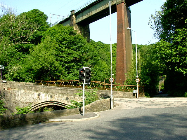
Broadbottom Viaduct

Broadbottom Viaduct (also known as Etherow or Mottram Viaduct) is a railway viaduct that spans the River Etherow between Derbyshire and Greater Manchester...

Simmondley

Simmondley is a small village near the town of Glossop in Derbyshire, England. The population of the High Peak ward at the 2011 Census was 4,727. It has...

Broadbottom railway station

Broadbottom railway station serves the village of Broadbottom in Greater Manchester, England. It is on the Manchester-Glossop Line, 10 miles (16 km) east...

Nearby Amenities

Located within 500m of 53.424587,-1.9995547
Passing Place
Lat/Long: 53.423397/-2.003288
Passing Place
Lat/Long: 53.4234334/-2.0027331
Parking
Access: unknown
Source: Bing and view from A626
Lat/Long: 53.4264299/-2.0056108
Ele: 188
Lat/Long: 53.4239832/-1.999493
Place Of Worship
Lat/Long: 53.4264357/-2.0032211
Generator Method: photovoltaic
Generator Output Electricity: yes
Generator Source: solar
Generator Type: solar_photovoltaic_panel
Location: roof
Power: generator
Lat/Long: 53.4279364/-1.9990182
Bus Stop
Chisworth, Marple Road / opposite 91 Marple Road
Bus: yes
Naptan AtcoCode: 100000008356
Naptan NaptanCode: dbsdpgpa
Network: Derbyshire County Council
Operator: Derbyshire County Council
Public Transport: platform
Lat/Long: 53.4263225/-2.0053527
Bus Stop
Chisworth, Marple Road / adjacent Holehouse
Bus: yes
Network: Derbyshire County Council
Operator: Derbyshire County Council
Public Transport: platform
Lat/Long: 53.4266397/-2.0016616
Bus Stop
Chisworth, Marple Road / opposite Holehouse
Bus: yes
Network: Derbyshire County Council
Operator: Derbyshire County Council
Public Transport: platform
Lat/Long: 53.4263344/-2.0022121
Bus Stop
Chisworth, Marple Road / adjacent 91 Marple Road
Bus: yes
Network: Derbyshire County Council
Operator: Derbyshire County Council
Public Transport: platform
Lat/Long: 53.4262623/-2.0057735
The data included in this document is from www.openstreetmap.org. The data is made available under ODbL.

Have you been to Bot Wood?

Leave your review of Bot Wood below (or comments, questions and feedback).