Àird Tobha

Settlement in Argyllshire

Scotland

Àird Tobha

Ardtoe Ardtoe Village, Moidart
Ardtoe Credit: Vanhercke Christiaan

Àird Tobha is a small coastal village located in Argyllshire, Scotland. Situated on the western coast of the country, it lies approximately 7 miles northwest of the town of Oban. The village is nestled amidst stunning natural beauty, surrounded by rolling hills and overlooking the picturesque Loch Nell.

With a population of around 400 inhabitants, Àird Tobha offers a tranquil and close-knit community atmosphere. The village has a rich history, dating back centuries, and remnants of ancient settlements can still be found in the surrounding areas.

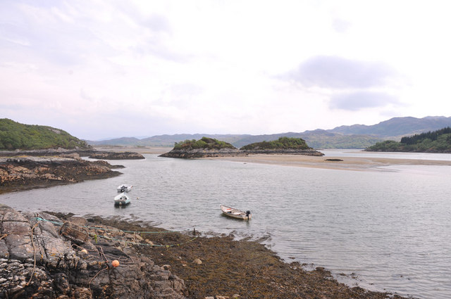
Nature enthusiasts are drawn to Àird Tobha for its idyllic location and diverse wildlife. The nearby Loch Nell is a haven for birdwatchers, with a variety of species making their home in and around the water. The surrounding hills also provide ample opportunities for hiking and exploring the Scottish countryside.

Despite its small size, Àird Tobha provides essential amenities for its residents and visitors. The village boasts a local shop, where essential groceries can be purchased, as well as a charming pub that serves as a social hub for the community. Nearby Oban offers additional amenities, including shops, restaurants, and schools.

The village is well-connected to the rest of Argyllshire and beyond, with regular bus services operating to Oban and other nearby towns. The stunning scenery and peaceful atmosphere make Àird Tobha an attractive destination for those seeking a quiet getaway or a place to call home amidst the beauty of the Scottish Highlands.

If you have any feedback on the listing, please let us know in the comments section below.
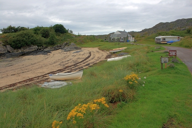
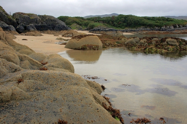
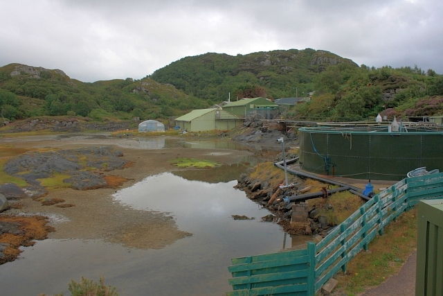
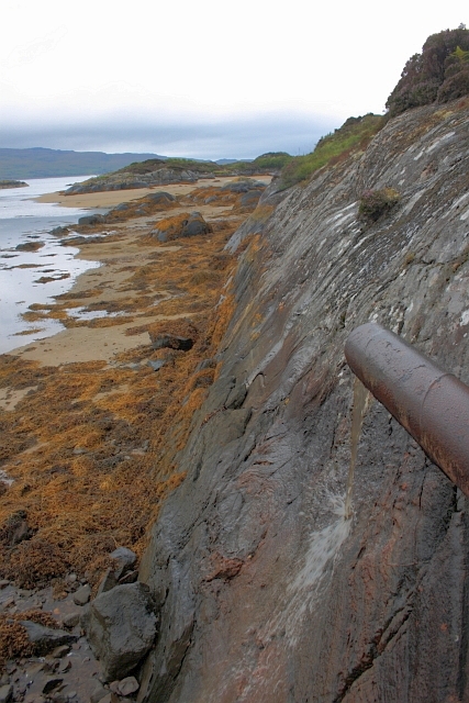
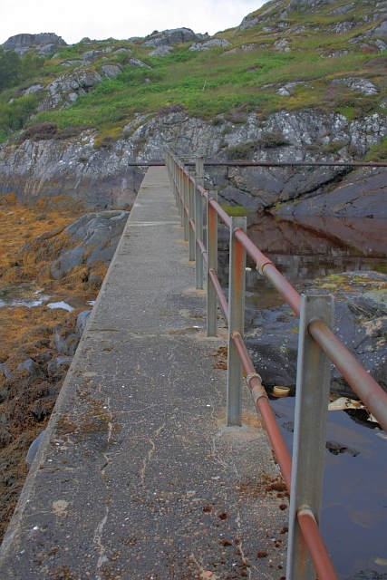
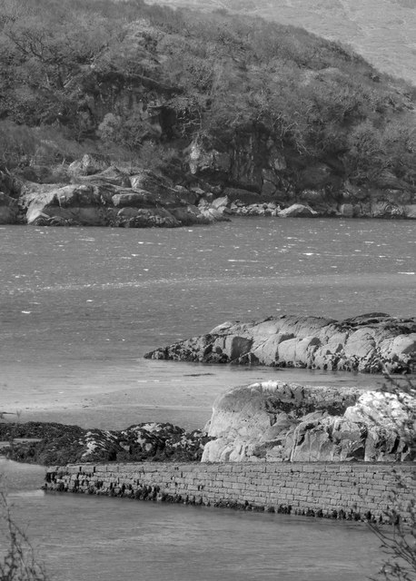
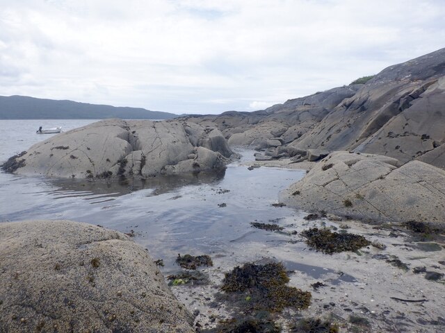
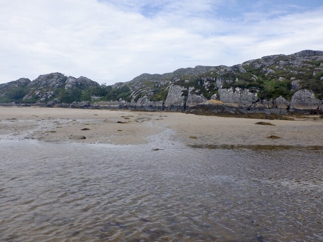
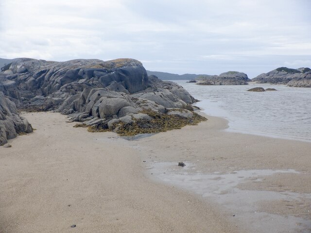
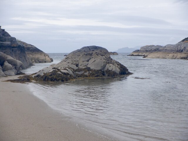
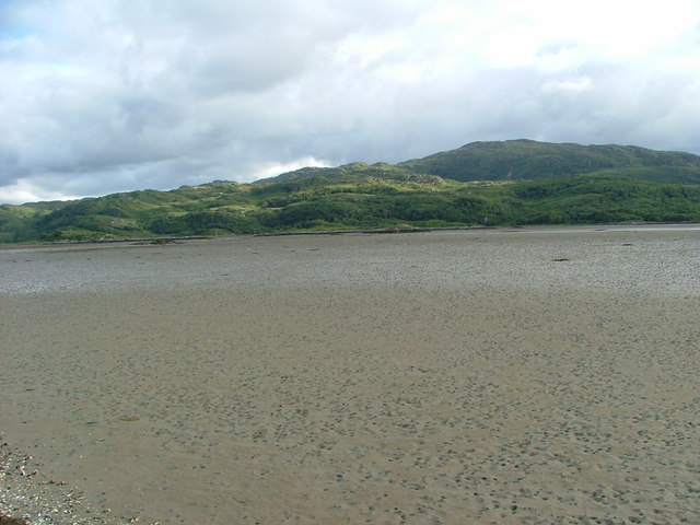
Àird Tobha Images

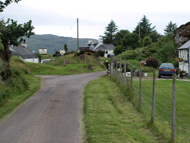
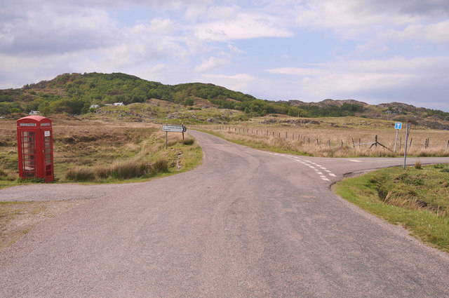
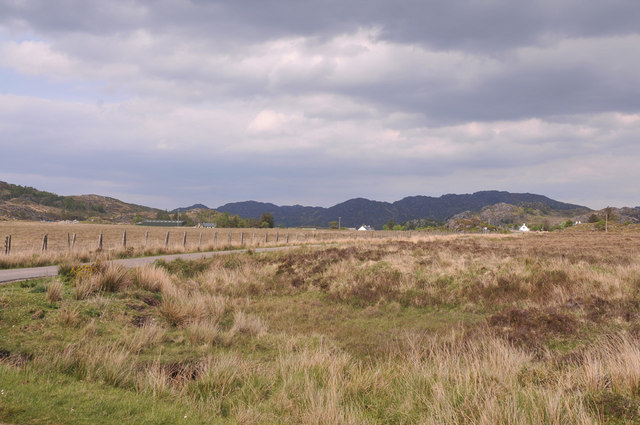
Images are sourced within 2km of 56.764526/-5.8741996 or Grid Reference NM6370. Thanks to Geograph Open Source API. All images are credited.

Ardtoe Ardtoe Village, Moidart
Ardtoe
Ardtoe Village, Moidart
Road junction near Newton of Ardtoe
Across Kentra Moss to Newton of Ardtoe
Kentra Bay
Kentra Bay
Jetty on Kentra Bay
Jetty on Kentra Bay
Ardtoe at Low Tide
Ardtoe at Low Tide
Fish Pond Originally used to conduct research into fish farming.
Fish Pond
Originally used to conduct research into fish farming.
Discharge Pipe Possibly to divert fresh water away from the nearby fish pond where research into fish farming was carried out.
Discharge Pipe
Possibly to divert fresh water away from the nearby fish pond where research into fish farming was carried out.
Dam Wall Constructed to provide a fish pond in which research into fish farming was conducted.
Dam Wall
Constructed to provide a fish pond in which research into fish farming was conducted.
Jetty at Kentra Bay
Jetty at Kentra Bay
Rocks, Ardtoe A narrow mouth to a fine beach at low water.
Rocks, Ardtoe
A narrow mouth to a fine beach at low water.
Sàilean Dubh A small drying inlet at Ardtoe.
Sàilean Dubh
A small drying inlet at Ardtoe.
Rocks, Ardtoe Low water, Sàilean Dubh.
Rocks, Ardtoe
Low water, Sàilean Dubh.
Sàilean Dubh
Sàilean Dubh
Beach, Ardtoe Between the rocky islets at low water.
Beach, Ardtoe
Between the rocky islets at low water.
Rocky hills above Ardtoe
A rocky islet, Ardtoe Tidal rock set in the beach off Ardtoe.
A rocky islet, Ardtoe
Tidal rock set in the beach off Ardtoe.
Show me another place!

Àird Tobha is located at Grid Ref: NM6370 (Lat: 56.764526, Lng: -5.8741996)

Unitary Authority: Highland

Police Authority: Highlands and Islands

Also known as: Ardtoe

What 3 Words

///snowboard.clumped.love. Near Kilchoan, Highland

Related Wikis

Ardtoe

Ardtoe (Scottish Gaelic: Àird Tobha) is a place on the coast of Ardnamurchan, Lochaber, in the Highland council area of Scotland. It has sandy beaches...

Newton of Ardtoe

Newton of Ardtoe is a scattered crofting hamlet near Acharacle in Lochaber, Scottish Highlands and is in the council area of Highland.

Kentra Bay

Kentra Bay, also known as the Singing Sands, is a remote tidal, 306° orientated, coastal embayment located on the northern shore of the Ardnamurchan peninsula...

Eden (2016 TV series)

Eden is a British reality TV series; the first series was broadcast on Channel 4 from 18 July to 8 August 2016. It featured 23 participants living for...

Nearby Amenities

Located within 500m of 56.764526,-5.8741996
Source: PGS
Lat/Long: 56.7627305/-5.8791783
Source: PGS
Lat/Long: 56.7629446/-5.8792967
Source: PGS
Lat/Long: 56.762977/-5.8790073
Source: PGS
Lat/Long: 56.7628415/-5.8789741
Source: PGS
Lat/Long: 56.7642483/-5.8819666
Source: PGS
Lat/Long: 56.7641668/-5.8818853
Source: PGS
Lat/Long: 56.7639837/-5.8810984
Source: PGS
Lat/Long: 56.763769/-5.8803321
Source: PGS
Lat/Long: 56.7637125/-5.8796517
Source: PGS
Lat/Long: 56.7637889/-5.8792963
Source: PGS
Lat/Long: 56.7639262/-5.8789746
Source: PGS
Lat/Long: 56.7642153/-5.8772125
Source: PGS
Lat/Long: 56.7639117/-5.8758625
Source: PGS
Lat/Long: 56.7637272/-5.8757102
Source: PGS
Lat/Long: 56.763542/-5.8754977
Source: PGS
Lat/Long: 56.763185/-5.8751248
Source: PGS
Lat/Long: 56.763058/-5.8749959
Source: PGS
Lat/Long: 56.7629178/-5.8747695
Source: PGS
Lat/Long: 56.7622835/-5.874407
Source: PGS
Lat/Long: 56.7622344/-5.8743331
Source: PGS
Lat/Long: 56.7620924/-5.8735132
Source: PGS
Lat/Long: 56.7618267/-5.8728079
Source: PGS
Lat/Long: 56.7618148/-5.8725699
Source: PGS
Lat/Long: 56.7621269/-5.8720129
Source: PGS
Lat/Long: 56.7621081/-5.8704635
Source: PGS
Lat/Long: 56.7617614/-5.8693864
Source: PGS
Lat/Long: 56.7614267/-5.8688346
Source: PGS
Lat/Long: 56.7611986/-5.8688216
Dal Ghorm
Place: isolated_dwelling
Lat/Long: 56.7642718/-5.8748696
Torr na Beithe
Place: isolated_dwelling
Lat/Long: 56.7640601/-5.8704064
Power: pole
Lat/Long: 56.7624992/-5.8676755
Power: pole
Lat/Long: 56.763321/-5.8684856
Power: pole
Lat/Long: 56.7634062/-5.8705509
Power: pole
Lat/Long: 56.7642692/-5.8724606
Power: pole
Lat/Long: 56.7650953/-5.8743301
Power: pole
Lat/Long: 56.7652938/-5.8748022
Power: pole
Lat/Long: 56.7672754/-5.8794853
Power: pole
Lat/Long: 56.7670946/-5.8784044
Power: pole
Lat/Long: 56.7668697/-5.876736
Power: pole
Lat/Long: 56.7664154/-5.8754191
Power: pole
Lat/Long: 56.7657363/-5.8750409
The data included in this document is from www.openstreetmap.org. The data is made available under ODbL.

Have you been to Àird Tobha?

Leave your review of Àird Tobha below (or comments, questions and feedback).