Croxtonbank

Settlement in Staffordshire Stafford

England

Croxtonbank

Footpath off Langot Lane Footpath east off Langot Lane
Footpath off Langot Lane Credit: Peter Fleming

Croxtonbank is a small village located in the county of Staffordshire, England. Situated near the town of Stone, it is part of the Stone rural district. The village is nestled in the beautiful countryside, surrounded by rolling hills and picturesque landscapes.

Croxtonbank is known for its tranquil and peaceful atmosphere, making it an ideal destination for those seeking a quiet and relaxing getaway. The village is characterized by its charming cottages, many of which date back to the 18th and 19th centuries, giving it a distinct historic charm.

The village is primarily residential, with a small and close-knit community. It offers limited amenities, including a local pub and a village hall, which serves as a hub for community events and social gatherings. However, for more extensive amenities and services, residents and visitors can easily access the nearby town of Stone, which is just a short drive away.

Croxtonbank is surrounded by an abundance of natural beauty, making it a haven for outdoor enthusiasts. The village is located near the Staffordshire Peak District, offering opportunities for hiking, cycling, and exploring the stunning countryside. Additionally, the nearby River Trent provides opportunities for fishing and boating.

Overall, Croxtonbank is a charming and idyllic village, offering a peaceful retreat from the hustle and bustle of city life. With its beautiful scenery and close proximity to amenities, it is a hidden gem within Staffordshire that attracts those seeking a slower pace of life and a connection with nature.

If you have any feedback on the listing, please let us know in the comments section below.
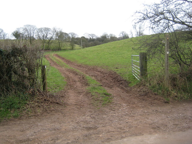
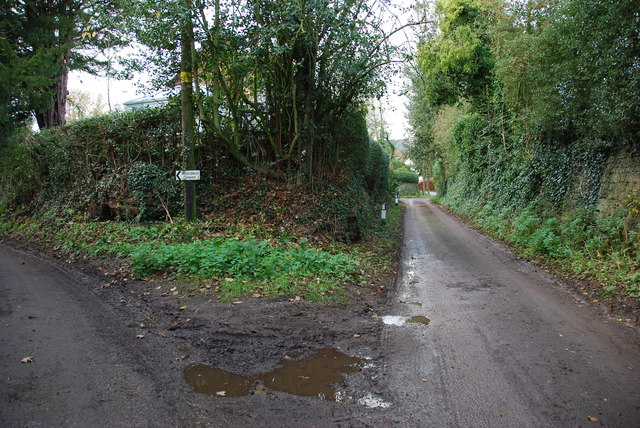
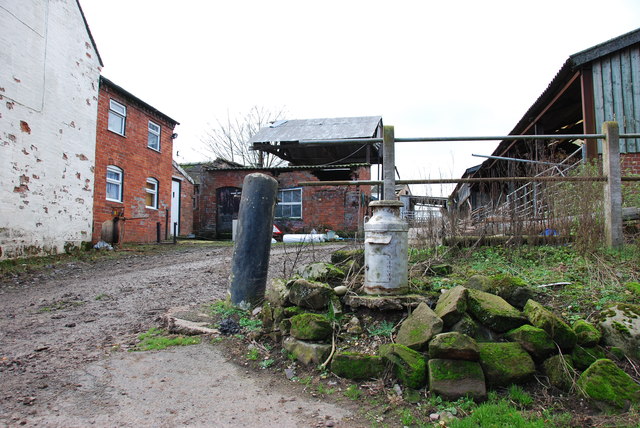
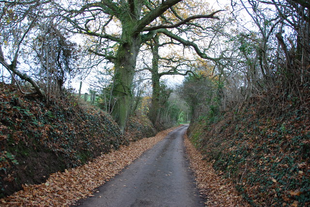
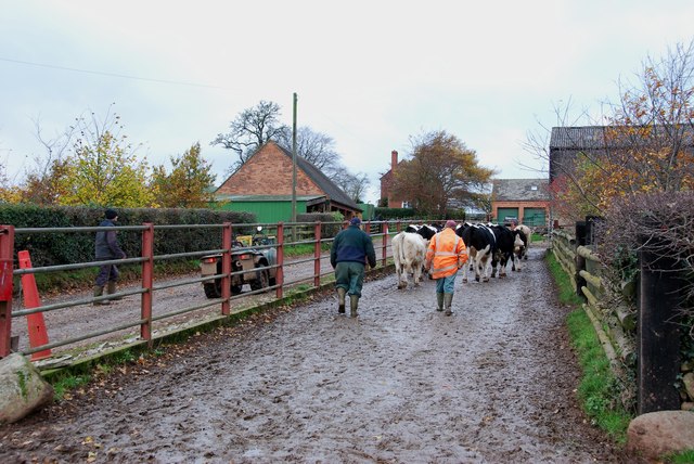
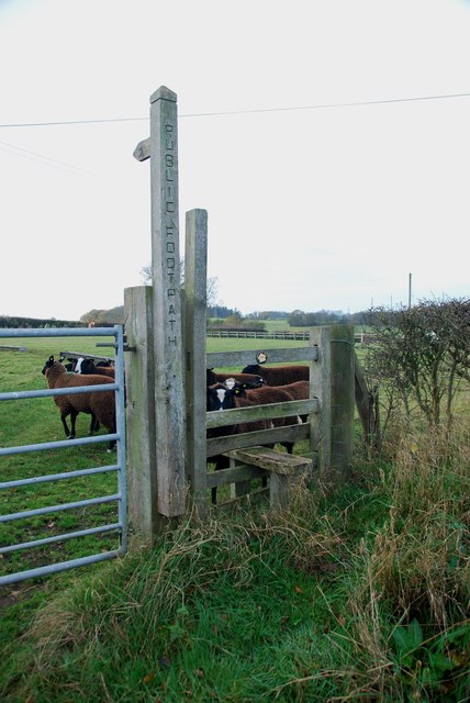
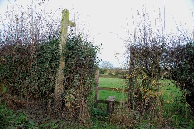
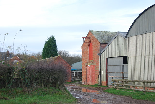
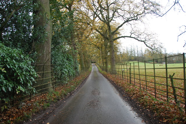
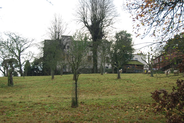
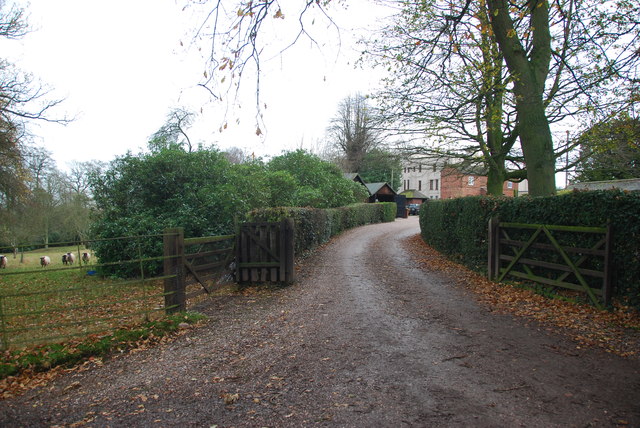
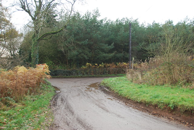
Croxtonbank Images

Images are sourced within 2km of 52.889047/-2.321744 or Grid Reference SJ7832. Thanks to Geograph Open Source API. All images are credited.

Footpath off Langot Lane Footpath east off Langot Lane
Footpath off Langot Lane
Footpath east off Langot Lane
Pasture to the left of Sugnall Hall The main Hall is on the opposite side of the B5026 to the Walled Garden.  see<span class="nowrap"><a title="http://www.sugnall.co.uk/history.html" rel="nofollow ugc noopener" href="http://www.sugnall.co.uk/history.html">Link</a><img style="margin-left:2px;" alt="External link" title="External link - shift click to open in new window" src="https://s1.geograph.org.uk/img/external.png" width="10" height="10"/></span>
Pasture to the left of Sugnall Hall
The main Hall is on the opposite side of the B5026 to the Walled Garden. seeLinkExternal link
Outbuildings for Sugnall Hall
The B5026 on its way to Sugnall
Storage Yard for Farm Implements in Croxton
Side Streets in Croxton The lane straight on rejoins the B5026 just outside the village, the lane to the left goes to Woodwall Green.
Side Streets in Croxton
The lane straight on rejoins the B5026 just outside the village, the lane to the left goes to Woodwall Green.
Small Farm in Croxton This farm has a very inventive post box, it is an old milk churn, with a waterproof slot near the top, and a door has been cut lower down to enable the post to be removed.
Small Farm in Croxton
This farm has a very inventive post box, it is an old milk churn, with a waterproof slot near the top, and a door has been cut lower down to enable the post to be removed.
Country Lane near Croxton
Narrow Lane heading towards Newhouse Farm The lanes round here don't seem to get much wider, but at least they are not getting narrower. They must be rough when there is snow about.
Narrow Lane heading towards Newhouse Farm
The lanes round here don't seem to get much wider, but at least they are not getting narrower. They must be rough when there is snow about.
Cattle Drive English Style at Newhouse Farm These young cattle were being brought back to the farm, from a field down the lane.
Cattle Drive English Style at Newhouse Farm
These young cattle were being brought back to the farm, from a field down the lane.
Red brick barn at Brooklyn Farm
Stile and footpath with rare breed sheep A rare breed of small black and white sheep called Balwen, looking like Border Collies. They are marked with a white stripe on the head (hence the name), have four white feet and long tails with a white tip.     see link  <span class="nowrap"><a title="http://lifeasahuman.com/2010/humor/a-rare-breed-of-sheep-and-civil-servants/" rel="nofollow ugc noopener" href="http://lifeasahuman.com/2010/humor/a-rare-breed-of-sheep-and-civil-servants/">Link</a><img style="margin-left:2px;" alt="External link" title="External link - shift click to open in new window" src="https://s1.geograph.org.uk/img/external.png" width="10" height="10"/></span>
Stile and footpath with rare breed sheep
A rare breed of small black and white sheep called Balwen, looking like Border Collies. They are marked with a white stripe on the head (hence the name), have four white feet and long tails with a white tip. see link LinkExternal link
Stile and footpath to Chatcull
Entrance to Charnes Old Hall farm
Road through Charnes estate This road with its metal fences and avenue of trees, gives the impression that there is large estate nearby.   see link  <span class="nowrap"><a title="http://www.britishlistedbuildings.co.uk/en-272232-charnes-hall-eccleshall" rel="nofollow ugc noopener" href="http://www.britishlistedbuildings.co.uk/en-272232-charnes-hall-eccleshall">Link</a><img style="margin-left:2px;" alt="External link" title="External link - shift click to open in new window" src="https://s1.geograph.org.uk/img/external.png" width="10" height="10"/></span>
Road through Charnes estate
This road with its metal fences and avenue of trees, gives the impression that there is large estate nearby. see link LinkExternal link
Charnes Hall, Eccleshall It is a pity that this old hall is partly covered by trees.  see link  <span class="nowrap"><a title="http://www.britishlistedbuildings.co.uk/en-272232-charnes-hall-eccleshall" rel="nofollow ugc noopener" href="http://www.britishlistedbuildings.co.uk/en-272232-charnes-hall-eccleshall">Link</a><img style="margin-left:2px;" alt="External link" title="External link - shift click to open in new window" src="https://s1.geograph.org.uk/img/external.png" width="10" height="10"/></span>
Charnes Hall, Eccleshall
It is a pity that this old hall is partly covered by trees. see link LinkExternal link
The driveway to Charnes Hall
Looking back to a road junction near the Ashley Road Plantation
Show me another place!

Croxtonbank is located at Grid Ref: SJ7832 (Lat: 52.889047, Lng: -2.321744)

Administrative County: Staffordshire

District: Stafford

Police Authority: Staffordshire

What 3 Words

///snaps.micro.unless. Near Standon, Staffordshire

Related Wikis

Croxton, Staffordshire

Croxton is a village on the B5026 between Eccleshall and Loggerheads. Population details for the 2011 census can be found under Eccleshall. It is notable...

Armsdale

Armsdale is a village in Staffordshire, England. Population details for the 2011 census can be found under Eccleshall.

Jackson's Coppice and Marsh

Jackson's Coppice and Marsh is a nature reserve of the Staffordshire Wildlife Trust. It is along the River Sow, near the village of Bishop's Offley and...

Outlands, Staffordshire

Outlands is a hamlet in the English county of Staffordshire. It lies 1 km eas of Bishop's Offley. == External links == Map sources for Outlands, Staffordshire

Cop Mere

Cop Mere is one of the largest natural bodies of water in Staffordshire, England, covering 42 acres (17 ha). It has been designated a SSSI as an oligotrophic...

Offleyhay

Offleyhay is a village in Staffordshire, England. The population as taken at the 2011 census can be found under Eccleshall. == References ==

Bowers, Staffordshire

Bowers is a village in Staffordshire, England. For population details as taken in the 2011 census see Standon.

Eccleshall F.C.

Eccleshall Football Club is a football club based in Eccleshall, Staffordshire, England. They are currently members of the North West Counties League Division...

Nearby Amenities

Located within 500m of 52.889047,-2.321744
Bus Stop
The Vicarage
Bus: yes
Naptan AtcoCode: 3800C702500
Naptan Bearing: SE
Naptan CommonName: The Vicarage
Naptan Indicator: Adj
Naptan Landmark: The Vicarage
Naptan Street: The Highfields
Naptan Verified: no
Public Transport: platform
Source: naptan_import
Lat/Long: 52.8878282/-2.3196592
Bus Stop
The Vicarage
Bus: yes
Naptan AtcoCode: 3800C702501
Naptan Bearing: NW
Naptan BusStopType: CUS
Naptan CommonName: The Vicarage
Naptan Indicator: Opp
Naptan Landmark: The Vicarage
Naptan Street: The Highfields
Naptan Verified: no
Public Transport: platform
Source: naptan_import
Lat/Long: 52.8878273/-2.3199861
Croxton
Place: village
Source: OS_OpenData_StreetView
Wikidata: Q5189631
Lat/Long: 52.8864849/-2.3188021
Addr Postcode: ST21 6NL
Disused Amenity: pub
Fhrs Id: 386766
Note: FHRS ID is realy old_fhrs:id
Old Name: Vernon Yonge Arms
Source: OS_OpenData_StreetView
Source Postcode: FHRS Open Data
Lat/Long: 52.8911444/-2.3246386
Barrier: stile
Lat/Long: 52.8890301/-2.3277364
Blackwaters
Place: hamlet
Lat/Long: 52.8898349/-2.3264405
Post Box
Post Box Mounting: brick_pillar
Post Box Type: wall
Lat/Long: 52.8861162/-2.3167201
Parking
Capacity: 2
Lat/Long: 52.8888667/-2.3213912
Bench
Lat/Long: 52.8889406/-2.3215167
Barrier: stile
Lat/Long: 52.8892986/-2.3249059
The data included in this document is from www.openstreetmap.org. The data is made available under ODbL.

Have you been to Croxtonbank?

Leave your review of Croxtonbank below (or comments, questions and feedback).