Bedlam Wood

Wood, Forest in Worcestershire

England

Bedlam Wood

The River Rea emerging from under the Bristol Road South bridge
The River Rea emerging from under the Bristol Road South bridge Credit: Roy Hughes

Bedlam Wood, located in Worcestershire, is a picturesque forest known for its natural beauty and tranquility. Stretching across a sprawling area of land, this enchanting woodland is a haven for nature lovers and outdoor enthusiasts alike.

Covered in a lush canopy of tall, ancient trees, Bedlam Wood is home to a diverse range of flora and fauna. The forest floor is adorned with a vibrant carpet of wildflowers, creating a stunning display of colors during the spring and summer months. Various species of birds, including woodpeckers and owls, can be spotted perching on branches or soaring through the air, adding to the peaceful ambiance of the wood.

Visitors to Bedlam Wood can explore an extensive network of well-maintained trails that wind through the forest. These pathways offer a chance to immerse oneself in the natural surroundings, providing an opportunity to spot wildlife and enjoy the serenity of the woodland. The wood is also a popular spot for picnics, with several designated areas equipped with benches and tables.

In addition to its natural beauty, Bedlam Wood holds historical significance. It is believed that the wood once served as a hunting ground for the nobility during medieval times. Today, remnants of ancient earthworks can still be seen, adding an air of mystery and intrigue to the forest.

Overall, Bedlam Wood, Worcestershire is a captivating destination for those seeking solace in nature. Its breathtaking scenery, diverse wildlife, and rich history make it a must-visit location for anyone looking to escape the hustle and bustle of everyday life.

If you have any feedback on the listing, please let us know in the comments section below.
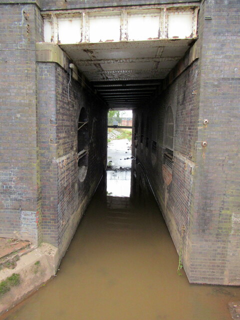
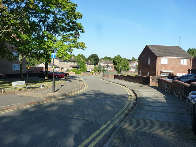
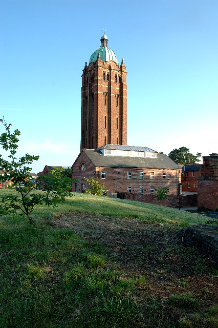
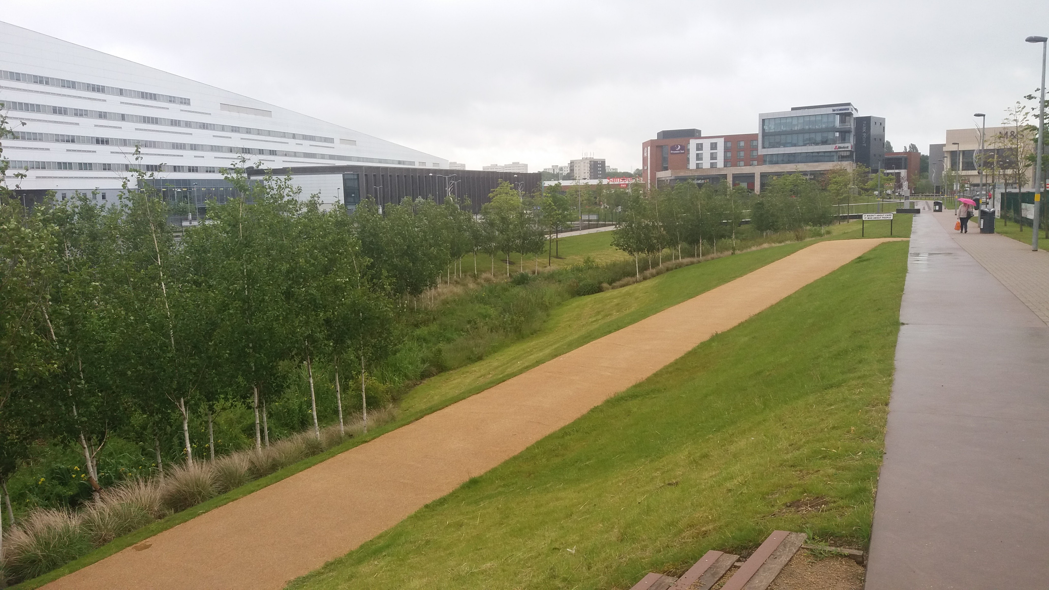
Bedlam Wood Images

Images are sourced within 2km of 52.401138/-2.0007201 or Grid Reference SP0078. Thanks to Geograph Open Source API. All images are credited.

The River Rea emerging from under the Bristol Road South bridge
River Rea passing under Bristol Road South, Longbridge
Pedestrian path under the Bristol Road South, Longbridge
River Rea looking towards Rubery
Crossing Longbridge Lane to Longbridge railway station
Sculpture at Longbridge near bus shelter See <a href="https://www.geograph.org.uk/photo/7257657">SP0177 : Close look at sculpture at the Longbridge Interchange</a> for a close look.
Sculpture at Longbridge near bus shelter
Close look at sculpture at the Longbridge Interchange This is located close to a bus shelter, and a short walk from the railway station.
Close look at sculpture at the Longbridge Interchange
This is located close to a bus shelter, and a short walk from the railway station.
Ford in the River Rea at The Mill Walk, Northfield
Tessall Lane over the River Rea, Longbridge The lane leads to the Rea Valley Walk.  The main railway line runs the other side of the fence.
Tessall Lane over the River Rea, Longbridge
The lane leads to the Rea Valley Walk. The main railway line runs the other side of the fence.
The Rea Valley cycle route 5 approaches Rea Road, Longbridge Cycle Route 5 follows the valley of this stream here.
The Rea Valley cycle route 5 approaches Rea Road, Longbridge
Cycle Route 5 follows the valley of this stream here.
Cycle Route 5 sign at Tessall Lane junction with Rea Valley path, Longbridge
The Greenlands Inn, Longbridge
Train departing Longbridge A pair of class 323 Electric Multiple Units departing Longbridge with a Redditch - Four Oaks service.
Train departing Longbridge
A pair of class 323 Electric Multiple Units departing Longbridge with a Redditch - Four Oaks service.
Park Point at Dusk Despite it being a weekday after 7pm, the redeveloped mixed-use area here was still bustling with people and had a pleasant vibe. There are some interesting buildings set in a high-quality urban design. In this view the Cambridge 'Hungry Horse' pub takes centre place.
Park Point at Dusk
Despite it being a weekday after 7pm, the redeveloped mixed-use area here was still bustling with people and had a pleasant vibe. There are some interesting buildings set in a high-quality urban design. In this view the Cambridge 'Hungry Horse' pub takes centre place.
Art Deco building, 1730 Bristol Road South One of the commercial premises on the south side of the A38, with a distinctly 1920s Art Deco look to it. There is an OS benchmark cut into the brickwork low on the 'tower'
Art Deco building, 1730 Bristol Road South
One of the commercial premises on the south side of the A38, with a distinctly 1920s Art Deco look to it. There is an OS benchmark cut into the brickwork low on the 'tower'
OS benchmark - Longbridge, 1730 Bristol Rd South An OS cutmark on the 'tower' part of <a href="https://www.geograph.org.uk/photo/7423346">SP0077 : Art Deco building, 1730 Bristol Road South</a>, which was last levelled by the OS in 1956 at 180.146m above Ordnance Datum Newlyn.
OS benchmark - Longbridge, 1730 Bristol Rd South
An OS cutmark on the 'tower' part of SP0077 : Art Deco building, 1730 Bristol Road South, which was last levelled by the OS in 1956 at 180.146m above Ordnance Datum Newlyn.
Longbridge Methodist Church Located just off the main A38 Bristol Road South.
Longbridge Methodist Church
Located just off the main A38 Bristol Road South.
Houses west of the former motor works A view down the intriguingly named Tinmeadow Crescent.
Houses west of the former motor works
A view down the intriguingly named Tinmeadow Crescent.
Show me another place!

Bedlam Wood is located at Grid Ref: SP0078 (Lat: 52.401138, Lng: -2.0007201)

Unitary Authority: Birmingham

Police Authority: West Midlands

What 3 Words

///votes.almost.sugars. Near Bartley Green, West Midlands

Nearby Locations

Bedlam Wood

Related Wikis

Hollymoor Hospital

Hollymoor Hospital was a psychiatric hospital located at Tessall Lane, Northfield in Birmingham, England, and is famous primarily for the work on group...

Colmers School

Colmers School is a coeducational secondary school and sixth form located in the Rednal area of Birmingham, in the West Midlands of England.Previously...

Longbridge railway station (1915–1964)

Longbridge railway station was a railway station in Longbridge, Birmingham, England, on the Great Western Railway and Midland Railway's joint Halesowen...

Rubery Hill Hospital

Rubery Hill Hospital was a mental health facility in Birmingham, England. The chapel, which still survives, is a Grade II listed building. == History... ==

Nearby Amenities

Located within 500m of 52.401138,-2.0007201
Crossing
Bicycle: yes
Crossing: traffic_signals
Crossing Ref: toucan
Source Type: BCC_CycleData
Lat/Long: 52.4022302/-2.0065784
Segregated: no
Lat/Long: 52.4006988/-2.0049999
Barrier: bollard
Material: concrete
Lat/Long: 52.4041051/-1.9974312
Crossing
Bicycle: yes
Crossing: traffic_signals
Crossing Ref: toucan
Lat/Long: 52.4013045/-2.001717
Nuffield Health Fitness & Wellbeing
Addr City: Birmingham
Addr Housenumber: 20
Addr Postcode: B45 9FN
Addr Street: Ashbrook Drive
Brand: Nuffield Health Fitness & Wellbeing
Brand Wikidata: Q7068711
Leisure: fitness_centre
Lat/Long: 52.3990051/-2.0045318
Bus Stop
Bus: yes
Public Transport: platform
Lat/Long: 52.4017106/-1.9960813
Crossing
Crossing: unmarked
Kerb: flush
Tactile Paving: yes
Lat/Long: 52.4042333/-1.998717
Mini Roundabout
Direction: clockwise
Lat/Long: 52.4024437/-2.0008964
Bus Stop
Tessall Lane / Raven Hays Rd
Bus: yes
Naptan AtcoCode: 43000361402
Naptan Bearing: SW
Naptan BusStopType: MKD
Naptan CommonName: Raven Hays Rd
Naptan Indicator: opp
Naptan NaptanCode: nwmawaja
Naptan PlusbusZoneRef: BHAMNWS
Naptan Status: ACT
Naptan StopType: BCT
Naptan Street: TESSALL LANE
Naptan Towards: Frankley
Public Transport: platform
Route Ref: 42;X61
Source: WMCA
Lat/Long: 52.4042375/-2.0002103
Bus Stop
Tessall Lane / Raven Hays Rd
Bus: yes
Naptan AtcoCode: 43000361401
Naptan Bearing: NE
Naptan BusStopType: MKD
Naptan CommonName: Raven Hays Rd
Naptan Indicator: adj
Naptan NaptanCode: nwmawagw
Naptan PlusbusZoneRef: BHAMNWS
Naptan Status: ACT
Naptan StopType: BCT
Naptan Street: TESSALL LANE
Naptan Towards: Northfield
Public Transport: platform
Route Ref: X61
Source: WMCA
Lat/Long: 52.4042975/-2.0003843
Barrier: bollard
Lat/Long: 52.4039591/-2.0031096
Bus Stop
New St / Frogmill Rd
Bus: yes
Naptan AtcoCode: 43000393101
Naptan Bearing: W
Naptan BusStopType: MKD
Naptan CommonName: Frogmill Rd
Naptan Indicator: after
Naptan NaptanCode: nwmawtat
Naptan PlusbusZoneRef: BHAMNWS
Naptan Status: ACT
Naptan StopType: BCT
Naptan Street: NEW ST
Naptan Towards: Northfield (via Holly Hill Rd)
Public Transport: platform
Route Ref: 49;X61
Source: WMCA
Lat/Long: 52.4030486/-2.0055837
Barrier: bollard
Lat/Long: 52.4026109/-1.9982272
Crossing
Crossing: traffic_signals
Crossing Ref: pelican
Kerb: flush
Tactile Paving: yes
Lat/Long: 52.4002972/-2.005943
Traffic Signals
Source: bing
Lat/Long: 52.4017297/-2.0074677
Cycleway: asl
Source: bing
Lat/Long: 52.4020218/-2.0077876
Bus Stop
Parkway / Hollywood Bowl
NaPTANAreaCode: 43003601001
Bus: yes
Local Ref: RA
Naptan AtcoCode: 43003601001
Naptan Bearing: NE
Naptan BusStopType: MKD
Naptan CommonName: Hollywood Bowl
Naptan Indicator: Stop RA
Naptan NaptanCode: nwmdmtmd
Naptan PlusbusZoneRef: BHAMNWS
Naptan Status: ACT
Naptan StopType: BCT
Naptan Street: PARKWAY
Naptan Towards: Northfield
Public Transport: platform
Route Ref: 42;98
Shelter: yes
Shelter Ref: 611923
Source: WMCA
Lat/Long: 52.3990787/-2.0054096
Bus Stop
Tessall Lane / Manor Park Grove
Bus: yes
Naptan AtcoCode: 43000361301
Naptan Bearing: SW
Naptan BusStopType: MKD
Naptan CommonName: Manor Park Grove
Naptan Indicator: adj
Naptan Landmark: Medical Centre
Naptan NaptanCode: nwmawagp
Naptan PlusbusZoneRef: BHAMNWS
Naptan Status: ACT
Naptan StopType: BCT
Naptan Street: TESSALL LANE
Naptan Towards: Frankley
Naptan Verified: no
Public Transport: platform
Route Ref: 42;X61
Source: WMCA
Lat/Long: 52.4046525/-1.9989122
Bus Stop
Tessall Lane / Manor Park Grove
NaPTANAreaCode: 43000361302
Bus: yes
Naptan AtcoCode: 43000361302
Naptan Bearing: NE
Naptan BusStopType: MKD
Naptan CommonName: Manor Park Grove
Naptan Indicator: opp
Naptan Landmark: Medical Centre
Naptan NaptanCode: nwmawagt
Naptan PlusbusZoneRef: BHAMNWS
Naptan Status: ACT
Naptan StopType: BCT
Naptan Street: TESSALL LANE
Naptan Towards: Northfield
Naptan Verified: no
Public Transport: platform
Route Ref: X61
Shelter: yes
Shelter Ref: 610320
Source: WMCA
Lat/Long: 52.4049042/-1.9983537
Bus Stop
Rubery Lane / Frogmill Rd
Bus: yes
Naptan AtcoCode: 43000361501
Naptan Bearing: NE
Naptan BusStopType: MKD
Naptan CommonName: Frogmill Rd
Naptan Indicator: adj
Naptan NaptanCode: nwmawajg
Naptan PlusbusZoneRef: BHAMNWS
Naptan Status: ACT
Naptan StopType: BCT
Naptan Street: RUBERY LANE
Naptan Towards: Northfield
Naptan Verified: no
Public Transport: platform
Route Ref: 42;49
Source: WMCA
Lat/Long: 52.4025397/-2.0041744
Bus Stop
Hollymoor Way / Balaams Wood Drive
Bus: yes
Naptan AtcoCode: 43000361701
Naptan Bearing: SE
Naptan BusStopType: MKD
Naptan CommonName: Balaams Wood Drive
Naptan Indicator: opp
Naptan NaptanCode: nwmwapap
Naptan Status: ACT
Naptan StopType: BCT
Naptan Street: HOLLYMOOR WAY
Naptan Towards: Rubery
Naptan Verified: no
Public Transport: platform
Route Ref: 42
Source: WMCA
Lat/Long: 52.4023779/-2.0022783
Bus Stop
Hollymoor Way / Hollymoor Way
Bus: yes
Naptan AtcoCode: 43000361801
Naptan Bearing: E
Naptan BusStopType: MKD
Naptan CommonName: Hollymoor Way
Naptan Indicator: on
Naptan NaptanCode: nwmwapat
Naptan Status: ACT
Naptan StopType: BCT
Naptan Street: HOLLYMOOR WAY
Naptan Towards: Rubery
Naptan Verified: no
Public Transport: platform
Route Ref: 42
Source: WMCA
Lat/Long: 52.4010743/-1.9989417
Bus Stop
New St / Frogmill Rd
NaPTANAreaCode: 43000393102
Bus: yes
Naptan AtcoCode: 43000393102
Naptan Bearing: E
Naptan BusStopType: MKD
Naptan CommonName: Frogmill Rd
Naptan Indicator: before
Naptan NaptanCode: nwmawtaw
Naptan PlusbusZoneRef: BHAMNWS
Naptan Status: ACT
Naptan StopType: BCT
Naptan Street: NEW ST
Naptan Towards: Northfield (via Tessall Lane)
Public Transport: platform
Route Ref: 49;X61
Shelter: yes
Shelter Ref: 610328
Source: WMCA
Lat/Long: 52.4030877/-2.0048698
Bus Stop
Parkway / Hollywood Bowl
NaPTANAreaCode: 43003601002
Bench: yes
Bus: yes
Local Ref: RB
Naptan AtcoCode: 43003601002
Naptan Bearing: SW
Naptan BusStopType: MKD
Naptan CommonName: Hollywood Bowl
Naptan Indicator: Stop RB
Naptan NaptanCode: nwmtgpmd
Naptan PlusbusZoneRef: BHAMNWS
Naptan Status: ACT
Naptan StopType: BCT
Naptan Street: PARKWAY
Naptan Towards: Rednal, Rubery
Public Transport: platform
Route Ref: 42;98
Shelter: yes
Shelter Ref: 611922
Source: WMCA
Lat/Long: 52.3990925/-2.0051044
Barrier: cycle_barrier
Cycle Barrier: chicane
Lat/Long: 52.4033039/-1.9961551
Barrier: bollard
Lat/Long: 52.4040412/-2.0032667
Traffic Signals
Source: bing
Lat/Long: 52.4019446/-2.0073135
Traffic Signals
Source: bing
Lat/Long: 52.4020065/-2.0077492
Pharmacy
Healthcare: pharmacy
Source: survey
Lat/Long: 52.404369/-1.9968706
Power: substation
Source: visual survey;estimate
Lat/Long: 52.4013366/-1.9967943
Power: substation
Source: visual survey;estimate
Lat/Long: 52.4013532/-1.9944048
Crossing
Crossing Island: yes
Kerb: flush
Tactile Paving: yes
Lat/Long: 52.3997524/-2.0042381
Crossing
Crossing Island: yes
Kerb: flush
Tactile Paving: yes
Lat/Long: 52.3983766/-2.0058191
Barrier: bollard
Lat/Long: 52.4021943/-2.0053392
Barrier: bollard
Lat/Long: 52.4021893/-2.0053732
Barrier: bollard
Lat/Long: 52.4021856/-2.0053928
Barrier: bollard
Lat/Long: 52.4021561/-2.0056003
Barrier: bollard
Lat/Long: 52.4021543/-2.0056176
Barrier: bollard
Lat/Long: 52.402152/-2.0056402
Barrier: bollard
Lat/Long: 52.4021501/-2.0056516
Barrier: bollard
Lat/Long: 52.4021925/-2.0053536
Barrier: entrance
Bicycle: yes
Foot: yes
Lat/Long: 52.4031541/-1.9988196
Barrier: entrance
Bicycle: yes
Foot: yes
Lat/Long: 52.4035646/-1.9983545
Barrier: bollard
Lat/Long: 52.4017646/-2.0016736
Barrier: bollard
Lat/Long: 52.4017226/-2.0018171
Post Box
Ref: B31 1434
Lat/Long: 52.401705/-2.0016226
Grit Bin
Lat/Long: 52.401679/-2.0016594
Barrier: cycle_barrier
Cycle Barrier: chicane
Lat/Long: 52.4035415/-1.998661
Barrier: cycle_barrier
Cycle Barrier: chicane
Lat/Long: 52.4013442/-2.0015799
Barrier: cycle_barrier
Cycle Barrier: chicane
Lat/Long: 52.4012758/-2.0018215
Barrier: bollard
Lat/Long: 52.402614/-1.9982246
Barrier: bollard
Lat/Long: 52.4026069/-1.9982303
Post Box
Post Box Type: pillar
Ref: B45 100
Royal Cypher: EIIR
Royal Cypher Wikidata: Q33102113
Lat/Long: 52.401059/-2.0071131
Power: substation
Source: survey
Lat/Long: 52.3999936/-2.0056111
Power: substation
Lat/Long: 52.4034564/-2.0041332
Man Made: street_cabinet
Source: survey
Street Cabinet: telecom
Lat/Long: 52.4033926/-2.0026298
Crossing
Crossing: unmarked
Kerb: flush
Tactile Paving: yes
Lat/Long: 52.4050369/-1.9982006
Crossing
Crossing Island: yes
Kerb: flush
Tactile Paving: yes
Lat/Long: 52.3983947/-2.0062812
Crossing
Crossing Island: yes
Kerb: flush
Tactile Paving: yes
Lat/Long: 52.3987566/-2.0062143
Crossing
Crossing Island: yes
Kerb: flush
Tactile Paving: yes
Lat/Long: 52.3987878/-2.0056911
Crossing
Crossing: unmarked
Kerb: flush
Tactile Paving: yes
Lat/Long: 52.3993813/-2.0048268
Crossing
Crossing: unmarked
Kerb: flush
Tactile Paving: yes
Lat/Long: 52.399689/-2.0048766
Crossing
Crossing: unmarked
Direction: both
Kerb: flush
Priority: forward
Surface: asphalt
Tactile Paving: yes
Traffic Calming: choker
Lat/Long: 52.4018655/-1.9943455
Crossing
Crossing: unmarked
Kerb: flush
Tactile Paving: yes
Lat/Long: 52.4046668/-1.9985831
Bicycle Parking
Access: customers
Bicycle Parking: stands
Capacity: 14
Lat/Long: 52.3982686/-2.0061654
Atm
Lat/Long: 52.3993991/-2.0056907
Entrance: main
Lat/Long: 52.3996002/-2.0054307
Generator Method: photovoltaic
Generator Output Electricity: yes
Generator Source: solar
Generator Type: solar_photovoltaic_panel
Location: roof
Power: generator
Lat/Long: 52.4038164/-1.9950968
Generator Method: photovoltaic
Generator Output Electricity: yes
Generator Source: solar
Generator Type: solar_photovoltaic_panel
Location: roof
Power: generator
Lat/Long: 52.4038246/-1.9950351
Generator Method: photovoltaic
Generator Output Electricity: yes
Generator Source: solar
Generator Type: solar_photovoltaic_panel
Location: roof
Power: generator
Lat/Long: 52.4022094/-1.9961563
Generator Method: photovoltaic
Generator Output Electricity: yes
Generator Source: solar
Generator Type: solar_photovoltaic_panel
Location: roof
Power: generator
Lat/Long: 52.4022209/-1.9960678
Generator Method: photovoltaic
Generator Output Electricity: yes
Generator Source: solar
Generator Type: solar_photovoltaic_panel
Location: roof
Power: generator
Lat/Long: 52.4022487/-1.9987902
Generator Method: photovoltaic
Generator Output Electricity: yes
Generator Source: solar
Generator Type: solar_photovoltaic_panel
Location: roof
Power: generator
Lat/Long: 52.4017708/-2.0003915
Generator Method: photovoltaic
Generator Output Electricity: yes
Generator Source: solar
Generator Type: solar_photovoltaic_panel
Location: roof
Power: generator
Lat/Long: 52.4014599/-2.0030496
Generator Method: photovoltaic
Generator Output Electricity: yes
Generator Source: solar
Generator Type: solar_photovoltaic_panel
Location: roof
Power: generator
Lat/Long: 52.4015254/-2.0046911
Generator Method: photovoltaic
Generator Output Electricity: yes
Generator Source: solar
Generator Type: solar_photovoltaic_panel
Location: roof
Power: generator
Lat/Long: 52.4028836/-2.0057532
Generator Method: photovoltaic
Generator Output Electricity: yes
Generator Source: solar
Generator Type: solar_photovoltaic_panel
Power: generator
Lat/Long: 52.4016219/-1.9990182
Generator Method: photovoltaic
Generator Output Electricity: yes
Generator Source: solar
Generator Type: solar_photovoltaic_panel
Location: roof
Power: generator
Lat/Long: 52.4051803/-1.998522
Generator Method: photovoltaic
Generator Output Electricity: yes
Generator Source: solar
Generator Type: solar_photovoltaic_panel
Location: roof
Power: generator
Lat/Long: 52.4054018/-1.9989471
Generator Method: photovoltaic
Generator Output Electricity: yes
Generator Source: solar
Generator Type: solar_photovoltaic_panel
Location: roof
Power: generator
Lat/Long: 52.4054568/-1.9987057
Generator Method: photovoltaic
Generator Output Electricity: yes
Generator Source: solar
Generator Type: solar_photovoltaic_panel
Location: roof
Power: generator
Lat/Long: 52.4052695/-1.9985837
Generator Method: photovoltaic
Generator Output Electricity: yes
Generator Source: solar
Generator Type: solar_photovoltaic_panel
Location: roof
Power: generator
Lat/Long: 52.4050649/-1.9984053
Generator Method: photovoltaic
Generator Output Electricity: yes
Generator Source: solar
Generator Type: solar_photovoltaic_panel
Location: roof
Power: generator
Lat/Long: 52.4014861/-1.999615
Generator Method: photovoltaic
Generator Output Electricity: yes
Generator Source: solar
Generator Type: solar_photovoltaic_panel
Location: roof
Power: generator
Lat/Long: 52.40132/-2.0011331
Generator Method: photovoltaic
Generator Output Electricity: yes
Generator Source: solar
Generator Type: solar_photovoltaic_panel
Location: roof
Power: generator
Lat/Long: 52.4007759/-2.0016159
Generator Method: photovoltaic
Generator Output Electricity: yes
Generator Source: solar
Generator Type: solar_photovoltaic_panel
Location: roof
Power: generator
Lat/Long: 52.4018968/-2.0027867
Cycleway: asl
Lat/Long: 52.4017013/-2.007443
Cycleway: asl
Lat/Long: 52.4019615/-2.0072767
The data included in this document is from www.openstreetmap.org. The data is made available under ODbL.

Have you been to Bedlam Wood?

Leave your review of Bedlam Wood below (or comments, questions and feedback).