Crookledy Plantation

Wood, Forest in Durham

England

Crookledy Plantation

Moor House beside B6278 Moor House is a small, deserted property beside the B6278 south of Stanhope. Scurfield House is partly hidden by the right hand tree.
Moor House beside B6278 Credit: Trevor Littlewood

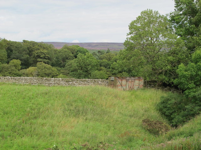
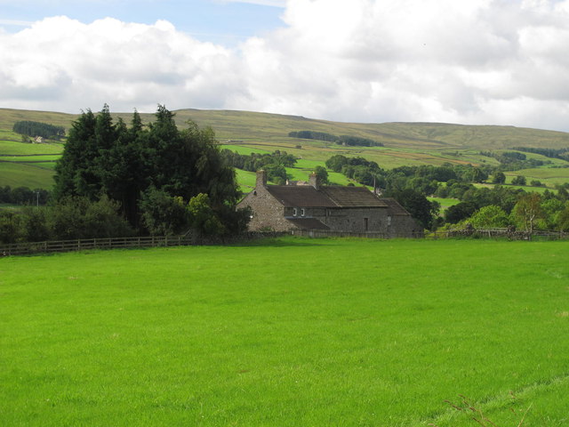
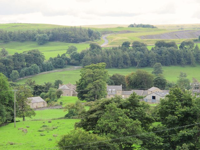
Crookledy Plantation is a picturesque woodland area located in Durham, England. Nestled amidst the beautiful countryside, this plantation is well-known for its dense forest cover and scenic walking trails. The plantation is situated near the small village of Crookledy, and it serves as a popular destination for nature lovers and outdoor enthusiasts.

Covering an expansive area, Crookledy Plantation is dominated by a variety of tree species, including oak, beech, and birch. The diverse vegetation creates a vibrant and dynamic ecosystem, supporting an array of wildlife. Visitors can often spot squirrels, rabbits, and a variety of bird species as they explore the plantation.

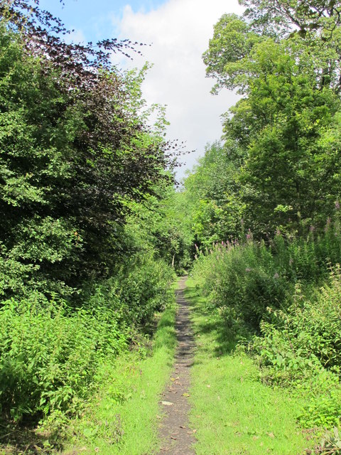
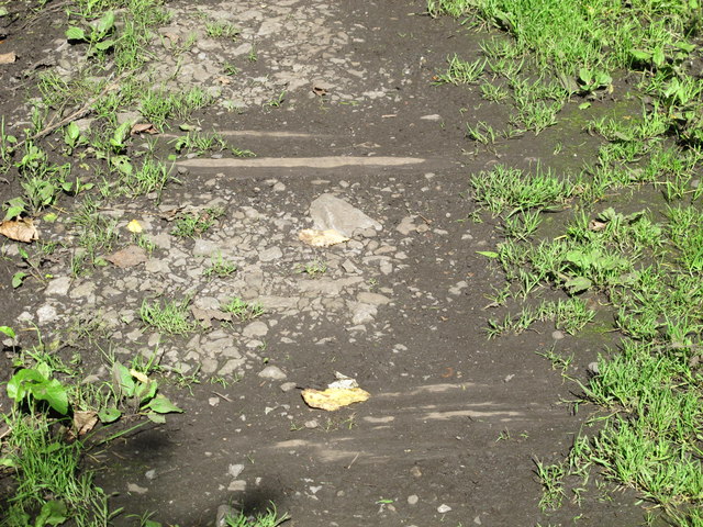
The walking trails within Crookledy Plantation are well-maintained and offer a range of difficulty levels, catering to both casual strollers and more experienced hikers. The paths wind through the woodland, providing opportunities to immerse oneself in the tranquil surroundings and observe the diverse flora and fauna.

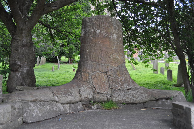
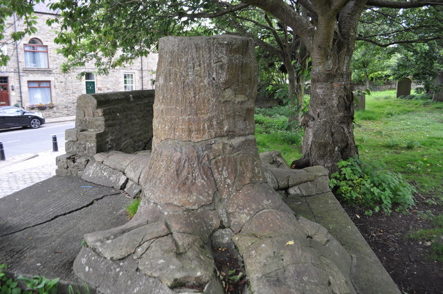
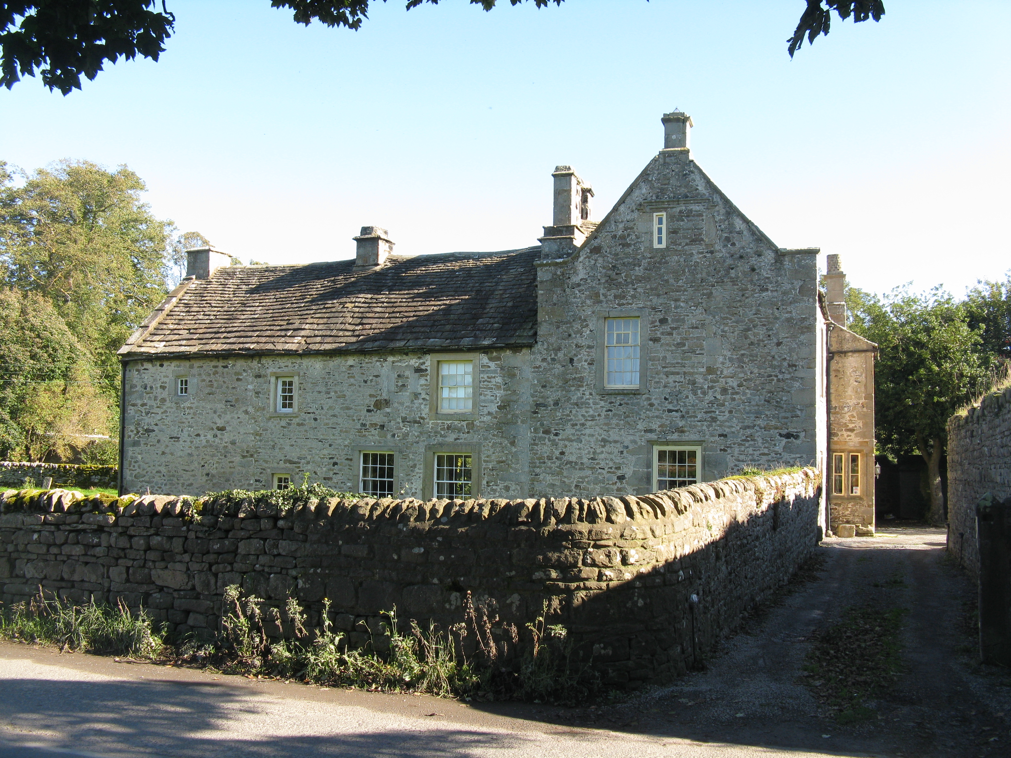
In addition to its natural beauty, Crookledy Plantation holds historical significance. The area was once part of a larger estate and has witnessed centuries of human activity. Remnants of old stone walls and ruins can still be found within the woodland, adding a sense of intrigue and charm to the plantation.

Crookledy Plantation is easily accessible, with designated parking areas and clear signposting. It is a popular destination for families, nature enthusiasts, and those seeking solace in the serene and enchanting ambiance of the woodland. Whether it's a leisurely walk or an immersive exploration of nature, Crookledy Plantation offers a delightful experience for all who visit.

If you have any feedback on the listing, please let us know in the comments section below.

Crookledy Plantation Images

Images are sourced within 2km of 54.741916/-2.0102043 or Grid Reference NY9938. Thanks to Geograph Open Source API. All images are credited.

Moor House beside B6278 Moor House is a small, deserted property beside the B6278 south of Stanhope. Scurfield House is partly hidden by the right hand tree.
Moor House beside B6278
Moor House is a small, deserted property beside the B6278 south of Stanhope. Scurfield House is partly hidden by the right hand tree.
Stanhope Tree A preserved Sigillaria tree from the mid Carboniferous coal swamps. Instead of joining its coal friends it rotted away but was covered in sand which left a cast. <span class="nowrap"><a title="http://arthuride.files.wordpress.com/2010/12/sigillaria-tree1.jpg" rel="nofollow ugc noopener" href="http://arthuride.files.wordpress.com/2010/12/sigillaria-tree1.jpg">Link</a><img style="margin-left:2px;" alt="External link" title="External link - shift click to open in new window" src="https://s1.geograph.org.uk/img/external.png" width="10" height="10"/></span>

Preserved at a sand quarry it was brought here and erected in front of the church. The bark and root impressions are very good.
Stanhope Tree
A preserved Sigillaria tree from the mid Carboniferous coal swamps. Instead of joining its coal friends it rotted away but was covered in sand which left a cast. LinkExternal link Preserved at a sand quarry it was brought here and erected in front of the church. The bark and root impressions are very good.
St Thomas the Apostle Church, Stanhope The Church is an ancient structure, standing on the north side of the town. It is mainly of the Norman period, with its oldest portion being the lower stages of the tower. It consists of nave, aisles, chancel, south porch, and western tower. The chantry chapel at the east end of the south aisle, and dedicated to St. Mary, was probably added about 1225. (Carol Bleasdale)
St Thomas the Apostle Church, Stanhope
The Church is an ancient structure, standing on the north side of the town. It is mainly of the Norman period, with its oldest portion being the lower stages of the tower. It consists of nave, aisles, chancel, south porch, and western tower. The chantry chapel at the east end of the south aisle, and dedicated to St. Mary, was probably added about 1225. (Carol Bleasdale)
Stanhope Tree A preserved Sigillaria tree from the mid Carboniferous coal swamps. Instead of joining its coal friends it rotted away but was covered in sand which left a cast. <span class="nowrap"><a title="http://arthuride.files.wordpress.com/2010/12/sigillaria-tree1.jpg" rel="nofollow ugc noopener" href="http://arthuride.files.wordpress.com/2010/12/sigillaria-tree1.jpg">Link</a><img style="margin-left:2px;" alt="External link" title="External link - shift click to open in new window" src="https://s1.geograph.org.uk/img/external.png" width="10" height="10"/></span>

Preserved at a sand quarry it was brought here and erected in front of the church. The bark and root impressions are very good.
Stanhope Tree
A preserved Sigillaria tree from the mid Carboniferous coal swamps. Instead of joining its coal friends it rotted away but was covered in sand which left a cast. LinkExternal link Preserved at a sand quarry it was brought here and erected in front of the church. The bark and root impressions are very good.
Stanhope Railway Station Steam was due to be running but problems meant no service today. The station was restored in 2004 with reconstruction of the canopy. The Edwardian traveller would notice little difference apart from the footbridge, signal box and signage.
Stanhope Railway Station
Steam was due to be running but problems meant no service today. The station was restored in 2004 with reconstruction of the canopy. The Edwardian traveller would notice little difference apart from the footbridge, signal box and signage.
Stanhope Railway Station A view of the footbridge which hasn't changed in many years.
Stanhope Railway Station
A view of the footbridge which hasn't changed in many years.
Stanhope Railway Station The preserved railway station on the Weardale railway, a line offering a service to Bishops Auckland. Steam runs to Wolsingham and return. Since 2004 the canopy has been restored and facilities improved. <span class="nowrap"><a title="http://www.weardale-railway.org.uk/" rel="nofollow ugc noopener" href="http://www.weardale-railway.org.uk/">Link</a><img style="margin-left:2px;" alt="External link" title="External link - shift click to open in new window" src="https://s1.geograph.org.uk/img/external.png" width="10" height="10"/></span>
Stanhope Railway Station
The preserved railway station on the Weardale railway, a line offering a service to Bishops Auckland. Steam runs to Wolsingham and return. Since 2004 the canopy has been restored and facilities improved. LinkExternal link
Former Weardale Railway The line to Eastgate is now disused but ready for restoration.
Former Weardale Railway
The line to Eastgate is now disused but ready for restoration.
Old railway goods van near Greenhead Farm The location of this old railway goods van is shown in <a href="https://www.geograph.org.uk/photo/2559305">NY9739 : The valley of Allerton Burn near Greenhead Farm</a>.
Old railway goods van near Greenhead Farm
The location of this old railway goods van is shown in NY9739 : The valley of Allerton Burn near Greenhead Farm.
The valley of Allerton Burn near Greenhead Farm Shows the location of <a href="https://www.geograph.org.uk/photo/2559299">NY9739 : Old railway goods van near Greenhead Farm</a>.
The valley of Allerton Burn near Greenhead Farm
Weardale near Greenfoot
The Church of St. Thomas, Stanhope Viewed from Church Lane.
The Church of St. Thomas, Stanhope
Viewed from Church Lane.
Ashes Quarry (2) The quarry was a mile long and was worked for over 70 years. The North Pennines AONB has produced a leaflet about the quarry that includes a 2 mile walk around the area <span class="nowrap"><a title="http://www.northpennines.org.uk/getmedia.cfm?mediaid=13093" rel="nofollow ugc noopener" href="http://www.northpennines.org.uk/getmedia.cfm?mediaid=13093">Link</a><img style="margin-left:2px;" alt="External link" title="External link - shift click to open in new window" src="https://s1.geograph.org.uk/img/external.png" width="10" height="10"/></span>.
Ashes Quarry (2)
The quarry was a mile long and was worked for over 70 years. The North Pennines AONB has produced a leaflet about the quarry that includes a 2 mile walk around the area LinkExternal link.
Ashes Quarry The quarry was a mile long and was worked for over 70 years. The North Pennines AONB has produced a leaflet about the quarry that includes a 2 mile walk around the area <span class="nowrap"><a title="http://www.northpennines.org.uk/getmedia.cfm?mediaid=13093" rel="nofollow ugc noopener" href="http://www.northpennines.org.uk/getmedia.cfm?mediaid=13093">Link</a><img style="margin-left:2px;" alt="External link" title="External link - shift click to open in new window" src="https://s1.geograph.org.uk/img/external.png" width="10" height="10"/></span>. See also <a href="https://www.geograph.org.uk/photo/2559354">NY9939 : Ashes Quarry (2)</a>.
Ashes Quarry
The quarry was a mile long and was worked for over 70 years. The North Pennines AONB has produced a leaflet about the quarry that includes a 2 mile walk around the area LinkExternal link. See also NY9939 : Ashes Quarry (2).
Weardale around Allerton bridge west of Stanhope Looking south across the valley towards <a href="https://www.geograph.org.uk/photo/1226084">NY9838 : Newlandside Quarry</a> photographed by Peter McDermott.
Weardale around Allerton bridge west of Stanhope
Looking south across the valley towards NY9838 : Newlandside Quarry photographed by Peter McDermott.
Trackbed of the former mineral railway between Ashes Quarry and Crawleyside See <a href="https://www.geograph.org.uk/photo/2559354">NY9939 : Ashes Quarry (2)</a>.
Trackbed of the former mineral railway between Ashes Quarry and Crawleyside
Wooden sleepers in the trackbed of the former mineral railway between Ashes Quarry and Crawleyside See <a href="https://www.geograph.org.uk/photo/2562753">NY9939 : Trackbed of the former mineral railway between Ashes Quarry and Crawleyside</a>.
Wooden sleepers in the trackbed of the former mineral railway between Ashes Quarry and Crawleyside
Stanhope Bridge Stanhope Bridge is a grade II* listed building: 'Medieval and early C19 with C20 restoration' as the website British Listed Buildings tells - <span class="nowrap"><a title="http://britishlistedbuildings.co.uk/en-407548-stanhope-bridge-over-river-wear-stanhope" rel="nofollow ugc noopener" href="http://britishlistedbuildings.co.uk/en-407548-stanhope-bridge-over-river-wear-stanhope">Link</a><img style="margin-left:2px;" alt="External link" title="External link - shift click to open in new window" src="https://s1.geograph.org.uk/img/external.png" width="10" height="10"/></span> . The bridge provides a crossing of the River Wear just west of the town of Stanhope.
Stanhope Bridge
Stanhope Bridge is a grade II* listed building: 'Medieval and early C19 with C20 restoration' as the website British Listed Buildings tells - LinkExternal link . The bridge provides a crossing of the River Wear just west of the town of Stanhope.
Show me another place!

Crookledy Plantation is located at Grid Ref: NY9938 (Lat: 54.741916, Lng: -2.0102043)

Unitary Authority: County Durham

Police Authority: Durham

What 3 Words

///shepherds.speak.forgot. Near Stanhope, Co. Durham

Nearby Locations

Crookledy Plantation

Related Wikis

Unthank, Stanhope

Unthank is a collection of houses in the civil parish of Stanhope, in County Durham, England. Unthank can be found just over Stanhope Ford and at the bottom...

Stanhope, County Durham

Stanhope is a market town and civil parish in the County Durham district, in the ceremonial county of Durham, England. It lies on the River Wear between...

Stanhope Town Hall

Stanhope Town Hall is a former municipal building on Front Street, Stanhope, a town in County Durham, England. The building is not currently in use and...

Shittlehope

Shittlehope is a hamlet in the civil parish of Stanhope, in County Durham, England. It is situated on the north side of Weardale between Stanhope and Frosterley...

Nearby Amenities

Located within 500m of 54.741916,-2.0102043
Stanhope
Naptan AtcoCode: 910GSHPE
Public Transport: station
Railway: station
Train: yes
Usage: tourism
Wikidata: Q106437994
Lat/Long: 54.7431657/-2.0030416
Bus Stop
Railway Station
Fixme: Confirm no physical marker, as customer request stop
Naptan AtcoCode: 13004529H
Naptan Bearing: NW
Naptan BusStopType: CUS
Naptan CommonName: Railway Station
Naptan Indicator: outside station
Naptan Landmark: outside station
Naptan NaptanCode: durdatjg
Naptan Notes: Railway Station Depot- Bondisle Way- Stanhope
Naptan Street: Bondisle Way
Naptan Verified: no
Source: naptan_import
Lat/Long: 54.743483/-2.0030912
Railway: switch
Lat/Long: 54.7443634/-2.0049734
Parking
Lat/Long: 54.7431289/-2.0027122
Weardale Railway
Addr City: Bishop Auckland
Addr Housenumber: Stanhope Station
Addr Postcode: DL13 2YS
Addr Suburb: Stanhope
Tourism: attraction
Lat/Long: 54.7433374/-2.0030755
Barrier: stile
Foot: yes
Lat/Long: 54.7418905/-2.0068382
Railway: crossing
Lat/Long: 54.7450114/-2.0071635
Barrier: kissing_gate
Lat/Long: 54.7432473/-2.0035056
Barrier: kissing_gate
Lat/Long: 54.7428721/-2.0047595
Cafe
Stanhope Station Cafe
Addr City: Bishop Auckland
Addr Housename: Weardale Railways CIC Stanhope Station
Addr Postcode: DL13 2YS
Addr Street: Bondisle Way
Addr Town: Stanhope
Fhrs Id: 1523244
Note: FHRS data gives name as No. 40 Cafe
Opening Hours: Mo-Su 11:00-16:00
Source Addr: FHRS Open Data
Lat/Long: 54.7434328/-2.0032043
Weardale
Description: Valley of the River Wear, one of the major rivers of County Durham.
Natural: valley
Source: local_knowledge
Lat/Long: 54.7461314/-2.0127311
Railway: level_crossing
Lat/Long: 54.7445023/-2.0053188
Power: pole
Lat/Long: 54.7388692/-2.0047568
Power: pole
Lat/Long: 54.739151/-2.0058947
Power: pole
Lat/Long: 54.7394514/-2.0071077
Power: pole
Lat/Long: 54.7398463/-2.0081337
Power: pole
Lat/Long: 54.740341/-2.0093916
Power: pole
Lat/Long: 54.7406081/-2.0101078
Power: pole
Lat/Long: 54.7410169/-2.0111404
Power: pole
Lat/Long: 54.7418034/-2.0118164
Power: pole
Lat/Long: 54.7428447/-2.0127404
Power: pole
Lat/Long: 54.7435538/-2.01336
Power: pole
Lat/Long: 54.7441777/-2.0139098
Man Made: mast
Tower Type: communication
Lat/Long: 54.7380958/-2.0119987
Man Made: mast
Tower Type: communication
Lat/Long: 54.7382297/-2.0122911
Man Made: mast
Tower Type: communication
Lat/Long: 54.7385169/-2.0131803
Bushy Flat Farm
Addr City: Bishop Auckland
Addr Postcode: DL13 2PP
Addr Suburb: Stanhope
Place: farm
Source Name: OS_OpenData_StreetView
Source Postcode: CodePoint Open
Lat/Long: 54.7402976/-2.0105007
The data included in this document is from www.openstreetmap.org. The data is made available under ODbL.

Have you been to Crookledy Plantation?

Leave your review of Crookledy Plantation below (or comments, questions and feedback).