Black Wood

Wood, Forest in Staffordshire Stafford

England

Black Wood

View to Millennium Green, Hixon, Staffordshire The view is taken from the car park. The Bank House public house is immediately behind the camera. The Hixon Millennium Green was opened on January 1st 2000 as part of a nationwide series of Millennium Greens in England each managed by trustees.
View to Millennium Green, Hixon, Staffordshire Credit: Rod Grealish

Black Wood is a dense and picturesque forest located in the county of Staffordshire, England. This ancient woodland covers an area of approximately 100 hectares and is situated near the town of Woodseaves, just a few miles from the bustling city of Stafford.

The forest gets its name from the dark and mysterious appearance of the trees, which are predominantly oak and beech. These towering trees create a canopy that blocks out much of the sunlight, giving the forest an enchanting and otherworldly atmosphere. The woodland floor is covered in a thick layer of fallen leaves and moss, adding to the sense of tranquility and natural beauty.

Black Wood is home to a diverse range of flora and fauna, with many species of wildflowers, ferns, and fungi making their homes among the trees. The forest is also a haven for wildlife, including deer, squirrels, and various bird species, making it a popular spot for nature enthusiasts and birdwatchers.

The forest is crisscrossed by a network of walking trails, allowing visitors to explore its hidden corners and discover its unique charms. These trails lead to viewpoints that offer breathtaking vistas of the surrounding countryside and the nearby River Sow.

Black Wood is a cherished natural treasure in Staffordshire, attracting visitors from near and far who seek solace in its peaceful ambiance and marvel at its timeless beauty. Whether it's for a leisurely stroll, a picnic, or a chance to reconnect with nature, this ancient forest never fails to captivate and inspire all who venture within its depths.

If you have any feedback on the listing, please let us know in the comments section below.
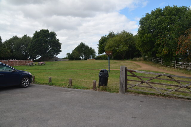
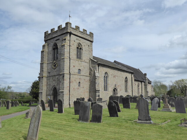
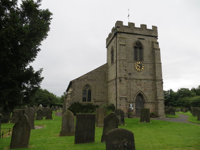
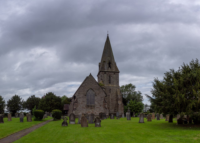
Black Wood Images

Images are sourced within 2km of 52.828492/-2.0120539 or Grid Reference SJ9925. Thanks to Geograph Open Source API. All images are credited.

View to Millennium Green, Hixon, Staffordshire The view is taken from the car park. The Bank House public house is immediately behind the camera. The Hixon Millennium Green was opened on January 1st 2000 as part of a nationwide series of Millennium Greens in England each managed by trustees.
View to Millennium Green, Hixon, Staffordshire
The view is taken from the car park. The Bank House public house is immediately behind the camera. The Hixon Millennium Green was opened on January 1st 2000 as part of a nationwide series of Millennium Greens in England each managed by trustees.
Stowe by Chartley, St John the Baptist
The Church of St John at Stowe-by-Chartley Viewed from the north-west.
The Church of St John at Stowe-by-Chartley
Viewed from the north-west.
Ordnance Survey Flush Bracket G3875 This can be found on the roadside wall of Bistro le Coq (former Cock Inn) in Stowe-by-Chartley.
For more detail see : <span class="nowrap"><a title="http://www.bench-marks.org.uk/bm10451" rel="nofollow ugc noopener" href="http://www.bench-marks.org.uk/bm10451">Link</a><img style="margin-left:2px;" alt="External link" title="External link - shift click to open in new window" src="https://s1.geograph.org.uk/img/external.png" width="10" height="10"/></span>
Ordnance Survey Flush Bracket G3875
This can be found on the roadside wall of Bistro le Coq (former Cock Inn) in Stowe-by-Chartley. For more detail see : LinkExternal link
St John the Baptist Church, Stowe-by-Chartley
Bistro Le Coq, Stowe-by-Chartley  Bar restaurant on Station Road.
Bistro Le Coq, Stowe-by-Chartley
Bar restaurant on Station Road.
Sign for the Bistro Le Coq, Stowe-by-Chartley
Victorian postbox on Station Road, Stowe-by-Chartley Postbox No. ST18 64.

See <a href="https://www.geograph.org.uk/photo/5564735">SK0027 : Outbuilding, Bistro Le Coq, Stowe-by-Chartley</a> for context.
Victorian postbox on Station Road, Stowe-by-Chartley
Postbox No. ST18 64. See SK0027 : Outbuilding, Bistro Le Coq, Stowe-by-Chartley for context.
Outbuilding, Bistro Le Coq, Stowe-by-Chartley On Station Road.
Showing position of Victorian Postbox No. ST18 64.

See <a href="https://www.geograph.org.uk/photo/5564732">SK0027 : Victorian postbox on Station Road, Stowe-by-Chartley</a> for postbox.
Outbuilding, Bistro Le Coq, Stowe-by-Chartley
On Station Road. Showing position of Victorian Postbox No. ST18 64. See SK0027 : Victorian postbox on Station Road, Stowe-by-Chartley for postbox.
St. Peter's Church, Hixon The 19th century parish church of Saint Peter is a Grade II listed building, in the early English Gothic style and was designed and built by the English Gothic revival architect George Gilbert Scott.

The site for the church was given by Lord Talbot and had previously been occupied by a windmill: this gives the church an unusual location on high ground, away from the road, on the edge of the village. The foundation stone was laid by the Marchioness of Lothian in July 1846. The Church was consecrated on St. Peter's Day 1848 (Tuesday, 29 June) by the then Bishop of Lichfield, John Lonsdale.

The church is part of the combined Mid-Trent Churches benefice of the Diocese of Lichfield, covering ten churches across eight parishes.

<span class="nowrap"><a title="https://en.wikipedia.org/wiki/Hixon,_Staffordshire" rel="nofollow ugc noopener" href="https://en.wikipedia.org/wiki/Hixon,_Staffordshire">Link</a><img style="margin-left:2px;" alt="External link" title="External link - shift click to open in new window" src="https://s1.geograph.org.uk/img/external.png" width="10" height="10"/></span>
St. Peter's Church, Hixon
The 19th century parish church of Saint Peter is a Grade II listed building, in the early English Gothic style and was designed and built by the English Gothic revival architect George Gilbert Scott. The site for the church was given by Lord Talbot and had previously been occupied by a windmill: this gives the church an unusual location on high ground, away from the road, on the edge of the village. The foundation stone was laid by the Marchioness of Lothian in July 1846. The Church was consecrated on St. Peter's Day 1848 (Tuesday, 29 June) by the then Bishop of Lichfield, John Lonsdale. The church is part of the combined Mid-Trent Churches benefice of the Diocese of Lichfield, covering ten churches across eight parishes. LinkExternal link
St. John The Baptist Church, Stowe-By-Chartley C12 church restored 1866 by Habershon & Pite, north aisle added 1879.

The 3-stage tower is C13 but has C15 bell stage details and embattled parapet.

<span class="nowrap"><a title="https://britishlistedbuildings.co.uk/101273551-church-of-st-john-the-baptist-stowe-by-chartley#.XzPUiShKiUk" rel="nofollow ugc noopener" href="https://britishlistedbuildings.co.uk/101273551-church-of-st-john-the-baptist-stowe-by-chartley#.XzPUiShKiUk">Link</a><img style="margin-left:2px;" alt="External link" title="External link - shift click to open in new window" src="https://s1.geograph.org.uk/img/external.png" width="10" height="10"/></span>

<span class="nowrap"><a title="https://en.wikipedia.org/wiki/Stowe-by-Chartley" rel="nofollow ugc noopener" href="https://en.wikipedia.org/wiki/Stowe-by-Chartley">Link</a><img style="margin-left:2px;" alt="External link" title="External link - shift click to open in new window" src="https://s1.geograph.org.uk/img/external.png" width="10" height="10"/></span>
St. John The Baptist Church, Stowe-By-Chartley
C12 church restored 1866 by Habershon & Pite, north aisle added 1879. The 3-stage tower is C13 but has C15 bell stage details and embattled parapet. LinkExternal link LinkExternal link
Victorian Post Box, Stowe-by-Chartley 1837-1901 Victorian (VR) Wall Post Box.


<span class="nowrap"><a title="https://en.wikipedia.org/wiki/Stowe-by-Chartley" rel="nofollow ugc noopener" href="https://en.wikipedia.org/wiki/Stowe-by-Chartley">Link</a><img style="margin-left:2px;" alt="External link" title="External link - shift click to open in new window" src="https://s1.geograph.org.uk/img/external.png" width="10" height="10"/></span>
Victorian Post Box, Stowe-by-Chartley
1837-1901 Victorian (VR) Wall Post Box. LinkExternal link
WWII Staffordshire: RAF Hixon - Battle HQ (5) -
Airfield Battle HQ: EDoB ID: e25430

In a field near the centre of the village of Stowe-by-Chartley is RAF Hixon's former Battle Headquarters, instantly recognisable by its observation cupola. Never used in anger, its location is unusual being situated near a place of habitation. It would have been handy for the nearby pub which makes one wonder if that influenced its location! Unusual too is that the bunker was accessed via Bridge Lane by what appears to have been a walk-in entrance that's now bricked up. Traces of the brickwork are visible in an embankment on the south side of Bridge Lane.

<a href="https://www.geograph.org.uk/photo/6617538">SK0027 : WWII Staffordshire: RAF Hixon - Battle HQ (6)</a>
WWII Staffordshire: RAF Hixon - Battle HQ (5)
- Airfield Battle HQ: EDoB ID: e25430 In a field near the centre of the village of Stowe-by-Chartley is RAF Hixon's former Battle Headquarters, instantly recognisable by its observation cupola. Never used in anger, its location is unusual being situated near a place of habitation. It would have been handy for the nearby pub which makes one wonder if that influenced its location! Unusual too is that the bunker was accessed via Bridge Lane by what appears to have been a walk-in entrance that's now bricked up. Traces of the brickwork are visible in an embankment on the south side of Bridge Lane. SK0027 : WWII Staffordshire: RAF Hixon - Battle HQ (6)
WWII Staffordshire: RAF Hixon - Battle HQ (6) -
Airfield Battle HQ: EDoB ID: e25430

The emergency escape chamber in front of the cupola has been sealed, and the observation slit of the cupola has been bricked up. 

<a href="https://www.geograph.org.uk/photo/6617550">SK0027 : WWII Staffordshire: RAF Hixon - Battle HQ (7)</a>
WWII Staffordshire: RAF Hixon - Battle HQ (6)
- Airfield Battle HQ: EDoB ID: e25430 The emergency escape chamber in front of the cupola has been sealed, and the observation slit of the cupola has been bricked up. SK0027 : WWII Staffordshire: RAF Hixon - Battle HQ (7)
WWII Staffordshire: RAF Hixon - Battle HQ (7) -
Airfield Battle HQ: EDoB ID: e25430

In an embankment on the south side of Bridge Lane are traces of the brickwork of the former entrance to the BHQ.

START: <a href="https://www.geograph.org.uk/photo/6617459">SJ9926 : WWII Staffordshire: RAF Hixon - Control Tower (1)</a>
WWII Staffordshire: RAF Hixon - Battle HQ (7)
- Airfield Battle HQ: EDoB ID: e25430 In an embankment on the south side of Bridge Lane are traces of the brickwork of the former entrance to the BHQ. START: SJ9926 : WWII Staffordshire: RAF Hixon - Control Tower (1)
Stowe by Chartley War Memorial Staffordshire War memorial which is in St John the Baptist church
Stowe by Chartley War Memorial Staffordshire
War memorial which is in St John the Baptist church
Entering Hixon on Church Lane Entrance to St. Peters is on the left hand side.
Entering Hixon on Church Lane
Entrance to St. Peters is on the left hand side.
Red Brick House, Smithy Lane, Hixon
Show me another place!

Black Wood is located at Grid Ref: SJ9925 (Lat: 52.828492, Lng: -2.0120539)

Administrative County: Staffordshire

District: Stafford

Police Authority: Staffordshire

What 3 Words

///deflection.explained.examiner. Near Great Haywood, Staffordshire

Nearby Locations

Pasturefields Black Wood

Related Wikis

Hixon railway station

Hixon railway station is a disused railway station in Staffordshire, England. The railway line between Stone and Colwich was opened by the North Staffordshire...

Hixon rail crash

On 6 January 1968, a low-loader transporter carrying a 120-ton electrical transformer was struck by a British Rail express train on a recently installed...

Hixon, Staffordshire

Hixon is a village and a civil parish in the English county of Staffordshire.grid reference SK003259 == Location == The village is 7.8 miles (12.6 km)...

RAF Hixon

Royal Air Force Hixon, or more simply RAF Hixon, was a Royal Air Force station located on the north western edge of the village of Hixon in Staffordshire...

RAF Seighford

Royal Air Force Seighford or more simply RAF Seighford is a former Royal Air Force satellite station located 3.6 miles (5.8 km) northwest of Stafford,...

Amerton

Amerton is a small village in the Borough of Stafford, Staffordshire, England, situated on the A518 road between Stafford and Uttoxeter. The population...

Ingestre

Ingestre is a village and civil parish in the Stafford district, in the county of Staffordshire, England. The population of the civil parish taken at the...

Ingestre railway station

Ingestre and Weston railway station was a former British railway station to serve the village of Ingestre in Staffordshire.It was opened by the Stafford...

Nearby Amenities

Located within 500m of 52.828492,-2.0120539
Bus Stop
Airfield Industrial Estate
Bus: yes
Naptan AtcoCode: 3800C717700
Naptan Bearing: NE
Naptan CommonName: Airfield Industrial Estate
Naptan Indicator: Adj
Naptan Landmark: Airfield Industrial Estate
Naptan Street: New Rd
Naptan Verified: no
Public Transport: platform
Source: naptan_import
Lat/Long: 52.831183/-2.0065606
Railway: level_crossing
Lat/Long: 52.8300871/-2.0129162
Railway: level_crossing
Lat/Long: 52.8300788/-2.0129645
Hixon Halt
Historic Railway: station
Railway: site
Lat/Long: 52.8298998/-2.0126846
Barrier: lift_gate
Lat/Long: 52.8310944/-2.0082758
The data included in this document is from www.openstreetmap.org. The data is made available under ODbL.

Have you been to Black Wood?

Leave your review of Black Wood below (or comments, questions and feedback).