Blackton Foot Plantation

Wood, Forest in Durham

England

Blackton Foot Plantation

Tractor on moorland of Grey Carrs The tractor is part of a heather burning operation on the heather moorland, part of the management scheme for grouse shooting. Tractors are used to mow 'lanes' around areas of heather to be burned, those lanes then act as firebreaks to contain the blaze. The tractor very likely has doubled wheels at the rear to spread its load on delicate ground.
Tractor on moorland of Grey Carrs Credit: Trevor Littlewood

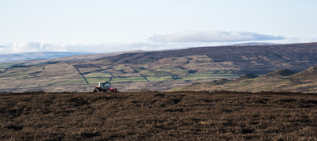
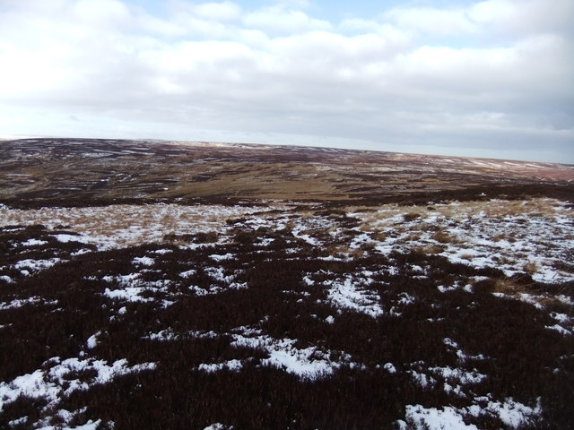
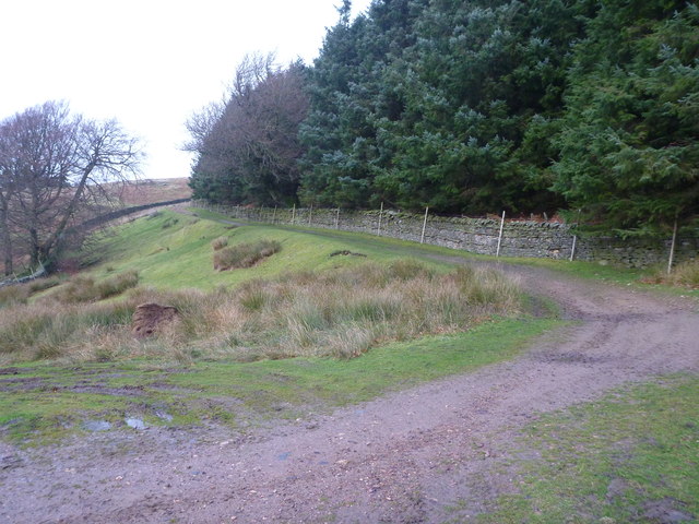
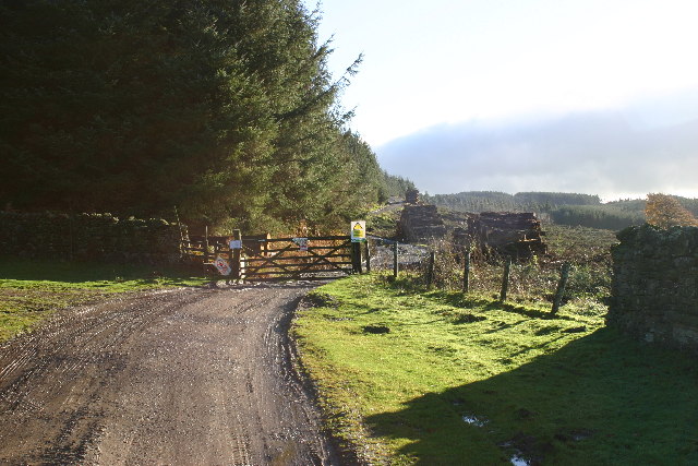
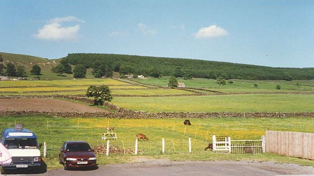
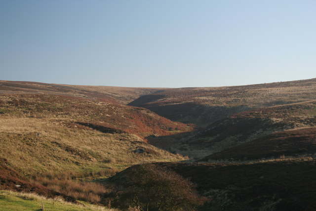
Blackton Foot Plantation, located in Durham, is a sprawling woodland area known for its diverse range of plant species. Covering a vast expanse, the plantation is predominantly composed of dense woods and forests, offering a serene and picturesque landscape for visitors to explore.

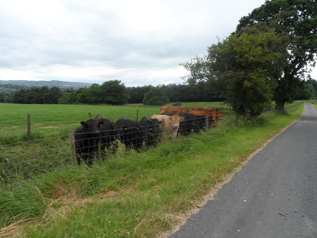
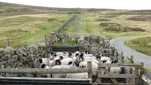
One of the notable features of Blackton Foot Plantation is its rich biodiversity. The area is home to a wide variety of trees, including oak, ash, beech, and birch, among others. These trees provide a habitat for numerous animal species, making the plantation a haven for wildlife enthusiasts. Visitors may spot deer, rabbits, squirrels, and a plethora of bird species as they explore the plantation's trails.

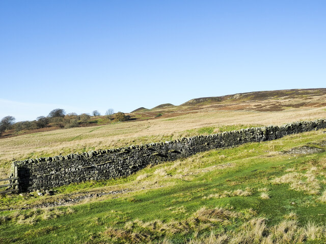
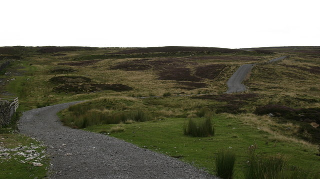
Additionally, Blackton Foot Plantation offers several walking trails that wind through the woods, allowing visitors to immerse themselves in the natural beauty of the area. These trails are well-maintained and suitable for all levels of fitness, providing a fantastic opportunity for both leisurely strolls and more challenging hikes.

The plantation also boasts a small lake, which adds to the overall charm of the area. The tranquil waters provide an ideal spot for fishing or simply enjoying a peaceful picnic by the shore.

Blackton Foot Plantation is a popular destination for nature lovers, photographers, and those seeking a peaceful retreat from the bustling city life of Durham. Its stunning woodlands, diverse flora and fauna, and well-maintained trails make it a must-visit location for anyone looking to reconnect with nature in this beautiful corner of the country.

If you have any feedback on the listing, please let us know in the comments section below.

Blackton Foot Plantation Images

Images are sourced within 2km of 54.618475/-2.0145705 or Grid Reference NY9924. Thanks to Geograph Open Source API. All images are credited.

Tractor on moorland of Grey Carrs The tractor is part of a heather burning operation on the heather moorland, part of the management scheme for grouse shooting. Tractors are used to mow 'lanes' around areas of heather to be burned, those lanes then act as firebreaks to contain the blaze. The tractor very likely has doubled wheels at the rear to spread its load on delicate ground.
Tractor on moorland of Grey Carrs
The tractor is part of a heather burning operation on the heather moorland, part of the management scheme for grouse shooting. Tractors are used to mow 'lanes' around areas of heather to be burned, those lanes then act as firebreaks to contain the blaze. The tractor very likely has doubled wheels at the rear to spread its load on delicate ground.
Wall and grassy track climbing out of valley The wall climbs to the north from the valley of the Blackton Beck.
The run of knolls on the skyline are known as Knotts.
Wall and grassy track climbing out of valley
The wall climbs to the north from the valley of the Blackton Beck. The run of knolls on the skyline are known as Knotts.
Nemour Hall Nemour Hall appears in this image as a fairly modest house with a barn attached at the rear; it is in fact revealed to be a quite large building once the front comes into view.
Nemour Hall
Nemour Hall appears in this image as a fairly modest house with a barn attached at the rear; it is in fact revealed to be a quite large building once the front comes into view.
Fields above B6278 near Eggleston Eggleston with the B6278 can be seen at the left side of the image; the fields lie above the road on its north side. The distant high ground rises to Monk's Moor.
Fields above B6278 near Eggleston
Eggleston with the B6278 can be seen at the left side of the image; the fields lie above the road on its north side. The distant high ground rises to Monk's Moor.
Junction of B classified roads outside Eggleston The B6282 and the B6278 meet just east of the County Durham village of Eggleston. The blue and yellow road sign is characteristic of a style of signage introduced by County Durham some years ago.
Junction of B classified roads outside Eggleston
The B6282 and the B6278 meet just east of the County Durham village of Eggleston. The blue and yellow road sign is characteristic of a style of signage introduced by County Durham some years ago.
Bleak moorland above Blackton Head
Track on Grey Carrs
Track on Grey Carrs
Frozen track on Nemour Hill
Track to Grey Carrs Taken from just beyond the end of the public road, at the point where a rather esoteric public footpath turns south west to end at a random point of no destination. The more useful public right of way is the bridleway which starts up this track up Nemour Hill, and breaks out onto the open fell to cross the southern slopes of Grey Carrs. Although, as a bridleway, one has every right to pursue this route on a bike, it is not particularly enjoyable, being deeply rutted, boggy or deep in heather in various stages of the crossing.
Track to Grey Carrs
Taken from just beyond the end of the public road, at the point where a rather esoteric public footpath turns south west to end at a random point of no destination. The more useful public right of way is the bridleway which starts up this track up Nemour Hill, and breaks out onto the open fell to cross the southern slopes of Grey Carrs. Although, as a bridleway, one has every right to pursue this route on a bike, it is not particularly enjoyable, being deeply rutted, boggy or deep in heather in various stages of the crossing.
Bullocks at West Barnley Farm
Stobgreen plantation Looking SE from position
Stobgreen plantation
Looking SE from position
Middle Nemour and Stobgreen Plantation
Folly Bank : Eggleston Looking south to Barnard Castle, Gatehouse on the left, Lowsons Garage centre.
Folly Bank : Eggleston
Looking south to Barnard Castle, Gatehouse on the left, Lowsons Garage centre.
Sheep Pens above Eggleston Sheep in pens close to Blackton Beck on the moor above Eggleston.
Sheep Pens above Eggleston
Sheep in pens close to Blackton Beck on the moor above Eggleston.
The way to Hamsterley Bridleway across the moors leading to Hamsterley.  This section is well surfaced, probably for the benefit of grouse shooting parties.
The way to Hamsterley
Bridleway across the moors leading to Hamsterley. This section is well surfaced, probably for the benefit of grouse shooting parties.
Blackton Beck View looking up Blackton Beck towards Blackton Head on Eggleston Common.
Blackton Beck
View looking up Blackton Beck towards Blackton Head on Eggleston Common.
Road junction, Eggleston Unusually, six B roads converge on Eggleston, although they do not all meet at one point - the B6278 Barnard Castle to Stanhope road intersects the B6282 Bishop Auckland to Middleton-in-Teesdale road; also converging on Eggleston are the B6279  from Darlington and the B6281 from Mickleton. This image shows Folly Bank designated as the B6278, but also carrying the B6282 for a short distance. Lowson's Garage Centre stands by the road.
Road junction, Eggleston
Unusually, six B roads converge on Eggleston, although they do not all meet at one point - the B6278 Barnard Castle to Stanhope road intersects the B6282 Bishop Auckland to Middleton-in-Teesdale road; also converging on Eggleston are the B6279 from Darlington and the B6281 from Mickleton. This image shows Folly Bank designated as the B6278, but also carrying the B6282 for a short distance. Lowson's Garage Centre stands by the road.
Eggleston The B6282 passing through Eggleston.
Eggleston
The B6282 passing through Eggleston.
Show me another place!

Blackton Foot Plantation is located at Grid Ref: NY9924 (Lat: 54.618475, Lng: -2.0145705)

Unitary Authority: County Durham

Police Authority: Durham

What 3 Words

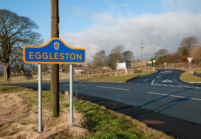
///rezoning.probing.moving. Near Eggleston, Co. Durham

Related Wikis

Hill Top, Teesdale

Hill Top is a small village in County Durham, in England. It is situated to the north of Eggleston. == References ==

Egglesburn

Egglesburn is a village in County Durham, Northern England. It is in the Teesdale, Mickleton is on opposite bank of the River Tees. In the 1960s Durham...

Eggleston Hall

Eggleston Hall is a privately owned 19th-century English country house in Eggleston, Teesdale, County Durham. It is a Grade II* listed building. ��2�...

Eggleston

Eggleston is a village in County Durham, in England. The population of the civil parish taken at the 2011 Census was 448. It is in the Teesdale, a few...

Mickleton railway station

Mickleton railway station was situated on the Tees Valley Railway between Barnard Castle and Middleton-in-Teesdale. It served the village of Mickleton...

Romaldkirk

Romaldkirk is a village in Teesdale, in the Pennines of England. The village lies within the historic boundaries of the North Riding of Yorkshire, but...

Romaldkirk railway station

Romaldkirk railway station was situated on the Tees Valley Railway between Barnard Castle and Middleton-in-Teesdale. It served the village of Romaldkirk...

Mickleton, County Durham

Mickleton is a village and civil parish in Teesdale, County Durham, England, situated 8.5 miles (13.7 km) north west of Barnard Castle. Lying within the...

Nearby Amenities

Located within 500m of 54.618475,-2.0145705
Bus Stop
Blackton Cottage
Naptan AtcoCode: 13007821D
Naptan Bearing: SE
Naptan CommonName: Blackton Cottage
Naptan Indicator: south east bound
Naptan Landmark: opposite Blackton Cottage 1km nth of Eggleston
Naptan NaptanCode: durgagwm
Naptan Street: B6278
Naptan Verified: no
Source: naptan_import
Lat/Long: 54.6202364/-2.0114602
Bus Stop
Blackton Cottage
Naptan AtcoCode: 13007821H
Naptan Bearing: NW
Naptan CommonName: Blackton Cottage
Naptan Indicator: north west bound
Naptan Landmark: Outside Blackton Cottage 1km nth of Eggleston
Naptan NaptanCode: durgagwp
Naptan Street: B6278
Naptan Verified: no
Source: naptan_import
Lat/Long: 54.6201645/-2.0115686
Ford: yes
Image: https://www.geograph.org.uk/photo/2171249
Lat/Long: 54.6173749/-2.0165373
Blackton House
Place: farm
Source: OS 1:25k
Lat/Long: 54.6217863/-2.012302
Toft House
Addr City: Barnard Castle
Addr Postcode: DL12 0AZ
Place: farm
Source Name: OS_OpenData_StreetView
Source Postcode: CodePoint Open
Lat/Long: 54.6173719/-2.0190918
Ford: yes
Lat/Long: 54.6181268/-2.0180308
The data included in this document is from www.openstreetmap.org. The data is made available under ODbL.

Have you been to Blackton Foot Plantation?

Leave your review of Blackton Foot Plantation below (or comments, questions and feedback).