Riddles Plantation

Wood, Forest in Northumberland

England

Riddles Plantation

A public footpath on Northfieldhead Hill Viewed in mid March near the northeast corner of Pennylaws South Plantation.
A public footpath on Northfieldhead Hill Credit: Walter Baxter

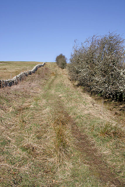
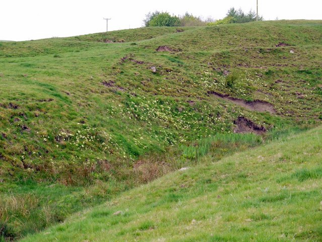
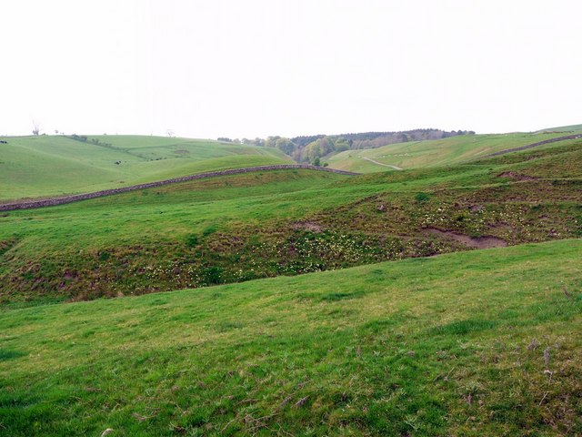
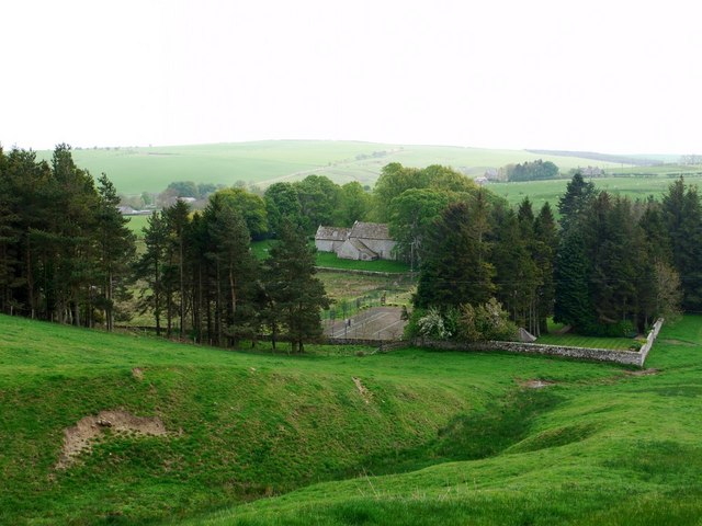
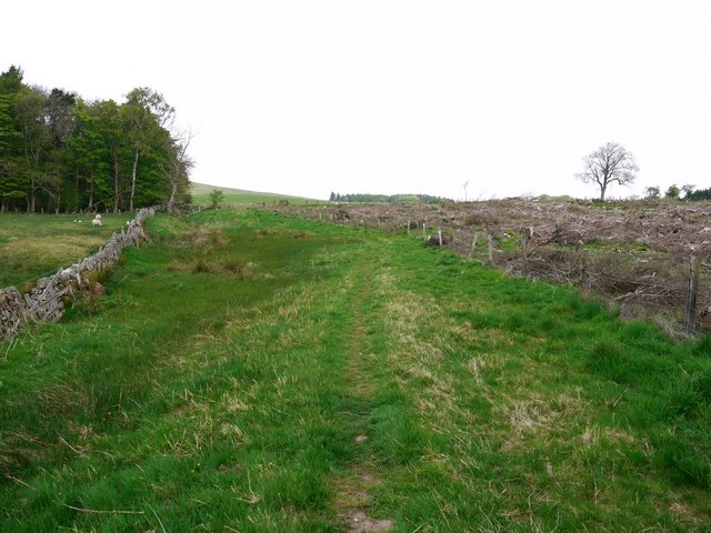
Riddles Plantation is an enchanting woodland located in the county of Northumberland, England. Spanning over a vast expanse of land, this plantation is renowned for its picturesque beauty and diverse range of flora and fauna. Situated in the heart of the Northumberland National Park, Riddles Plantation offers visitors a tranquil escape into nature.

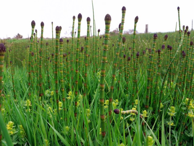
The woodland is predominantly composed of dense deciduous trees, including oak, beech, and birch, which create a stunning canopy overhead. The forest floor is adorned with a vibrant array of wildflowers, ferns, and mosses, providing a rich tapestry of colors throughout the year. The plantation is also home to various wildlife species, such as red squirrels, roe deer, and a plethora of bird species, making it a haven for nature enthusiasts and wildlife photographers.

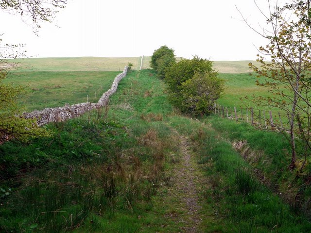
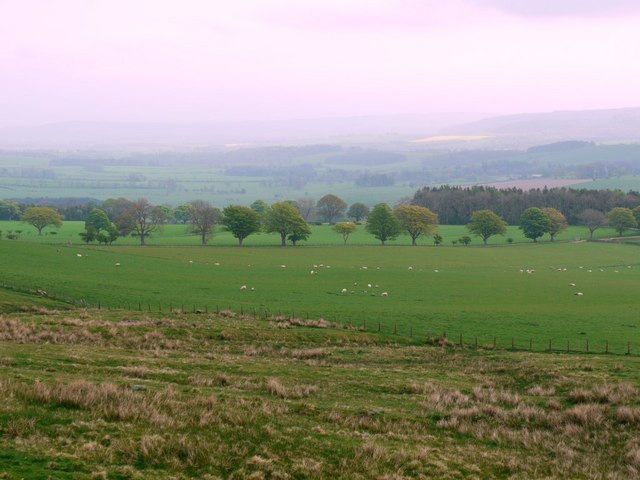
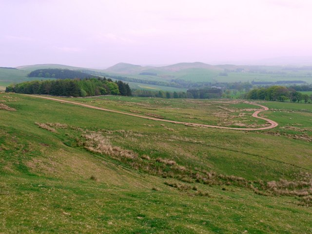
Riddles Plantation offers an extensive network of walking trails, allowing visitors to explore its beauty at their own pace. The trails are well-maintained and provide breathtaking views of the surrounding countryside, including the nearby Simonside Hills. Additionally, there are designated picnic areas and benches scattered throughout the woodland, inviting visitors to relax and immerse themselves in the tranquility of nature.

The plantation is open to the public year-round, with the changing seasons offering unique experiences. In spring, the woodland bursts into life with a riot of blossoms, while autumn transforms the landscape into a kaleidoscope of warm hues. Riddles Plantation is a true gem of Northumberland, offering a captivating escape into the natural wonders of the region.

If you have any feedback on the listing, please let us know in the comments section below.

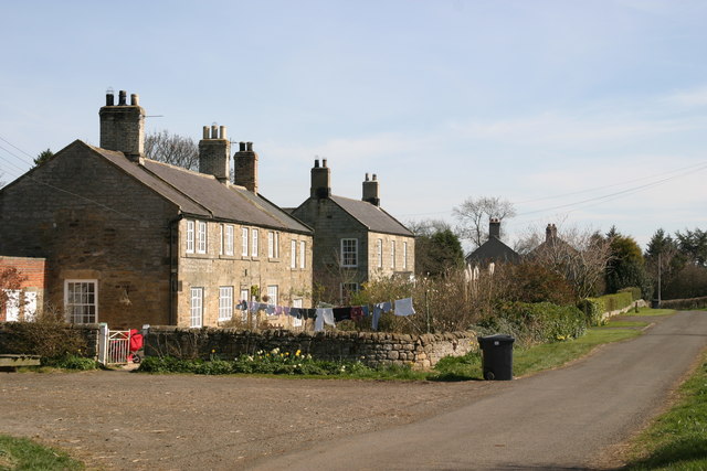
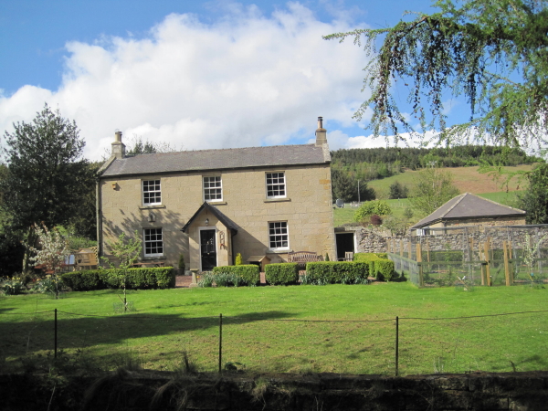
Riddles Plantation Images

Images are sourced within 2km of 55.402847/-2.0221266 or Grid Reference NT9812. Thanks to Geograph Open Source API. All images are credited.

A public footpath on Northfieldhead Hill Viewed in mid March near the northeast corner of Pennylaws South Plantation.
A public footpath on Northfieldhead Hill
Viewed in mid March near the northeast corner of Pennylaws South Plantation.
The triangulation pillar on Hart Law Trig point S8034 is at 341m in an improved grazing area.
The triangulation pillar on Hart Law
Trig point S8034 is at 341m in an improved grazing area.
The road to Ewartly Shank This road from Alnham passes through hill farming countryside on the way to Ewartly Shank Farm.
The road to Ewartly Shank
This road from Alnham passes through hill farming countryside on the way to Ewartly Shank Farm.
Comfrey (Symphytum officinale) by garden back gate of Tower House
Small valley west of Salters Road The east facing valley sides are lined with primroses
Small valley west of Salters Road
The east facing valley sides are lined with primroses
View south-west from Salters Road Looking over the primorose-speckled valley <a href="https://www.geograph.org.uk/photo/2385345">NT9811 : Small valley west of Salters Road</a> in the green pastures south-west of the wall by the Salters Road bridleway. The wood in the distance is Hazeltonrig Plantation, beyond the road which ascends from Alnham to Ewartly Shank.
View south-west from Salters Road
Looking over the primorose-speckled valley NT9811 : Small valley west of Salters Road in the green pastures south-west of the wall by the Salters Road bridleway. The wood in the distance is Hazeltonrig Plantation, beyond the road which ascends from Alnham to Ewartly Shank.
Valley east of Salters Road Looking south-east towards Alnham Church and the Tower House (Vicarage) garden.
Valley east of Salters Road
Looking south-east towards Alnham Church and the Tower House (Vicarage) garden.
Salter's Road near Pennylaws South Plantation My last visit here was two years ago and just over one month earlier. Comparison of the same scene in early March <a href="https://www.geograph.org.uk/photo/1202729">NT9811 : Salter's Road near Pennylaws South Plantation</a> show the extent of changes even in the uplands. The seasonal difference has greened up the grass and the trees. The marsh to the left of the path is now thick with the flowering stems of horsetails <a href="https://www.geograph.org.uk/photo/2385405">NT9811 : Flowering horsetails in marsh near Pennylaws South Plantation</a> and the bright yellow dots of marsh marigolds.
The plantation to the right of the track has now been partially felled, opening up the landscape.
Salter's Road near Pennylaws South Plantation
My last visit here was two years ago and just over one month earlier. Comparison of the same scene in early March NT9811 : Salter's Road near Pennylaws South Plantation show the extent of changes even in the uplands. The seasonal difference has greened up the grass and the trees. The marsh to the left of the path is now thick with the flowering stems of horsetails NT9811 : Flowering horsetails in marsh near Pennylaws South Plantation and the bright yellow dots of marsh marigolds. The plantation to the right of the track has now been partially felled, opening up the landscape.
Flowering horsetails in marsh near Pennylaws South Plantation The water horsetail (Equisitum fluviatile) is just starting to develop its whorled branches.
Flowering horsetails in marsh near Pennylaws South Plantation
The water horsetail (Equisitum fluviatile) is just starting to develop its whorled branches.
Salter's Road climbing Northfieldhead Hill This is a duplicate of a photo taken two years and one month earlier from the same location <a href="https://www.geograph.org.uk/photo/1202743">NT9811 : Salter's Road climbing Northfieldhead Hill</a>
Salter's Road climbing Northfieldhead Hill
This is a duplicate of a photo taken two years and one month earlier from the same location NT9811 : Salter's Road climbing Northfieldhead Hill
Fields north-west of Northfieldhead
Track east of Northfieldhead Hill
Access track west of Salter's Road The four-wheel drive access track avoids the line of the old Salter's Road track using the dry land directly over Northfieldhead Hill. The tracks meet just before <a href="https://www.geograph.org.uk/photo/1203172">NT9812 : Salter's Road  fords the Coppath Burn</a>
Access track west of Salter's Road
The four-wheel drive access track avoids the line of the old Salter's Road track using the dry land directly over Northfieldhead Hill. The tracks meet just before NT9812 : Salter's Road fords the Coppath Burn
Salter's Road at the Coppath Burn There is a photo from 2009 here <a href="https://www.geograph.org.uk/photo/1203172">NT9812 : Salter's Road  fords the Coppath Burn</a>
Salter's Road at the Coppath Burn
There is a photo from 2009 here NT9812 : Salter's Road fords the Coppath Burn
Coppath Burn Romano-British Settlement The settlement is 310m south west of White Gate <a href="https://www.geograph.org.uk/photo/1203194">NT9712 : Salter's Road at White Gate</a>, north of Coppath Burn. Six small stone round houses have been found at this site. They may have been surrounded by a earth and rubble bank, though much of this has been disturbed. Its position on flat relatively low-lying ground is unusual  as they are normally 'scooped' into hill slopes.
<span class="nowrap"><a title="http://ads.ahds.ac.uk/catalogue/collections/nsmr03abstracts/1349.html" rel="nofollow ugc noopener" href="http://ads.ahds.ac.uk/catalogue/collections/nsmr03abstracts/1349.html">Link</a><img style="margin-left:2px;" alt="External link" title="External link - shift click to open in new window" src="https://s1.geograph.org.uk/img/external.png" width="10" height="10"/></span>
The aerial view shows the layout <span class="nowrap"><a title="http://wtp2.appspot.com/wheresthepath.htm?lat=55.40459370759485&lon=-2.037593722343445&gz=18&oz=8&gt=1" rel="nofollow ugc noopener" href="http://wtp2.appspot.com/wheresthepath.htm?lat=55.40459370759485&lon=-2.037593722343445&gz=18&oz=8&gt=1">Link</a><img style="margin-left:2px;" alt="External link" title="External link - shift click to open in new window" src="https://s1.geograph.org.uk/img/external.png" width="10" height="10"/></span>
The upright post on the left marks the line of the bridleway to Hazeltonrig and Alnham although there are only small sections of path visible across the boggy ground.
Coppath Burn Romano-British Settlement
The settlement is 310m south west of White Gate NT9712 : Salter's Road at White Gate, north of Coppath Burn. Six small stone round houses have been found at this site. They may have been surrounded by a earth and rubble bank, though much of this has been disturbed. Its position on flat relatively low-lying ground is unusual as they are normally 'scooped' into hill slopes. LinkExternal link The aerial view shows the layout LinkExternal link The upright post on the left marks the line of the bridleway to Hazeltonrig and Alnham although there are only small sections of path visible across the boggy ground.
High Knowes palisaded settlement This is the western of two similar settlements on the south-east ridge of High Knowes. The details are very impressive in aerial view <span class="nowrap"><a title="http://wtp2.appspot.com/wheresthepath.htm?lat=55.40630236287813&lon=-2.046326994895935&gz=18&oz=8&gt=1" rel="nofollow ugc noopener" href="http://wtp2.appspot.com/wheresthepath.htm?lat=55.40630236287813&lon=-2.046326994895935&gz=18&oz=8&gt=1">Link</a><img style="margin-left:2px;" alt="External link" title="External link - shift click to open in new window" src="https://s1.geograph.org.uk/img/external.png" width="10" height="10"/></span>
The homestead known as High Knowes A was excavated 1962-63 by Newcastle University. It consists of two circular palisade trenches 10ft apart enclosing an area 150ft in diameter with an entrance on the east side <a href="https://www.geograph.org.uk/photo/2386035">NT9712 : High Knowes palisaded settlement</a>. Within the interior of the palisaded settlement, there are the foundations of at least four timber built hut circles although only two are visible in aerial view. It is considered to date from the Iron Age <span class="nowrap"><a title="http://ads.ahds.ac.uk/catalogue/collections/nsmr03abstracts/1340.html" rel="nofollow ugc noopener" href="http://ads.ahds.ac.uk/catalogue/collections/nsmr03abstracts/1340.html">Link</a><img style="margin-left:2px;" alt="External link" title="External link - shift click to open in new window" src="https://s1.geograph.org.uk/img/external.png" width="10" height="10"/></span>
The settlement to the east, known as High Knowes B, is an oval palisaded enclosure. Within the interior of the settlement are the remains of at least 19 timber built hut circles. Excavation showed later Romano-British occupation overlying an Iron Age settlement <span class="nowrap"><a title="http://ads.ahds.ac.uk/catalogue/collections/nsmr03abstracts/1347.html" rel="nofollow ugc noopener" href="http://ads.ahds.ac.uk/catalogue/collections/nsmr03abstracts/1347.html">Link</a><img style="margin-left:2px;" alt="External link" title="External link - shift click to open in new window" src="https://s1.geograph.org.uk/img/external.png" width="10" height="10"/></span>
The aerial photo also shows the faint traces of prehistoric ploughing, known as cord rig, to the south-east of High Knowes B <span class="nowrap"><a title="http://www.keystothepast.info/article/10339/Site-Details?PRN=N1370" rel="nofollow ugc noopener" href="http://www.keystothepast.info/article/10339/Site-Details?PRN=N1370">Link</a><img style="margin-left:2px;" alt="External link" title="External link - shift click to open in new window" src="https://s1.geograph.org.uk/img/external.png" width="10" height="10"/></span>
High Knowes palisaded settlement
This is the western of two similar settlements on the south-east ridge of High Knowes. The details are very impressive in aerial view LinkExternal link The homestead known as High Knowes A was excavated 1962-63 by Newcastle University. It consists of two circular palisade trenches 10ft apart enclosing an area 150ft in diameter with an entrance on the east side NT9712 : High Knowes palisaded settlement. Within the interior of the palisaded settlement, there are the foundations of at least four timber built hut circles although only two are visible in aerial view. It is considered to date from the Iron Age LinkExternal link The settlement to the east, known as High Knowes B, is an oval palisaded enclosure. Within the interior of the settlement are the remains of at least 19 timber built hut circles. Excavation showed later Romano-British occupation overlying an Iron Age settlement LinkExternal link The aerial photo also shows the faint traces of prehistoric ploughing, known as cord rig, to the south-east of High Knowes B LinkExternal link
High Knowes palisaded settlement Showing the south side of the ditched enclosure <a href="https://www.geograph.org.uk/photo/2385974">NT9712 : High Knowes palisaded settlement</a>. It consists of two circular palisade trenches 10ft apart with a slight mound between the two, probably formed from the upcast. The circular feature on the ground to the right may be the site of one of the timber round houses or possibly an area used for providing addition winter feed for the hill sheep <span class="nowrap"><a title="http://ads.ahds.ac.uk/catalogue/collections/nsmr03abstracts/1340.html" rel="nofollow ugc noopener" href="http://ads.ahds.ac.uk/catalogue/collections/nsmr03abstracts/1340.html">Link</a><img style="margin-left:2px;" alt="External link" title="External link - shift click to open in new window" src="https://s1.geograph.org.uk/img/external.png" width="10" height="10"/></span>
Hogdon Law can be seen in the distance.
High Knowes palisaded settlement
Showing the south side of the ditched enclosure NT9712 : High Knowes palisaded settlement. It consists of two circular palisade trenches 10ft apart with a slight mound between the two, probably formed from the upcast. The circular feature on the ground to the right may be the site of one of the timber round houses or possibly an area used for providing addition winter feed for the hill sheep LinkExternal link Hogdon Law can be seen in the distance.
View south-east from the slopes of High Knowes Visible below is the road that runs from Alnham to Ewartly Shank. On the left can be seen the part of the road where it climbs the flanks of Castle Hill with the deep valley of the Spartley Burn to its right as it drops to Hazeltonrig.
View south-east from the slopes of High Knowes
Visible below is the road that runs from Alnham to Ewartly Shank. On the left can be seen the part of the road where it climbs the flanks of Castle Hill with the deep valley of the Spartley Burn to its right as it drops to Hazeltonrig.
Show me another place!

Riddles Plantation is located at Grid Ref: NT9812 (Lat: 55.402847, Lng: -2.0221266)

Unitary Authority: Northumberland

Police Authority: Northumbria

What 3 Words

///push.arose.artichoke. Near Whittingham, Northumberland

Related Wikis

Church of St Michael, Alnham

The Church of St Michael in Alnham, in the English county of Northumberland, is a medieval structure dating from circa 1200. Built on a Roman camp site...

Alnham

Alnham is a hamlet and civil parish in Northumberland, England. It is about 14 miles (23 km) west of Alnwick, about 6 miles (9.7 km) from Scotland and...

Milbourne, Northumberland

Milbourne is a village and former civil parish 14 miles (23 km) from Morpeth, now in the parish of Ponteland, in the county of Northumberland, England...

Scrainwood

Scrainwood is a hamlet and former civil parish 20 miles (32 km) from Morpeth, now in the parish of Alnham, in the county of Northumberland, England. In...

Unthank, Alnham

Unthank is a hamlet and former civil parish, now in the parish of Alnham in Northumberland, England. In 1951 the parish had a population of 11. == History... ==

Netherton, Northumberland

Netherton is a village and civil parish in the English county of Northumberland. The population of the village at the 2011 census was 185.Located 6+1⁄2...

Biddlestone

Biddlestone is a village and civil parish in Northumberland, England. It is about 14 miles (23 km) to the west of Alnwick. In the early 21st Century several...

Yetlington

Yetlington is a village in the civil parish of Callaly, in the county of Northumberland, England. Yetlington seems to have been known in the Middle Ages...

Nearby Amenities

Located within 500m of 55.402847,-2.0221266
Northfield Hill
Created By: Potlatch 0.10f
Place: locality
Lat/Long: 55.4010336/-2.0287405
Information: guidepost
Tourism: information
Lat/Long: 55.4027794/-2.0265399
The data included in this document is from www.openstreetmap.org. The data is made available under ODbL.

Have you been to Riddles Plantation?

Leave your review of Riddles Plantation below (or comments, questions and feedback).