Brocton Coppice

Wood, Forest in Staffordshire Stafford

England

Brocton Coppice

The path towards Beggar's Hill
The path towards Beggar's Hill Credit: Anthony Parkes

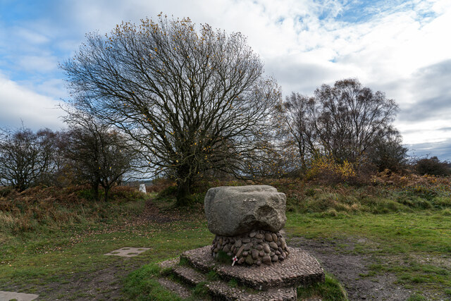
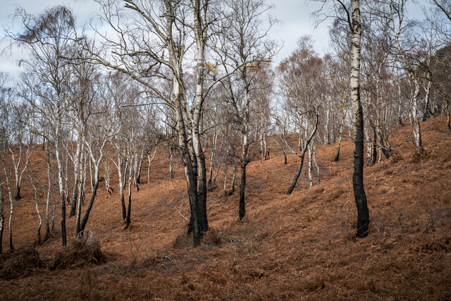
Brocton Coppice is a picturesque woodland located in Staffordshire, England. Covering an area of approximately 400 acres, it is a popular destination for nature lovers and outdoor enthusiasts. The coppice is situated near the village of Brocton, just south of Cannock Chase, which is designated as an Area of Outstanding Natural Beauty.

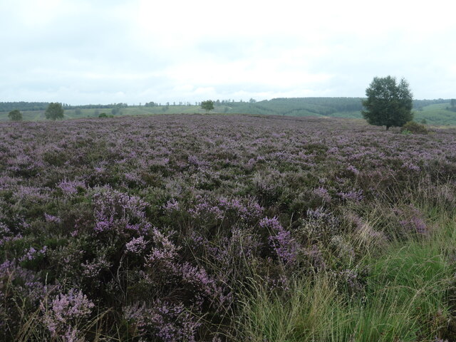
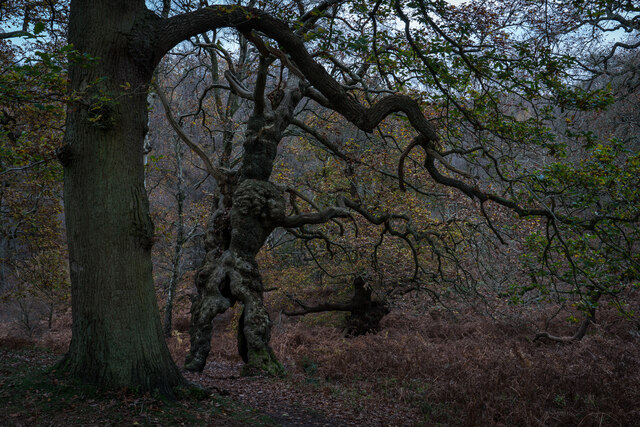
The woodland is predominantly composed of oak and birch trees, creating a diverse and vibrant ecosystem. It is home to a wide variety of wildlife, including deer, birds, and various species of insects. The rich vegetation provides an ideal habitat for these creatures, making it a haven for nature enthusiasts and photographers.

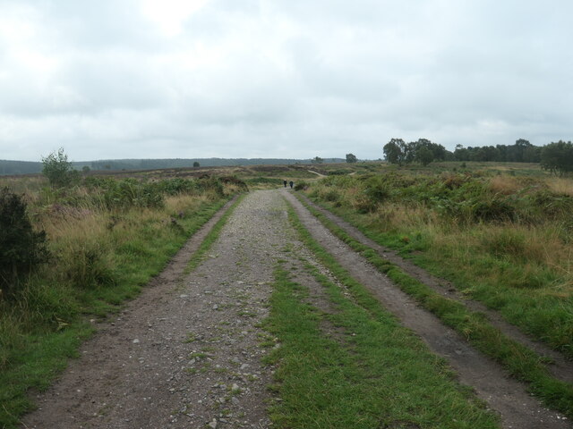
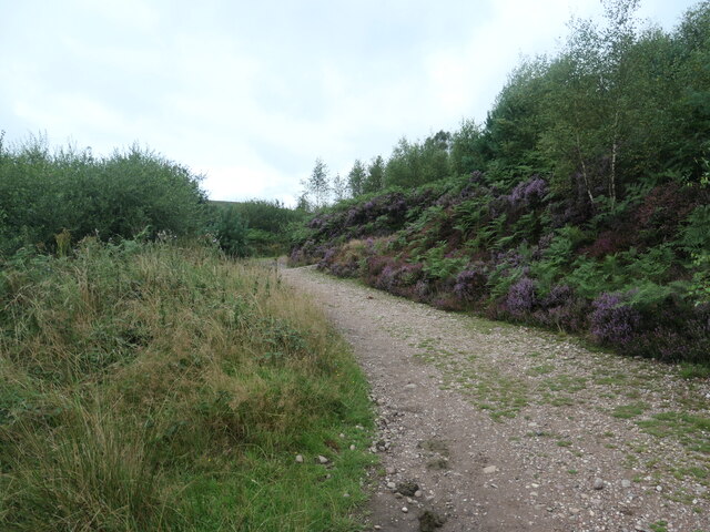
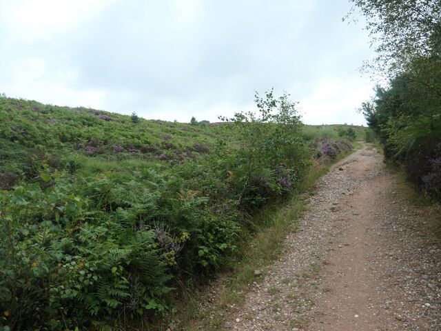
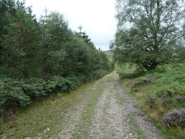
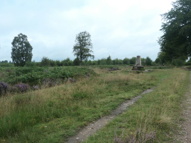
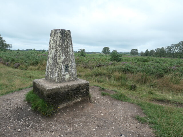
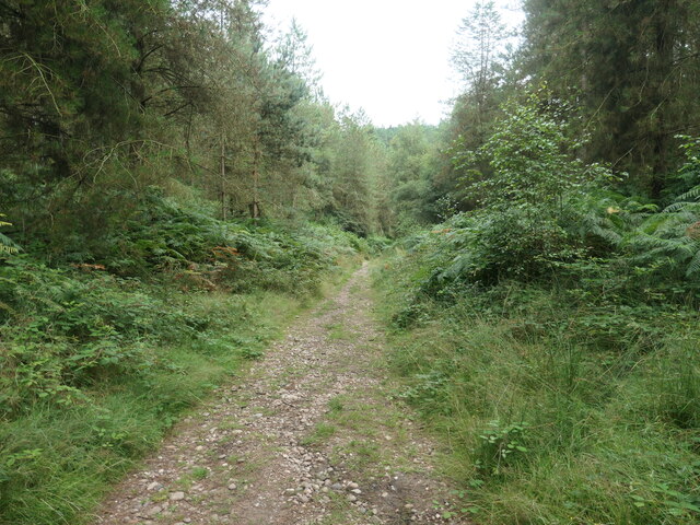
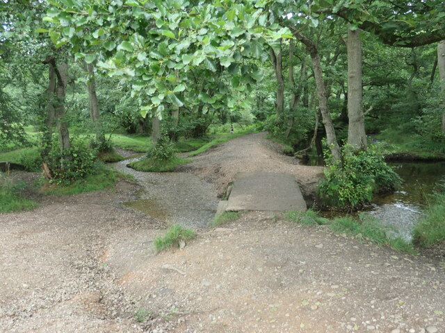
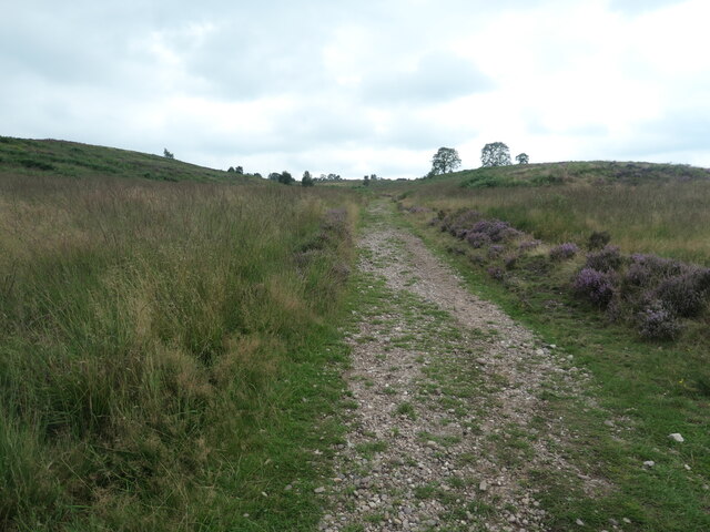
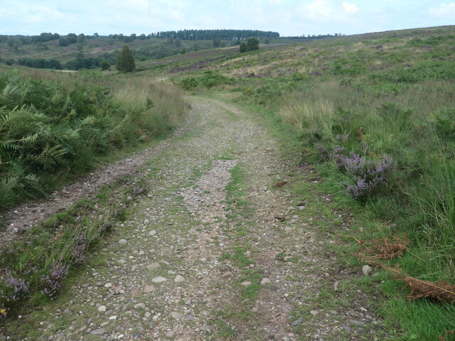
Brocton Coppice offers a range of activities for visitors. There are well-maintained walking trails throughout the woodland, allowing visitors to explore the area at their own pace. These paths provide stunning views of the surrounding landscape and are suitable for all levels of fitness.

In addition to walking, the woodland is also a popular destination for birdwatching and photography. The tranquil atmosphere and abundance of wildlife make it an ideal spot for capturing the beauty of nature on camera.

The woodland is easily accessible, with ample parking available for visitors. There are also picnic areas and benches scattered throughout the coppice, providing opportunities for relaxation and enjoying a packed lunch amidst the natural surroundings.

Overall, Brocton Coppice is a treasure trove of natural beauty, offering a peaceful retreat for those seeking solace in the great outdoors. Whether it's a leisurely walk, birdwatching, or simply taking in the serene atmosphere, this woodland is a must-visit destination for nature enthusiasts in Staffordshire.

If you have any feedback on the listing, please let us know in the comments section below.

Brocton Coppice Images

Images are sourced within 2km of 52.775569/-2.0240313 or Grid Reference SJ9819. Thanks to Geograph Open Source API. All images are credited.

The path towards Beggar's Hill
Sabrina Way Long Distance Route Post Marker This 203 mile route is primarily designed and intended for horses and horseback riders and links bridleways between the Pennines and the Cotswolds and The Ridgeway.

It runs north / south between Hartington in the Derbyshire Peak District and Great Barrington.

It passes from Derbyshire where it leaves the Pennine Bridleway (and bridleway networks that run north to Cumbria) through Staffordshire heading south through Weston Park and the Wyre Forest in Worcestershire to enter Gloucestershire, Wiltshire and Oxfordshire.
Sabrina Way Long Distance Route Post Marker
This 203 mile route is primarily designed and intended for horses and horseback riders and links bridleways between the Pennines and the Cotswolds and The Ridgeway. It runs north / south between Hartington in the Derbyshire Peak District and Great Barrington. It passes from Derbyshire where it leaves the Pennine Bridleway (and bridleway networks that run north to Cumbria) through Staffordshire heading south through Weston Park and the Wyre Forest in Worcestershire to enter Gloucestershire, Wiltshire and Oxfordshire.
Track at the foot of Haywood Warren This track runs from the Sherbrook Valley ford eastwards to Beggar's Hill and Seven Springs; it's a popular walking and running route, and is also used by many of the cyclists on the Chase.
Track at the foot of Haywood Warren
This track runs from the Sherbrook Valley ford eastwards to Beggar's Hill and Seven Springs; it's a popular walking and running route, and is also used by many of the cyclists on the Chase.
'Turn right along the track' The Heart of England Way at Brocton Field, Cannock Chase. The quote comes from Staffordshire County Council's 'Cannock Chase Circular Walk'.
'Turn right along the track'
The Heart of England Way at Brocton Field, Cannock Chase. The quote comes from Staffordshire County Council's 'Cannock Chase Circular Walk'.
Flowering heather, Cannock Chase The heathland west of Sher Brook.
Flowering heather, Cannock Chase
The heathland west of Sher Brook.
'The left-hand path around the edge of the pine plantation' On the east bank of Sher Brook. The quote comes from Staffordshire County Council's 'Cannock Chase Circular Walk'.
'The left-hand path around the edge of the pine plantation'
On the east bank of Sher Brook. The quote comes from Staffordshire County Council's 'Cannock Chase Circular Walk'.
'Walk straight on up the hill' Bridleway on the boundary of a pine plantation. The quote comes from Staffordshire County Council's 'Cannock Chase Circular Walk'.
'Walk straight on up the hill'
Bridleway on the boundary of a pine plantation. The quote comes from Staffordshire County Council's 'Cannock Chase Circular Walk'.
Bridleway on northern boundary of a pine plantation Looking west, towards the valley of Sher Brook.
Bridleway on northern boundary of a pine plantation
Looking west, towards the valley of Sher Brook.
'At the top of the hill you pass a white trig. point' 199 metres above sea level. The quote comes from Staffordshire County Council's 'Cannock Chase Circular Walk'.
'At the top of the hill you pass a white trig. point'
199 metres above sea level. The quote comes from Staffordshire County Council's 'Cannock Chase Circular Walk'.
Bracken and heather, above Sher Brook valley Looking northwest from the trig point.
Bracken and heather, above Sher Brook valley
Looking northwest from the trig point.
'Take the path opposite ... through the young pine plantation' The quote comes from Staffordshire County Council's 'Cannock Chase Circular Walk'.
'Take the path opposite ... through the young pine plantation'
The quote comes from Staffordshire County Council's 'Cannock Chase Circular Walk'.
Sher Brook, looking downstream [locally north] The brook is a civil parish boundary here, between Brocton and Rugeley.
Sher Brook, looking downstream [locally north]
The brook is a civil parish boundary here, between Brocton and Rugeley.
'Cross the footbridge over Sher Brook' A parish boundary on Cannock Chase. The quote comes from Staffordshire County Council's 'Cannock Chase Circular Walk'.
'Cross the footbridge over Sher Brook'
A parish boundary on Cannock Chase. The quote comes from Staffordshire County Council's 'Cannock Chase Circular Walk'.
'Ascend the hill following ... the Staffordshire Way' The western side of Sherbrook valley, Cannock Chase. The quote comes from Staffordshire County Council's 'Cannock Chase Circular Walk'.
'Ascend the hill following ... the Staffordshire Way'
The western side of Sherbrook valley, Cannock Chase. The quote comes from Staffordshire County Council's 'Cannock Chase Circular Walk'.
Staffordshire Way, Cannock Chase Descending Sherbrook Banks.
Staffordshire Way, Cannock Chase
Descending Sherbrook Banks.
Groot Tree, Brockton Coppice, Cannock Chase Old Oak Tree, maybe 500+ years old.
Groot Tree, Brockton Coppice, Cannock Chase
Old Oak Tree, maybe 500+ years old.
Glacial Boulder and Trigpoint, Cannock Chase Set upon a pedestal of Triassic pebbles, the boulder is of Granite which is out of place here on the Moorlands of South Staffordshire, there being no granite outcrops anywhere in the Midlands. The boulder has been matched however, to the intrusive rock outcrop at Cniffel in Dumfries & Galloway, which is over 170 miles (280km) away from the Chase in the Southern Uplands of Scotland. This granite 'erratic' is marked on the OS map as the "Glacial Boulder", which gives some idea how it got here. The boulder was ripped from its parent mountain sometime during the last Ice-Age, and was transported by glacial action to its present location, the journey perhaps taking ten-thousand years during which the edges of the rock were worn down, giving its present rounded appearance.
Glacial Boulder and Trigpoint, Cannock Chase
Set upon a pedestal of Triassic pebbles, the boulder is of Granite which is out of place here on the Moorlands of South Staffordshire, there being no granite outcrops anywhere in the Midlands. The boulder has been matched however, to the intrusive rock outcrop at Cniffel in Dumfries & Galloway, which is over 170 miles (280km) away from the Chase in the Southern Uplands of Scotland. This granite 'erratic' is marked on the OS map as the "Glacial Boulder", which gives some idea how it got here. The boulder was ripped from its parent mountain sometime during the last Ice-Age, and was transported by glacial action to its present location, the journey perhaps taking ten-thousand years during which the edges of the rock were worn down, giving its present rounded appearance.
Silver Burnt Trees, Cannock Chase Looks like there has been a fire early this year or last.
Silver Burnt Trees, Cannock Chase
Looks like there has been a fire early this year or last.
Show me another place!

Brocton Coppice is located at Grid Ref: SJ9819 (Lat: 52.775569, Lng: -2.0240313)

Administrative County: Staffordshire

District: Stafford

Police Authority: Staffordshire

What 3 Words

///sensitive.conceals.impressed. Near Colwich, Staffordshire

Nearby Locations

Brocton Coppice

Related Wikis

Brocton, Staffordshire

Brocton is a village and civil parish in the English county of Staffordshire. It is within the borough of Stafford. The village describes itself as the...

Milford, Staffordshire

Milford is a village in the county of Staffordshire, England. It lies at the edge of Cannock Chase, on the A513 road between Stafford and Rugeley. Just...

Shugborough Tunnel

The Shugborough Tunnel is a 777-yard (710 m) railway tunnel on the Trent Valley line running under part of the Shugborough Estate in Colwich, Staffordshire...

Milford and Brocton railway station

Milford and Brocton railway station served the villages of Milford and Brocton in Staffordshire, England from 1877 to 1950 on the Trent Valley line....

Milford Hall

Milford Hall is a privately owned 18th-century English country house at Milford, near Stafford. It is the family seat of the Levett Haszard family and...

Staffordshire County Museum

Staffordshire County Museum is housed in the Servants' Quarters of Shugborough Hall, Milford, near Stafford, Staffordshire, England. The museum features...

Little Haywood

Little Haywood is a village in Staffordshire, England. For population details as taken at the 2011 census see under Colwich. It lies beside a main arterial...

Colwich rail crash

The Colwich rail crash occurred on the evening of Friday 19 September 1986 at Colwich Junction, Staffordshire, England. It was significant in that it...

Nearby Amenities

Located within 500m of 52.775569,-2.0240313
Stepping Stones
Foot: yes
Ford: yes
Source Name: Sign posted on local paths
Lat/Long: 52.7779103/-2.0201406
Tourism: picnic_site
Lat/Long: 52.7765427/-2.0189072
Barrier: swing_gate
Material: wood
Lat/Long: 52.7791182/-2.0250196
Information: guidepost
Tourism: information
Lat/Long: 52.7778082/-2.0203434
Board Type: sight
Information: board
Tourism: information
Lat/Long: 52.7777095/-2.0203275
The data included in this document is from www.openstreetmap.org. The data is made available under ODbL.

Have you been to Brocton Coppice?

Leave your review of Brocton Coppice below (or comments, questions and feedback).