Hare Wood

Wood, Forest in Northumberland

England

Hare Wood

Woodhouses Bastle This bastle, located south-west of Holystone Grange, was built in the early 17th century. It is built of coarse stonework and measures 11.5m long by 7.5m wide. Inside is a vaulted basement, the entrance to which is carved with the date 1602. The basement was used to keep animals, but upstairs is the first floor living area. Here, there are a few small windows and two stone wall cupboards, a stone sink, and traces of an original fireplace. The bastle was increased in height in the 18th century when an attic was added and was restored and reroofed in 1904. This is a Scheduled Monument and Grade II* Listed Building protected by law.
<span class="nowrap"><a title="https://keystothepast.info/search-records/results-of-search/results-of-search-2/site-details/?PRN=N1192" rel="nofollow ugc noopener" href="https://keystothepast.info/search-records/results-of-search/results-of-search-2/site-details/?PRN=N1192">Link</a><img style="margin-left:2px;" alt="External link" title="External link - shift click to open in new window" src="https://s1.geograph.org.uk/img/external.png" width="10" height="10"/></span>
Woodhouses Bastle Credit: Les Hull

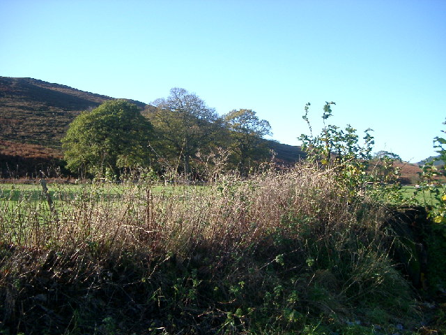
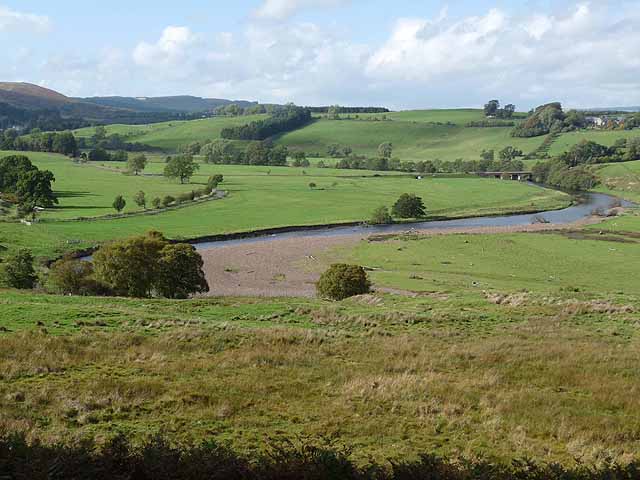
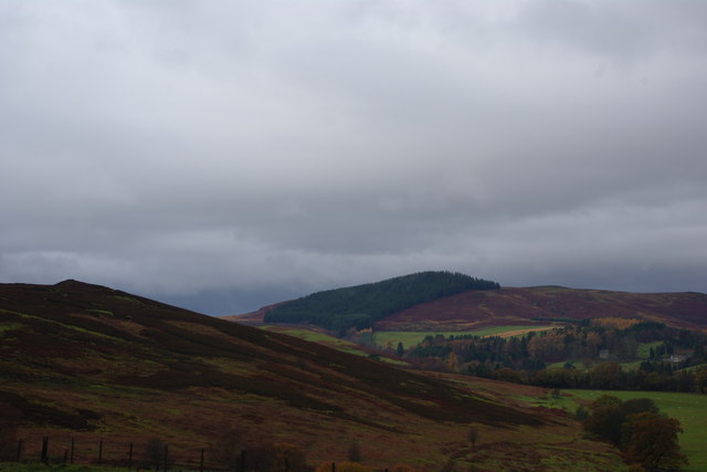
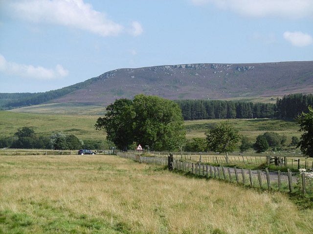
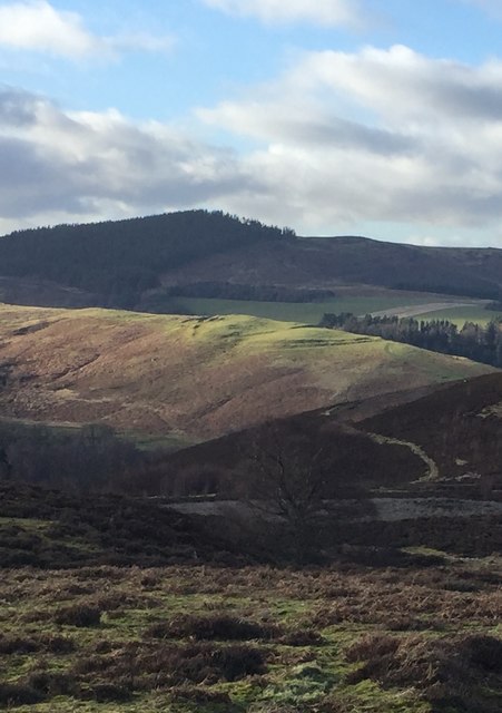
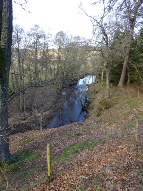
Hare Wood is a picturesque forest located in the county of Northumberland, England. Situated near the village of Harehope, this woodland is known for its natural beauty and diverse ecosystem. Spanning over an area of approximately 200 acres, Hare Wood is a remarkable destination for nature enthusiasts and outdoor adventurers.

The forest is predominantly composed of ancient broadleaf trees, including oak, beech, and ash, creating a lush and green environment. These trees form a dense canopy, providing shade and shelter for a wide range of wildlife. Hare Wood is home to various species of birds, such as woodpeckers, owls, and thrushes, which can be spotted and heard throughout the forest.

The forest floor is covered in a thick layer of moss, ferns, and wildflowers, adding to the enchanting atmosphere of Hare Wood. As visitors explore the woodland, they may come across babbling streams and small ponds, enhancing the tranquility of the surroundings.

For those who enjoy walking or hiking, Hare Wood offers a network of well-maintained trails that wind through the forest. These paths cater to different levels of difficulty, ensuring there is something suitable for everyone. The forest also has designated picnic areas, allowing visitors to enjoy a relaxing meal amidst the natural surroundings.

Hare Wood is not only a haven for nature lovers but also a valuable habitat for various species. The forest is carefully managed to maintain its ecological balance, ensuring the long-term preservation of this remarkable woodland in Northumberland.

If you have any feedback on the listing, please let us know in the comments section below.

Hare Wood Images

Images are sourced within 2km of 55.307774/-2.0418903 or Grid Reference NT9701. Thanks to Geograph Open Source API. All images are credited.

Woodhouses Bastle This bastle, located south-west of Holystone Grange, was built in the early 17th century. It is built of coarse stonework and measures 11.5m long by 7.5m wide. Inside is a vaulted basement, the entrance to which is carved with the date 1602. The basement was used to keep animals, but upstairs is the first floor living area. Here, there are a few small windows and two stone wall cupboards, a stone sink, and traces of an original fireplace. The bastle was increased in height in the 18th century when an attic was added and was restored and reroofed in 1904. This is a Scheduled Monument and Grade II* Listed Building protected by law.
<span class="nowrap"><a title="https://keystothepast.info/search-records/results-of-search/results-of-search-2/site-details/?PRN=N1192" rel="nofollow ugc noopener" href="https://keystothepast.info/search-records/results-of-search/results-of-search-2/site-details/?PRN=N1192">Link</a><img style="margin-left:2px;" alt="External link" title="External link - shift click to open in new window" src="https://s1.geograph.org.uk/img/external.png" width="10" height="10"/></span>
Woodhouses Bastle
This bastle, located south-west of Holystone Grange, was built in the early 17th century. It is built of coarse stonework and measures 11.5m long by 7.5m wide. Inside is a vaulted basement, the entrance to which is carved with the date 1602. The basement was used to keep animals, but upstairs is the first floor living area. Here, there are a few small windows and two stone wall cupboards, a stone sink, and traces of an original fireplace. The bastle was increased in height in the 18th century when an attic was added and was restored and reroofed in 1904. This is a Scheduled Monument and Grade II* Listed Building protected by law. LinkExternal link
Storm Arwen Damage at Dry Burn Wood
Near Hepple, under Swindon Hill On the other side of the River Coquet from Hepple.
Near Hepple, under Swindon Hill
On the other side of the River Coquet from Hepple.
River Coquet, near Hepple, and view of the Northumbrian hills
River Coquet The River Coquet near Hepple.
River Coquet
The River Coquet near Hepple.
Hawthorn Blossom Hawthorn tree in blossom next to Grasslees Burn near Swindon.
Hawthorn Blossom
Hawthorn tree in blossom next to Grasslees Burn near Swindon.
River Coquet Looking upstream with Hepple Bridge <a href="https://www.geograph.org.uk/gridref/NT9800">NT9800</a> in the middle distance.
River Coquet
Looking upstream with Hepple Bridge NT9800 in the middle distance.
View towards the Beacon
B6341, Hepple A view towards Tosson Hill.
B6341, Hepple
A view towards Tosson Hill.
The road to Rothbury
Cottage at Swindon The Northumberland Swindon seems to consist of just three dwellings and a named hill. A little disappointing for this contributor, a native of that other Swindon, who was expecting at least a road sign and maybe a board saying 'Welcome to Swindon'. Of course there are at least two other Swindons, one being a few miles west of Dudley and the other on the northern fringe of Cheltenham.
Cottage at Swindon
The Northumberland Swindon seems to consist of just three dwellings and a named hill. A little disappointing for this contributor, a native of that other Swindon, who was expecting at least a road sign and maybe a board saying 'Welcome to Swindon'. Of course there are at least two other Swindons, one being a few miles west of Dudley and the other on the northern fringe of Cheltenham.
From one hill fort to another The hill fort near Harehaugh Hill seen from Witchy Nick hill fort.  Both are scheduled monuments.

<span class="nowrap"><a title="https://historicengland.org.uk/listing/the-list/list-entry/1011397" rel="nofollow ugc noopener" href="https://historicengland.org.uk/listing/the-list/list-entry/1011397">Link</a><img style="margin-left:2px;" alt="External link" title="External link - shift click to open in new window" src="https://s1.geograph.org.uk/img/external.png" width="10" height="10"/></span>
From one hill fort to another
The hill fort near Harehaugh Hill seen from Witchy Nick hill fort. Both are scheduled monuments. LinkExternal link
Direction Sign – Signpost Located on the south side of a T junction on the B6341 on Swindon Hill in Hepple parish. 2 arms, 1 missing, and lost finial. 

Milestone Society National ID: NB_NY9899
Direction Sign – Signpost
Located on the south side of a T junction on the B6341 on Swindon Hill in Hepple parish. 2 arms, 1 missing, and lost finial. Milestone Society National ID: NB_NY9899
River Coquet below Hareshaugh Hill
Cattle in field near Hareshaugh Farm
Grasslees Burn  Just before it joins the River Coquet.
Grasslees Burn
Just before it joins the River Coquet.
Lane beneath Harehaugh Hill
Show me another place!

Hare Wood is located at Grid Ref: NT9701 (Lat: 55.307774, Lng: -2.0418903)

Unitary Authority: Northumberland

Police Authority: Northumbria

What 3 Words

///fraction.resembles.basket. Near Rothbury, Northumberland

Nearby Locations

Geordie's Wood Hare Wood

Related Wikis

Hepple

Hepple is a small village and parish in rural Northumberland, 4 miles (6.4 km) west of Rothbury, which provides most of its local services. It is on the...

Holystone, Northumberland

Holystone is a small village and former civil parish, now in the parish of Harbottle, in Northumberland, England. It lies on the edge of (and just within...

Sharperton

Sharperton is a small settlement and former civil parish, now in the parish of Harbottle, in Northumberland, England. Sharperton is the site of a deserted...

Reivers Way

The Reivers Way is a long-distance footpath in Northumberland, passing through the Northumberland National Park and the Cheviot Hills. Totalling 242 kilometres...

High Cove

High Cove is a major slip feature to the west of Grasslees Burn in the Simonside Hills, Northumberland, England. It contains several small rifts and caves...
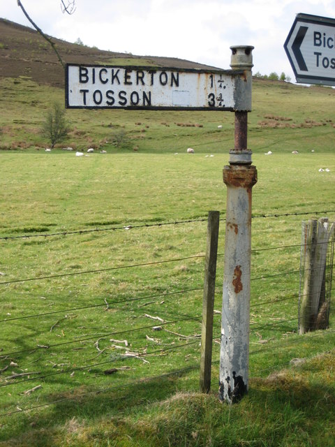
Tosson Hill

Tosson Hill is the highest hill in the Simonside Hills to the south of Rothbury in Northumberland, England. The summit lies about 2 kilometres (1.2 mi...

Harbottle

Harbottle is a village and civil parish in Northumberland, England about 10 miles (16 km) south-east of the Scottish border, in the southeastern part of...

Burradon, Northumberland

Burradon is a village and former civil parish, now in the parish of Netherton, in Northumberland, England. It is about 14 miles (23 km) to the south-west...

Nearby Amenities

Located within 500m of 55.307774,-2.0418903
Barrier: cattle_grid
Lat/Long: 55.3115321/-2.0377214
The data included in this document is from www.openstreetmap.org. The data is made available under ODbL.

Have you been to Hare Wood?

Leave your review of Hare Wood below (or comments, questions and feedback).