Crow Wood

Wood, Forest in Northumberland

England

Crow Wood

Trig point at Burradon Mains At 235m with a flush bracket number S7920.
With former tip used as a manure 'depot' in the background.
Looking over the Foxton Burn valley.
Storm Arwen took down adjacent trees.
Trig point at Burradon Mains Credit: Russel Wills

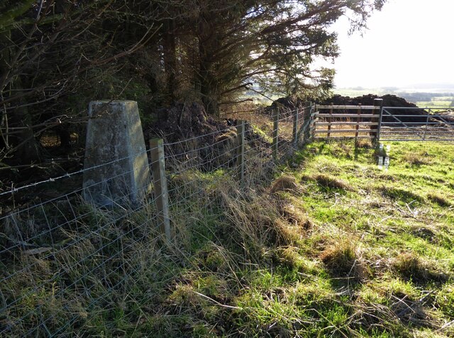
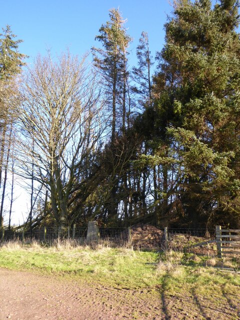
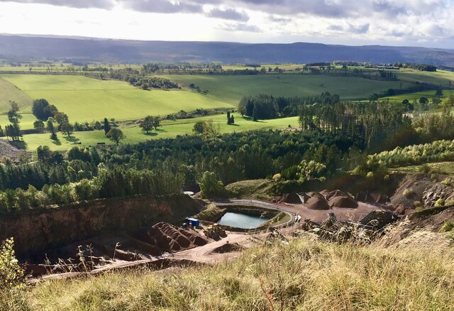
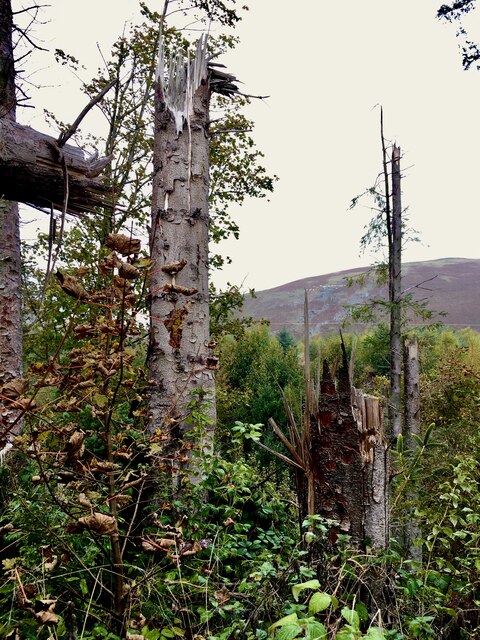
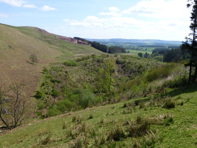
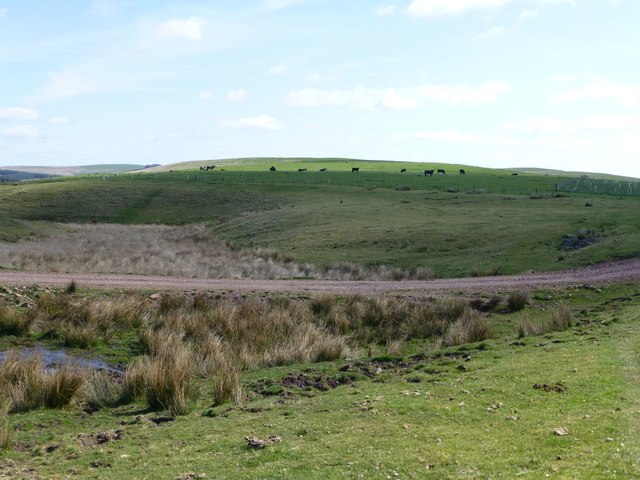
Crow Wood is a picturesque woodland located in the county of Northumberland, England. Spanning over an area of approximately 100 acres, it is a popular destination for nature enthusiasts and adventure seekers alike. The wood is characterized by its dense canopy of trees, predominantly consisting of oak, beech, and birch. This creates a diverse ecosystem that supports a wide range of flora and fauna.

The wood is known for its tranquil atmosphere, making it an ideal spot for leisurely walks and peaceful picnics. Its well-maintained footpaths crisscross through the woodland, guiding visitors through its enchanting beauty. The forest floor is covered with a rich carpet of mosses, ferns, and wildflowers, adding to the serene ambiance.

Crow Wood is also home to a variety of wildlife, providing a sanctuary for numerous species. Birdwatchers can spot a multitude of bird species, including woodpeckers, owls, and various songbirds. The wood also supports a healthy population of mammals, such as foxes, rabbits, and deer.

Aside from its natural beauty, Crow Wood is also steeped in history. It is believed to have been part of the ancient hunting grounds of the nearby Alnwick Castle. There are remnants of ancient structures and earthworks within the wood, adding an intriguing element to its charm.

In conclusion, Crow Wood in Northumberland is a stunning woodland that offers visitors a chance to immerse themselves in nature's splendor. With its varied wildlife, well-maintained footpaths, and rich history, it is a must-visit destination for anyone seeking a peaceful and idyllic natural retreat.

If you have any feedback on the listing, please let us know in the comments section below.

Crow Wood Images

Images are sourced within 2km of 55.362027/-2.0463806 or Grid Reference NT9707. Thanks to Geograph Open Source API. All images are credited.

Trig point at Burradon Mains At 235m with a flush bracket number S7920.
With former tip used as a manure 'depot' in the background.
Looking over the Foxton Burn valley.
Storm Arwen took down adjacent trees.
Trig point at Burradon Mains
At 235m with a flush bracket number S7920. With former tip used as a manure 'depot' in the background. Looking over the Foxton Burn valley. Storm Arwen took down adjacent trees.
Burradon Mains trig point Threatened by windfall from Storm Arwen.
Burradon Mains trig point
Threatened by windfall from Storm Arwen.
A peek into Harden Quarry The source of red roadstone.  'Harden Red' is a red volcanic felsite.  It is used for cycleways, bus lanes and, famously, for surfacing The Mall.
A peek into Harden Quarry
The source of red roadstone. 'Harden Red' is a red volcanic felsite. It is used for cycleways, bus lanes and, famously, for surfacing The Mall.
"Ill blows the wind that profits nobody" Massive piles of logs like these are scattered all over Northumberland.  Harvesting the forest has often been the only practical way of clearing up after Storm Arwen blew in from the north.  A year on and there are still many areas left to clear.
"Ill blows the wind that profits nobody"
Massive piles of logs like these are scattered all over Northumberland. Harvesting the forest has often been the only practical way of clearing up after Storm Arwen blew in from the north. A year on and there are still many areas left to clear.
The violence of Storm Arwen One can't help but be impressed by the ferocity of a wind that can snap mature tree trunks like a child snaps twigs.
The violence of Storm Arwen
One can't help but be impressed by the ferocity of a wind that can snap mature tree trunks like a child snaps twigs.
Netherton Road to Thropton
Netherton
Road to Thropton
Netherton Road to Alwinton
Netherton
Road to Alwinton
Ridge and furrowed field, Netherton
Southern slopes of Cold Law Harden Quarry on the left.
Southern slopes of Cold Law
Harden Quarry on the left.
Biddlestone RC Chapel 'Biddlestone stands on the southern slopes of the Cheviot Hills within Northumberland National Park. Biddlestone was a private chapel adjoining Biddlestone Hall, the demolished home of the Selby family. 
The chapel was built was over the remains of a mediaeval pele tower, that almost certainly dates  from the late 14th century. Mediaeval rubblestone survives to eaves height on the north side and there is a thick-walled, barrel-vaulted undercroft below.'
<span class="nowrap"><a title="http://www.hct.org.uk/chapels/north-east/biddlestone-rc-chapel/9" rel="nofollow ugc noopener" href="http://www.hct.org.uk/chapels/north-east/biddlestone-rc-chapel/9">Link</a><img style="margin-left:2px;" alt="External link" title="External link - shift click to open in new window" src="https://s1.geograph.org.uk/img/external.png" width="10" height="10"/></span>
Biddlestone RC Chapel
'Biddlestone stands on the southern slopes of the Cheviot Hills within Northumberland National Park. Biddlestone was a private chapel adjoining Biddlestone Hall, the demolished home of the Selby family. The chapel was built was over the remains of a mediaeval pele tower, that almost certainly dates from the late 14th century. Mediaeval rubblestone survives to eaves height on the north side and there is a thick-walled, barrel-vaulted undercroft below.' LinkExternal link
Looking down on Biddlestone Town Foot From the track to Singmoor.
Looking down on Biddlestone Town Foot
From the track to Singmoor.
Public bridleway To Singmoor 1 mile and Puncherton 3 miles.
Public bridleway
To Singmoor 1 mile and Puncherton 3 miles.
The track to Singmoor crosses a boggy marsh Cattle grazing on Bleakmoor Hill.
The track to Singmoor crosses a boggy marsh
Cattle grazing on Bleakmoor Hill.
Spring cereal, pasture and woodland With a bird scarer to keep birds off the cereal.
Spring cereal, pasture and woodland
With a bird scarer to keep birds off the cereal.
Grassland above Elilaw With Netherton in the centre.
Grassland above Elilaw
With Netherton in the centre.
Sheep country! Looking across Harden Hill.
The trees are below Cold Law.
Sheep country!
Looking across Harden Hill. The trees are below Cold Law.
Wall and fence beside grassland With rough pasture higher on Harden Hill.
Wall and fence beside grassland
With rough pasture higher on Harden Hill.
Dusty refuse collection vehicle On a rural road.
Scrabby Wood on the left.
Dusty refuse collection vehicle
On a rural road. Scrabby Wood on the left.
Show me another place!

Crow Wood is located at Grid Ref: NT9707 (Lat: 55.362027, Lng: -2.0463806)

Unitary Authority: Northumberland

Police Authority: Northumbria

What 3 Words

///stems.dissolves.poet. Near Rothbury, Northumberland

Related Wikis

Biddlestone

Biddlestone is a village and civil parish in Northumberland, England. It is about 14 miles (23 km) to the west of Alnwick. In the early 21st Century several...

Netherton, Northumberland

Netherton is a village and civil parish in the English county of Northumberland. The population of the village at the 2011 census was 185.Located 6+1⁄2...

Burradon, Northumberland

Burradon is a village and former civil parish, now in the parish of Netherton, in Northumberland, England. It is about 14 miles (23 km) to the south-west...
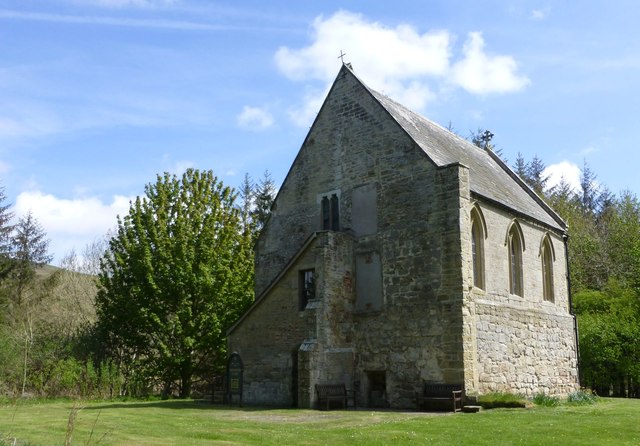
Biddlestone Chapel

Biddlestone Chapel is a redundant Roman Catholic chapel in Biddlestone, Northumberland, England. It is recorded in the National Heritage List for England...

Biddlestone Hall

Biddlestone Hall was a large country house at Biddlestone in Northumberland. == History == The Georgian style mansion was built for the Selby family about...

Milbourne, Northumberland

Milbourne is a village and former civil parish 14 miles (23 km) from Morpeth, now in the parish of Ponteland, in the county of Northumberland, England...

Scrainwood

Scrainwood is a hamlet and former civil parish 20 miles (32 km) from Morpeth, now in the parish of Alnham, in the county of Northumberland, England. In...

Church of St Michael, Alnham

The Church of St Michael in Alnham, in the English county of Northumberland, is a medieval structure dating from circa 1200. Built on a Roman camp site...

Have you been to Crow Wood?

Leave your review of Crow Wood below (or comments, questions and feedback).