Bromley Wood

Wood, Forest in Staffordshire Staffordshire Moorlands

England

Bromley Wood

Hall Lane Approaching <a href="https://www.geograph.org.uk/photo/459470">SJ9535 : Manor House, Hilderstone</a>. The wood on the right is named "New Forest" but is fairly modest in size.
Hall Lane Credit: Derek Harper

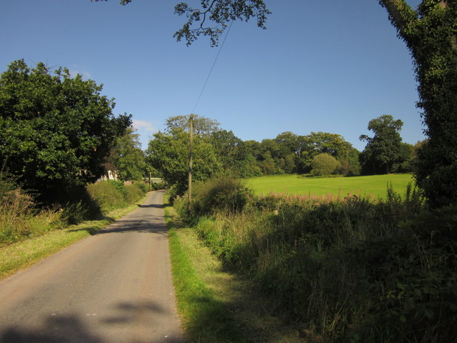
Bromley Wood is a small woodland area located in Staffordshire, England. Covering an approximate area of 50 acres, it is situated near the village of Bromley, about 5 miles southeast of the town of Rugeley. The wood is nestled within the picturesque countryside, offering a tranquil and serene environment for visitors to enjoy.

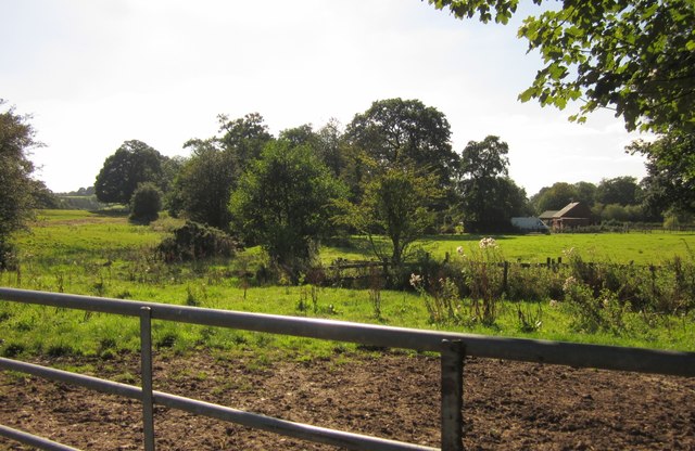
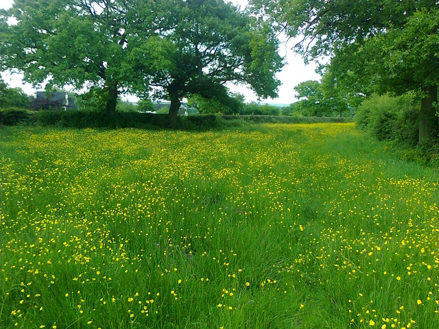
This woodland is predominantly composed of native broadleaf trees, including oak, ash, and beech, creating a diverse and rich ecosystem. The dense canopy of the trees provides a habitat for various wildlife species such as birds, squirrels, and deer. Moreover, the forest floor is home to a wide range of plants, including bluebells, foxgloves, and wild garlic, which add to the natural beauty of the area.

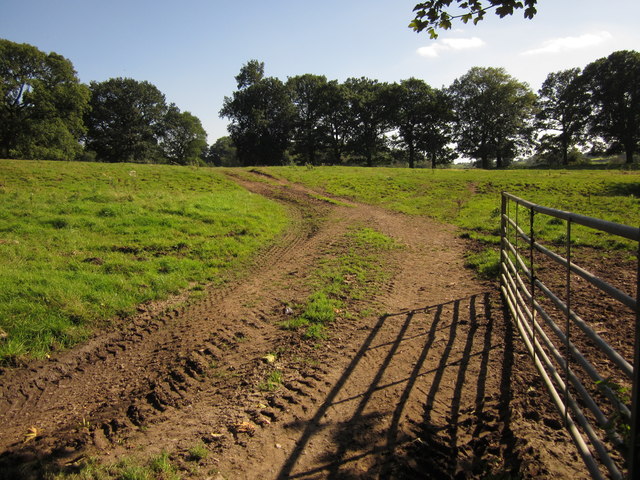
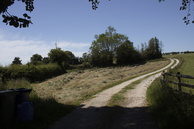
Bromley Wood is a popular destination for nature enthusiasts, hikers, and dog walkers. Several footpaths and trails are available throughout the wood, allowing visitors to explore the area and immerse themselves in nature. Additionally, there are picnic areas and benches scattered around the woodland, providing ample opportunities for relaxation and enjoying the peaceful surroundings.

The wood is well-maintained by local authorities, ensuring the preservation of its natural beauty. It is also actively managed to prevent the spread of invasive species and maintain a healthy ecosystem.

Overall, Bromley Wood in Staffordshire offers a charming and idyllic woodland experience, providing a haven for wildlife and a place of tranquility for visitors to enjoy nature at its finest.

If you have any feedback on the listing, please let us know in the comments section below.
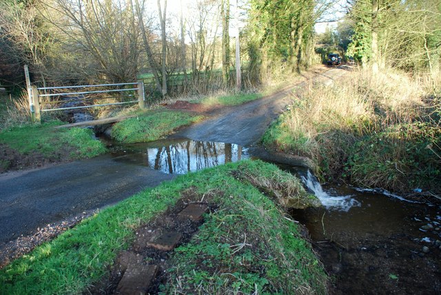
Bromley Wood Images

Images are sourced within 2km of 52.920805/-2.0441615 or Grid Reference SJ9735. Thanks to Geograph Open Source API. All images are credited.

Hall Lane Approaching <a href="https://www.geograph.org.uk/photo/459470">SJ9535 : Manor House, Hilderstone</a>. The wood on the right is named "New Forest" but is fairly modest in size.
Hall Lane
Approaching SJ9535 : Manor House, Hilderstone. The wood on the right is named "New Forest" but is fairly modest in size.
Field by Hall Lane An open gate into a pasture by the lane shown in <a href="https://www.geograph.org.uk/photo/3126295">SJ9535 : Hall Lane</a>. The trees ahead form an avenue across the park of Hilderstone Hall.
Field by Hall Lane
An open gate into a pasture by the lane shown in SJ9535 : Hall Lane. The trees ahead form an avenue across the park of Hilderstone Hall.
Towards Brook Farm Looking to the right from the same spot as <a href="https://www.geograph.org.uk/photo/3126311">SJ9534 : Field by Hall Lane</a>, looking across a small stream and pasture fields.
Towards Brook Farm
Looking to the right from the same spot as SJ9534 : Field by Hall Lane, looking across a small stream and pasture fields.
Morrilow Heath. Buttercup-filled meadow A long thin field..
Morrilow Heath. Buttercup-filled meadow
A long thin field..
View north from Morrilow Heath 10 minutes later these cattle nearly killed the photographer
View north from Morrilow Heath
10 minutes later these cattle nearly killed the photographer
Farm track with broken culvert, approaching Paynsley
Garshall Green Ford This ford on Wheatlow Brook is found beside Brookhouse Farm at Garshall Green.
Garshall Green Ford
This ford on Wheatlow Brook is found beside Brookhouse Farm at Garshall Green.
Development at the old Bird in Hand A new brick skin seems to have been added to what little remains of the old pub. The ultimate intention is to create 6 mews cottages.
Development at the old Bird in Hand
A new brick skin seems to have been added to what little remains of the old pub. The ultimate intention is to create 6 mews cottages.
Track to New Buildings farm Looking westward.
Track to New Buildings farm
Looking westward.
Old Milepost by Cresswell Road, Hilderstone parish Cast iron post by the UC road, in parish of HILDERSTONE (STAFFORD District), South of Bird Grove, on grass, on Southeast side of road. Lathe iron casting, erected by the County Council in the 19th/20th century. 

Inscription reads:-
: HILDERSTONE 1 / SANDON 4½ / STAFFORD 9 : : HILDERSTONE : : CHEADLE 7½ :
Maker:-
: Chas. Lathe, Tipton. :

Staffordshire HER.
HER Number: 53358 <span class="nowrap"><a title="https://www.heritagegateway.org.uk/Gateway/Results_Single.aspx?uid=MST17124&resourceID=1010" rel="nofollow ugc noopener" href="https://www.heritagegateway.org.uk/Gateway/Results_Single.aspx?uid=MST17124&resourceID=1010">Link</a><img style="margin-left:2px;" alt="External link" title="External link - shift click to open in new window" src="https://s1.geograph.org.uk/img/external.png" width="10" height="10"/></span>

Milestone Society National ID: ST_STCD09.
Old Milepost by Cresswell Road, Hilderstone parish
Cast iron post by the UC road, in parish of HILDERSTONE (STAFFORD District), South of Bird Grove, on grass, on Southeast side of road. Lathe iron casting, erected by the County Council in the 19th/20th century. Inscription reads:- : HILDERSTONE 1 / SANDON 4½ / STAFFORD 9 : : HILDERSTONE : : CHEADLE 7½ : Maker:- : Chas. Lathe, Tipton. : Staffordshire HER. HER Number: 53358 LinkExternal link Milestone Society National ID: ST_STCD09.
Knowle Farm track Hay field at Knowle Farm
Knowle Farm track
Hay field at Knowle Farm
Road heading north-west to Stone Heath Part of a network of minor roads in Milwich parish.
Road heading north-west to Stone Heath
Part of a network of minor roads in Milwich parish.
Hedged field boundary, north of Milwich Heath Farm Much of the farmland in this part of Staffordshire is grass, hedgerows and trees.
Hedged field boundary, north of Milwich Heath Farm
Much of the farmland in this part of Staffordshire is grass, hedgerows and trees.
Farmland west of Sprink Brook About 195 metres above sea level.
Farmland west of Sprink Brook
About 195 metres above sea level.
Sheep in a field, north of Milwich Heath Farm On the horizon is Sprink House Farm.
Sheep in a field, north of Milwich Heath Farm
On the horizon is Sprink House Farm.
Beware cattle when coming from Stone Heath Probably at Grove Farm, just beyond the next crossroads.
Beware cattle when coming from Stone Heath
Probably at Grove Farm, just beyond the next crossroads.
Road passing Heath Holding Farm Here part of the Stone Circles Challenge, a 33 mile circular walk around Stone.
Road passing Heath Holding Farm
Here part of the Stone Circles Challenge, a 33 mile circular walk around Stone.
Field edge track, north of Highpark Providing access to several fields near Brockholes Well.
Field edge track, north of Highpark
Providing access to several fields near Brockholes Well.
Show me another place!

Bromley Wood is located at Grid Ref: SJ9735 (Lat: 52.920805, Lng: -2.0441615)

Administrative County: Staffordshire

District: Staffordshire Moorlands

Police Authority: Staffordshire

What 3 Words

///funded.exporters.scores. Near Stone, Staffordshire

Nearby Locations

Bromley Wood Stone Heath

Related Wikis

Hilderstone

Hilderstone is a village and a civil parish in the English county of Staffordshire. == Location == The village is 8.6 miles (13.8 km) north of the town...

Fulford, Staffordshire

Fulford is a village and civil parish about 5 miles (8 km) north east of Stone, in the Stafford district, in the county of Staffordshire, England. The...

Cresswell railway station

Cresswell railway station was a railway station located on the Stoke-Derby line at Cresswell, Staffordshire, England. It was opened by the North Staffordshire...

Cresswell, Staffordshire

Cresswell is a hamlet in Staffordshire, England. It is approximately one mile SE of Blythe Bridge and has a population of approximately 300. From the 2011...

Milwich

Milwich is a village and a civil parish in the English county of Staffordshire. == Location == The village is 7.8 miles (12.6 km) north east of the town...

Coton Hill, Staffordshire

Coton Hill is a hamlet in the English county of Staffordshire. Coton Hill is located east of the village of Milwich on the B5027 road between Stone and...

Draycott in the Moors

Draycott in the Moors is a village in Staffordshire, England. It is between Stoke on Trent and Uttoxeter near the River Blythe. It is two and a half miles...

Leigh railway station (Staffordshire)

Leigh railway station was a railway station in Staffordshire, England. The railway line between Stoke-on-Trent and Uttoxeter was opened by the North Staffordshire...

Have you been to Bromley Wood?

Leave your review of Bromley Wood below (or comments, questions and feedback).