Crostwick

Settlement in Norfolk Broadland

England

Crostwick

OS Benchmark Recorded on Benchmark Database as 'Spixworth, St Peter's Church'.
OS Benchmark Credit: David Bremner

Crostwick is a small village located in the county of Norfolk, England. Situated approximately 7 miles northeast of the city of Norwich, it falls within the Broadland district. Crostwick is a picturesque village characterized by its rural charm and tranquil atmosphere.

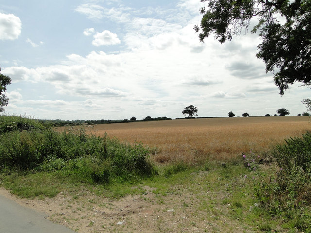
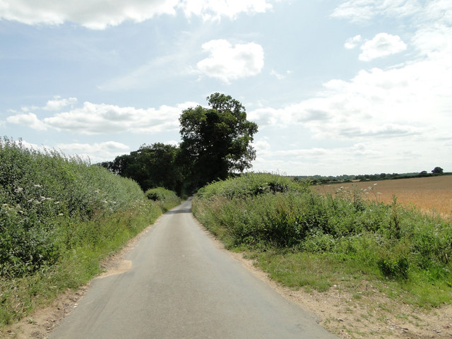
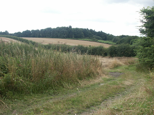
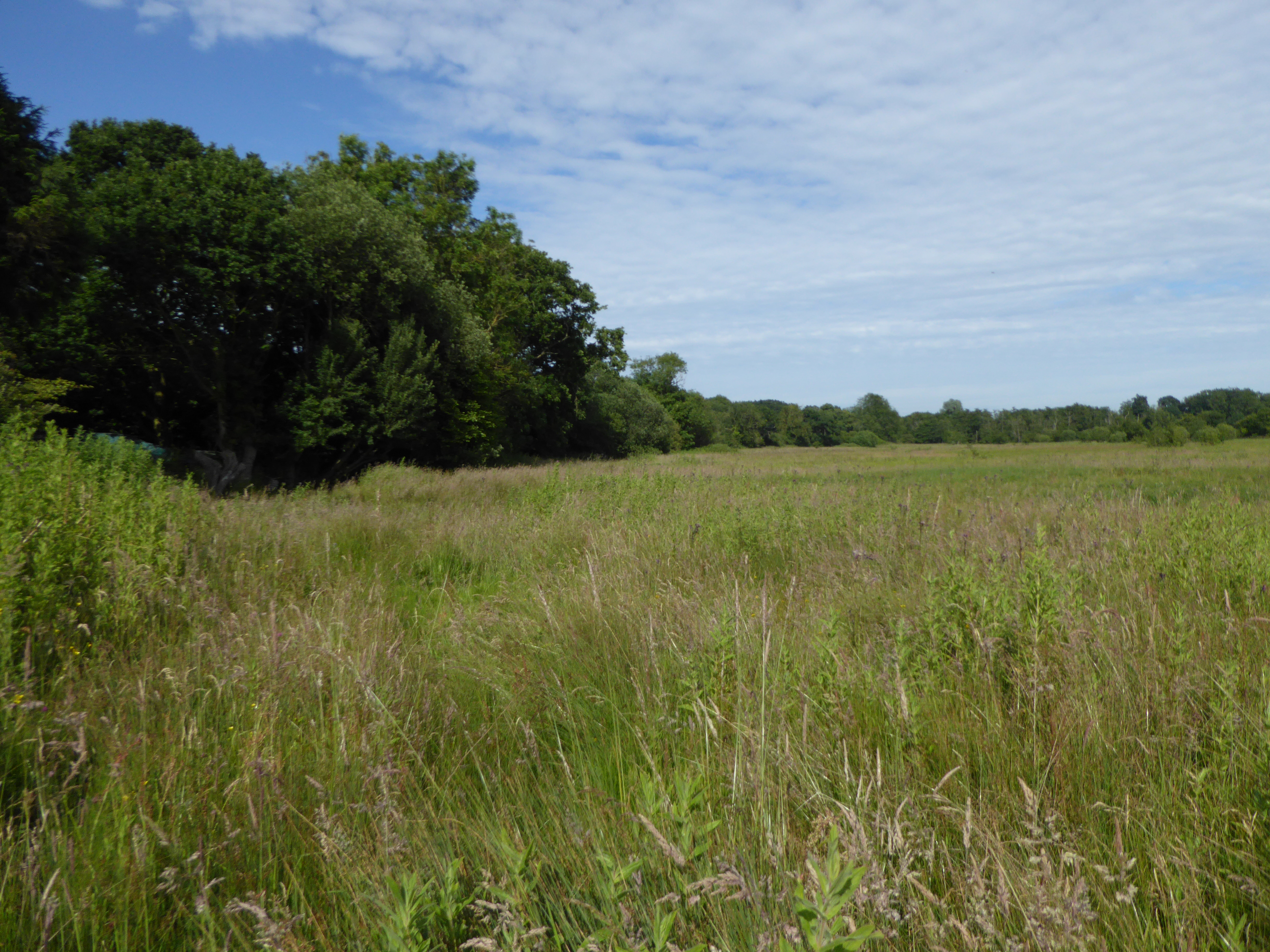
The village is surrounded by beautiful countryside, offering residents and visitors alike the opportunity to enjoy scenic walks and explore the natural surroundings. The nearby Coltishall Common, a local nature reserve, provides a haven for wildlife enthusiasts and bird watchers. Additionally, the village is bordered by the River Bure, making it an ideal location for boating and fishing enthusiasts.

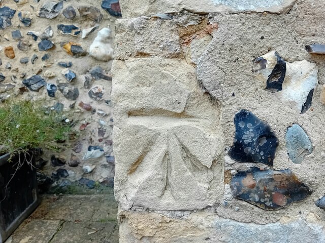
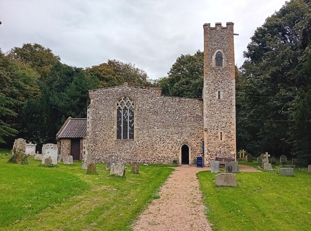
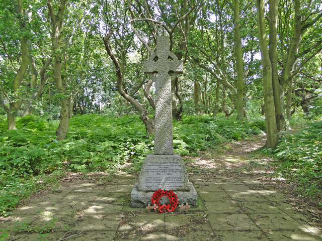
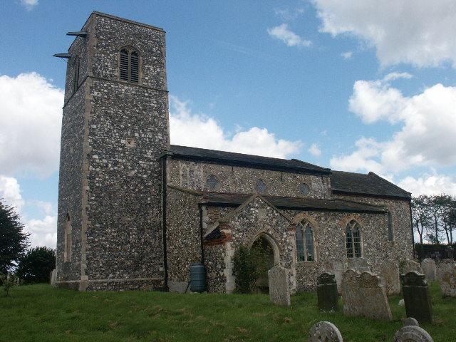
Crostwick has a rich history, with archaeological evidence suggesting human habitation in the area dating back to the Roman period. Today, remnants of the village's past can be seen in the form of historic buildings and landmarks, including St. Peter's Church, which dates back to the 12th century.

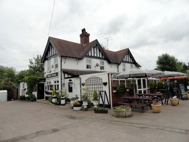
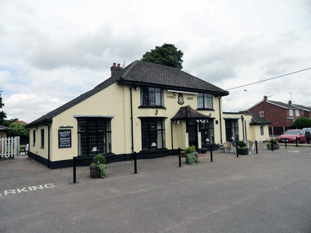
Despite its small size, Crostwick boasts a close-knit community and offers a range of amenities for its residents. These include a village hall, a local pub, and a primary school, providing a convenient and fulfilling lifestyle for its inhabitants. For further amenities and services, the city of Norwich is easily accessible, offering a wider range of shopping, dining, and cultural experiences.

Overall, Crostwick offers a peaceful and idyllic setting, making it a desirable place to live for those seeking a quieter rural lifestyle while still being within close proximity to larger towns and cities.

If you have any feedback on the listing, please let us know in the comments section below.

Crostwick Images

Images are sourced within 2km of 52.697186/1.33965 or Grid Reference TG2516. Thanks to Geograph Open Source API. All images are credited.

OS Benchmark Recorded on Benchmark Database as 'Spixworth, St Peter's Church'.
OS Benchmark
Recorded on Benchmark Database as 'Spixworth, St Peter's Church'.
St Peter's, Spixworth An attractive church which we were delighted to find open.
St Peter's, Spixworth
An attractive church which we were delighted to find open.
Flowers, St Peter's Church Attractive floral display at St Peter's Church, Spixworth.
Flowers, St Peter's Church
Attractive floral display at St Peter's Church, Spixworth.
The White Horse Crostwick Public House on the North Walsham Road
The White Horse Crostwick
Public House on the North Walsham Road
The Longe Arms Spixworth Located on the junction of Buxton Road and Crostwick Lane. It nearly closed at the end of 2010 when the lease was due to run out. Two villagers decided to take it over rather than see it close.
The Longe Arms Spixworth
Located on the junction of Buxton Road and Crostwick Lane. It nearly closed at the end of 2010 when the lease was due to run out. Two villagers decided to take it over rather than see it close.
Layby on the B1150 near Hills and Holes Farm
Converted windmill at Frettenham Frettenham tower mill was a 47 foot, five storey tarred brick mill that was built c.1870, and was one of the last tower mills to be built in Norfolk.
The mill is a private residence.
Converted windmill at Frettenham
Frettenham tower mill was a 47 foot, five storey tarred brick mill that was built c.1870, and was one of the last tower mills to be built in Norfolk. The mill is a private residence.
This is supposed to be a drain. Totally choked! It's no wonder all the roads locally have signs 'Liable to Flooding'.
This is supposed to be a drain. Totally choked!
It's no wonder all the roads locally have signs 'Liable to Flooding'.
Hump-back bridge near Old Hall Farm, Crostwick
Barley field on gently sloping land at Crostwick
Primrose Lane near Primrose Hole, Crostwick
Burntwood Lane with Burnt Wood on the left
Granny Bard's Lane, Crostwick
Crostwick War Memorial The Memorial stands beside the North Walsham road and is almost hidden from view.
It bears the names of six men lost in WW1 and of two lost in WW2.
Crostwick War Memorial
The Memorial stands beside the North Walsham road and is almost hidden from view. It bears the names of six men lost in WW1 and of two lost in WW2.
Frettenham towermill Taken early one morning looking across the field to the back of the mill. An old grubbed out hedgeline can clearly be seen. The mill ceased working during the first quarter of the 1900s and became derelict. A new cap was fitted during the 1990s, which has done much to help its preservation.
Frettenham towermill
Taken early one morning looking across the field to the back of the mill. An old grubbed out hedgeline can clearly be seen. The mill ceased working during the first quarter of the 1900s and became derelict. A new cap was fitted during the 1990s, which has done much to help its preservation.
Church Wood, Rackheath Seen from the end of the lane by the church.
Church Wood, Rackheath
Seen from the end of the lane by the church.
All Saints Church, Rackheath Now redundant. It is the resting place of members of the Stracey family, of nearby Rackheath Hall, and contains a memorial to Sir John Pettus (1550-1614) MP and Mayor of Norwich (1608).
All Saints Church, Rackheath
Now redundant. It is the resting place of members of the Stracey family, of nearby Rackheath Hall, and contains a memorial to Sir John Pettus (1550-1614) MP and Mayor of Norwich (1608).
Footpath and fields, Rackheath A footpath to the church running through a harvested rape seed field.
Footpath and fields, Rackheath
A footpath to the church running through a harvested rape seed field.
Show me another place!

Crostwick is located at Grid Ref: TG2516 (Lat: 52.697186, Lng: 1.33965)

Administrative County: Norfolk

District: Broadland

Police Authority: Norfolk

What 3 Words

///hourglass.pushes.replied. Near Spixworth, Norfolk

Related Wikis

Crostwick

Crostwick is a village in the English county of Norfolk. The village is part of the civil parish of Horstead with Stanninghall. Crostwick is located 2...
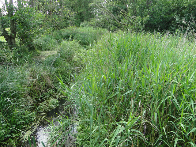
Crostwick Marsh

Crostwick Marsh is an 11.6-hectare (29-acre) biological Site of Special Scientific Interest in Crostwick, north of Norwich in Norfolk. It is part of the...

Hillside Animal Sanctuary

Hillside Animal Sanctuary, based in Frettenham, Norwich, and with a site at West Runton, North Norfolk, is the United Kingdom's largest home for different...

Spixworth

Spixworth is a village and civil parish in the English county of Norfolk. The village lies close to the B1150 road and is 5 miles (8.0 km) north of Norwich...

Frettenham

Frettenham is a village and civil parish in the English county of Norfolk. It is located 3.2 miles (5.1 km) west of Wroxham, and 5.7 miles (9.2 km) north...
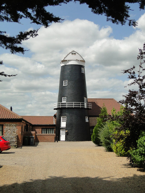
Frettenham Windmill

Frettenham Mill is a Grade II listed tower mill at Frettenham, Norfolk, England which has been converted to residential accommodation. == History == Frettenham...

Beeston St Andrew

Beeston St Andrew is a civil parish north of Norwich in the Broadland district of Norfolk, England. It contains Beeston Park and according to the 2001...

River Hor

The River Hor is a short river in the county of Norfolk, England. It runs 13.3 kilometres (8.3 mi) east from its source near Felthorpe to its confluence...

Nearby Amenities

Located within 500m of 52.697186,1.33965
Crostwick
Place: village
Source: NPE
Lat/Long: 52.6953661/1.3409531
Hall Lane, opp
Naptan AtcoCode: 2900C361
Naptan Bearing: SW
Naptan BusStopType: CUS
Naptan CommonName: Hall Lane
Naptan Indicator: opp
Naptan Landmark: White Horse
Naptan Locality: Crostwick
Naptan NaptanCode: nfoamajw
Naptan Street: North Walsham Road
Naptan Verified: no
Source: naptan_import
Lat/Long: 52.6995138/1.3424708
Hall Lane, adj
Naptan AtcoCode: 2900C363
Naptan Bearing: NE
Naptan BusStopType: CUS
Naptan CommonName: Hall Lane
Naptan Indicator: adj
Naptan Landmark: opp White Horse
Naptan Locality: Crostwick
Naptan NaptanCode: nfoamamd
Naptan Street: North Walsham Road
Naptan Verified: no
Source: naptan_import
Lat/Long: 52.6993606/1.342163
Post Box
Post Box Mounting: telegraph_pole
Post Box Type: lamp
Lat/Long: 52.6979331/1.3407608
Telephone
Booth: K6
Covered: booth
Lat/Long: 52.6979136/1.3408198
Historic: memorial
Memorial: war_memorial
Lat/Long: 52.6946545/1.3380128
Fixme: incomplete
Lat/Long: 52.6932126/1.3383105
Entrance: main
Lat/Long: 52.6934988/1.3396518
Charging Station
Fee: yes
Motorcar: yes
Opening Hours: 24/7
Operator: BP Pulse
Ref: 24710
Lat/Long: 52.6940895/1.3373017
The data included in this document is from www.openstreetmap.org. The data is made available under ODbL.

Have you been to Crostwick?

Leave your review of Crostwick below (or comments, questions and feedback).