Long Plantation

Wood, Forest in Worcestershire Wychavon

England

Long Plantation

Bredon Hill crest path, 13 Gradual descent south-east towards Ashton.
The distinctive outline of Dumbleton/Alderton Hill can be seen clearly as well as the Cotswold crest beyond.
This picture represents the completion of Hectad SO93 by the photographer, ie. a Geograph in every one of the 100 squares.
Bredon Hill crest path, 13 Credit: Jonathan Billinger

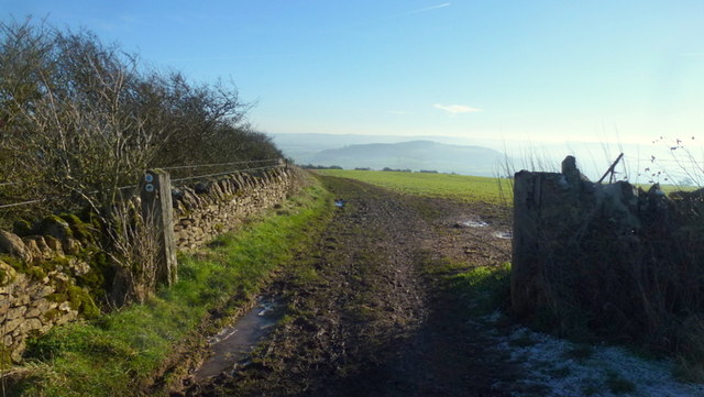
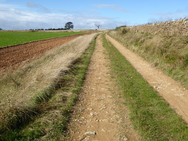
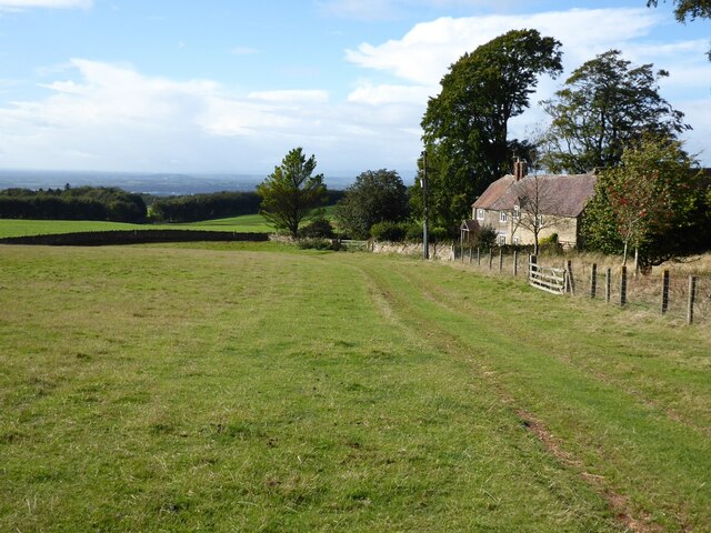
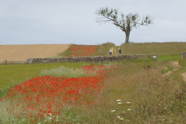
Long Plantation is a picturesque woodland located in Worcestershire, a county in the West Midlands region of England. Spanning over a vast area, this plantation is known for its dense forest and beautiful woodlands, making it a popular destination for nature enthusiasts and walkers alike.

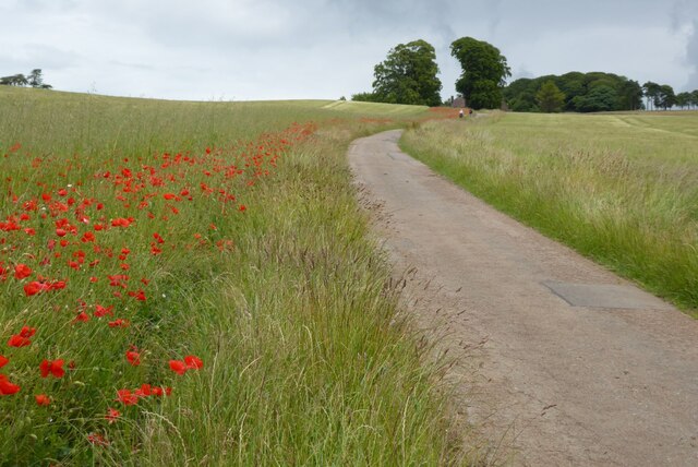
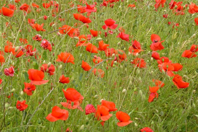
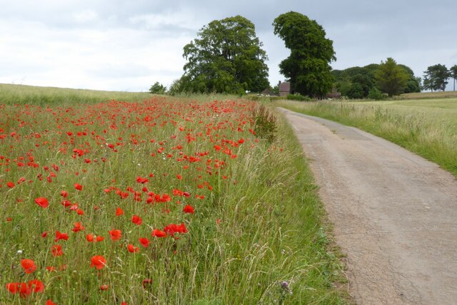
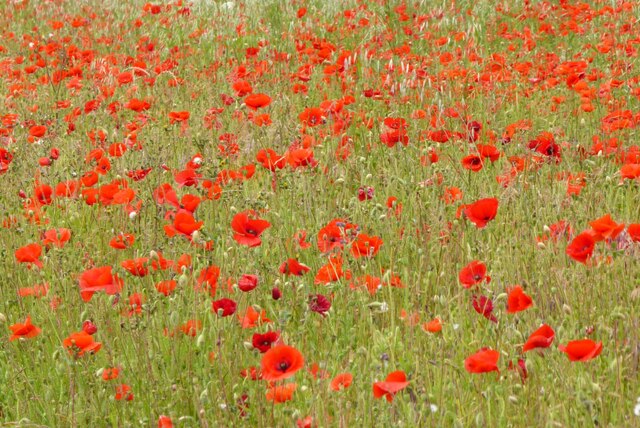
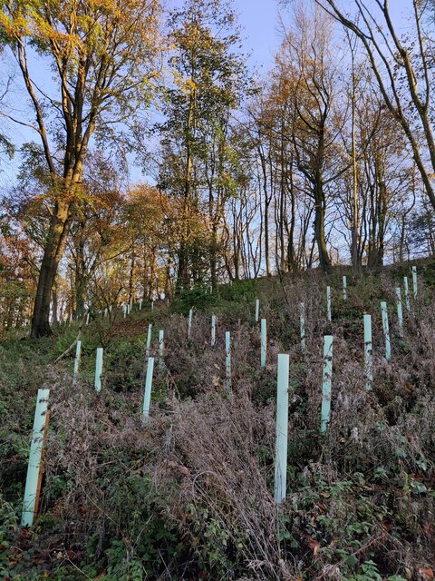
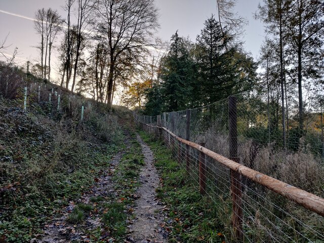
The woodland is named after its elongated shape, stretching for several miles along the outskirts of the charming village of Long. It is characterized by a rich variety of tree species, including oak, beech, birch, and pine, which create a diverse and vibrant ecosystem. The forest floor is adorned with an array of wildflowers, ferns, and mosses, further enhancing the natural beauty of the plantation.

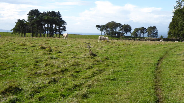
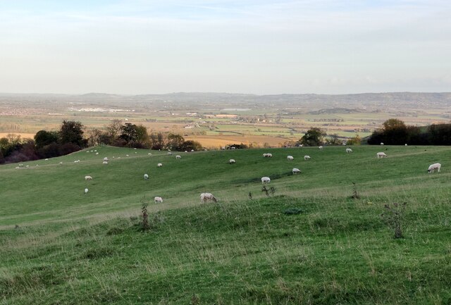
Long Plantation offers an abundance of wildlife, providing a habitat for numerous species. Visitors may spot deer, foxes, rabbits, and a wide variety of birdlife, including woodpeckers, owls, and thrushes. The woodland also features several streams and small ponds, attracting amphibians and insects.

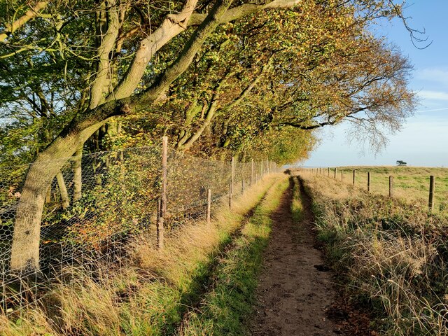
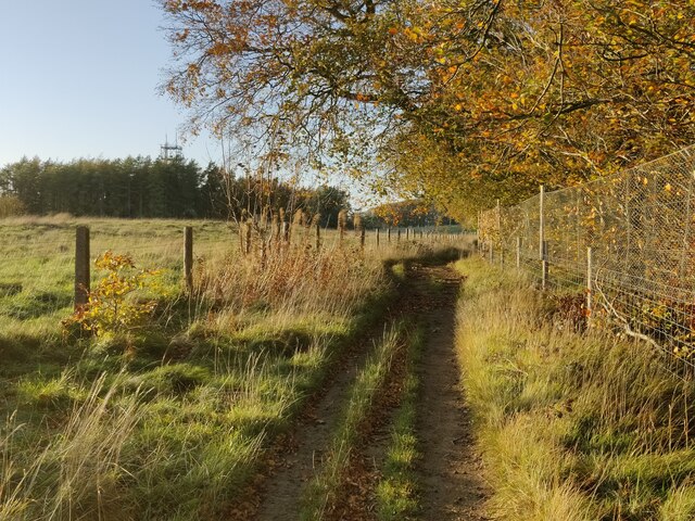
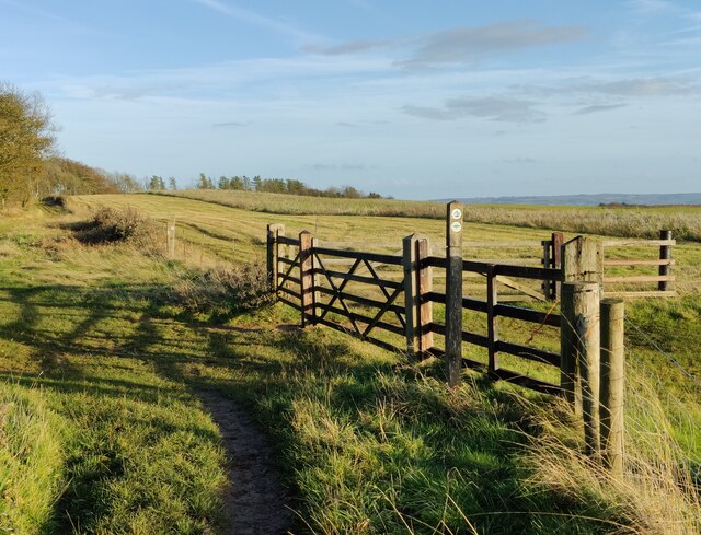
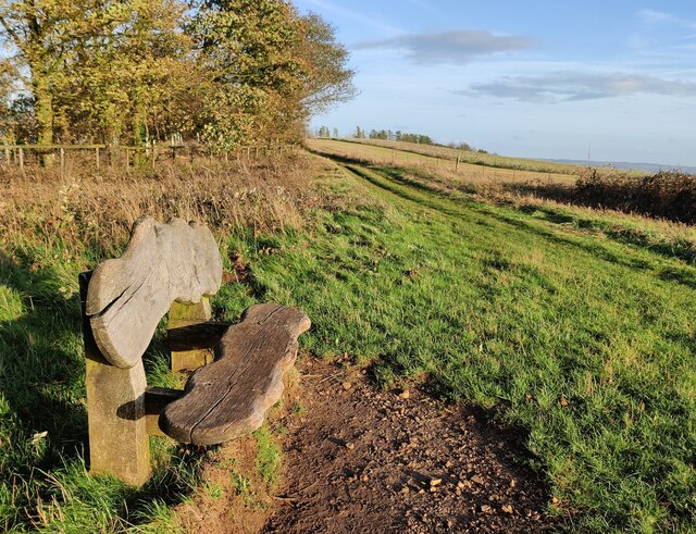
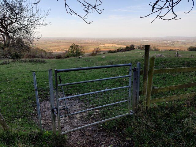
Throughout the year, Long Plantation is a popular destination for outdoor activities such as hiking, cycling, and picnicking. Numerous footpaths and trails meander through the woodland, offering visitors the opportunity to explore its hidden corners and discover its beauty. The plantation is well-maintained, with designated picnic areas and benches scattered throughout, providing a peaceful and tranquil setting for visitors to relax and enjoy the natural surroundings.

Long Plantation is a true haven for nature lovers, providing a serene escape from the hustle and bustle of daily life. Its breathtaking woodlands, diverse wildlife, and well-marked trails make it a must-visit destination for anyone seeking to immerse themselves in the natural beauty of Worcestershire.

If you have any feedback on the listing, please let us know in the comments section below.

Long Plantation Images

Images are sourced within 2km of 52.056772/-2.0439411 or Grid Reference SO9739. Thanks to Geograph Open Source API. All images are credited.

Bredon Hill crest path, 13 Gradual descent south-east towards Ashton.
The distinctive outline of Dumbleton/Alderton Hill can be seen clearly as well as the Cotswold crest beyond.
This picture represents the completion of Hectad SO93 by the photographer, ie. a Geograph in every one of the 100 squares.
Bredon Hill crest path, 13
Gradual descent south-east towards Ashton. The distinctive outline of Dumbleton/Alderton Hill can be seen clearly as well as the Cotswold crest beyond. This picture represents the completion of Hectad SO93 by the photographer, ie. a Geograph in every one of the 100 squares.
Track on Bredon Hill Track and permissive path near Lalu Farm on Bredon Hill.
Track on Bredon Hill
Track and permissive path near Lalu Farm on Bredon Hill.
Sheep and trees on Bredon Hill The trees in the background are in clump giving the impression it has been planted as an estate parkland.
Sheep and trees on Bredon Hill
The trees in the background are in clump giving the impression it has been planted as an estate parkland.
Bridleway passing Lalu Farm Bridleway passing Lalu Farm on Bredon Hill with Gloucestershire and the Severn vale in the distance.
Bridleway passing Lalu Farm
Bridleway passing Lalu Farm on Bredon Hill with Gloucestershire and the Severn vale in the distance.
Drive to Lalu Farm Poppies beside the drive on Bredon Hill leading to Lalu Farm.
Drive to Lalu Farm
Poppies beside the drive on Bredon Hill leading to Lalu Farm.
Poppies on Bredon Hill Poppies on Bredon Hill near Lalu Farm.
Poppies on Bredon Hill
Poppies on Bredon Hill near Lalu Farm.
Drive to Lalu Farm Poppies in the field headland beside the drive to Lalu Farm on Bredon Hill.
Drive to Lalu Farm
Poppies in the field headland beside the drive to Lalu Farm on Bredon Hill.
Poppies on Bredon Hill Poppies on Bredon Hill near Lalu Farm.
Poppies on Bredon Hill
Poppies on Bredon Hill near Lalu Farm.
Walkers on Bredon Hill Poppies in a field headland beside a track on Bredon Hill.  Walkers on the track are heading for Parsons Folly and summit of Bredon Hill.
Walkers on Bredon Hill
Poppies in a field headland beside a track on Bredon Hill. Walkers on the track are heading for Parsons Folly and summit of Bredon Hill.
Telecommunications mast on Bredon Hill Bredon Hill, 299 m (981 ft), is in South Worcestershire, it is geologically part of the Cotswolds but stands isolated in the Vale of Evesham.
There is a small stone tower on the summit called Parsons Folly, along with the remains of an Iron Age hill fort known as Kemerton Camp, abandoned in the 1st century AD.
Telecommunications mast on Bredon Hill
Bredon Hill, 299 m (981 ft), is in South Worcestershire, it is geologically part of the Cotswolds but stands isolated in the Vale of Evesham. There is a small stone tower on the summit called Parsons Folly, along with the remains of an Iron Age hill fort known as Kemerton Camp, abandoned in the 1st century AD.
Wychavon Way at Long Plantation on Bredon Hill The Wychavon Way begins in the Worcestershire town of Droitwich Spa and ends in the Cotswold village of Broadway. The trail is about 40 miles (64 km) in length and was created in 1977 to celebrate the Queen's Silver Jubilee.
Wychavon Way at Long Plantation on Bredon Hill
The Wychavon Way begins in the Worcestershire town of Droitwich Spa and ends in the Cotswold village of Broadway. The trail is about 40 miles (64 km) in length and was created in 1977 to celebrate the Queen's Silver Jubilee.
Wychavon Way on Bredon Hill The Wychavon Way begins in the Worcestershire town of Droitwich Spa and ends in the Cotswold village of Broadway. The trail is about 40 miles (64 km) in length and was created in 1977 to celebrate the Queen's Silver Jubilee.
Wychavon Way on Bredon Hill
The Wychavon Way begins in the Worcestershire town of Droitwich Spa and ends in the Cotswold village of Broadway. The trail is about 40 miles (64 km) in length and was created in 1977 to celebrate the Queen's Silver Jubilee.
Seat along the Wychavon Way on Bredon Hill Bredon Hill, 299 m (981 ft), is in South Worcestershire, it is geologically part of the Cotswolds but stands isolated in the Vale of Evesham.
There is a small stone tower on the summit called Parsons Folly, along with the remains of an Iron Age hill fort known as Kemerton Camp, abandoned in the 1st century AD.
Seat along the Wychavon Way on Bredon Hill
Bredon Hill, 299 m (981 ft), is in South Worcestershire, it is geologically part of the Cotswolds but stands isolated in the Vale of Evesham. There is a small stone tower on the summit called Parsons Folly, along with the remains of an Iron Age hill fort known as Kemerton Camp, abandoned in the 1st century AD.
Long Plantation on Bredon Hill Bredon Hill, 299 m (981 ft), is in South Worcestershire, it is geologically part of the Cotswolds but stands isolated in the Vale of Evesham.
There is a small stone tower on the summit called Parsons Folly, along with the remains of an Iron Age hill fort known as Kemerton Camp, abandoned in the 1st century AD.
Long Plantation on Bredon Hill
Bredon Hill, 299 m (981 ft), is in South Worcestershire, it is geologically part of the Cotswolds but stands isolated in the Vale of Evesham. There is a small stone tower on the summit called Parsons Folly, along with the remains of an Iron Age hill fort known as Kemerton Camp, abandoned in the 1st century AD.
Bridleway in Long Plantation on Bredon Hill Bredon Hill, 299 m (981 ft), is in South Worcestershire, it is geologically part of the Cotswolds but stands isolated in the Vale of Evesham.
There is a small stone tower on the summit called Parsons Folly, along with the remains of an Iron Age hill fort known as Kemerton Camp, abandoned in the 1st century AD.
Bridleway in Long Plantation on Bredon Hill
Bredon Hill, 299 m (981 ft), is in South Worcestershire, it is geologically part of the Cotswolds but stands isolated in the Vale of Evesham. There is a small stone tower on the summit called Parsons Folly, along with the remains of an Iron Age hill fort known as Kemerton Camp, abandoned in the 1st century AD.
Gate along a bridleway on Bredon Hill Bredon Hill, 299 m (981 ft), is in South Worcestershire, it is geologically part of the Cotswolds but stands isolated in the Vale of Evesham.
There is a small stone tower on the summit called Parsons Folly, along with the remains of an Iron Age hill fort known as Kemerton Camp, abandoned in the 1st century AD.
Gate along a bridleway on Bredon Hill
Bredon Hill, 299 m (981 ft), is in South Worcestershire, it is geologically part of the Cotswolds but stands isolated in the Vale of Evesham. There is a small stone tower on the summit called Parsons Folly, along with the remains of an Iron Age hill fort known as Kemerton Camp, abandoned in the 1st century AD.
Sheep at Fiddler's Knap on Bredon Hill Bredon Hill, 299 m (981 ft), is in South Worcestershire, it is geologically part of the Cotswolds but stands isolated in the Vale of Evesham.
There is a small stone tower on the summit called Parsons Folly, along with the remains of an Iron Age hill fort known as Kemerton Camp, abandoned in the 1st century AD.
Sheep at Fiddler's Knap on Bredon Hill
Bredon Hill, 299 m (981 ft), is in South Worcestershire, it is geologically part of the Cotswolds but stands isolated in the Vale of Evesham. There is a small stone tower on the summit called Parsons Folly, along with the remains of an Iron Age hill fort known as Kemerton Camp, abandoned in the 1st century AD.
Show me another place!

Long Plantation is located at Grid Ref: SO9739 (Lat: 52.056772, Lng: -2.0439411)

Administrative County: Worcestershire

District: Wychavon

Police Authority: West Mercia

What 3 Words

///speaker.baker.costumes. Near Eckington, Worcestershire

Nearby Locations

Long Plantation

Related Wikis

Elmley Castle (castle)

Elmley Castle was a late 11th-century earthwork and timber castle which received stone additions in the 12th and possibly 13th centuries, located 0.5 miles...

Bredon Hill

Bredon Hill is a hill in Worcestershire, England, south-west of Evesham in the Vale of Evesham. The summit of the hill is in the parish of Kemerton, and...

Bredon Hill Hoard

The Bredon Hill Hoard (also known as the Bredon Hill Roman Coin Hoard) is a hoard of 3,784 debased silver Roman coins discovered in June 2011 by two metal...

Elmley Castle

Elmley Castle is a village and civil parish in Worcestershire, in England, United Kingdom. It is located on the north side of Bredon Hill 3 miles south...

Kersoe

Kersoe is a hamlet in Worcestershire, England. It is at the foot of Bredon Hill an area of outstanding natural beauty.

Overbury

Overbury is a village and civil parish in Worcestershire, England, midway between Evesham and Tewkesbury south of Bredon Hill. The manor of Overbury was...

Netherton, Worcestershire

Netherton is a hamlet with population of 50 living in 20 households. It is part of the civil parish of Elmley Castle, Bricklehampton & Netherton in...

Overbury Court

Overbury Court is a Georgian style country house in Overbury, Worcestershire, England. It is a privately owned Grade II* listed building. It is built in...

Nearby Amenities

Located within 500m of 52.056772,-2.0439411
Man Made: tower
Source: Bing;local_knowledge
Tower Type: communication
Lat/Long: 52.0553932/-2.0464587
Bench
Source: survey
Lat/Long: 52.0541654/-2.0391253
GPO Radio Station
Location Transition: yes
Power: pole
Transformer: distribution
Voltage Primary: 11000
Lat/Long: 52.0557463/-2.0467629
Power: pole
Lat/Long: 52.0601245/-2.0401948
Long Plantation
Power: pole
Transformer: distribution
Voltage Primary: 11000
Lat/Long: 52.0594092/-2.0406555
The data included in this document is from www.openstreetmap.org. The data is made available under ODbL.

Have you been to Long Plantation?

Leave your review of Long Plantation below (or comments, questions and feedback).