Deerpen Thorns

Wood, Forest in Worcestershire Wychavon

England

Deerpen Thorns

Dovecote by Pumphouse Farm Early 17th century dovecote, Listed Grade II. Difficult to get a clear view over the hedge from the public road. There is no convenient public footpath here.
Dovecote by Pumphouse Farm Credit: Chris Allen

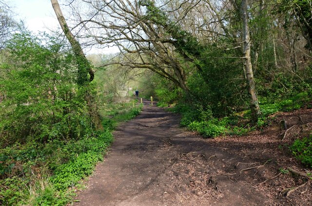
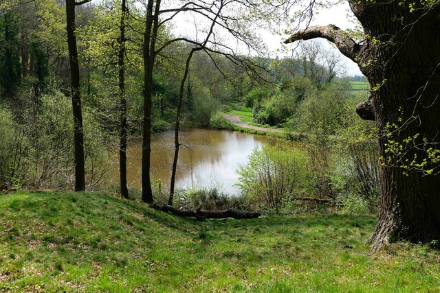
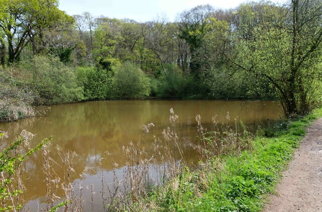
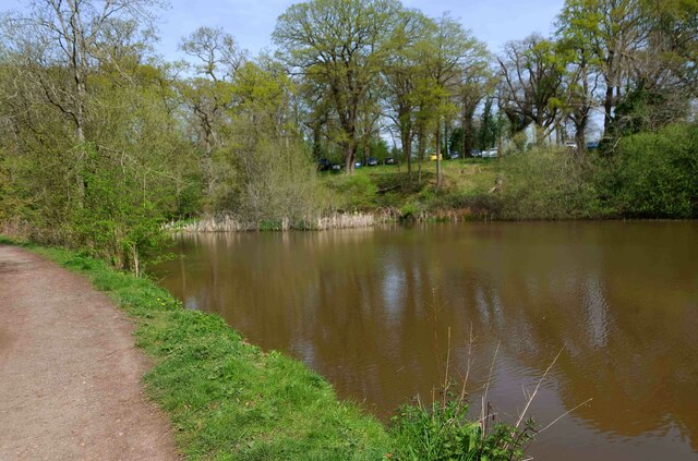
Deerpen Thorns is a picturesque woodland area located in Worcestershire, England. Situated within the larger Worcestershire Forest, this enchanting wood is renowned for its natural beauty and diverse wildlife. Covering an area of approximately 500 acres, Deerpen Thorns is a popular destination for nature lovers, hikers, and birdwatchers.

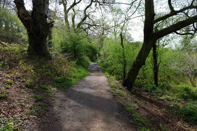
The woodland is characterized by its dense canopy of ancient oak and beech trees, creating a serene and tranquil atmosphere. The forest floor is adorned with a carpet of bluebells in the spring, creating a breathtaking sight for visitors. Walking through the wood, one can also spot various wildflowers, ferns, and mosses, adding to its enchanting charm.

Deerpen Thorns is not only a treat for the eyes but also a haven for wildlife. The wood is home to a diverse range of species, including deer, foxes, badgers, and rabbits. Bird enthusiasts can spot a variety of feathered friends, such as woodpeckers, owls, and warblers. The wood provides a vital habitat for these creatures, ensuring their survival in the region.

Visitors to Deerpen Thorns can enjoy a range of activities, including hiking, birdwatching, and picnicking. The wood is crisscrossed with well-maintained trails, allowing visitors to explore its natural wonders at their own pace. The peaceful ambiance and stunning scenery make it an ideal location for those seeking solace in nature.

Deerpen Thorns is a hidden gem in Worcestershire, offering a unique and unforgettable experience for those who venture into its depths. Whether you are an avid nature enthusiast or simply seeking an escape from the bustling city life, Deerpen Thorns is a must-visit destination for anyone looking to connect with the beauty of the natural world.

If you have any feedback on the listing, please let us know in the comments section below.

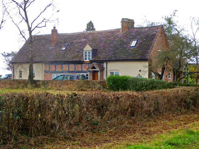
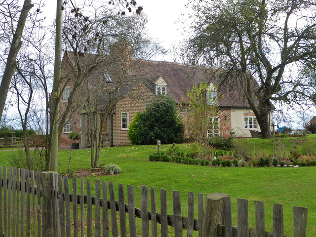
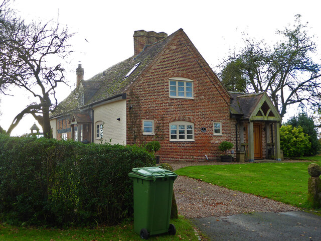
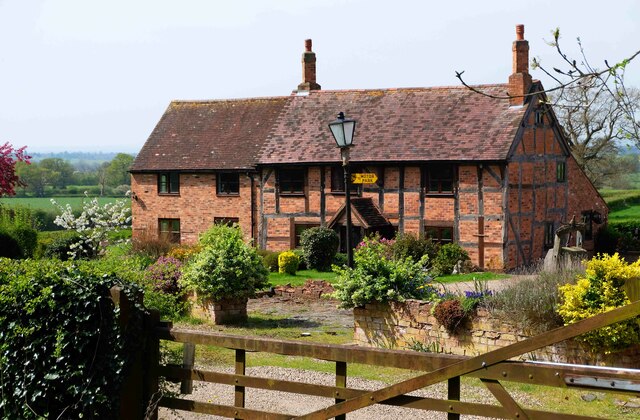
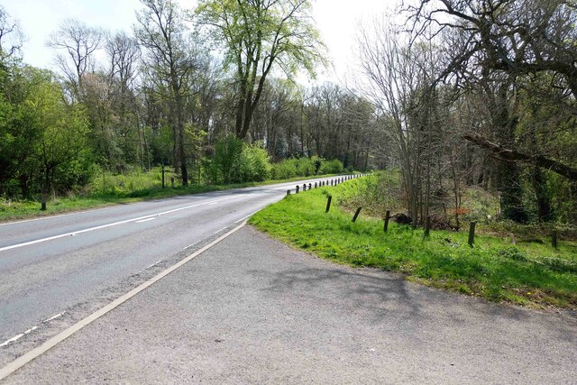
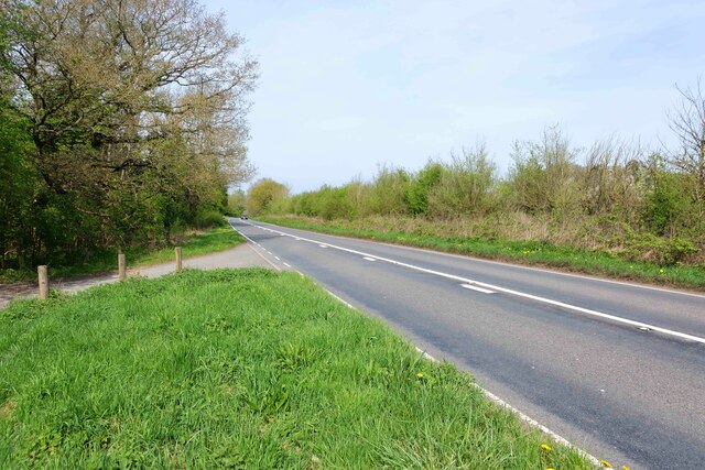
Deerpen Thorns Images

Images are sourced within 2km of 52.275374/-2.0452135 or Grid Reference SO9764. Thanks to Geograph Open Source API. All images are credited.

Dovecote by Pumphouse Farm Early 17th century dovecote, Listed Grade II. Difficult to get a clear view over the hedge from the public road. There is no convenient public footpath here.
Dovecote by Pumphouse Farm
Early 17th century dovecote, Listed Grade II. Difficult to get a clear view over the hedge from the public road. There is no convenient public footpath here.
Barn at Pumphouse Farm, Hanbury Grade II Listed.
Barn at Pumphouse Farm, Hanbury
Grade II Listed.
Pumphouse Farmhouse, Hanbury Grade II Listed.
Pumphouse Farmhouse, Hanbury
Grade II Listed.
White House Cottage, Hanbury Early 18th century with late 19th and early 20th century alterations. Grade II Listed.
White House Cottage, Hanbury
Early 18th century with late 19th and early 20th century alterations. Grade II Listed.
Appleby, Hanbury An early 17th century house with late 19th and mid-20th century alterations and additions. Listed Grade II.
Appleby, Hanbury
An early 17th century house with late 19th and mid-20th century alterations and additions. Listed Grade II.
Appleby, Hanbury An early 17th century house with late 19th and mid-20th century alterations and additions. Listed Grade II.
Appleby, Hanbury
An early 17th century house with late 19th and mid-20th century alterations and additions. Listed Grade II.
Appleby, Hanbury An early 17th century house with late 19th and mid-20th century alterations and additions. Listed Grade II.
Appleby, Hanbury
An early 17th century house with late 19th and mid-20th century alterations and additions. Listed Grade II.
Public footpath off Pumphouse Lane, Hanbury Hanbury Church is seen on the hill in the background
Public footpath off Pumphouse Lane, Hanbury
Hanbury Church is seen on the hill in the background
The White House, Hanbury A large old house in this Worcestershire village. I thought at first it must be one of the local listed buildings but soon realised it does not have any statutory protection.
The White House, Hanbury
A large old house in this Worcestershire village. I thought at first it must be one of the local listed buildings but soon realised it does not have any statutory protection.
Signpost at the junction of Loggerheads Lane and Pumphouse Lane, Hanbury Hanbury Church is in the right background.
Signpost at the junction of Loggerheads Lane and Pumphouse Lane, Hanbury
Hanbury Church is in the right background.
Footpath, Piper's Hill, near Hanbury, Worcs Piper's Hill and Dodderhill Commons is a nature reserve managed by Worcestershire Wildlife Trust. It contains over two hundred of the oldest trees in the county of Worcestershire. This footpath runs along the western edge of the reserve.
Footpath, Piper's Hill, near Hanbury, Worcs
Piper's Hill and Dodderhill Commons is a nature reserve managed by Worcestershire Wildlife Trust. It contains over two hundred of the oldest trees in the county of Worcestershire. This footpath runs along the western edge of the reserve.
Knotts Farmhouse, near Hanbury, Worcs Although the style of the building makes it look quite old, it was in fact constructed in 1950.
Knotts Farmhouse, near Hanbury, Worcs
Although the style of the building makes it look quite old, it was in fact constructed in 1950.
B4091 road to Hanbury, Worcs The B4091 road runs from north of Bromsgrove and then through that town and via Stoke Heath and Stoke Wharf on to Hanbury, all in Worcestershire. This view is looking in the direction of Hanbury. The road on the right is the access road to that nature reserve of Piper's Hill and Dodderhill Commons, managed by Worcestershire Wildlife Trust.
B4091 road to Hanbury, Worcs
The B4091 road runs from north of Bromsgrove and then through that town and via Stoke Heath and Stoke Wharf on to Hanbury, all in Worcestershire. This view is looking in the direction of Hanbury. The road on the right is the access road to that nature reserve of Piper's Hill and Dodderhill Commons, managed by Worcestershire Wildlife Trust.
B4091 road to Stoke Wharf, Worcs The B4091 road runs from Hanbury to Stoke Wharf and Stoke Heath and then to north of Bromsgrove after passing through that town. It is completely within the County of Worcestershire. This view is looking in the direction of Stoke Wharf. On the left is the Piper's Hill and Dodderhill Commons Nature Reserve, managed by Worcestershire Wildlife Trust.
B4091 road to Stoke Wharf, Worcs
The B4091 road runs from Hanbury to Stoke Wharf and Stoke Heath and then to north of Bromsgrove after passing through that town. It is completely within the County of Worcestershire. This view is looking in the direction of Stoke Wharf. On the left is the Piper's Hill and Dodderhill Commons Nature Reserve, managed by Worcestershire Wildlife Trust.
Pool (1), Piper's Hill & Dodderhill Commons Nature Reserve, near Hanbury, Worcs This pool is within the Nature Reserve managed by Worcestershire Wildlife Trust.

<a href="https://www.geograph.org.uk/photo/7151762">SO9565 : Pool (2), Piper's Hill & Dodderhill Commons Nature Reserve, near Hanbury, Worcs</a>.
<a href="https://www.geograph.org.uk/photo/7151768">SO9565 : Pool (3), Piper's Hill & Dodderhill Commons Nature Reserve, near Hanbury, Worcs</a>.
Pool (1), Piper's Hill & Dodderhill Commons Nature Reserve, near Hanbury, Worcs
Pool (2), Piper's Hill & Dodderhill Commons Nature Reserve, near Hanbury, Worcs This pool is within the Nature Reserve managed by Worcestershire Wildlife Trust.

<a href="https://www.geograph.org.uk/photo/7150810">SO9565 : Pool (1), Piper's Hill & Dodderhill Commons Nature Reserve, near Hanbury, Worcs</a>.
<a href="https://www.geograph.org.uk/photo/7151768">SO9565 : Pool (3), Piper's Hill & Dodderhill Commons Nature Reserve, near Hanbury, Worcs</a>.
Pool (2), Piper's Hill & Dodderhill Commons Nature Reserve, near Hanbury, Worcs
Pool (3), Piper's Hill & Dodderhill Commons Nature Reserve, near Hanbury, Worcs This pool is within the Nature Reserve managed by Worcestershire Wildlife Trust. In the far distance is the Reserve's small car parking area.

<a href="https://www.geograph.org.uk/photo/7150810">SO9565 : Pool (1), Piper's Hill & Dodderhill Commons Nature Reserve, near Hanbury, Worcs</a>.
<a href="https://www.geograph.org.uk/photo/7151762">SO9565 : Pool (2), Piper's Hill & Dodderhill Commons Nature Reserve, near Hanbury, Worcs</a>.
Pool (3), Piper's Hill & Dodderhill Commons Nature Reserve, near Hanbury, Worcs
This pool is within the Nature Reserve managed by Worcestershire Wildlife Trust. In the far distance is the Reserve's small car parking area. SO9565 : Pool (1), Piper's Hill & Dodderhill Commons Nature Reserve, near Hanbury, Worcs. SO9565 : Pool (2), Piper's Hill & Dodderhill Commons Nature Reserve, near Hanbury, Worcs.
Show me another place!

Deerpen Thorns is located at Grid Ref: SO9764 (Lat: 52.275374, Lng: -2.0452135)

Administrative County: Worcestershire

District: Wychavon

Police Authority: West Mercia

What 3 Words

///speaking.motive.cross. Near Stoke Prior, Worcestershire

Related Wikis

Hanbury, Worcestershire

Hanbury is a rural village in Worcestershire, England near Droitwich Spa and the M5 motorway. The population of Hanbury has remained around 1,000 since...

St Mary the Virgin, Hanbury

The church of St Mary the Virgin is an Anglican parish church in the village of Hanbury, Worcestershire. Its earliest parts date from about 1210 and it...

Feckenham Forest

Feckenham Forest was a royal forest, centred on the village of Feckenham, covering large parts of Worcestershire and west Warwickshire. It was not entirely...

Mere Green, Worcestershire

Mere Green is a hamlet in the English county of Worcestershire. It is located south of the village of Hanbury roughly midway between Worcester and Redditch...

Hanbury Hall

Hanbury Hall is a large 18th-century stately home standing in parkland at Hanbury, Worcestershire. The main range has two storeys and is built of red brick...

Upper Bentley

Upper Bentley is a village in Worcestershire, England. It is located between the towns of Redditch and Bromsgrove. It is near the villages of Elcocks Brook...

Cruise Hill

Cruise Hill is a hamlet outside Redditch, Worcestershire. It lies in between the villages of Feckenham, Callow Hill, Elcocks Brook & Ham Green.

Bradley Green, Worcestershire

Bradley Green is a village in the Wychavon district of Worcestershire, England. It is located just south of the town of Redditch and south of Feckenham...

Nearby Amenities

Located within 500m of 52.275374,-2.0452135
Power: pole
Source: bing
Lat/Long: 52.2737253/-2.047718
Power: pole
Source: bing
Lat/Long: 52.2738123/-2.0492099
Power: pole
Source: bing
Lat/Long: 52.2739049/-2.050667
Power: pole
Source: bing
Lat/Long: 52.273979/-2.0520757
Fishpool Cottage
Power: pole
Source: bing
Transformer: distribution
Voltage Primary: 11000
Lat/Long: 52.2740725/-2.0464879
Power: pole
Source: bing
Lat/Long: 52.2742716/-2.0457646
Power: pole
Source: bing
Lat/Long: 52.2747715/-2.0447236
Power: pole
Source: bing
Lat/Long: 52.2752853/-2.043958
Power: pole
Source: bing
Lat/Long: 52.2758121/-2.0431712
Power: pole
Source: bing
Lat/Long: 52.2762861/-2.0424373
Power: pole
Source: bing
Lat/Long: 52.2764435/-2.0386939
Power: pole
Source: bing
Lat/Long: 52.2765639/-2.0397652
Power: pole
Source: bing
Lat/Long: 52.2766889/-2.0407865
Power: pole
Source: bing
Lat/Long: 52.2767925/-2.0416581
Power: pole
Lat/Long: 52.2719358/-2.0419644
Power: pole
Lat/Long: 52.2726514/-2.0426644
Power: pole
Lat/Long: 52.2733628/-2.043335
Power: pole
Lat/Long: 52.2740751/-2.0440471
Forest Farm
Power: pole
Transformer: distribution
Voltage Primary: 11000
Lat/Long: 52.2773287/-2.0409063
The data included in this document is from www.openstreetmap.org. The data is made available under ODbL.

Have you been to Deerpen Thorns?

Leave your review of Deerpen Thorns below (or comments, questions and feedback).