Orchard Coppice

Wood, Forest in Dorset

England

Orchard Coppice

Ford At Corfe Mullen The ford at Corfe Mullen is secured by a locked pair of gates.
Ford At Corfe Mullen Credit: John Walton

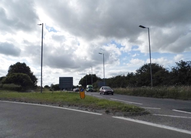
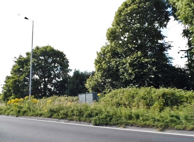
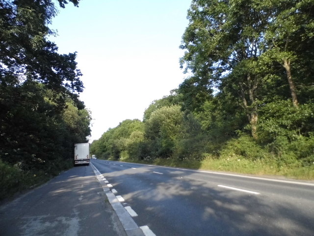
Orchard Coppice is a picturesque woodland area located in the county of Dorset, England. Covering an area of approximately 50 acres, it is a popular destination for nature enthusiasts and those seeking a peaceful retreat in the midst of nature.

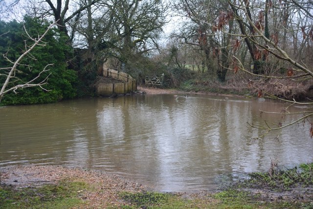
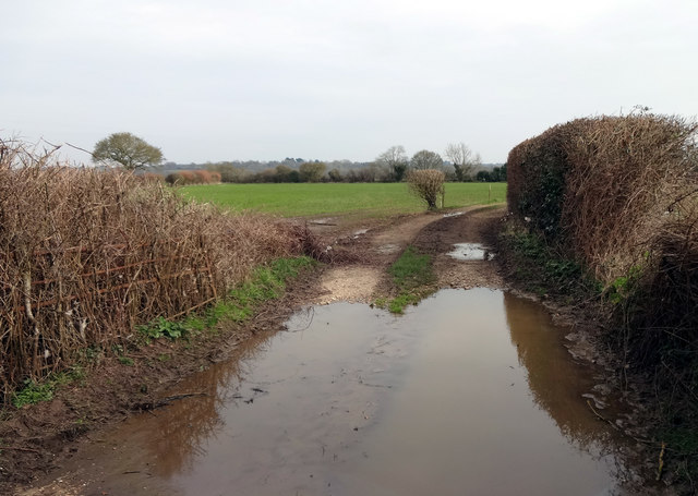
The coppice, which refers to a woodland area that is managed by periodically cutting down the trees to encourage regrowth, is characterized by a diverse range of tree species. Oak, beech, ash, and birch trees dominate the landscape, creating a rich and varied canopy overhead. The forest floor is covered in a lush carpet of ferns, mosses, and wildflowers, adding to the beauty of the surroundings.

Walking trails wind their way through Orchard Coppice, allowing visitors to explore the woodland at their own pace. These trails offer glimpses of wildlife that call the forest home, including deer, foxes, rabbits, and a variety of bird species. Birdwatchers are particularly drawn to Orchard Coppice for its abundance of woodland birds, such as woodpeckers, thrushes, and owls.

The woodland also holds historical significance, with evidence of human activity dating back centuries. Remnants of ancient stone structures and burial mounds can be found within the coppice, providing a glimpse into the area's past.

Orchard Coppice is a tranquil and idyllic destination for those seeking solace in nature. Its natural beauty, diverse wildlife, and rich history make it a must-visit location for both locals and tourists alike.

If you have any feedback on the listing, please let us know in the comments section below.

Orchard Coppice Images

Images are sourced within 2km of 50.781242/-2.0482027 or Grid Reference SY9697. Thanks to Geograph Open Source API. All images are credited.

Ford At Corfe Mullen The ford at Corfe Mullen is secured by a locked pair of gates.
Ford At Corfe Mullen
The ford at Corfe Mullen is secured by a locked pair of gates.
Remains of the Somerset & Dorset Joint Railway The site of Corfe Mullen Junction, with some old crossing gates and an (extended) crossing keeper / signalman's house.
Remains of the Somerset & Dorset Joint Railway
The site of Corfe Mullen Junction, with some old crossing gates and an (extended) crossing keeper / signalman's house.
Entrance to farmland by the River Stour Rather a wet entrance to fields on the north side of the River Stour between Cowgrove and Shapwick.
Entrance to farmland by the River Stour
Rather a wet entrance to fields on the north side of the River Stour between Cowgrove and Shapwick.
Lower Barford Farm Lower Barford Farm, situated on the north bank of the River Stour.
Lower Barford Farm
Lower Barford Farm, situated on the north bank of the River Stour.
Corfe Mullen, plantation Stony Down Plantation - conifers with a little hardwood.
Corfe Mullen, plantation
Stony Down Plantation - conifers with a little hardwood.
Corfe Mullen, timber Softwood logs awaiting collection in Stony Down Plantation.
Corfe Mullen, timber
Softwood logs awaiting collection in Stony Down Plantation.
Corfe Mullen, bridleway Across Stony Down Plantation, from Rushall Lane to Old Market Road.
Corfe Mullen, bridleway
Across Stony Down Plantation, from Rushall Lane to Old Market Road.
Corfe Mullen, plantation Stony Down Plantation - conifers with patches of hardwood.
Corfe Mullen, plantation
Stony Down Plantation - conifers with patches of hardwood.
Corfe Mullen, track junction From camera and ahead, the bridleway to Old Market Road; left and right, tracks belonging to a local camping business. Upgrading of the tracks seems to have caused local controversy: <span class="nowrap"><a title="https://susanjefferies.mycouncillor.org.uk/2015/10/16/stoney-down-plantation/" rel="nofollow ugc noopener" href="https://susanjefferies.mycouncillor.org.uk/2015/10/16/stoney-down-plantation/">Link</a><img style="margin-left:2px;" alt="External link" title="External link - shift click to open in new window" src="https://s1.geograph.org.uk/img/external.png" width="10" height="10"/></span>
Corfe Mullen, track junction
From camera and ahead, the bridleway to Old Market Road; left and right, tracks belonging to a local camping business. Upgrading of the tracks seems to have caused local controversy: LinkExternal link
Corfe Mullen, power lines Crossing Stony Down Plantation.
Corfe Mullen, power lines
Crossing Stony Down Plantation.
Corfe Mullen, bridleway Through Stony Down Plantation, from Rushall Lane to Old Market Road.
Corfe Mullen, bridleway
Through Stony Down Plantation, from Rushall Lane to Old Market Road.
Roundabout on the A31, Sturminster Marshall
Woodland by the A31, Sturminster Marshall
The entrance to Vines Close Farm
Layby on the A31, Sleight
Vines Close Farm
Vines Close Farm
Mill Street, Corfe Mullen
Show me another place!

Orchard Coppice is located at Grid Ref: SY9697 (Lat: 50.781242, Lng: -2.0482027)

Unitary Authority: Dorset

Police Authority: Dorset

What 3 Words

///sofas.dive.aviation. Near Sturminster Marshall, Dorset

Related Wikis

Henbury, Dorset

Henbury is a hamlet in the civil parish of Sturminster Marshall in Dorset, England. It lies on the A31 road. Henbury House is a classical Georgian house...

St. Hubert's Church, Corfe Mullen

St Hubert's Church is a 13th-century Church of England parish church in Corfe Mullen, a district of Wimborne, in the ceremonial county of Dorset, on the...

Castle Court School

Castle Court School is a co-educational, preparatory school located near the village of Corfe Mullen in the county of Dorset, England. == Location == Castle...

Stoney Down

Stoney Down or Stony Down is both a hill and an area of forested countryside in the county of Dorset, England, that has been designated an "Area of Great...

Bailey Gate railway station

Bailey Gate railway station was on the Somerset & Dorset Joint Railway in the English county of Dorset. == Usage == The station served the United Dairies...

Corfe Mullen

Corfe Mullen is a village in Dorset, England, on the north-western urban fringe of the South East Dorset conurbation. The community had a population of...

Sturminster Marshall

Sturminster Marshall is a village and civil parish in the east of Dorset in England, situated on the River Stour between Blandford Forum and Poole. The...

Corfe Mullen Halt railway station

Corfe Mullen Halt was a station in the English county of Dorset. It was located between Bailey Gate and Broadstone stations on the Somerset and Dorset...

Nearby Amenities

Located within 500m of 50.781242,-2.0482027
Power: tower
Source: bing
Lat/Long: 50.7777914/-2.0451287
Power: tower
Source: bing
Lat/Long: 50.779818/-2.0459967
Power: tower
Source: bing
Lat/Long: 50.7813205/-2.046628
Power: tower
Source: bing
Lat/Long: 50.7830513/-2.0473193
Power: tower
Source: bing
Lat/Long: 50.7842075/-2.0478109
Material: wood
Power: pole
Source: bing
Lat/Long: 50.7783952/-2.0428093
Barrier: stile
Foot: yes
Lat/Long: 50.7839326/-2.0459724
The data included in this document is from www.openstreetmap.org. The data is made available under ODbL.

Have you been to Orchard Coppice?

Leave your review of Orchard Coppice below (or comments, questions and feedback).