Scaletree Plantation

Wood, Forest in Yorkshire

England

Scaletree Plantation

Hury Reservoir Valve Tower
Hury Reservoir Valve Tower Credit: Sandy Gerrard

Scaletree Plantation, located in Yorkshire, is a picturesque wood and forest area that boasts an enchanting natural beauty. Spanning over several acres, this plantation is a haven for nature lovers and outdoor enthusiasts alike. The woodland is characterized by its dense canopy of trees, primarily consisting of oak, beech, and pine, providing a serene and tranquil atmosphere.

The plantation offers a myriad of recreational activities for visitors of all ages. Hiking trails meander through the forest, allowing visitors to explore its diverse flora and fauna. The well-marked paths cater to both novice and experienced hikers, ensuring a memorable experience for all. The plantation also features designated picnic areas, where families and friends can enjoy a leisurely day surrounded by nature.

Scaletree Plantation is home to a rich variety of wildlife, including deer, foxes, and a multitude of bird species. Birdwatchers can spot rare and migratory birds, making it a popular destination for ornithologists. Additionally, the plantation offers organized wildlife tours, providing visitors with the opportunity to learn about the local ecosystem and observe the animals in their natural habitat.

The management of Scaletree Plantation takes great pride in preserving the natural environment. Conservation efforts are in place to protect the biodiversity of the area, ensuring the sustainability of the woodland for future generations. Regular maintenance and tree planting initiatives contribute to the continual growth and development of the plantation.

Whether it's for a peaceful hike, a family picnic, or an educational wildlife encounter, Scaletree Plantation in Yorkshire offers a captivating escape into nature's embrace.

If you have any feedback on the listing, please let us know in the comments section below.

Scaletree Plantation Images

Images are sourced within 2km of 54.584978/-2.056165 or Grid Reference NY9621. Thanks to Geograph Open Source API. All images are credited.
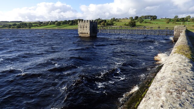
Hury Reservoir Valve Tower
Hury Reservoir Spillway The Spillway takes overflow from Hury Reservoir, but also from the two reservoirs up the valley via a by-wash.
Hury Reservoir Spillway
The Spillway takes overflow from Hury Reservoir, but also from the two reservoirs up the valley via a by-wash.
Direction Sign - Signpost on Briscoe Lane Located on the south side of the junction of Briscoe Lane and Gill-Lands Lane, east of Hury reservoir, in Cotherstone parish. 2 arms, 1 missing, and annulus finial. 

Milestone Society National ID: YN_NY9619
Direction Sign - Signpost on Briscoe Lane
Located on the south side of the junction of Briscoe Lane and Gill-Lands Lane, east of Hury reservoir, in Cotherstone parish. 2 arms, 1 missing, and annulus finial. Milestone Society National ID: YN_NY9619
Hury Reservoir and dam
Briscoe Lane
Briscoe Lane
Dusk at Hury Reservoir Looking towards the distinctive flat top of Shacklesborough.
Dusk at Hury Reservoir
Looking towards the distinctive flat top of Shacklesborough.
By Wash issuing to overflow channel at Hury Reservoir (The) By Wash, (capitalised on OS maps), is a wide, concrete channel on the south side of Hury Reservoir. Its purpose appears to be to allow excess water from Blackton Reservoir, (immediately upstream), to flow past the Hury Reservoir rather than first entering it.
By Wash issuing to overflow channel at Hury Reservoir
(The) By Wash, (capitalised on OS maps), is a wide, concrete channel on the south side of Hury Reservoir. Its purpose appears to be to allow excess water from Blackton Reservoir, (immediately upstream), to flow past the Hury Reservoir rather than first entering it.
How Gill Small, steep sided valley eroded into drift material that covers much of the ground in Baldersdale.
How Gill
Small, steep sided valley eroded into drift material that covers much of the ground in Baldersdale.
View to Bowbank Hill from Briscoe Lane
Covered reservoir with air shaft One of a line of four, east of Hury Reservoir. The three Baldersdale reservoirs [Balderhead, Blackton and Hury], together with two in Lunedale, provide the water supply for Teesdale.
Covered reservoir with air shaft
One of a line of four, east of Hury Reservoir. The three Baldersdale reservoirs [Balderhead, Blackton and Hury], together with two in Lunedale, provide the water supply for Teesdale.
Water spilling over at Hury reservoir On a very windy day, after weeks of wet weather. Hury reservoir was built in 1891-2 to supply water to Stockton and Middlesbrough. It is now the lowest of a chain of three reservoirs in Baldersdale. The water goes to a water treatment works at Lartington, and is also used to ensure a minimum water flow in the River Tees.
Water spilling over at Hury reservoir
On a very windy day, after weeks of wet weather. Hury reservoir was built in 1891-2 to supply water to Stockton and Middlesbrough. It is now the lowest of a chain of three reservoirs in Baldersdale. The water goes to a water treatment works at Lartington, and is also used to ensure a minimum water flow in the River Tees.
Bywash, Hury reservoir Allowing water from Balderhead and Blackton reservoirs to by-pass Hury reservoir. On a very windy day, after weeks of wet weather. Hury reservoir was built in 1891-2 to supply water to Stockton and Middlesbrough. It is now the lowest of a chain of three reservoirs in Baldersdale. The water goes to a water treatment works at Lartington, and is also used to ensure a minimum water flow in the River Tees.
Bywash, Hury reservoir
Allowing water from Balderhead and Blackton reservoirs to by-pass Hury reservoir. On a very windy day, after weeks of wet weather. Hury reservoir was built in 1891-2 to supply water to Stockton and Middlesbrough. It is now the lowest of a chain of three reservoirs in Baldersdale. The water goes to a water treatment works at Lartington, and is also used to ensure a minimum water flow in the River Tees.
Looking north-west across Hury reservoir The civil parish boundary between Cotherstone and Hunderthwaite is in the middle, along the former route of the River Balder. Taken on a very windy day, after weeks of wet weather. Hury reservoir was built in 1891-2 to supply water to Stockton and Middlesbrough. It is now the lowest of a chain of three reservoirs in Baldersdale. The water goes to a water treatment works at Lartington, and is also used to ensure a minimum water flow in the River Tees.
Looking north-west across Hury reservoir
The civil parish boundary between Cotherstone and Hunderthwaite is in the middle, along the former route of the River Balder. Taken on a very windy day, after weeks of wet weather. Hury reservoir was built in 1891-2 to supply water to Stockton and Middlesbrough. It is now the lowest of a chain of three reservoirs in Baldersdale. The water goes to a water treatment works at Lartington, and is also used to ensure a minimum water flow in the River Tees.
Path along the south bank of Hury reservoir Hury reservoir was built in 1891-2 to supply water to Stockton and Middlesbrough. It is now the lowest of a chain of three reservoirs in Baldersdale. The water goes to a water treatment works at Lartington, and is also used to ensure a minimum water flow in the River Tees.
Path along the south bank of Hury reservoir
Hury reservoir was built in 1891-2 to supply water to Stockton and Middlesbrough. It is now the lowest of a chain of three reservoirs in Baldersdale. The water goes to a water treatment works at Lartington, and is also used to ensure a minimum water flow in the River Tees.
Picnic table at Hury reservoir With a fine view of the top of the spillway.
Picnic table at Hury reservoir
With a fine view of the top of the spillway.
Footbridge across the bywash, Hury reservoir The former Reservoir House is now named Hury House.
Footbridge across the bywash, Hury reservoir
The former Reservoir House is now named Hury House.
Bywash channel, Hury reservoir On a very windy day, after weeks of wet weather. Compare with <a href="https://www.geograph.org.uk/photo/5597738">NY9619 : By Wash issuing to overflow channel at Hury Reservoir</a> taken in November 2017. The bywash lets water from Balderhead and Blackton reservoirs by-pass Hury reservoir.  Hury reservoir was built in 1891-2 to supply water to Stockton and Middlesbrough. It is now the lowest of a chain of three reservoirs in Baldersdale. The water goes to a water treatment works at Lartington, and is also used to ensure a minimum water flow in the River Tees.
Bywash channel, Hury reservoir
On a very windy day, after weeks of wet weather. Compare with NY9619 : By Wash issuing to overflow channel at Hury Reservoir taken in November 2017. The bywash lets water from Balderhead and Blackton reservoirs by-pass Hury reservoir. Hury reservoir was built in 1891-2 to supply water to Stockton and Middlesbrough. It is now the lowest of a chain of three reservoirs in Baldersdale. The water goes to a water treatment works at Lartington, and is also used to ensure a minimum water flow in the River Tees.
Storm at Hury Dam I think we'd chosen this day for a walk round Baldersdale before we'd seen the weather forecast. A very strong and blustery westerly wind meant that we were walking in real fear that the dog would blow away and we kept her on a lead. The surf was definitely up on Hury reservoir, and so much spray was blowing over the dam that I reckon you could have kayaked down the grass slope below (though I hate to think what would happen at the bottom). It certainly wasn't a day for paddlesport on the reservoir...
Storm at Hury Dam
I think we'd chosen this day for a walk round Baldersdale before we'd seen the weather forecast. A very strong and blustery westerly wind meant that we were walking in real fear that the dog would blow away and we kept her on a lead. The surf was definitely up on Hury reservoir, and so much spray was blowing over the dam that I reckon you could have kayaked down the grass slope below (though I hate to think what would happen at the bottom). It certainly wasn't a day for paddlesport on the reservoir...
Show me another place!

Scaletree Plantation is located at Grid Ref: NY9621 (Lat: 54.584978, Lng: -2.056165)

Division: North Riding

Unitary Authority: County Durham

Police Authority: Durham

What 3 Words

///sits.plausible.ironic. Near Mickleton, Co. Durham

Related Wikis

Botany Hill

Botany Hill, formerly known as Botany Quarry, is a Site of Special Scientific Interest in the Teesdale district of south-west County Durham, England. It...
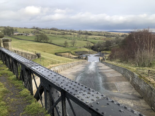
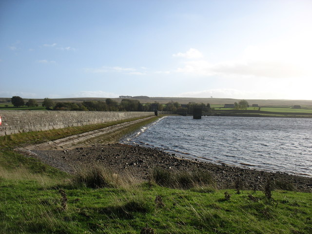
Hury Reservoir

Hury Reservoir is a reservoir in County Durham, England situated in Baldersdale. The reservoir is located about four miles south of Middleton-in-Teesdale...
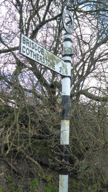
East Briscoe

East Briscoe is a village in Baldersdale, in the Pennines district of County Durham, England. It is traditionally located in the North Riding of Yorkshire...

Hunderthwaite

Hunderthwaite is a village and civil parish in Teesdale, in the Pennines of England. The population of the civil parish taken at the 2011 census was 114...

Nearby Amenities

Located within 500m of 54.584978,-2.056165
Park House
Place: farm
Source: OS 1:25k
Lat/Long: 54.581637/-2.0516984
Red Well
Natural: spring
Source: NLS-OS-NatGrid-110k-1940-60
Lat/Long: 54.5849152/-2.0485468
Abandoned Landuse: quarry
Fixme: Needs to be mapped as area
Source: NLS-OS-NatGrid-110k-1940-60
Lat/Long: 54.5890426/-2.0566814
The data included in this document is from www.openstreetmap.org. The data is made available under ODbL.

Have you been to Scaletree Plantation?

Leave your review of Scaletree Plantation below (or comments, questions and feedback).