Little High Wood

Wood, Forest in Worcestershire Wychavon

England

Little High Wood

The edge of Stock Green A road junction on the edge of Hollow Court but the signs proclaim this to be Stock Green. The road to the right goes to Grafton Flyford and Himbleton. The road ahead was closed for sewer works.
The edge of Stock Green Credit: Chris Allen

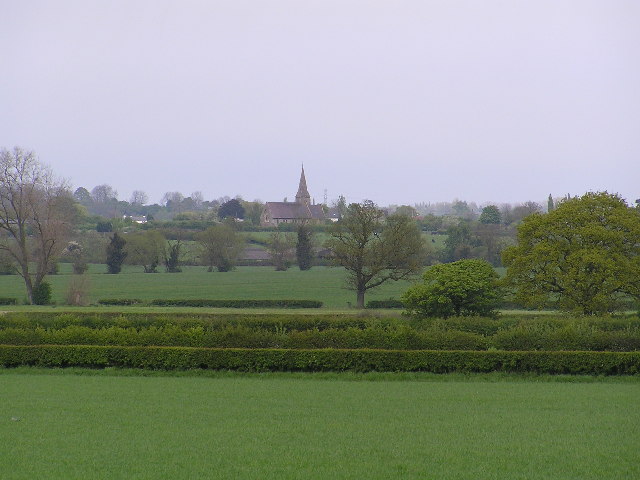
Little High Wood is a picturesque woodland located in the county of Worcestershire, England. Situated near the town of Bewdley, this small yet enchanting forest covers an area of approximately 15 acres. The wood is part of a larger complex known as the Wyre Forest, which is renowned for its natural beauty and rich biodiversity.

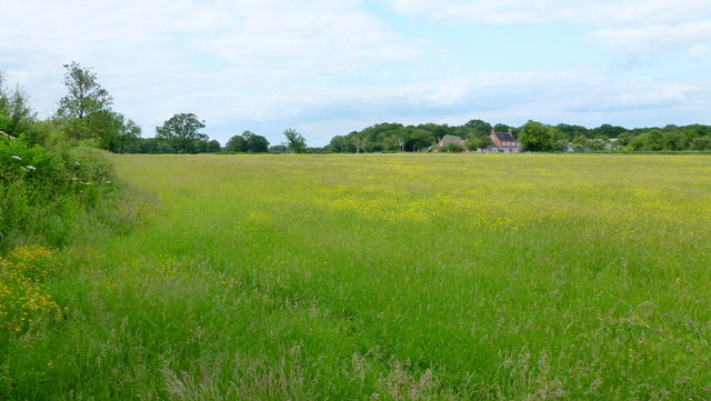
Little High Wood is predominantly composed of broadleaf trees, including oak, birch, and beech, which create a dense and verdant canopy. The woodland floor is covered with a carpet of wildflowers, ferns, and mosses, adding to its enchanting atmosphere. The area is also home to a variety of wildlife, such as squirrels, foxes, and a range of bird species, making it a popular spot for nature enthusiasts and birdwatchers.

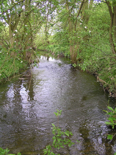
The wood is crisscrossed by a network of well-maintained footpaths and trails, allowing visitors to explore its natural wonders. These paths lead to various points of interest, including a tranquil pond and a small stream that meanders through the woodland. The peaceful ambiance, coupled with the soothing sound of the babbling brook, creates a serene and idyllic setting for a leisurely stroll or a picnic amidst nature.

Little High Wood offers a welcome escape from the hustle and bustle of everyday life, providing visitors with the opportunity to immerse themselves in the beauty of the natural world. Its proximity to Bewdley makes it easily accessible, attracting both locals and tourists alike who seek solace in its peaceful embrace.

If you have any feedback on the listing, please let us know in the comments section below.

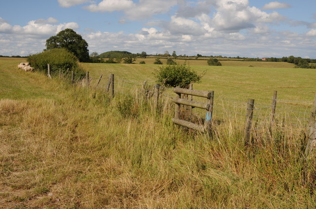
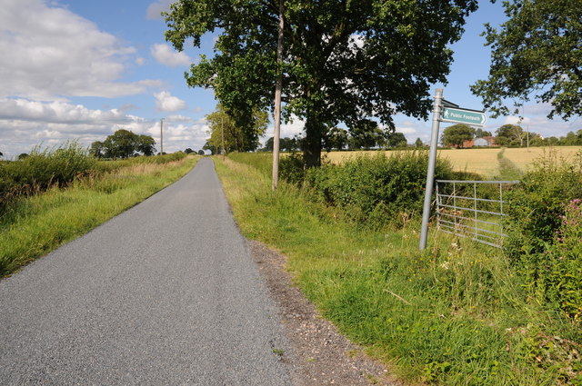
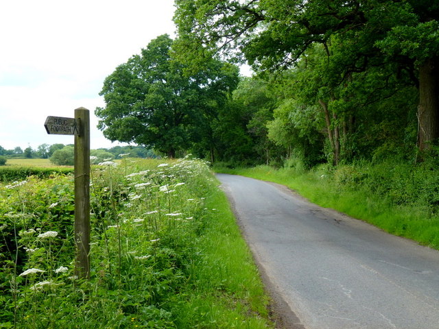
Little High Wood Images

Images are sourced within 2km of 52.233788/-2.0587885 or Grid Reference SO9659. Thanks to Geograph Open Source API. All images are credited.
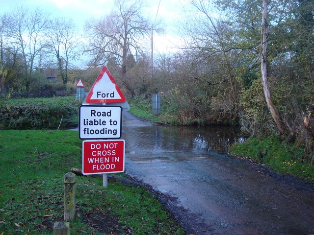
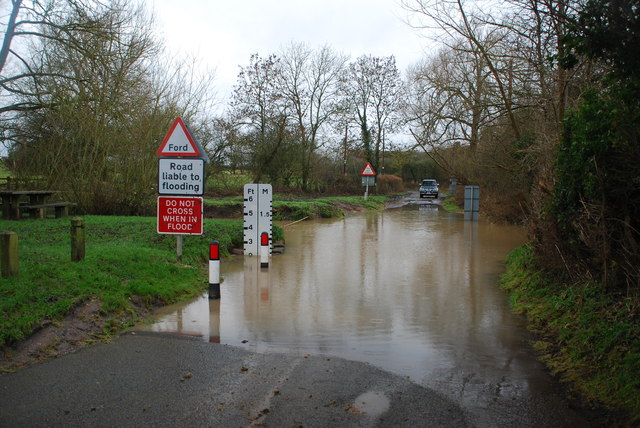
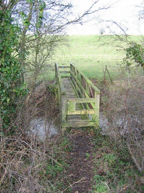
The edge of Stock Green A road junction on the edge of Hollow Court but the signs proclaim this to be Stock Green. The road to the right goes to Grafton Flyford and Himbleton. The road ahead was closed for sewer works.
The edge of Stock Green
A road junction on the edge of Hollow Court but the signs proclaim this to be Stock Green. The road to the right goes to Grafton Flyford and Himbleton. The road ahead was closed for sewer works.
Bulrushes beside the Wychavon Way Bulrushes growing in a drainage channel beside a footpath which is marked on the OS map as the Wychavon Way though I believe it may have since been rerouted.
Bulrushes beside the Wychavon Way
Bulrushes growing in a drainage channel beside a footpath which is marked on the OS map as the Wychavon Way though I believe it may have since been rerouted.
Sheep and Hill Top Farm Sheep in a field with Hill Top Farm in the background.
Sheep and Hill Top Farm
Sheep in a field with Hill Top Farm in the background.
Roadside verge near Shell Summer growth on the road verge between Shell and Earl's Common.
Roadside verge near Shell
Summer growth on the road verge between Shell and Earl's Common.
Farmland near Shell Farmland to the west of Shell.
Farmland near Shell
Farmland to the west of Shell.
Ford at Shell The ford close to the hamlet of Shell
Ford at Shell
The ford close to the hamlet of Shell
Picnic Site at Shell The small [1 table!] picnic site and footbridge at Shell beside the ford
Picnic Site at Shell
The small [1 table!] picnic site and footbridge at Shell beside the ford
Footpath to Hill Top Farm Two footpaths cross farmland to the right one of which leads to Hill Top Farm.
Footpath to Hill Top Farm
Two footpaths cross farmland to the right one of which leads to Hill Top Farm.
Lane alongside Rabbit Wood Looking north towards Himbleton.
Lane alongside Rabbit Wood
Looking north towards Himbleton.
Footpath across pasture to Saldons Farm This scene is not surprisingly very similar to <a href="https://www.geograph.org.uk/photo/846703">SO9558 : Saldons Farm, near Himbleton</a> taken 5 years previously.
Footpath across pasture to Saldons Farm
This scene is not surprisingly very similar to SO9558 : Saldons Farm, near Himbleton taken 5 years previously.
Shell Ford This ford on the Shell Brook was two and a half foot deep at the time of my visit as can be seen in the video:
<span class="nowrap"><a title="http://www.youtube.com/watch?v=p7t1kvldoZU" rel="nofollow ugc noopener" href="http://www.youtube.com/watch?v=p7t1kvldoZU">Link</a><img style="margin-left:2px;" alt="External link" title="External link - shift click to open in new window" src="https://s1.geograph.org.uk/img/external.png" width="10" height="10"/></span>
Shell Ford
This ford on the Shell Brook was two and a half foot deep at the time of my visit as can be seen in the video: LinkExternal link
Church - Himbleton Dedicated to St Mary Magdalene with a weather-boarded tower dating to the 15th century (allegedly) One of many pretty churches in Worcestershire.
Church - Himbleton
Dedicated to St Mary Magdalene with a weather-boarded tower dating to the 15th century (allegedly) One of many pretty churches in Worcestershire.
Shell Brook. photographed from SO 972599
Shell Brook.
photographed from SO 972599
Looking across fields to Bradley Green Church. View across to Bradley Green church from road junction at SO 973585
Looking across fields to Bradley Green Church.
View across to Bradley Green church from road junction at SO 973585
Shell Manor Farm. Shell Manor, a fine timbered house with work dating from the 14th to 16th century
Shell Manor Farm.
Shell Manor, a fine timbered house with work dating from the 14th to 16th century
Shell Brook Footbridge over the Shell Brook. - the good news is that the bull is a Hereford. This breed is making a comeback.
Shell Brook
Footbridge over the Shell Brook. - the good news is that the bull is a Hereford. This breed is making a comeback.
Himbleton Church Dedicated to Mary Magdalene. The clock was given in 1910 in memory of Marianne Lady Galton. Google associates her with correspondence with Florence nightingale.
Himbleton Church
Dedicated to Mary Magdalene. The clock was given in 1910 in memory of Marianne Lady Galton. Google associates her with correspondence with Florence nightingale.
Saldon Farm viewed from the south-east with Saldon Wood behind.
Saldon Farm
viewed from the south-east with Saldon Wood behind.
Show me another place!

Little High Wood is located at Grid Ref: SO9659 (Lat: 52.233788, Lng: -2.0587885)

Administrative County: Worcestershire

District: Wychavon

Police Authority: West Mercia

What 3 Words

///skyrocket.from.veal. Near Kington, Worcestershire

Related Wikis

Earls Common

Earls Common is a village in Worcestershire, England. Villages nearby include Himbleton and Stock Green.

Himbleton

Himbleton is a village in Worcestershire, England. It lies about 5 miles (8.0 km) south-east of Droitwich and 7.5 miles (12.1 km) north-east of Worcester...

Grafton Flyford

Grafton Flyford is a village about 6 miles (9.7 km) east of Worcester, in Worcestershire, England. It neighbours Stock Green, with the large farm house...

Huddington

Huddington is a village in Worcestershire, England. == Location == Huddington is located 5 miles (8.0 km) east of Worcester and 5 miles (8.0 km) south...

Huddington Court

Huddington Court is a 15th-century moated manor house in the village of Huddington in Worcestershire, England, some six miles east of Worcester. It was...

Mere Green, Worcestershire

Mere Green is a hamlet in the English county of Worcestershire. It is located south of the village of Hanbury roughly midway between Worcester and Redditch...

Bradley Green, Worcestershire

Bradley Green is a village in the Wychavon district of Worcestershire, England. It is located just south of the town of Redditch and south of Feckenham...

Dormston

Dormston is a village and civil parish in Worcestershire about 3 miles (4.8 km) south of Redditch. == Name == Dormston's toponym has evolved from Deormodesealdtune...

Nearby Amenities

Located within 500m of 52.233788,-2.0587885
Barrier: stile
Foot: yes
Lat/Long: 52.2322772/-2.065275
Post Box
Collection Times: Mo-Fr 16:00; Sa 07:00
Post Box Type: lamp
Ref: WR9 445
Royal Cypher: EIIR
Royal Cypher Wikidata: Q33102113
Lat/Long: 52.2308342/-2.0628488
Barrier: stile
Foot: yes
Lat/Long: 52.2295937/-2.0604027
Power: pole
Lat/Long: 52.2298705/-2.0617351
Earls Common East
Power: pole
Transformer: distribution
Voltage Primary: 11000
Lat/Long: 52.2299713/-2.0600773
Power: pole
Lat/Long: 52.2293645/-2.0586957
Power: pole
Lat/Long: 52.2296682/-2.0593849
Power: pole
Lat/Long: 52.2299824/-2.0625814
Barrier: cattle_grid
Lat/Long: 52.2322795/-2.0649826
Power: pole
Lat/Long: 52.2299476/-2.0604845
STW Pump Station
Power: pole
Transformer: distribution
Voltage Primary: 11000
Lat/Long: 52.2328199/-2.0617564
The data included in this document is from www.openstreetmap.org. The data is made available under ODbL.

Have you been to Little High Wood?

Leave your review of Little High Wood below (or comments, questions and feedback).