Long Plantation

Wood, Forest in Durham

England

Long Plantation

South Eastgate Plantation Plantations are normally large and densely packed with coniferous trees; South Eastgate Plantation is small and thinly populated with broadleaved trees.
South Eastgate Plantation Credit: Trevor Littlewood

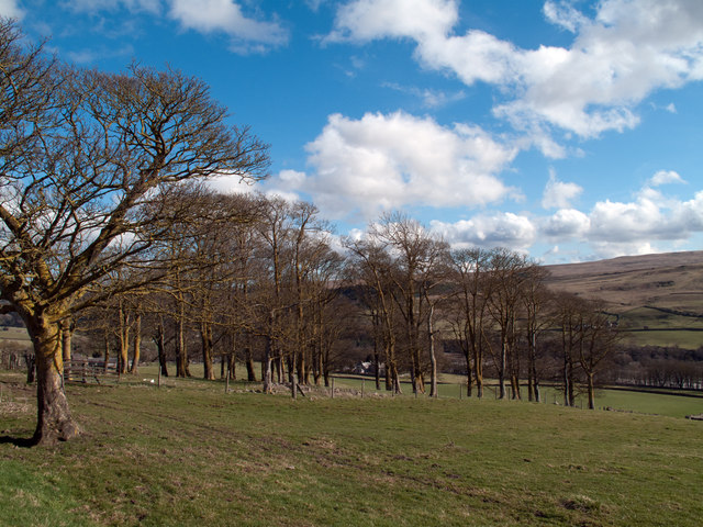
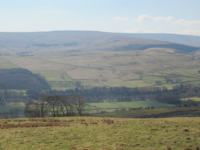
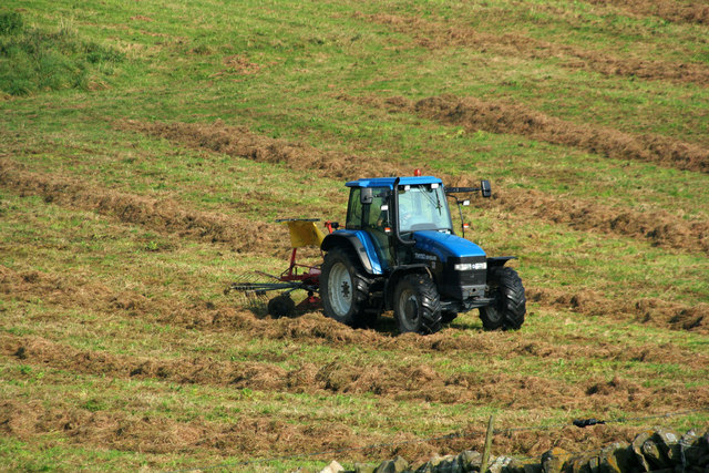
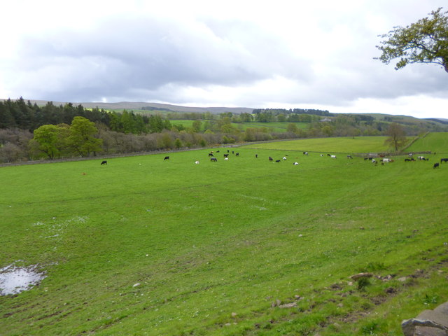
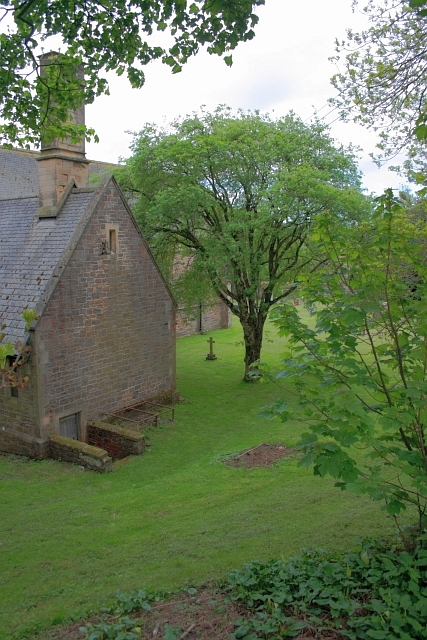
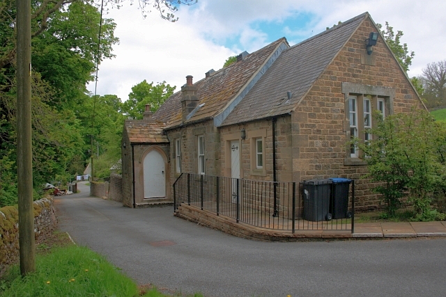
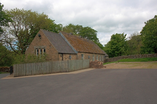
Long Plantation is a picturesque woodland located in Durham, England. Covering a vast area, it is renowned for its lush greenery, diverse wildlife, and tranquil atmosphere. Situated near the village of Long Newton, this beautiful plantation is a popular destination for nature lovers, hikers, and birdwatchers.

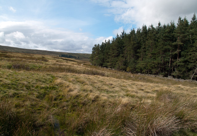
The plantation is primarily composed of a dense forest that features a variety of tree species, including oak, beech, ash, and birch. These majestic trees form a dense canopy, providing shade and shelter for the abundant flora and fauna that inhabit the area. The forest floor is carpeted with a rich undergrowth of ferns, wildflowers, and mosses, creating a vibrant and colorful landscape.

Long Plantation is home to a wide range of wildlife, making it a haven for nature enthusiasts. Visitors have the opportunity to spot various bird species, such as woodpeckers, owls, and songbirds. Additionally, the plantation is inhabited by small mammals like squirrels, rabbits, and foxes, as well as occasional sightings of deer.

The plantation offers a network of well-maintained walking trails that wind through the woodland, providing visitors with the opportunity to explore its beauty at their own pace. These trails offer stunning views of the surrounding countryside and are suitable for all ages and fitness levels.

Long Plantation is not only a haven for wildlife and nature enthusiasts but also provides a peaceful retreat for those seeking solace and tranquility. Its idyllic setting and serene ambiance make it a perfect destination for individuals looking to escape the bustle of city life and immerse themselves in the beauty of nature.

If you have any feedback on the listing, please let us know in the comments section below.

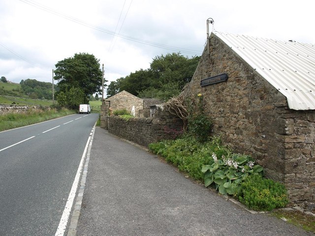
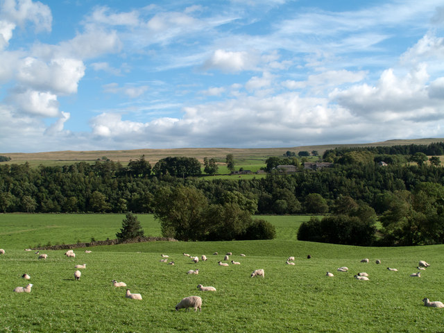
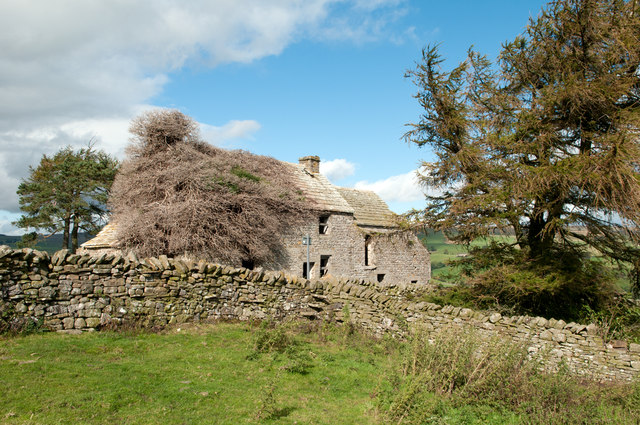
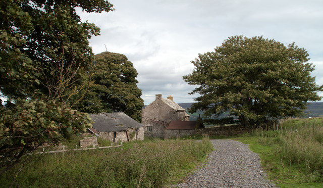
Long Plantation Images

Images are sourced within 2km of 54.734881/-2.0636722 or Grid Reference NY9537. Thanks to Geograph Open Source API. All images are credited.

South Eastgate Plantation Plantations are normally large and densely packed with coniferous trees; South Eastgate Plantation is small and thinly populated with broadleaved trees.
South Eastgate Plantation
Plantations are normally large and densely packed with coniferous trees; South Eastgate Plantation is small and thinly populated with broadleaved trees.
Weardale around Eastgate
Quarry of 'Weardale Works' Weardale has seen massive amounts of rock quarried from its sides and no larger working exists in the valley than the old Blue Circle, later Lafarge operation on the south side which supplied limestone by conveyor to the cement works at Eastgate; OS mapping names the area as 'Weardale Works'.
Soon after the Lafarge purchase quarrying and cement manufacture ceased and the cement works at Eastgate was erased. Similarly the quarrying operation ended and the quarry area has been landscaped.
Once a public footpath cut across the north end of the quarry site; it was closed during the period of extraction but it seems that it might be reopened in the future; the image here was taken from the probable line of the path and shows distantly part of the quarry face beyond nearer workings.
Quarry of 'Weardale Works'
Weardale has seen massive amounts of rock quarried from its sides and no larger working exists in the valley than the old Blue Circle, later Lafarge operation on the south side which supplied limestone by conveyor to the cement works at Eastgate; OS mapping names the area as 'Weardale Works'. Soon after the Lafarge purchase quarrying and cement manufacture ceased and the cement works at Eastgate was erased. Similarly the quarrying operation ended and the quarry area has been landscaped. Once a public footpath cut across the north end of the quarry site; it was closed during the period of extraction but it seems that it might be reopened in the future; the image here was taken from the probable line of the path and shows distantly part of the quarry face beyond nearer workings.
Pastures and dry stone walls next to A689
White House Farm, on the A689
Field west of Howl John The field with grazing sheep is in Weardale between the villages of Eastgate and Stanhope; it lies immediately west of the curiously named farm at Howl John. Other fields and clumps of trees lie beyond to the south before a slope rises to grassy moorland.
Field west of Howl John
The field with grazing sheep is in Weardale between the villages of Eastgate and Stanhope; it lies immediately west of the curiously named farm at Howl John. Other fields and clumps of trees lie beyond to the south before a slope rises to grassy moorland.
Aller Gill House Aller Gill House lies on the south side of the River Wear and north of the minor road there.
Aller Gill House
Aller Gill House lies on the south side of the River Wear and north of the minor road there.
Birkshaw Birkshaw is one of an number of old farmsteads in the vicinity which have been abandoned or at least are deserted. Another abandoned feature seen here is a public footpath: below the centre of the image the through stones of a stile can be seen in the wall, and above them a notice attached to a pole. The notice tells that a path heading east from Birkshaw is not useable due to quarrying; this is odd! This notice and others were erected just a few years ago and yet the quarrying operation ended many decades ago, possibly in the 1940s.
Birkshaw
Birkshaw is one of an number of old farmsteads in the vicinity which have been abandoned or at least are deserted. Another abandoned feature seen here is a public footpath: below the centre of the image the through stones of a stile can be seen in the wall, and above them a notice attached to a pole. The notice tells that a path heading east from Birkshaw is not useable due to quarrying; this is odd! This notice and others were erected just a few years ago and yet the quarrying operation ended many decades ago, possibly in the 1940s.
Snape Gate Horsley Burn is a tributary stream to the River Wear flowing north-east to join it west of Stanhope. Enclosures rise on the south side of the burn eventually giving way to grassy moorland; among the enclosures on that slope there's a surprising number of old farmsteads no longer in use. Some of the buildings are now ruins others merely abandoned; Snape Gate is one of that last group.
Snape Gate
Horsley Burn is a tributary stream to the River Wear flowing north-east to join it west of Stanhope. Enclosures rise on the south side of the burn eventually giving way to grassy moorland; among the enclosures on that slope there's a surprising number of old farmsteads no longer in use. Some of the buildings are now ruins others merely abandoned; Snape Gate is one of that last group.
Snapegate Plantation The southern side of Snapegate Plantation is seen in this image where it abuts on to grassy moorland rising (leftwards) towards the ridge of Carrs Top.
Snapegate Plantation
The southern side of Snapegate Plantation is seen in this image where it abuts on to grassy moorland rising (leftwards) towards the ridge of Carrs Top.
Ludwell Haymaking in fields on Ludwell Farm.
Ludwell
Haymaking in fields on Ludwell Farm.
Stanhope, cattle grazing In a field next to the Wear, with the preserved railway line North of the river.
Stanhope, cattle grazing
In a field next to the Wear, with the preserved railway line North of the river.
Entrance to Eastgate
Eastgate: approaching former station,  1995 View NW across a temporarily closed bridge over the River Wear, to the ex-NER Bishop Auckland (to left) - Wearhead (to right) line. Eastgate station and the service to Wearhead closed to passengers from 29/6/53, but goods continued until 1961, to Westgate until 1/7/68 and (for cement) from Eastgate until 17/3/93. The line was mothballed until 2004, then acquired as a heritage operation by the Weardale Railway for progressive restoration.
Eastgate: approaching former station, 1995
View NW across a temporarily closed bridge over the River Wear, to the ex-NER Bishop Auckland (to left) - Wearhead (to right) line. Eastgate station and the service to Wearhead closed to passengers from 29/6/53, but goods continued until 1961, to Westgate until 1/7/68 and (for cement) from Eastgate until 17/3/93. The line was mothballed until 2004, then acquired as a heritage operation by the Weardale Railway for progressive restoration.
All Saints Church, Eastgate
Village Hall, Eastgate
Hag Bridge
Hag Bridge
Show me another place!

Long Plantation is located at Grid Ref: NY9537 (Lat: 54.734881, Lng: -2.0636722)

Unitary Authority: County Durham

Police Authority: Durham

What 3 Words

///lists.expose.ringers. Near Stanhope, Co. Durham

Nearby Locations

Long Plantation

Related Wikis

Horsley Hall

Horsley Hall is a 17th-century country house, now in use as a hotel, near Stanhope, County Durham, England. It is a Grade II listed building. The manor...

Eastgate railway station

Eastgate railway station, also known as Eastgate-in-Weardale, served the village of Eastgate in County Durham, North East England from 1895 to 1953 as...

West Newlandside Meadows

West Newlandside Meadows is a Site of Special Scientific Interest in the Wear Valley district of County Durham, England. It lies 3 km south-west of the...

Eastgate, County Durham

Eastgate is a village in the civil parish of Stanhope, in County Durham, England. It is situated in Weardale, a few miles west of Stanhope. In the 2001...

Westernhope Burn Wood

Westernhope Burn Wood is a Site of Special Scientific Interest in the Wear Valley district of south-west County Durham, England. It occupies the steeply...

Greenfoot Quarry

Greenfoot Quarry is a Site of Special Scientific Interest in the Wear Valley district of west County Durham, England. It is a disused quarry, situated...

Weardale campaign

The Weardale campaign, part of the First War of Scottish Independence, occurred during July and August 1327 in Weardale, England. A Scottish force under...

Fairy Holes Cave

Fairy Holes Cave is a Site of Special Scientific Interest in the Wear Valley district of west County Durham, England. It is located on the western flanks...

Nearby Amenities

Located within 500m of 54.734881,-2.0636722
Power: pole
Lat/Long: 54.7356383/-2.068358
Power: pole
Lat/Long: 54.7361732/-2.0693623
Power: pole
Lat/Long: 54.7329054/-2.0583962
Power: pole
Lat/Long: 54.7333246/-2.0623439
Power: pole
Lat/Long: 54.7327565/-2.0585714
Power: pole
Lat/Long: 54.7360713/-2.0695372
Power: pole
Lat/Long: 54.7347629/-2.0671093
Power: pole
Lat/Long: 54.7334173/-2.0645874
Power: pole
Lat/Long: 54.7331223/-2.060388
Power: pole
Lat/Long: 54.7333106/-2.0636387
Power: pole
Lat/Long: 54.7334767/-2.063639
Power: pole
Lat/Long: 54.7367233/-2.0703623
Power: pole
Lat/Long: 54.7348698/-2.0669152
Power: pole
Lat/Long: 54.7335713/-2.0644437
Power: pole
Lat/Long: 54.7341027/-2.0654858
Power: pole
Lat/Long: 54.732758/-2.0569471
Power: pole
Lat/Long: 54.7325874/-2.0570104
Power: pole
Lat/Long: 54.7353761/-2.0682539
Power: pole
Lat/Long: 54.7340971/-2.0658846
Power: pole
Lat/Long: 54.7329561/-2.0604373
Power: pole
Lat/Long: 54.7366941/-2.0706931
Power: pole
Lat/Long: 54.7332056/-2.0627055
Barrier: cattle_grid
Lat/Long: 54.7332335/-2.0625816
Horlsey Head
Image: https://www.geograph.org.uk/photo/564509
Place: isolated_dwelling
Source: OS_OpenData_StreetView
Lat/Long: 54.7317697/-2.0596898
Barrier: entrance
Lat/Long: 54.733471/-2.0694944
Power: pole
Lat/Long: 54.7377164/-2.0591292
Power: pole
Lat/Long: 54.736987/-2.0596388
Power: pole
Lat/Long: 54.7362592/-2.0601484
Power: pole
Lat/Long: 54.7355763/-2.0606285
Power: pole
Lat/Long: 54.7349274/-2.0610818
Power: pole
Lat/Long: 54.7342584/-2.0615485
Power: pole
Lat/Long: 54.7337536/-2.062093
The data included in this document is from www.openstreetmap.org. The data is made available under ODbL.

Have you been to Long Plantation?

Leave your review of Long Plantation below (or comments, questions and feedback).