Blue Wood

Wood, Forest in Northumberland

England

Blue Wood

Car park near Hepplewoodside Bridge
Car park near Hepplewoodside Bridge Credit: Gordon Brown

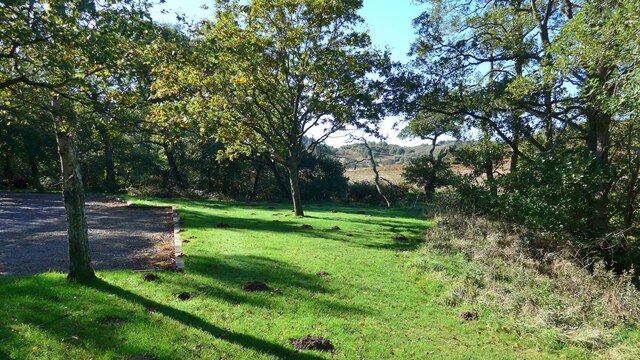
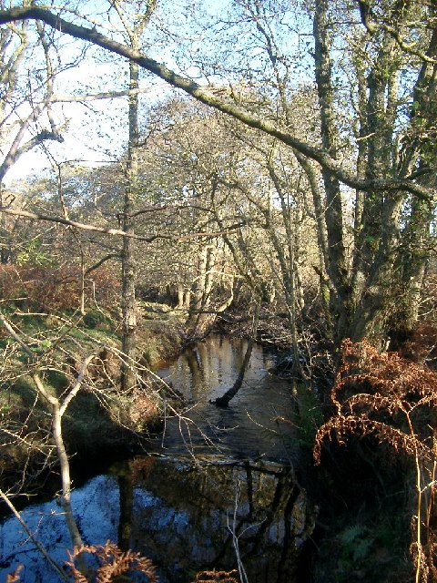
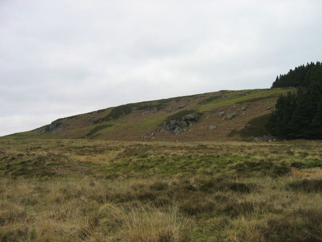
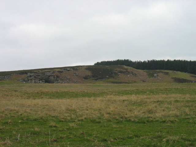
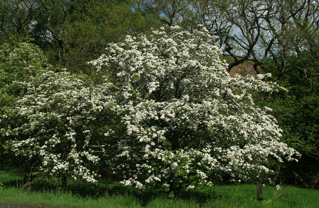
Blue Wood is a picturesque forest located in the county of Northumberland, England. Covering an area of approximately 500 acres, this woodland is renowned for its natural beauty and diverse range of flora and fauna. The name "Blue Wood" is derived from the prominent bluebells that carpet the forest floor during spring, creating a stunning visual spectacle.

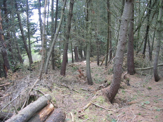
The forest is predominantly made up of native broadleaf trees such as oak, beech, and ash, which provide a rich habitat for a variety of wildlife. Visitors to Blue Wood can expect to encounter a plethora of bird species, including woodpeckers, owls, and songbirds, as well as small mammals such as squirrels and rabbits. The tranquil atmosphere of the woodland makes it an ideal location for birdwatching and wildlife photography.

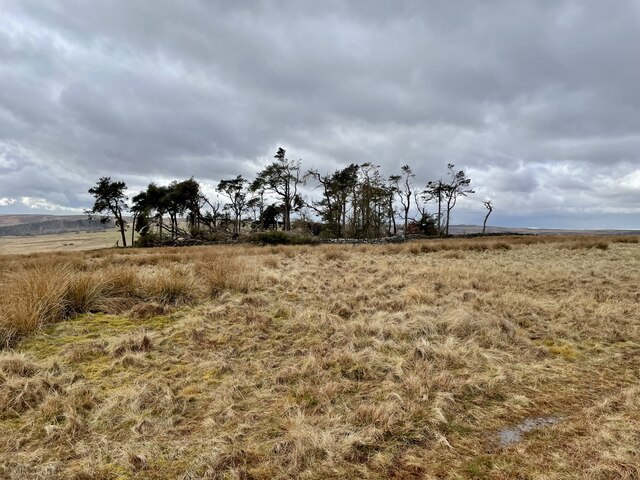
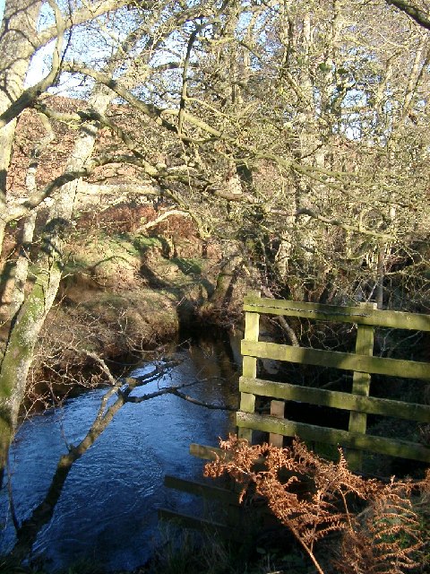
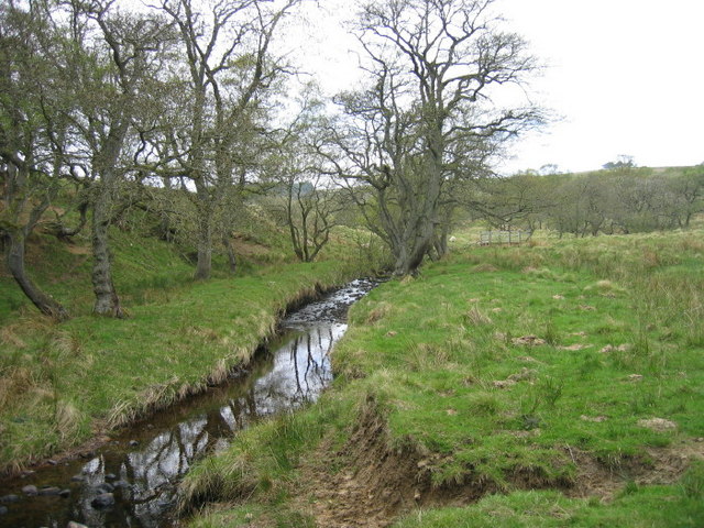
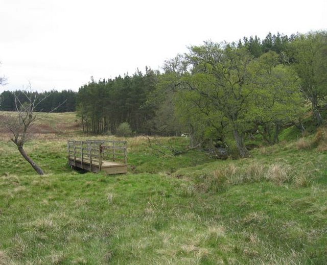
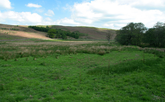
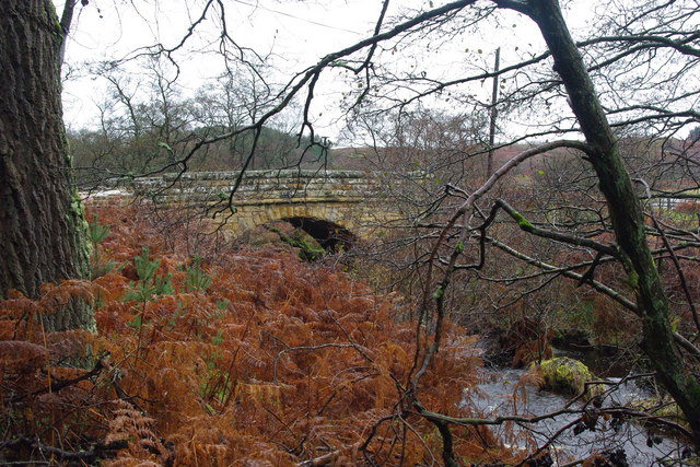
Blue Wood offers a network of well-maintained walking trails, allowing visitors to explore the forest at their own pace. The trails vary in difficulty, catering to both casual strollers and avid hikers. Along the way, visitors can enjoy breathtaking views of the surrounding countryside, with rolling hills and meandering streams adding to the charm of the woodland.

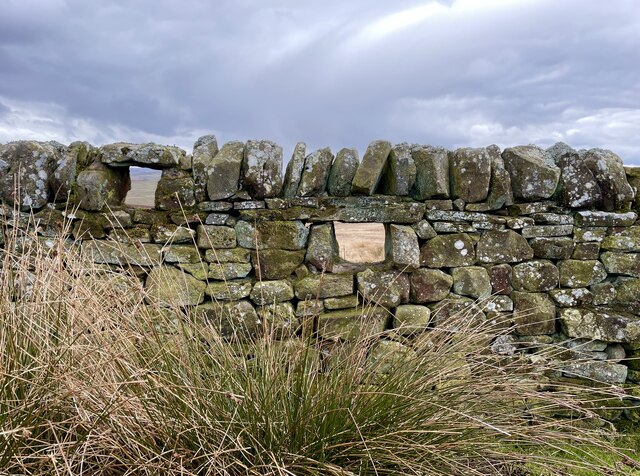
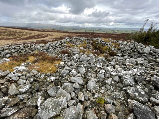
In addition to its natural beauty, Blue Wood also boasts a rich history. The forest has been a valuable resource for timber throughout the centuries and remnants of old sawmills can still be found. Archaeological evidence suggests that the area has been inhabited for thousands of years, with prehistoric artifacts and Roman remains discovered within the woodland.

Overall, Blue Wood is a delightful destination for nature lovers and history enthusiasts alike. Its tranquil ambiance, diverse wildlife, and scenic trails make it a must-visit location for those seeking a peaceful retreat in the heart of Northumberland.

If you have any feedback on the listing, please let us know in the comments section below.

Blue Wood Images

Images are sourced within 2km of 55.299335/-2.0652854 or Grid Reference NT9500. Thanks to Geograph Open Source API. All images are credited.

Car park near Hepplewoodside Bridge
Another Storm Arwen ravaged copse of trees Like its near neighbour this small walled enclosure is probably of military origin since it boasts gun loops.  Although it's well outside the boundary of the Otterburn Ranges, it too is still used by troops in training, evidenced by the odd cartridge case lying around.  See

<a href="https://www.geograph.org.uk/photo/7441540">NT9300 : Small copse of Scots Pine in walled enclosure</a>
Another Storm Arwen ravaged copse of trees
Like its near neighbour this small walled enclosure is probably of military origin since it boasts gun loops. Although it's well outside the boundary of the Otterburn Ranges, it too is still used by troops in training, evidenced by the odd cartridge case lying around. See NT9300 : Small copse of Scots Pine in walled enclosure
Firing loops One of a number of groups of gun loops set into the wall enclosing a small copse of Scots Pine.  See

<a href="https://www.geograph.org.uk/photo/7441544">NT9400 : Another Storm Arwen ravaged copse of trees</a>
Firing loops
One of a number of groups of gun loops set into the wall enclosing a small copse of Scots Pine. See NT9400 : Another Storm Arwen ravaged copse of trees
Dues Hill round cairn Archaeological site.  Scheduled Monument, see

<span class="nowrap"><a title="https://historicengland.org.uk/listing/the-list/list-entry/1021032" rel="nofollow ugc noopener" href="https://historicengland.org.uk/listing/the-list/list-entry/1021032">Link</a><img style="margin-left:2px;" alt="External link" title="External link - shift click to open in new window" src="https://s1.geograph.org.uk/img/external.png" width="10" height="10"/></span>
Dues Hill round cairn
Archaeological site. Scheduled Monument, see LinkExternal link
Woodhouses Bastle This bastle, located south-west of Holystone Grange, was built in the early 17th century. It is built of coarse stonework and measures 11.5m long by 7.5m wide. Inside is a vaulted basement, the entrance to which is carved with the date 1602. The basement was used to keep animals, but upstairs is the first floor living area. Here, there are a few small windows and two stone wall cupboards, a stone sink, and traces of an original fireplace. The bastle was increased in height in the 18th century when an attic was added and was restored and reroofed in 1904. This is a Scheduled Monument and Grade II* Listed Building protected by law.
<span class="nowrap"><a title="https://keystothepast.info/search-records/results-of-search/results-of-search-2/site-details/?PRN=N1192" rel="nofollow ugc noopener" href="https://keystothepast.info/search-records/results-of-search/results-of-search-2/site-details/?PRN=N1192">Link</a><img style="margin-left:2px;" alt="External link" title="External link - shift click to open in new window" src="https://s1.geograph.org.uk/img/external.png" width="10" height="10"/></span>
Woodhouses Bastle
This bastle, located south-west of Holystone Grange, was built in the early 17th century. It is built of coarse stonework and measures 11.5m long by 7.5m wide. Inside is a vaulted basement, the entrance to which is carved with the date 1602. The basement was used to keep animals, but upstairs is the first floor living area. Here, there are a few small windows and two stone wall cupboards, a stone sink, and traces of an original fireplace. The bastle was increased in height in the 18th century when an attic was added and was restored and reroofed in 1904. This is a Scheduled Monument and Grade II* Listed Building protected by law. LinkExternal link
Storm Arwen Damage at Dry Burn Wood
Stream near picnic area under Harehaugh Hill Taken down the stream at the picnic area. Stream runs into the River Coquet.
Stream near picnic area under Harehaugh Hill
Taken down the stream at the picnic area. Stream runs into the River Coquet.
Grasslees Burn near picnic area under Harehaugh Hill Taken downstream of the picnic area, towards the River Coquet.
Grasslees Burn near picnic area under Harehaugh Hill
Taken downstream of the picnic area, towards the River Coquet.
Beehives at Swindon in the valley of the Grasslees Burn
Keenshaw Burn
Keenshaw Burn
Footbridge over Keenshaw Burn
Piper's Shaws
Piper's Shaws
Piper's Shaws
Piper's Shaws
Footpath through wood
Grasslees Burn Looking down the valley of Grasslees Burn from Hepplewoodside Bridge.
Grasslees Burn
Looking down the valley of Grasslees Burn from Hepplewoodside Bridge.
Hawthorn Blossom Hawthorn tree in blossom next to Grasslees Burn near Swindon.
Hawthorn Blossom
Hawthorn tree in blossom next to Grasslees Burn near Swindon.
Hepplewoodside Bridge Bridge over a stream runs in to the River Coquet.
Hepplewoodside Bridge
Bridge over a stream runs in to the River Coquet.
Show me another place!

Blue Wood is located at Grid Ref: NT9500 (Lat: 55.299335, Lng: -2.0652854)

Unitary Authority: Northumberland

Police Authority: Northumbria

What 3 Words

///waters.dispose.workloads. Near Rothbury, Northumberland

Related Wikis

Holystone, Northumberland

Holystone is a small village and former civil parish, now in the parish of Harbottle, in Northumberland, England. It lies on the edge of (and just within...

Hepple

Hepple is a small village and parish in rural Northumberland, 4 miles (6.4 km) west of Rothbury, which provides most of its local services. It is on the...

High Cove

High Cove is a major slip feature to the west of Grasslees Burn in the Simonside Hills, Northumberland, England. It contains several small rifts and caves...

Sharperton

Sharperton is a small settlement and former civil parish, now in the parish of Harbottle, in Northumberland, England. Sharperton is the site of a deserted...

Reivers Way

The Reivers Way is a long-distance footpath in Northumberland, passing through the Northumberland National Park and the Cheviot Hills. Totalling 242 kilometres...

Billsmoor Park and Grasslees Wood

Billsmoor Park and Grasslees Wood is the name given to a Site of Special Scientific Interest (SSSI) in Northumberland, North East England, designated in...

Harbottle

Harbottle is a village and civil parish in Northumberland, England about 10 miles (16 km) south-east of the Scottish border, in the southeastern part of...

Harbottle Castle

Harbottle Castle is a ruined medieval castle situated at the west end of the village of Harbottle, Northumberland, England, 9 miles (14 km) west-north...

Nearby Amenities

Located within 500m of 55.299335,-2.0652854
Power: pole
Lat/Long: 55.2977012/-2.0580341
The data included in this document is from www.openstreetmap.org. The data is made available under ODbL.

Have you been to Blue Wood?

Leave your review of Blue Wood below (or comments, questions and feedback).