Ardroil

Settlement in Ross-shire

Scotland

Ardroil

Baile-na-Cille, Lewis, 1989
Baile-na-Cille, Lewis, 1989 Credit: Nigel Thompson

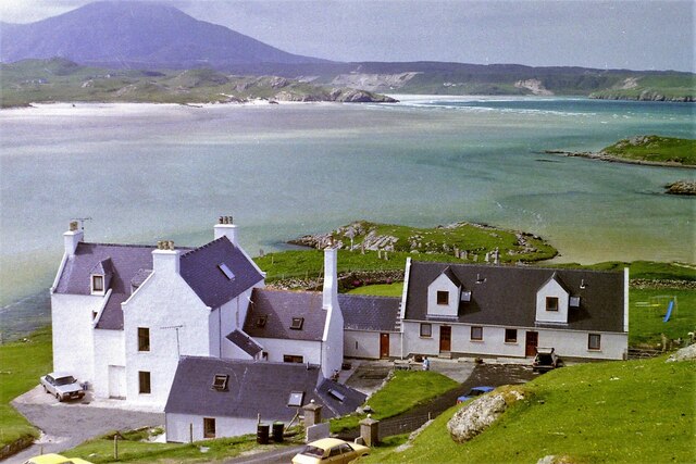
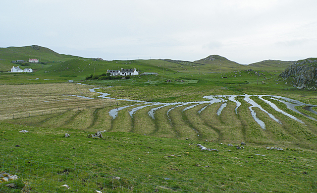
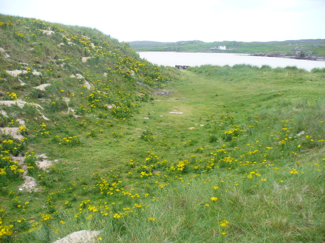
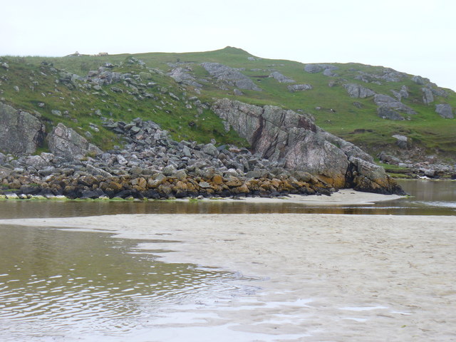
Ardroil is a small village located in the county of Ross-shire, in the northern part of Scotland. Situated on the west coast of the Isle of Lewis, this remote settlement offers stunning views of the Atlantic Ocean and is surrounded by picturesque landscapes.

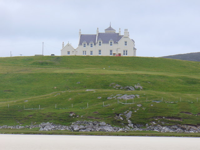
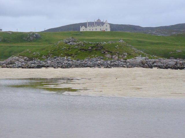
With a population of approximately 200 residents, Ardroil is known for its peaceful and tranquil atmosphere. The village is mainly residential, consisting of traditional houses and cottages, which add to its charm and character. The local community is tight-knit and welcoming, making visitors feel at home.

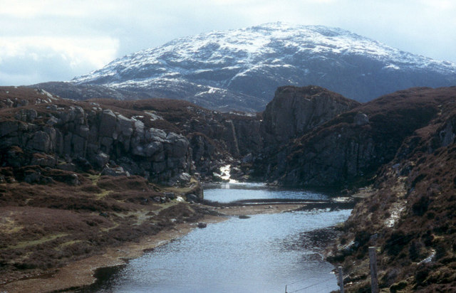
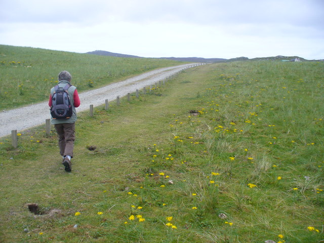
Nature enthusiasts will find plenty to explore in Ardroil. The village is just a stone's throw away from Traigh na Beirigh, a beautiful sandy beach that stretches for miles. This pristine coastline is ideal for long walks, birdwatching, and enjoying breathtaking sunsets. The nearby Loch an Duna is another popular spot, offering opportunities for fishing and sailing.

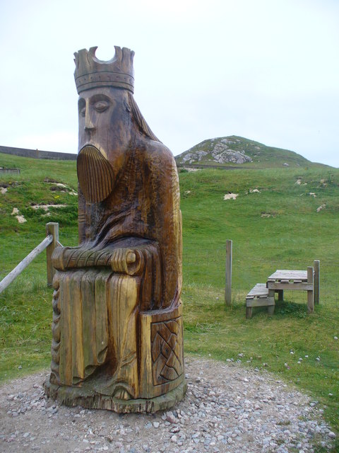
Ardroil is also rich in history and culture. The village is home to several ancient sites, including standing stones and the remains of Iron Age settlements. Visitors can learn about the area's past at the nearby Carloway Broch, one of the best-preserved brochs (prehistoric round towers) in Scotland.

Although Ardroil is a remote village, it is well-connected to other parts of the Isle of Lewis. The nearby town of Stornoway provides essential amenities such as shops, restaurants, and healthcare facilities. Overall, Ardroil is a hidden gem for those seeking tranquility, natural beauty, and a taste of Scottish history.

If you have any feedback on the listing, please let us know in the comments section below.

Ardroil Images

Images are sourced within 2km of 58.179034/-7.0303351 or Grid Reference NB0432. Thanks to Geograph Open Source API. All images are credited.

Baile-na-Cille, Lewis, 1989
Cappadale Sands
Cappadale Sands
Beach and headland at Carnais
Beach at Carnais
Beach at Carnais
Wooden sculpture of a Lewis Knight Chess Piece at the Abhainn Dearg Distillery car park
Tom A small tidal island near Carnais.
Tom
A small tidal island near Carnais.
River leading from Loch Stacsabhat
The Gravel Pits at Carnais, on the Red River, Uig, Lewis The Abhainn Dearg Distillery lies to the left of the picture. The Red River - Ahbainn Dearg flows to the sea at the foot of the scree slope, but is shown on the OS Sheet as Abhainn Caslabhat.
The Gravel Pits at Carnais, on the Red River, Uig, Lewis
The Abhainn Dearg Distillery lies to the left of the picture. The Red River - Ahbainn Dearg flows to the sea at the foot of the scree slope, but is shown on the OS Sheet as Abhainn Caslabhat.
A river tumbles down to Uig Bay Late snow coats the west Lewis mountains.
A river tumbles down to Uig Bay
Late snow coats the west Lewis mountains.
Waterlogged Lazybeds After a day of torrential rain, the old lazybeds at Eadar Dha Fhadail (Ardroil) are almost submerged by flooding.
Waterlogged Lazybeds
After a day of torrential rain, the old lazybeds at Eadar Dha Fhadail (Ardroil) are almost submerged by flooding.
Cappadale Sands The map names this arm of Tràigh Uige as Cappadale Sands. As the tide is in, the sand is only visible through the water, giving it that characteristic Hebridean turquoise colour. It would have been even better in sunshine. The hill on the skyline is Forsnabhal (205 metres), and the houses at the far side of the bay are at Timsgearraidh.
Cappadale Sands
The map names this arm of Tràigh Uige as Cappadale Sands. As the tide is in, the sand is only visible through the water, giving it that characteristic Hebridean turquoise colour. It would have been even better in sunshine. The hill on the skyline is Forsnabhal (205 metres), and the houses at the far side of the bay are at Timsgearraidh.
Càrnais (Carinish) Two cottages overlooking Tràigh Lèire at the head of Cappadale Sands in Uig Bay.
Càrnais (Carinish)
Two cottages overlooking Tràigh Lèire at the head of Cappadale Sands in Uig Bay.
Wooden King, Uig Sculpture based on one of the famous Lewis chessmen, sited close to the cemetery at Uig.
<span class="nowrap"><a title="http://www.uigandbernera.com/" rel="nofollow ugc noopener" href="http://www.uigandbernera.com/">Link</a><img style="margin-left:2px;" alt="External link" title="External link - shift click to open in new window" src="https://s1.geograph.org.uk/img/external.png" width="10" height="10"/></span>
Wooden King, Uig
Sculpture based on one of the famous Lewis chessmen, sited close to the cemetery at Uig. LinkExternal link
Track to Uig Sands Paralleled by a grassy footpath across the machair.
<span class="nowrap"><a title="http://www.uigandbernera.com/" rel="nofollow ugc noopener" href="http://www.uigandbernera.com/">Link</a><img style="margin-left:2px;" alt="External link" title="External link - shift click to open in new window" src="https://s1.geograph.org.uk/img/external.png" width="10" height="10"/></span>
Track to Uig Sands
Paralleled by a grassy footpath across the machair. LinkExternal link
Sand Dunes at Uig Flanking the wide expanses of sand flats at Uig Bay.
<span class="nowrap"><a title="http://www.uigandbernera.com/" rel="nofollow ugc noopener" href="http://www.uigandbernera.com/">Link</a><img style="margin-left:2px;" alt="External link" title="External link - shift click to open in new window" src="https://s1.geograph.org.uk/img/external.png" width="10" height="10"/></span>
Sand Dunes at Uig
Flanking the wide expanses of sand flats at Uig Bay. LinkExternal link
Outflow at Tràigh Ùige Rivermouth where the outflow is hemmed beneath rocky crags.
<span class="nowrap"><a title="http://www.uigandbernera.com/" rel="nofollow ugc noopener" href="http://www.uigandbernera.com/">Link</a><img style="margin-left:2px;" alt="External link" title="External link - shift click to open in new window" src="https://s1.geograph.org.uk/img/external.png" width="10" height="10"/></span>
Outflow at Tràigh Ùige
Rivermouth where the outflow is hemmed beneath rocky crags. LinkExternal link
Loidse Uig Uig Lodge, large hilltop mansion overlooking the expanses of Tràigh Ùige.
<span class="nowrap"><a title="http://www.uigandbernera.com/" rel="nofollow ugc noopener" href="http://www.uigandbernera.com/">Link</a><img style="margin-left:2px;" alt="External link" title="External link - shift click to open in new window" src="https://s1.geograph.org.uk/img/external.png" width="10" height="10"/></span>
Loidse Uig
Uig Lodge, large hilltop mansion overlooking the expanses of Tràigh Ùige. LinkExternal link
Dun Borrainais Remains of an Early Iron Age fort below a rocky promontory at Uig Sands.
<span class="nowrap"><a title="http://www.uigandbernera.com/" rel="nofollow ugc noopener" href="http://www.uigandbernera.com/">Link</a><img style="margin-left:2px;" alt="External link" title="External link - shift click to open in new window" src="https://s1.geograph.org.uk/img/external.png" width="10" height="10"/></span>
Dun Borrainais
Remains of an Early Iron Age fort below a rocky promontory at Uig Sands. LinkExternal link
Show me another place!

Ardroil is located at Grid Ref: NB0432 (Lat: 58.179034, Lng: -7.0303351)

Unitary Authority: Na h-Eileanan an Iar

Police Authority: Highlands and Islands

Also known as: Eadar Dhà Fhadhail

What 3 Words

///adopts.slowly.gossiping. Near Carloway, Na h-Eileanan Siar

Related Wikis

Ardroil

Ardroil (Scottish Gaelic: Eadar Dhà Fhadhail) is a village on the Isle of Lewis in the Outer Hebrides, Scotland. Ardroil is within the parish of Uig....

Uig, Lewis

Uig (Scottish Gaelic: Ùig [uːkʲ]), also known as Sgìr' Ùig, is a civil parish and community in the west of the Isle of Lewis in the Outer Hebrides, Scotland...

Abhainn Dearg distillery

Abhainn Dearg distillery ( AV-in JAIRG) or Red River distillery is a Scotch whisky distillery in Uig, on the west coast of the Isle of Lewis in the Outer...

Timsgarry

Timsgarry (Scottish Gaelic: Tuimisgearraidh) is a village on the Isle of Lewis, in the Outer Hebrides, Scotland. Timsgarry is home to the Baile na Cille...

Camas Uig

Camas Uig (Uig Bay) is a bay on the west coast of the Isle of Lewis, in the Outer Hebrides of Scotland. The Lewis Chessmen were discovered in the dunes...

Gasker

Gasker is a small uninhabited islet in the Outer Hebrides of Scotland, 8 kilometres (4+1⁄2 nautical miles) southwest of Scarp, off the west coast of Harris...

Stac Dhòmhnaill Chaim

Stac Dhòmnuill Chaim, or Stac Dhòmhnaill Chaim, or Stac Domhnuill Chaim, is a fortified promontory located near Mangursta (or Mangersta, Scottish Gaelic...

Cliff, Lewis

Cliff (Scottish Gaelic: Cliobh) is a small settlement on the Isle of Lewis, in the Outer Hebrides, Scotland. Cliff is within the parish of Uig. The settlement...

Nearby Amenities

Located within 500m of 58.179034,-7.0303351
Passing Place
Lat/Long: 58.1790008/-7.0300098
Passing Place
Lat/Long: 58.1788834/-7.0256041
Passing Place
Lat/Long: 58.1801066/-7.0239612
Bus Stop
Ardroil Sands
Naptan AtcoCode: 6010731869
Naptan Bearing: W
Naptan CommonName: Ardroil Sands
Naptan Indicator: Ardroil Sands
Naptan Landmark: Ardroil Sands
Naptan NaptanCode: 94723824
Naptan Street: Ardroil Sands
Naptan Verified: no
Source: naptan_import
Lat/Long: 58.1783992/-7.0290186
Passing Place
Lat/Long: 58.1783346/-7.0342274
Barrier: cattle_grid
Lat/Long: 58.1788269/-7.0312042
Barrier: cattle_grid
Lat/Long: 58.1788748/-7.0303222
King
Artist Name: Stephen Hayward
Artwork Type: statue
Material: wood
Tourism: artwork
Lat/Long: 58.1805085/-7.0303723
Power: pole
Lat/Long: 58.1776866/-7.036702
Power: pole
Lat/Long: 58.1780854/-7.0358273
Power: pole
Lat/Long: 58.1785681/-7.0347085
Power: pole
Lat/Long: 58.1791135/-7.033529
Power: pole
Lat/Long: 58.179617/-7.032275
Power: pole
Lat/Long: 58.1800494/-7.0312081
Barrier: cattle_grid
Lat/Long: 58.1801669/-7.0258477
Power: pole
Lat/Long: 58.1802589/-7.0304431
Power: pole
Lat/Long: 58.1804638/-7.0296351
Board Type: history
Check Date: 2021-08-09
Information: board
Tourism: information
Lat/Long: 58.1804837/-7.0303837
Power: pole
Lat/Long: 58.1808398/-7.0282058
Power: pole
Lat/Long: 58.1810706/-7.0269693
Power: pole
Lat/Long: 58.1813045/-7.0258002
Eadar Dhà Fhadhail
Name En: Ardroil
Name Gd: Eadar Dhà Fhadhail
Place: village
Wikidata: Q4788255
Wikipedia: en:Ardroil
Lat/Long: 58.1797779/-7.0278388
Post Box
Drive Through: no
Lat/Long: 58.1770652/-7.0359933
Power: pole
Lat/Long: 58.1770409/-7.0368683
Power: pole
Lat/Long: 58.1779168/-7.029933
Power: pole
Lat/Long: 58.1781284/-7.0306631
Power: pole
Lat/Long: 58.1783084/-7.0313647
Power: pole
Lat/Long: 58.1782174/-7.0318869
Power: pole
Lat/Long: 58.1780873/-7.03253
Power: pole
Lat/Long: 58.1779422/-7.0332722
Power: pole
Lat/Long: 58.1778076/-7.0339788
Power: pole
Lat/Long: 58.1775058/-7.0346776
Power: pole
Lat/Long: 58.1772304/-7.0353351
Power: pole
Lat/Long: 58.1769391/-7.0359985
Power: pole
Lat/Long: 58.1770993/-7.0374444
Power: pole
Lat/Long: 58.1783417/-7.0302673
Power: pole
Lat/Long: 58.178714/-7.0302348
Power: pole
Lat/Long: 58.1790804/-7.0301592
Power: pole
Lat/Long: 58.1788319/-7.0307475
Power: pole
Lat/Long: 58.1824029/-7.0251864
Power: pole
Lat/Long: 58.1819841/-7.0252526
Power: pole
Lat/Long: 58.1815713/-7.0243932
Turning Circle
Lat/Long: 58.1777639/-7.0357693
Power: pole
Lat/Long: 58.1815745/-7.025293
The data included in this document is from www.openstreetmap.org. The data is made available under ODbL.

Have you been to Ardroil?

Leave your review of Ardroil below (or comments, questions and feedback).