Cock Wood

Wood, Forest in Northumberland

England

Cock Wood

Swallowship Wood
Swallowship Wood Credit: brian clark

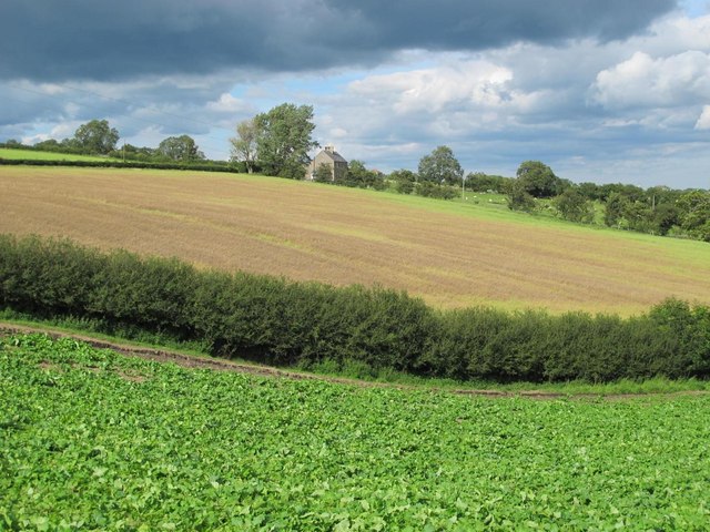
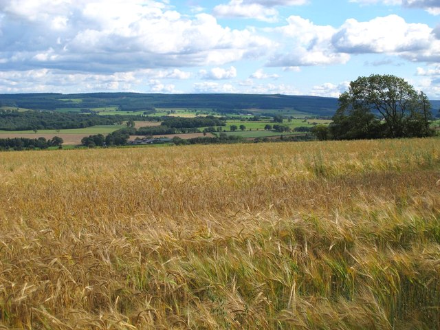
Cock Wood is a small forest located in the rural region of Northumberland, England. Situated in the northern part of the county, this woodland area covers approximately 20 hectares of land. It is known for its natural beauty and serene atmosphere, making it a popular destination for nature lovers and hikers.

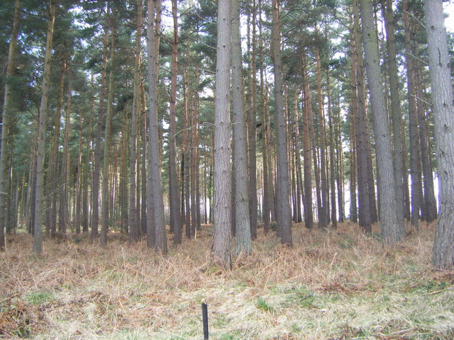
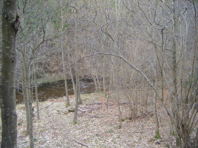
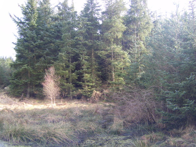
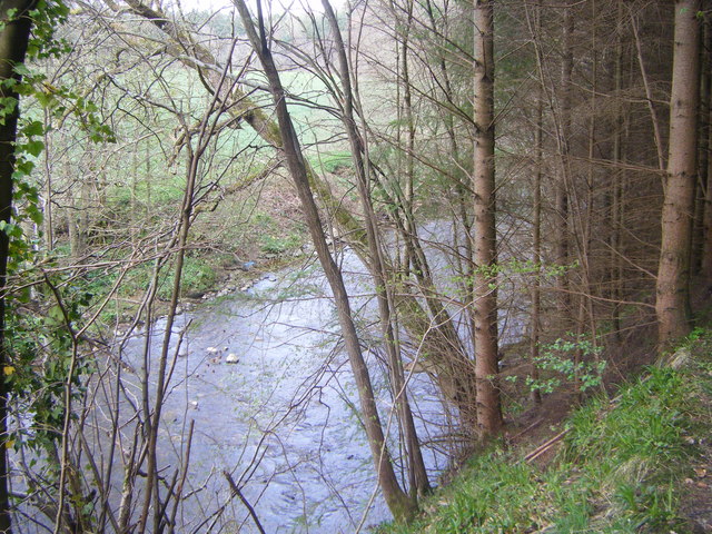
The forest is predominantly composed of native tree species, such as oak, ash, and birch, which provide a dense canopy that creates a shaded and cool environment. The undergrowth is rich with ferns, mosses, and wildflowers, adding to the picturesque scenery.

Cock Wood is home to a diverse range of wildlife. Various bird species, including woodpeckers and owls, can be spotted among the trees. The forest also serves as a habitat for small mammals like squirrels, rabbits, and foxes. Rare and protected species, such as the red squirrel, can occasionally be found here, adding to the ecological importance of the area.

A network of well-maintained footpaths and trails wind their way through the woodland, allowing visitors to explore the area at their own pace. These paths also provide access to viewpoints and picnic areas, offering visitors the opportunity to relax and enjoy the natural surroundings.

Cock Wood is managed by the local authorities, who ensure the preservation of the forest and its ecosystem. The area is open to the public throughout the year, and there are no admission fees, making it an accessible destination for all. Whether it's a leisurely stroll or an immersive nature experience, Cock Wood offers a tranquil escape into the heart of Northumberland's natural beauty.

If you have any feedback on the listing, please let us know in the comments section below.
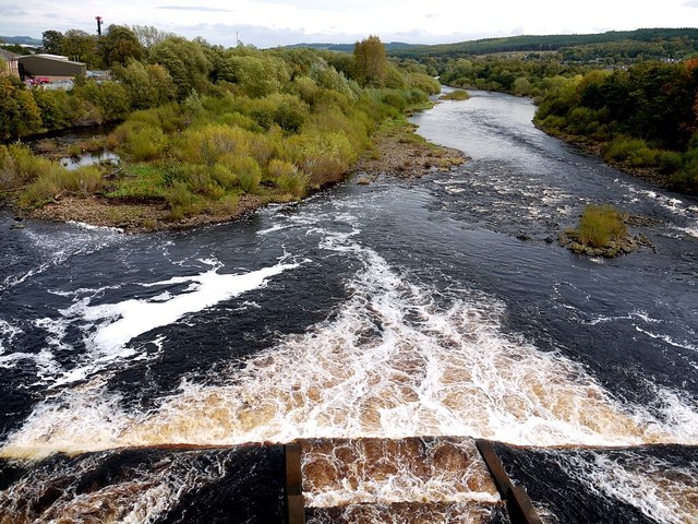
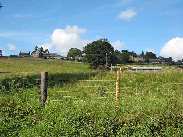
Cock Wood Images

Images are sourced within 2km of 54.965448/-2.0723627 or Grid Reference NY9563. Thanks to Geograph Open Source API. All images are credited.

Swallowship Wood
Swallowship Wood
Swallowship Wood and Devils water
Swallowship Wood
Swallowship Wood
Thankyou, young lady! A lively street band entertaining the shoppers in Fore Street, Hexham
Thankyou, young lady!
A lively street band entertaining the shoppers in Fore Street, Hexham
Street band, Fore Street, Hexham A lively band entertaining shoppers in Fore Street, Hexham. It rather looks as if the lady on the left is vamping along with the band on a harmonica, but there may be some other explanation!
Street band, Fore Street, Hexham
A lively band entertaining shoppers in Fore Street, Hexham. It rather looks as if the lady on the left is vamping along with the band on a harmonica, but there may be some other explanation!
Devils Water
Devils Water
Factory, Hexham This is Egger's chipboard factory. Chipboard (also known as hardboard) is a cheap building material made by pressing together wood chips and binding them with a synthetic resin at high temperatures. Information from the Science Photo Library.
There is something very spectacular about these industrial buildings with their intricate, convoluted, shiny pipes, vats and chimneys. I'm sure aesthetics is not a consideration when building such structures, but I don't think that means one cannot admire them from an aesthetic perspective.
Some great shots from Peter McDermott here: <a href="https://www.geograph.org.uk/photo/1464432">NY9464 : Egger</a>, <a href="https://www.geograph.org.uk/photo/1273088">NY9464 : Egger</a>, <a href="https://www.geograph.org.uk/photo/1272892">NY9464 : Egger</a>.
Factory, Hexham
This is Egger's chipboard factory. Chipboard (also known as hardboard) is a cheap building material made by pressing together wood chips and binding them with a synthetic resin at high temperatures. Information from the Science Photo Library. There is something very spectacular about these industrial buildings with their intricate, convoluted, shiny pipes, vats and chimneys. I'm sure aesthetics is not a consideration when building such structures, but I don't think that means one cannot admire them from an aesthetic perspective. Some great shots from Peter McDermott here: NY9464 : Egger, NY9464 : Egger, NY9464 : Egger.
Farmland between Houtley and Birks
Farmland north of Birks
Hexham Railway Station A multiple unit approaching Hexham railway station. The distinctive North Eastern Railway signal box can be seen in the background.
Hexham Railway Station
A multiple unit approaching Hexham railway station. The distinctive North Eastern Railway signal box can be seen in the background.
Footbridge at Hexham Railway Station. The footbridge at Hexham railway station, looking West.
Footbridge at Hexham Railway Station.
The footbridge at Hexham railway station, looking West.
Egger's factory, Hexham Around the edge of the factory compound the raw materials are stacked: logs from Kielder Forest and a huge pile of sawdust. The logs will be chipped, sawdust added and bound with resin to make chip board used to make kitchen units and furniture.
Egger's factory, Hexham
Around the edge of the factory compound the raw materials are stacked: logs from Kielder Forest and a huge pile of sawdust. The logs will be chipped, sawdust added and bound with resin to make chip board used to make kitchen units and furniture.
Sawdust hill at Egger's Factory, Hexham One of the most useful raw materials for making chipboard is sawdust from local sawmills.
Sawdust hill at Egger's Factory, Hexham
One of the most useful raw materials for making chipboard is sawdust from local sawmills.
Manufacturing plant, Egger chipboard factory, Hexham
Egger factory chimneys above Bridge End Industrial Estate
Weir on River Tyne below Hexham Bridge There are more details about the weir here <a href="https://www.geograph.org.uk/photo/2658513">NY9464 : Salmon fails to jump weir below Hexham Bridge</a>
Weir on River Tyne below Hexham Bridge
There are more details about the weir here NY9464 : Salmon fails to jump weir below Hexham Bridge
Salmon fails to jump weir below Hexham Bridge Record numbers of salmon have been recorded in the River Tyne, making it the best river for the species in England and Wales. Hexham road bridge weir <a href="https://www.geograph.org.uk/photo/2658495">NY9464 : Weir on River Tyne below Hexham Bridge</a> is thought to be a threat to salmon's ability to progress up river because wartime gravel extraction has increased the height difference. There is a proposal to install a fish pass for the 2012 season <span class="nowrap"><a title="http://www.journallive.co.uk/north-east-news/todays-news/2011/07/01/wartime-legacy-threat-to-salmon-61634-28974772/" rel="nofollow ugc noopener" href="http://www.journallive.co.uk/north-east-news/todays-news/2011/07/01/wartime-legacy-threat-to-salmon-61634-28974772/">Link</a><img style="margin-left:2px;" alt="External link" title="External link - shift click to open in new window" src="https://s1.geograph.org.uk/img/external.png" width="10" height="10"/></span>
Ok, I know it's 'spot the salmon' but after 30 minutes wait and many photos of just water, this was my best effort.
A £100,000 green energy prize was awarded in December 2011 for a community based hydro scheme to generate electricity at the weir below Hexham Bridge <span class="nowrap"><a title="http://www.bbc.co.uk/news/uk-england-tyne-16041778" rel="nofollow ugc noopener" href="http://www.bbc.co.uk/news/uk-england-tyne-16041778">Link</a><img style="margin-left:2px;" alt="External link" title="External link - shift click to open in new window" src="https://s1.geograph.org.uk/img/external.png" width="10" height="10"/></span> <span class="nowrap"><a title="http://www.hexhamcommunity.net/pages/projects/hexham-river-hydro/hrh---find-out-more.php" rel="nofollow ugc noopener" href="http://www.hexhamcommunity.net/pages/projects/hexham-river-hydro/hrh---find-out-more.php">Link</a><img style="margin-left:2px;" alt="External link" title="External link - shift click to open in new window" src="https://s1.geograph.org.uk/img/external.png" width="10" height="10"/></span>
Salmon fails to jump weir below Hexham Bridge
Record numbers of salmon have been recorded in the River Tyne, making it the best river for the species in England and Wales. Hexham road bridge weir NY9464 : Weir on River Tyne below Hexham Bridge is thought to be a threat to salmon's ability to progress up river because wartime gravel extraction has increased the height difference. There is a proposal to install a fish pass for the 2012 season LinkExternal link Ok, I know it's 'spot the salmon' but after 30 minutes wait and many photos of just water, this was my best effort. A £100,000 green energy prize was awarded in December 2011 for a community based hydro scheme to generate electricity at the weir below Hexham Bridge LinkExternal link LinkExternal link
Manufacturing plant, Egger's chipboard factory, Hexham
Show me another place!

Cock Wood is located at Grid Ref: NY9563 (Lat: 54.965448, Lng: -2.0723627)

Unitary Authority: Northumberland

Police Authority: Northumbria

What 3 Words

///provider.contained.sonic. Near Hexham, Northumberland

Nearby Locations

Cock Wood

Related Wikis

Hexham General Hospital

Hexham General Hospital is an acute general hospital in Hexham, Northumberland, England. It is managed by the Northumbria Healthcare NHS Foundation Trust...

Anick

Anick ( AY-nik) is a village and former civil parish, now in the parish of Sandhoe, in Northumberland, England, situated to the north of Hexham. In 1881...

Hexham railway station

Hexham is a railway station on the Tyne Valley Line, which runs between Newcastle and Carlisle via Hexham. The station, situated 22 miles 22 chains (22...

Battle of Hexham

The Battle of Hexham, 15 May 1464, marked the end of significant Lancastrian resistance in the north of England during the early part of the reign of Edward...
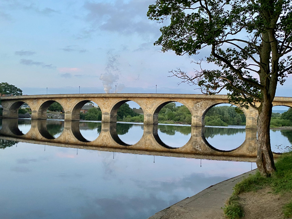
Hexham Bridge

Hexham Bridge is a road bridge in Northumberland, England linking Hexham with the North Tyne valley. It lies north of the town of Hexham and is the main...

Hexham Old Gaol

The Old Gaol, also known as the Manor Office, is a custodial building in Hallgate in Hexham, Northumberland, England. The building, which now operates...

Hexham Rowing Club

Hexham Rowing Club is a rowing club on the River Tyne, based at Tyne Green boathouse, Nr Hexham Bridge, Hexham, Northumberland. Rowers aged 12 and upwards...

Queen Elizabeth High School Rowing Club

Queen Elizabeth High School Rowing Club is a rowing club on the River Tyne, based at Tyne Green boathouse, Nr Hexham Bridge, Hexham, Northumberland....

Nearby Amenities

Located within 500m of 54.965448,-2.0723627
Noexit: yes
Lat/Long: 54.9695838/-2.0754075
Noexit: yes
Lat/Long: 54.9696269/-2.0730539
Noexit: yes
Lat/Long: 54.9682505/-2.067807
Noexit: yes
Lat/Long: 54.9684945/-2.0676834
Generator Method: photovoltaic
Generator Output Electricity: yes
Generator Source: solar
Generator Type: solar_photovoltaic_panel
Location: roof
Power: generator
Lat/Long: 54.9695447/-2.0740186
Generator Method: photovoltaic
Generator Output Electricity: yes
Generator Source: solar
Generator Type: solar_photovoltaic_panel
Location: roof
Power: generator
Lat/Long: 54.9695463/-2.0740776
Generator Method: photovoltaic
Generator Output Electricity: yes
Generator Source: solar
Generator Type: solar_photovoltaic_panel
Location: roof
Power: generator
Lat/Long: 54.9695386/-2.0742117
Generator Method: photovoltaic
Generator Output Electricity: yes
Generator Source: solar
Generator Type: solar_photovoltaic_panel
Location: roof
Power: generator
Lat/Long: 54.9695555/-2.0742975
Generator Method: photovoltaic
Generator Output Electricity: yes
Generator Source: solar
Generator Type: solar_photovoltaic_panel
Location: roof
Power: generator
Lat/Long: 54.9695555/-2.0744906
Generator Method: photovoltaic
Generator Output Electricity: yes
Generator Source: solar
Generator Type: solar_photovoltaic_panel
Location: roof
Power: generator
Lat/Long: 54.9695648/-2.0745577
Generator Method: photovoltaic
Generator Output Electricity: yes
Generator Source: solar
Generator Type: solar_photovoltaic_panel
Location: roof
Power: generator
Lat/Long: 54.9695848/-2.0747267
Generator Method: photovoltaic
Generator Output Electricity: yes
Generator Source: solar
Generator Type: solar_photovoltaic_panel
Location: roof
Power: generator
Lat/Long: 54.969584/-2.0749385
Generator Method: photovoltaic
Generator Output Electricity: yes
Generator Source: solar
Generator Type: solar_photovoltaic_panel
Location: roof
Power: generator
Lat/Long: 54.9695894/-2.0751558
Generator Method: photovoltaic
Generator Output Electricity: yes
Generator Source: solar
Generator Type: solar_photovoltaic_panel
Location: roof
Power: generator
Lat/Long: 54.9697526/-2.0742224
Generator Method: photovoltaic
Generator Output Electricity: yes
Generator Source: solar
Generator Type: solar_photovoltaic_panel
Location: roof
Power: generator
Lat/Long: 54.9697511/-2.0741339
Generator Method: photovoltaic
Generator Output Electricity: yes
Generator Source: solar
Generator Type: solar_photovoltaic_panel
Location: roof
Power: generator
Lat/Long: 54.9697079/-2.0732863
Generator Method: photovoltaic
Generator Output Electricity: yes
Generator Source: solar
Generator Type: solar_photovoltaic_panel
Location: roof
Power: generator
Lat/Long: 54.9697018/-2.0731656
Generator Method: photovoltaic
Generator Output Electricity: yes
Generator Source: solar
Generator Type: solar_photovoltaic_panel
Location: roof
Power: generator
Lat/Long: 54.9694847/-2.0732702
Generator Method: photovoltaic
Generator Output Electricity: yes
Generator Source: solar
Generator Type: solar_photovoltaic_panel
Location: roof
Power: generator
Lat/Long: 54.9697218/-2.0736672
Generator Method: photovoltaic
Generator Output Electricity: yes
Generator Source: solar
Generator Type: solar_photovoltaic_panel
Location: roof
Power: generator
Lat/Long: 54.9697295/-2.0737718
Generator Method: photovoltaic
Generator Output Electricity: yes
Generator Source: solar
Generator Type: solar_photovoltaic_panel
Location: roof
Power: generator
Lat/Long: 54.9694929/-2.0735344
Generator Method: photovoltaic
Generator Output Electricity: yes
Generator Source: solar
Generator Type: solar_photovoltaic_panel
Location: roof
Power: generator
Lat/Long: 54.9687854/-2.0679898
Generator Method: photovoltaic
Generator Output Electricity: yes
Generator Source: solar
Generator Type: solar_photovoltaic_panel
Location: roof
Power: generator
Lat/Long: 54.9687854/-2.0678182
Generator Method: photovoltaic
Generator Output Electricity: yes
Generator Source: solar
Generator Type: solar_photovoltaic_panel
Location: roof
Power: generator
Lat/Long: 54.9684636/-2.0679469
Generator Method: photovoltaic
Generator Output Electricity: yes
Generator Source: solar
Generator Type: solar_photovoltaic_panel
Location: roof
Power: generator
Lat/Long: 54.9684729/-2.0673568
Generator Method: photovoltaic
Generator Output Electricity: yes
Generator Source: solar
Generator Type: solar_photovoltaic_panel
Location: roof
Power: generator
Lat/Long: 54.9681803/-2.0680193
Generator Method: photovoltaic
Generator Output Electricity: yes
Generator Source: solar
Generator Type: solar_photovoltaic_panel
Location: roof
Power: generator
Lat/Long: 54.968265/-2.067676
Generator Method: photovoltaic
Generator Output Electricity: yes
Generator Source: solar
Generator Type: solar_photovoltaic_panel
Location: roof
Power: generator
Lat/Long: 54.9682589/-2.0674775
Generator Method: photovoltaic
Generator Output Electricity: yes
Generator Source: solar
Generator Type: solar_photovoltaic_panel
Location: roof
Power: generator
Lat/Long: 54.9682342/-2.0671744
Generator Method: photovoltaic
Generator Output Electricity: yes
Generator Source: solar
Generator Type: solar_photovoltaic_panel
Location: roof
Power: generator
Lat/Long: 54.9684467/-2.0668338
Generator Method: photovoltaic
Generator Output Electricity: yes
Generator Source: solar
Generator Type: solar_photovoltaic_panel
Location: roof
Power: generator
Lat/Long: 54.9685776/-2.0667828
Generator Method: photovoltaic
Generator Output Electricity: yes
Generator Source: solar
Generator Type: solar_photovoltaic_panel
Location: roof
Power: generator
Lat/Long: 54.968302/-2.0669491
Generator Method: photovoltaic
Generator Output Electricity: yes
Generator Source: solar
Generator Type: solar_photovoltaic_panel
Location: roof
Power: generator
Lat/Long: 54.9687716/-2.0674427
Generator Method: photovoltaic
Generator Output Electricity: yes
Generator Source: solar
Generator Type: solar_photovoltaic_panel
Location: roof
Power: generator
Lat/Long: 54.96873/-2.0671423
Generator Method: photovoltaic
Generator Output Electricity: yes
Generator Source: solar
Generator Type: solar_photovoltaic_panel
Location: roof
Power: generator
Lat/Long: 54.968573/-2.0679469
Generator Method: photovoltaic
Generator Output Electricity: yes
Generator Source: solar
Generator Type: solar_photovoltaic_panel
Location: roof
Power: generator
Lat/Long: 54.9686631/-2.0775414
Generator Method: photovoltaic
Generator Output Electricity: yes
Generator Source: solar
Generator Type: solar_photovoltaic_panel
Location: roof
Power: generator
Lat/Long: 54.9695751/-2.0752621
Generator Method: photovoltaic
Generator Output Electricity: yes
Generator Source: solar
Generator Type: solar_photovoltaic_panel
Location: roof
Power: generator
Lat/Long: 54.9695882/-2.0748571
Generator Method: photovoltaic
Generator Output Electricity: yes
Generator Source: solar
Generator Type: solar_photovoltaic_panel
Location: roof
Power: generator
Lat/Long: 54.9695066/-2.073638
Generator Method: photovoltaic
Generator Output Electricity: yes
Generator Source: solar
Generator Type: solar_photovoltaic_panel
Location: roof
Power: generator
Lat/Long: 54.9695027/-2.0733685
Generator Method: photovoltaic
Generator Output Electricity: yes
Generator Source: solar
Generator Type: solar_photovoltaic_panel
Location: roof
Power: generator
Lat/Long: 54.9687637/-2.0727127
Generator Method: photovoltaic
Generator Output Electricity: yes
Generator Source: solar
Generator Type: solar_photovoltaic_panel
Location: roof
Power: generator
Lat/Long: 54.9682887/-2.0680057
Bus Stop
Bench: yes
Bin: yes
Bus: yes
Public Transport: platform
Shelter: no
Lat/Long: 54.9690598/-2.0688744
Bus: yes
Public Transport: stop_position
Lat/Long: 54.9691143/-2.0689448
The data included in this document is from www.openstreetmap.org. The data is made available under ODbL.

Have you been to Cock Wood?

Leave your review of Cock Wood below (or comments, questions and feedback).