Bird Bank Wood

Wood, Forest in Yorkshire

England

Bird Bank Wood

Lobb Mill The Rochdale Canal locks to the right of view from Halifax Road
Lobb Mill Credit: Raymond Knapman

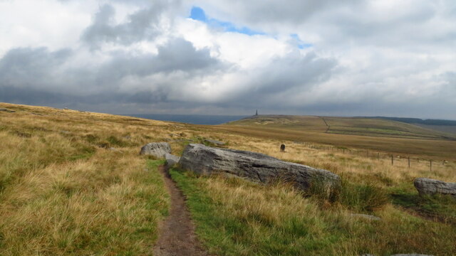
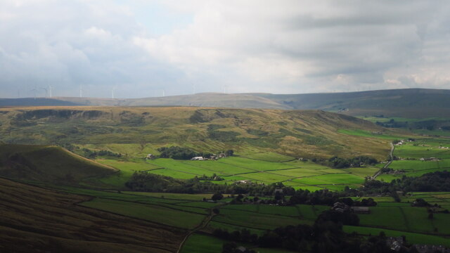
Bird Bank Wood is a picturesque woodland located in Yorkshire, England. Covering an expansive area, it is a nature lover's paradise and a popular destination for outdoor enthusiasts. The wood is situated near the town of Harrogate, providing easy access for visitors.

The wood is characterized by its diverse range of tree species, including oak, beech, and birch, which create a rich and vibrant canopy. The dense foliage provides a haven for a variety of bird species, lending the wood its name. Bird watchers can spot a wide array of species, including woodpeckers, owls, and various songbirds. In fact, the wood is recognized as an important breeding site for many bird species.

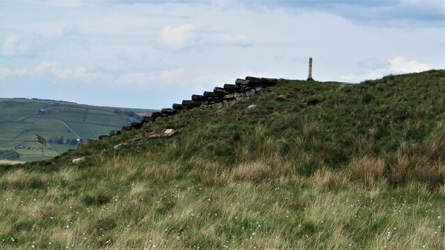
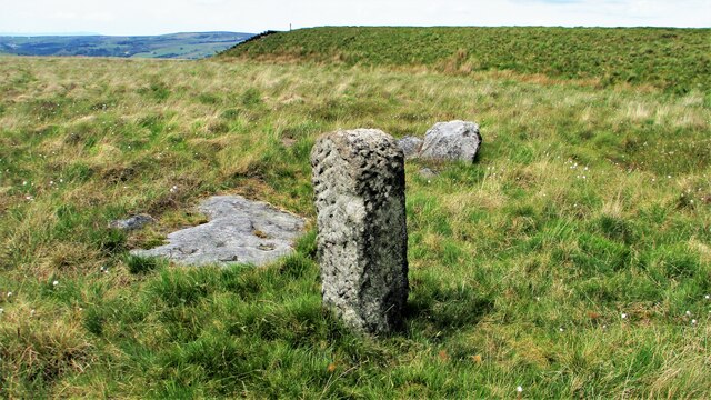
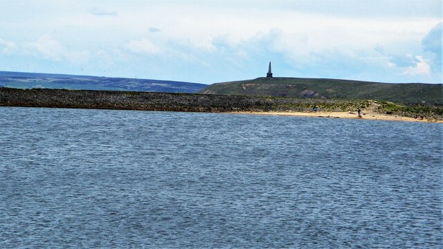
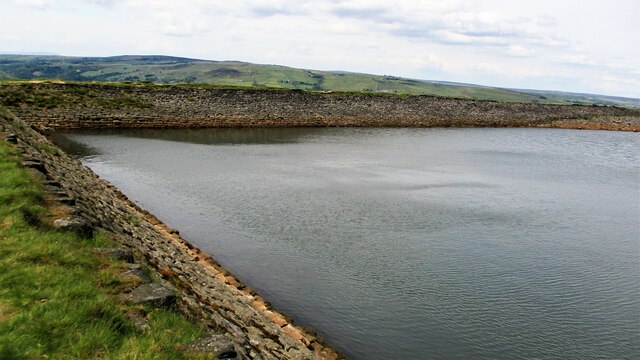
The woodland has a network of well-maintained walking trails, making it an ideal spot for hiking and exploring. As visitors wander through the wood, they will encounter enchanting streams, small waterfalls, and peaceful ponds. These features not only add to the natural beauty of the area but also provide habitats for amphibians and other aquatic creatures.

Bird Bank Wood is also home to a diverse range of flora and fauna. Wildflowers, such as bluebells and primroses, bloom in abundance during the spring, creating a carpet of vibrant colors. The wood also supports a variety of mammals, including deer, squirrels, and foxes.

Overall, Bird Bank Wood is a truly remarkable woodland in Yorkshire, offering visitors a chance to immerse themselves in nature and experience the tranquility and beauty of the natural world.

If you have any feedback on the listing, please let us know in the comments section below.

Bird Bank Wood Images

Images are sourced within 2km of 53.710166/-2.0765617 or Grid Reference SD9523. Thanks to Geograph Open Source API. All images are credited.

Lobb Mill The Rochdale Canal locks to the right of view from Halifax Road
Lobb Mill
The Rochdale Canal locks to the right of view from Halifax Road
Burnley Road, Todmorden View from Rochdale to Leeds railway
Burnley Road, Todmorden
View from Rochdale to Leeds railway
Rodwell End Clough View from Lobb Mill Viaduct
Rodwell End Clough
View from Lobb Mill Viaduct
Pennine Way descending from Bald Scout Hill
Sunlight on Todmorden from ridge south of Stoodley Pike Monument
Lumbutts from Stoodley Pike Monument
Old Boundary Marker in Stoodley Glen, Calderdale Township Boundary Marker above Stoodley Glen and south of Stoodley Lane. Formerly on the boundary of Langfield and Sowerby townships in Halifax parish. It marked the boundary of the Sowerby Ramble, a narrow strip of land along the Calder valley and up Stoodley Glen between Erringden and Stansfield townships and Erringden and Langfield township. Sowerby Ramble was part of Sowerby township but in 1850 it became part of Erringden township, later parish. In 1897 Langfield and Stansfield became part of Todmorden parish and in 1937 this part of Erringden parish also became part of Todmorden parish. 

Milestone Society National ID: YW_LANSOW02pb
Old Boundary Marker in Stoodley Glen, Calderdale
Township Boundary Marker above Stoodley Glen and south of Stoodley Lane. Formerly on the boundary of Langfield and Sowerby townships in Halifax parish. It marked the boundary of the Sowerby Ramble, a narrow strip of land along the Calder valley and up Stoodley Glen between Erringden and Stansfield townships and Erringden and Langfield township. Sowerby Ramble was part of Sowerby township but in 1850 it became part of Erringden township, later parish. In 1897 Langfield and Stansfield became part of Todmorden parish and in 1937 this part of Erringden parish also became part of Todmorden parish. Milestone Society National ID: YW_LANSOW02pb
Lower Knowl A work in progress
Lower Knowl
A work in progress
Swineshead Farm View from Lower Knowl
Swineshead Farm
View from Lower Knowl
Lower Knowl A farmhouse hopefully work in progress
Lower Knowl
A farmhouse hopefully work in progress
Steps at Gaddings Dam Steps at western corner of dam showing daylight through them
Steps at Gaddings Dam
Steps at western corner of dam showing daylight through them
Old Boundary Marker in Stoodley Glen, Calderdale Parish Boundary Marker in Stoodley Glen below Height Wood. Formerly on the boundary of Langfield and Sowerby townships in Halifax parish. It marked the boundary of the Sowerby Ramble, a narrow strip of land along the Calder valley and up Stoodley Glen between Erringden and Stansfield townships and Erringden and Langfield township. Sowerby Ramble was part of Sowerby township but in 1850 it became part of Erringden township, later parish. In 1897 Langfield and Stansfield became part of Todmorden parish and in 1937 this part of Erringden parish also became part of Todmorden parish..

Milestone Society National ID: YW_SOWERR01pb
Old Boundary Marker in Stoodley Glen, Calderdale
Parish Boundary Marker in Stoodley Glen below Height Wood. Formerly on the boundary of Langfield and Sowerby townships in Halifax parish. It marked the boundary of the Sowerby Ramble, a narrow strip of land along the Calder valley and up Stoodley Glen between Erringden and Stansfield townships and Erringden and Langfield township. Sowerby Ramble was part of Sowerby township but in 1850 it became part of Erringden township, later parish. In 1897 Langfield and Stansfield became part of Todmorden parish and in 1937 this part of Erringden parish also became part of Todmorden parish.. Milestone Society National ID: YW_SOWERR01pb
Langfield Common Boundary Stone Stone with L on face away from camera, nothing discernible on other. Gaddings Dam steps in background
Langfield Common Boundary Stone
Stone with L on face away from camera, nothing discernible on other. Gaddings Dam steps in background
Costa del Todmordo The beach in Gaddings Dam, a very popular spot for Todmorden folk. Stoodley Pike Monument in the background
Costa del Todmordo
The beach in Gaddings Dam, a very popular spot for Todmorden folk. Stoodley Pike Monument in the background
Old Boundary Marker Estate Boundary Marker set in a stone wall on Matthew Lane, a green lane. In the former Stansfield township and parish, absorbed into Todmorden parish in 1897. Not on any township or parish boundary so is thought to mark an estate boundary.

Milestone Society National ID: YW_TOD10em
Old Boundary Marker
Estate Boundary Marker set in a stone wall on Matthew Lane, a green lane. In the former Stansfield township and parish, absorbed into Todmorden parish in 1897. Not on any township or parish boundary so is thought to mark an estate boundary. Milestone Society National ID: YW_TOD10em
Gaddings Dam The stone inner face of the dam. Gaddings is maintained by a local Group with Friends support.
Gaddings Dam
The stone inner face of the dam. Gaddings is maintained by a local Group with Friends support.
Gaddings Dam Outlet Pipe The culvert in the North West dam wall
Gaddings Dam Outlet Pipe
The culvert in the North West dam wall
Gaddings Dam Outlet Culvert Keystone 1853 datestone on outlet culvert in North West dam wall
Gaddings Dam Outlet Culvert Keystone
1853 datestone on outlet culvert in North West dam wall
Show me another place!

Bird Bank Wood is located at Grid Ref: SD9523 (Lat: 53.710166, Lng: -2.0765617)

Division: West Riding

Unitary Authority: Calderdale

Police Authority: West Yorkshire

What 3 Words

///panic.repaying.intent. Near Todmorden, West Yorkshire

Related Wikis

Mankinholes

Mankinholes is a hamlet in the Metropolitan Borough of Calderdale, in West Yorkshire, England. It is situated in the Pennines and the nearest town is Todmorden...

Todmorden

Todmorden ( TOD-mər-dən; locally ) is a market town and civil parish in the Upper Calder Valley in Calderdale, West Yorkshire, England. It is 17 miles...

Todmorden Markets

Todmorden Markets consist of an indoor market held in the Public Market Hall and an outdoor open air market held to the front of the Public Market Hall...

Todmorden Town Hall

Todmorden Town Hall is a municipal building in Halifax Road, Todmorden, West Yorkshire, England. The town hall, which is the meeting place of Todmorden...

Todmorden bus station

Todmorden bus station serves the town of Todmorden, West Yorkshire, England. The bus station is owned and managed by West Yorkshire Metro and was opened...

Todmorden Unitarian Church

Todmorden Unitarian Church is a Unitarian church located in Honey Hole Road, Todmorden, West Yorkshire, England (grid reference SD935239). Built in honour...

Stansfield Hall railway station

Stansfield Hall railway station (English: ) was the second station in Stansfield, Todmorden in West Yorkshire, England and was situated on the Copy Pit...

Todmorden railway station

Todmorden railway station serves the town of Todmorden in West Yorkshire, England, originally on the Yorkshire and Lancashire border. It was built by the...

Nearby Amenities

Located within 500m of 53.710166,-2.0765617
Bus Stop
Lumbutts Road Lumbutts
Local Ref: 45018965
Naptan AtcoCode: 450018965
Naptan Bearing: E
Naptan CommonName: Lumbutts Road Lumbutts
Naptan Crossing: Causeway Wood Road
Naptan Indicator: Stop 45018965
Naptan PlusbusZoneRef: LEEDS
Naptan ShortCommonName: Croft Gate
Naptan Street: Lumbutts Road
Naptan Verified: no
Shelter: no
Source: naptan_import
Lat/Long: 53.7063464/-2.0774276
Lumbutts Road
Local Ref: 45050711
Naptan AtcoCode: 450050711
Naptan Bearing: W
Naptan BusStopType: CUS
Naptan CommonName: Lumbutts Road
Naptan Indicator: Stop 45050711
Naptan PlusbusZoneRef: LEEDS
Naptan ShortCommonName: Croft Farm
Naptan Street: Lumbutts Road
Naptan Verified: no
Source: naptan_import
Lat/Long: 53.7062925/-2.0773972
Barrier: stile
Bicycle: no
Foot: yes
Horse: no
Material: wood
Motor Vehicle: no
Stile: stepover
Lat/Long: 53.7080455/-2.0817519
Barrier: stile
Foot: yes
Material: wood
Stile: stepover
Lat/Long: 53.7122476/-2.0787184
Barrier: stile
Lat/Long: 53.708958/-2.0707024
Barrier: stile
Foot: yes
Material: stone
Stile: squeezer
Lat/Long: 53.7095073/-2.0769131
Barrier: stile
Foot: yes
Material: stone
Lat/Long: 53.7086754/-2.0763034
Barrier: stile
Foot: yes
Stile: stepover
Lat/Long: 53.7074854/-2.0746915
Barrier: stile
Foot: yes
Material: stone
Stile: squeezer
Lat/Long: 53.7079653/-2.0753003
Power: pole
Lat/Long: 53.7089839/-2.0693911
Power: pole
Lat/Long: 53.7073242/-2.0723631
Power: pole
Lat/Long: 53.7075809/-2.0744815
Power: pole
Lat/Long: 53.7077918/-2.0761912
Power: pole
Lat/Long: 53.7080234/-2.0781176
Power: pole
Lat/Long: 53.7083081/-2.0804304
Power: pole
Lat/Long: 53.7085972/-2.0827531
Croft Farm
Place: farm
Lat/Long: 53.7072687/-2.0777035
Barrier: stile
Foot: yes
Material: stone
Stile: squeezer
Lat/Long: 53.7097787/-2.0769417
Hiking: yes
Information: guidepost
Tourism: information
Lat/Long: 53.7101502/-2.0771268
Barrier: stile
Bicycle: no
Foot: yes
Horse: no
Material: wood
Motor Vehicle: no
Stile: stepover
Lat/Long: 53.7080544/-2.0792879
Power: pole
Lat/Long: 53.7099755/-2.0830303
Power: pole
Lat/Long: 53.7100089/-2.0821533
Power: pole
Lat/Long: 53.7106788/-2.0758595
Power: pole
Lat/Long: 53.7113408/-2.0765139
Power: pole
Lat/Long: 53.7117115/-2.0780066
Power: pole
Lat/Long: 53.7119305/-2.0789923
Power: pole
Lat/Long: 53.712629/-2.0796575
Power: pole
Lat/Long: 53.7103994/-2.081008
Power: pole
Lat/Long: 53.7107217/-2.0801094
Power: pole
Lat/Long: 53.7111281/-2.0789909
Power: pole
Lat/Long: 53.7115654/-2.0778336
Power: pole
Lat/Long: 53.7129076/-2.0766668
Power: pole
Lat/Long: 53.7140473/-2.0749998
The data included in this document is from www.openstreetmap.org. The data is made available under ODbL.

Have you been to Bird Bank Wood?

Leave your review of Bird Bank Wood below (or comments, questions and feedback).