West Cross

Settlement in Glamorgan

Wales

West Cross

Ordnance Survey Cut Mark This OS cut mark can be found on the wall between Nos 364 & 366 Mumbles Road. It marks a point 7.001m above mean sea level.
Ordnance Survey Cut Mark Credit: Adrian Dust

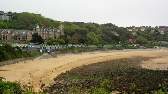
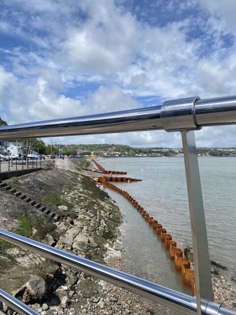
West Cross is a small coastal village located in the county of Glamorgan, Wales. Situated on the eastern side of the Gower Peninsula, it lies approximately 4 miles southwest of Swansea city center. The village is nestled between the popular tourist destinations of Mumbles and Clyne Valley Country Park.

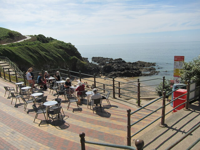
West Cross boasts stunning views of Swansea Bay and is renowned for its picturesque scenery. The area is characterized by its charming residential streets lined with a mix of traditional Welsh cottages and modern houses. The village is largely residential, providing a peaceful and family-friendly atmosphere for its residents.

The village benefits from excellent amenities, including a local supermarket, a post office, and a range of independent shops and cafes. The nearby Mumbles Road offers a wider selection of amenities, including restaurants, pubs, and boutique stores, ensuring that residents have everything they need within easy reach.

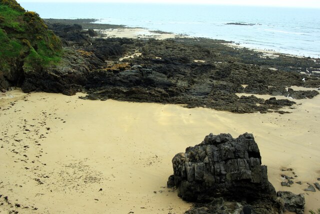
West Cross is also known for its proximity to beautiful natural landscapes. Clyne Valley Country Park, which lies just to the north, provides ample opportunities for outdoor activities, including walking, cycling, and bird watching. Additionally, the stunning beaches of Langland Bay and Caswell Bay are just a short drive away, offering residents and visitors alike the chance to enjoy sandy shores and clear waters.

With its idyllic coastal location, excellent amenities, and access to natural beauty, West Cross is a sought-after place to live for those seeking a peaceful and scenic lifestyle within close proximity to Swansea city center.

If you have any feedback on the listing, please let us know in the comments section below.
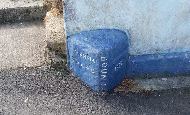
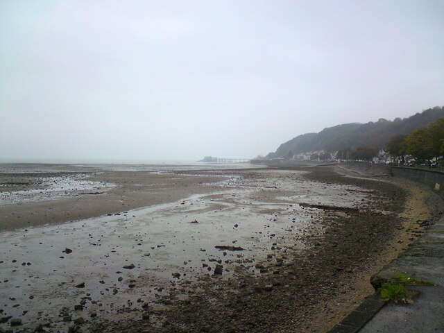
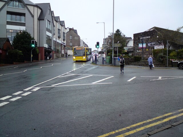
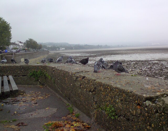
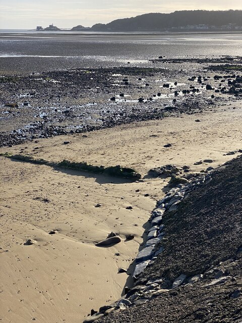
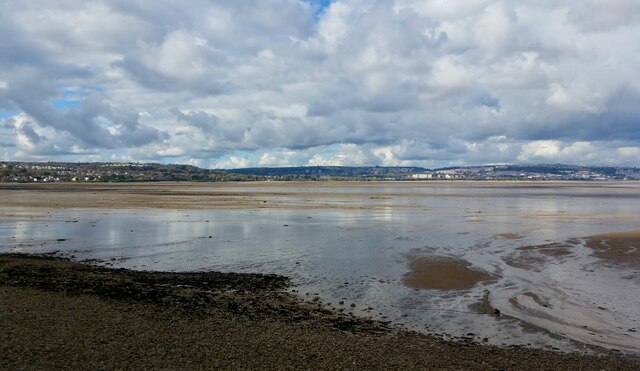
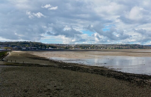
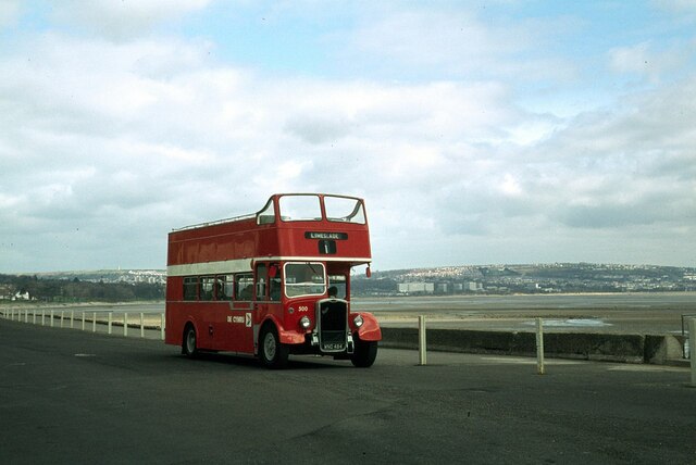
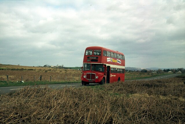
West Cross Images

Images are sourced within 2km of 51.585002/-4.005282 or Grid Reference SS6189. Thanks to Geograph Open Source API. All images are credited.

Ordnance Survey Cut Mark This OS cut mark can be found on the wall between Nos 364 & 366 Mumbles Road. It marks a point 7.001m above mean sea level.
Ordnance Survey Cut Mark
This OS cut mark can be found on the wall between Nos 364 & 366 Mumbles Road. It marks a point 7.001m above mean sea level.
Turnpike Boundary Stone
Mumbles foreshore Looking towards Mumbles and the pier from Oystermouth.
Mumbles foreshore
Looking towards Mumbles and the pier from Oystermouth.
Newton Road, Mumbles The B4593 out of Oystermouth. On the corner of Castle Avenue is  the Ostreme Community Centre. In 1978 Ostreme Community Association obtained a 35 year lease from All Saints' Church, Oystermouth to refurbish their derelict church hall and run it as a community centre. In 1980 after major work, Ostreme Centre opened to the public as an independent community hall managed by volunteers.
<span class="nowrap"><a title="http://www.ostremecentre.co.uk/about-us/" rel="nofollow ugc noopener" href="http://www.ostremecentre.co.uk/about-us/">Link</a><img style="margin-left:2px;" alt="External link" title="External link - shift click to open in new window" src="https://s1.geograph.org.uk/img/external.png" width="10" height="10"/></span>
Newton Road, Mumbles
The B4593 out of Oystermouth. On the corner of Castle Avenue is the Ostreme Community Centre. In 1978 Ostreme Community Association obtained a 35 year lease from All Saints' Church, Oystermouth to refurbish their derelict church hall and run it as a community centre. In 1980 after major work, Ostreme Centre opened to the public as an independent community hall managed by volunteers. LinkExternal link
Oystermouth pigeons 
At most seaside resorts it is the gulls that gather on the seawall scavenging for visitors' titbits as they sit watching the tide. But this is Oystermouth and we are within the city of Swansea so here it is urban pigeons that congregate on the seawall.
Oystermouth pigeons
At most seaside resorts it is the gulls that gather on the seawall scavenging for visitors' titbits as they sit watching the tide. But this is Oystermouth and we are within the city of Swansea so here it is urban pigeons that congregate on the seawall.
Mumbles Head View across Swansea Bay towards Mumbles Head at low tide.
Mumbles Head
View across Swansea Bay towards Mumbles Head at low tide.
Swansea Bay
Swansea Bay
Swansea Bay
Swansea Bay
Langland Bay Beach Chalets Behind the chalets is the WCIU Holiday & Convalescent Home built in baronial style. Viewed from the coastal path
Langland Bay Beach Chalets
Behind the chalets is the WCIU Holiday & Convalescent Home built in baronial style. Viewed from the coastal path
Oystermouth Castle The curtain wall to the west
Oystermouth Castle
The curtain wall to the west
The Chapel At Oystermouth Castle before the 2011 renovation
The Chapel
At Oystermouth Castle before the 2011 renovation
Ordnance Survey Rivet This repositioned OS rivet can be found a stone east side of the cemetery path. It marked a point 55.745m above mean sea level.
Ordnance Survey Rivet
This repositioned OS rivet can be found a stone east side of the cemetery path. It marked a point 55.745m above mean sea level.
Ordnance Survey Flush Bracket (G3817) This almost entirely buried OS Flush Bracket can be found on the garage of No199 Mayals Road.
Ordnance Survey Flush Bracket (G3817)
This almost entirely buried OS Flush Bracket can be found on the garage of No199 Mayals Road.
Rotherslade Bay
Rotherslade Bay
At Oystermouth – 1979 South Wales Transport bus 500 was on a private tour, covering bus routes in the Swansea and Gower area, and was posed for photography at this location.

The bus was built in 1953 for the Eastern National company and converted to open top configuration in 1965. It moved to South Wales in 1974 to provide open top services in the Swansea Bay and Gower area. It survives in preservation.

This is one of a series of views featuring buses in the 60s, 70s, and 80s. <a title="https://www.geograph.org.uk/search.php?i=137652761" href="https://www.geograph.org.uk/search.php?i=137652761">Link</a>
At Oystermouth – 1979
South Wales Transport bus 500 was on a private tour, covering bus routes in the Swansea and Gower area, and was posed for photography at this location. The bus was built in 1953 for the Eastern National company and converted to open top configuration in 1965. It moved to South Wales in 1974 to provide open top services in the Swansea Bay and Gower area. It survives in preservation. This is one of a series of views featuring buses in the 60s, 70s, and 80s. Link
On Clyne Common – 1979 Taken during a tour of local bus routes by a group of bus enthusiasts.

South Wales Transport bus 584 is an AEC Regent V with Willowbrook bodywork, new to the company in 1965 and due at this time for early retirement.

This is one of a series of views featuring buses in the 60s, 70s, and 80s. <a title="https://www.geograph.org.uk/search.php?i=137652761" href="https://www.geograph.org.uk/search.php?i=137652761">Link</a>
On Clyne Common – 1979
Taken during a tour of local bus routes by a group of bus enthusiasts. South Wales Transport bus 584 is an AEC Regent V with Willowbrook bodywork, new to the company in 1965 and due at this time for early retirement. This is one of a series of views featuring buses in the 60s, 70s, and 80s. Link
Iron and steel Iron sheet piling is being used to create a reinforced sea wall at Mumbles - viewed here through a stainless steel balustrade.  

Across Swansea Bay about ten miles away are the Port Talbot steelworks which perhaps supplied some of the material.
Iron and steel
Iron sheet piling is being used to create a reinforced sea wall at Mumbles - viewed here through a stainless steel balustrade. Across Swansea Bay about ten miles away are the Port Talbot steelworks which perhaps supplied some of the material.
Rotherslade Beach View from the coastal path
Rotherslade Beach
View from the coastal path
Show me another place!

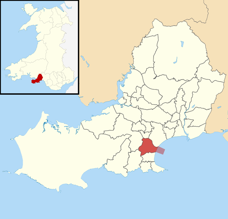
West Cross is located at Grid Ref: SS6189 (Lat: 51.585002, Lng: -4.005282)

Unitary Authority: Swansea

Police Authority: South Wales

What 3 Words

///likely.button.humid. Near Bishopston, Swansea

Nearby Locations

Cross, West West Cross

Related Wikis

West Cross (electoral ward)

West Cross is the name of an electoral ward in the Mumbles community and a suburb in the City and County of Swansea, Wales, UK. The ward falls within...

West Cross

West Cross is a suburban area of Swansea, Wales, located to the south of Swansea city centre, near Mumbles falling within the West Cross ward. == Description... ==

West Cross railway station

West Cross railway station served the suburb of West Cross, in the historical county of Glamorgan, Wales, from 1807 to 1960 on the Swansea and Mumbles...

Mayals (electoral ward)

Mayals is the name of an electoral ward of the City and County of Swansea, Wales, UK. It is also part of the Mumbles Community. The electoral ward consists...

Oystermouth Cemetery

Oystermouth Cemetery (Welsh: Mynwentydd Ystumllwynarth) is a municipal cemetery in the village of Oystermouth, Swansea, South Wales. It was opened in 1883...
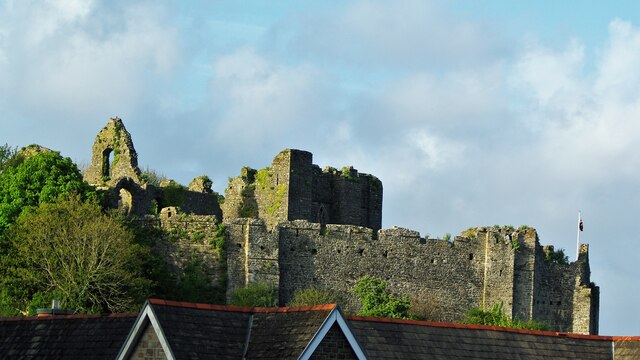
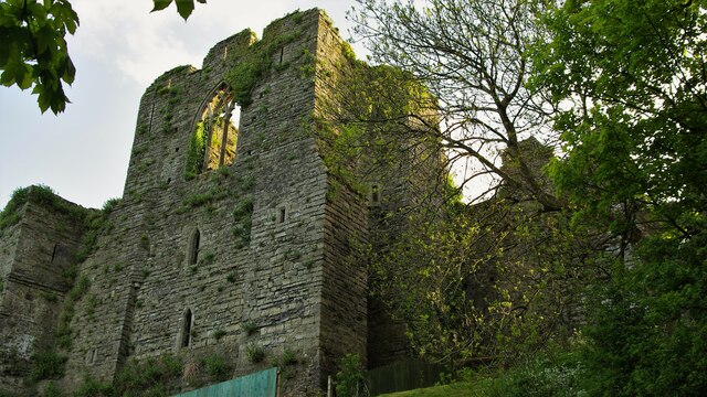
Oystermouth Castle

Oystermouth Castle (Welsh: Castell Ystum Llwynarth) is a Norman stone castle in Wales, overlooking Swansea Bay on the east side of the Gower Peninsula...

Oystermouth

Oystermouth (Welsh: Ystumllwynarth) is a village (and former electoral ward) in the district of Mumbles, Swansea, Wales. It is part of the Mumbles community...

Oystermouth railway station

Oystermouth railway station served the village of Oystermouth, in the historical county of Glamorgan, Wales, from 1807 to 1960 on the Swansea and Mumbles...

Nearby Amenities

Located within 500m of 51.585002,-4.005282
Source: PGS
Lat/Long: 51.5853871/-3.9996735
Mini Roundabout
Direction: clockwise
Lat/Long: 51.5873957/-4.0000845
Priority: backwards
Traffic Calming: choker
Lat/Long: 51.5828869/-4.0053755
West Cross
Is In: Swansea
Landuse: residential
Place: suburb
Postal Code: SA3 5
Wikidata: Q16248696
Lat/Long: 51.5872191/-4.0102932
Priority: forward
Traffic Calming: choker
Lat/Long: 51.5833084/-4.0057972
Parking
Access: yes
Created By: Potlatch 0.5d
Fee: no
Parking: surface
Lat/Long: 51.5859195/-4.0009502
Traffic Signals
Lat/Long: 51.5857616/-4.0005173
Bus Stop
West Cross Comm Centre (NW)
Bench: yes
Bus: yes
Naptan AtcoCode: 5810AWC50067
Naptan Bearing: NW
Naptan CommonName: West Cross Comm Centre (NW)
Naptan Crossing: Acacia Road
Naptan Landmark: West Cross Community Centre
Naptan NaptanCode: swapjta
Naptan PlusbusZoneRef: SWANSEA
Naptan Street: Linden Avenue
Public Transport: platform
Shelter: yes
Source: naptan_import
Lat/Long: 51.587724/-4.0055565
Bus Stop
Bench: yes
Bin: yes
Bus: yes
Public Transport: platform
Shelter: yes
Lat/Long: 51.5875189/-4.0006105
Bus Stop
Bench: no
Bin: no
Bus: yes
Lit: yes
Name Signed: no
Note: route 2a
Public Transport: platform
Shelter: no
Tactile Paving: no
Lat/Long: 51.5853933/-4.0031229
Crossing
Lat/Long: 51.5871179/-4.0016865
Bus Stop
West Cross Hotel (SW)
Bench: yes
Bin: yes
Bus: yes
Naptan AtcoCode: 5810AWC50022
Naptan Bearing: SW
Naptan CommonName: West Cross Hotel (SW)
Naptan Crossing: Alderwood Road
Naptan Landmark: West Cross Hotel PH
Naptan NaptanCode: swapmdg
Naptan PlusbusZoneRef: SWANSEA
Naptan Street: Mumbles Road
Public Transport: platform
Shelter: yes
Source: naptan_import
Lat/Long: 51.5860861/-4.000296
Bus Stop
West Cross Hotel (NE)
Bus: yes
Naptan AtcoCode: 5810AWC50023
Naptan Bearing: NE
Naptan CommonName: West Cross Hotel (NE)
Naptan Crossing: Fairwood Road
Naptan Landmark: West Cross Hotel PH
Naptan NaptanCode: swapmdj
Naptan PlusbusZoneRef: SWANSEA
Naptan Street: Mumbles Road
Public Transport: platform
Shelter: yes
Source: naptan_import
Lat/Long: 51.5868828/-4.0001919
Bus Stop
Norton Avenue
Bus: yes
Naptan AtcoCode: 5810AWC50051
Naptan Bearing: N
Naptan CommonName: Norton Avenue (N)
Naptan Crossing: Norton Avenue
Naptan NaptanCode: swapmam
Naptan PlusbusZoneRef: SWANSEA
Naptan Street: Mumbles Road
Public Transport: platform
Source: naptan_import
Lat/Long: 51.5812705/-4.0013825
Bus Stop
Heathwood Road
Bench: no
Bin: no
Bus: yes
Naptan AtcoCode: 5810AWC50063
Naptan Bearing: NW
Naptan CommonName: Heathwood Road
Naptan Crossing: Heathwood Road
Naptan NaptanCode: swapjtg
Naptan PlusbusZoneRef: SWANSEA
Naptan Street: Fairwood Road
Public Transport: platform
Shelter: no
Source: naptan_import
Tactile Paving: no
Lat/Long: 51.5874503/-4.0007591
Bus Stop
Baywood Avenue (SE)
Bus: yes
Naptan AtcoCode: 5810AWC50064
Naptan Bearing: SE
Naptan CommonName: Baywood Avenue (SE)
Naptan Crossing: Baywood Avenue
Naptan NaptanCode: swapjtj
Naptan PlusbusZoneRef: SWANSEA
Naptan Street: Fairwood Road
Naptan Verified: no
Public Transport: platform
Source: naptan_import
Lat/Long: 51.5877599/-4.0021153
Bus Stop
Baywood Avenue (NW)
Bus: yes
Naptan AtcoCode: 5810AWC50065
Naptan Bearing: NW
Naptan CommonName: Baywood Avenue (NW)
Naptan Crossing: Baywood Avenue
Naptan NaptanCode: swapjpd
Naptan PlusbusZoneRef: SWANSEA
Naptan Street: Fairwood Road
Public Transport: platform
Source: naptan_import
Lat/Long: 51.5876472/-4.001807
Bus Stop
West Cross Comm Centre (SE)
Bus: yes
Naptan AtcoCode: 5810AWC50066
Naptan Bearing: SE
Naptan CommonName: West Cross Comm Centre (SE)
Naptan Crossing: Cartersford Place
Naptan Landmark: West Cross Community Centre
Naptan NaptanCode: swapjpw
Naptan PlusbusZoneRef: SWANSEA
Naptan Street: Linden Avenue
Public Transport: platform
Shelter: no
Source: naptan_import
Lat/Long: 51.5876482/-4.0049688
Bus Stop
Sycamore Road
Bench: no
Bus: yes
Naptan AtcoCode: 5810AWC50068
Naptan Bearing: S
Naptan CommonName: Sycamore Road S
Naptan Crossing: Sycamore Road
Naptan NaptanCode: swapjwg
Naptan PlusbusZoneRef: SWANSEA
Naptan Street: Linden Avenue
Public Transport: platform
Shelter: yes
Source: naptan_import
Tactile Paving: no
Lat/Long: 51.5888596/-4.0072508
Bus Stop
Druslyn Road (NW)
Bench: no
Bus: yes
Naptan AtcoCode: 5810AWC50082
Naptan Bearing: NW
Naptan CommonName: Druslyn Road (NW)
Naptan Crossing: Druslyn Road
Naptan NaptanCode: swapmdw
Naptan PlusbusZoneRef: SWANSEA
Naptan Street: West Cross Lane
Naptan Verified: no
Public Transport: platform
Shelter: no
Source: naptan_import
Tactile Paving: no
Lat/Long: 51.5844506/-4.0122
Bus Stop
Druslyn Road (SE)
Bench: no
Bus: yes
Naptan AtcoCode: 5810AWC50083
Naptan Bearing: SE
Naptan CommonName: Druslyn Road (SE)
Naptan Crossing: Druslyn Road
Naptan NaptanCode: swapmga
Naptan PlusbusZoneRef: SWANSEA
Naptan Street: West Cross Lane
Naptan Verified: no
Public Transport: platform
Shelter: no
Source: naptan_import
Tactile Paving: no
Lat/Long: 51.5844742/-4.0117724
Bus Stop
Woodland Avenue (SE)
Bus: yes
Naptan AtcoCode: 5810AWC50087
Naptan Bearing: SE
Naptan CommonName: Woodland Avenue (SE)
Naptan Crossing: Woodland Avenue
Naptan NaptanCode: swapmad
Naptan PlusbusZoneRef: SWANSEA
Naptan Street: Moorside Road
Public Transport: platform
Shelter: yes
Source: naptan_import
Lat/Long: 51.5865174/-4.0100202
Bus Stop
West Cross House (S)
Bench: no
Bus: yes
Naptan AtcoCode: 5810AWC50089
Naptan Bearing: S
Naptan CommonName: West Cross House (S)
Naptan Crossing: Bellevue Road
Naptan NaptanCode: swapmaj
Naptan PlusbusZoneRef: SWANSEA
Naptan Street: Moorside Road
Public Transport: platform
Shelter: no
Source: naptan_import
Tactile Paving: no
Lat/Long: 51.5843801/-4.0073634
Bus Stop
White Lodge (SW)
Bench: no
Bin: no
Bus: yes
Lit: yes
Naptan AtcoCode: 5810AWC50090
Naptan Bearing: SW
Naptan CommonName: White Lodge (SW)
Naptan Crossing: Grange Road
Naptan Landmark: White Lodge
Naptan NaptanCode: swapjtp
Naptan PlusbusZoneRef: SWANSEA
Naptan Street: West Cross Road
Naptan Verified: no
Public Transport: platform
Shelter: no
Source: naptan_import
Tactile Paving: no
Lat/Long: 51.5853078/-4.0035232
Bus Stop
Alderwood Road (NE)
Bus: yes
Naptan AtcoCode: 5810AWC50092
Naptan Bearing: NE
Naptan CommonName: Alderwood Road (NE)
Naptan Crossing: Alderwood Road
Naptan NaptanCode: swapmgd
Naptan PlusbusZoneRef: SWANSEA
Naptan Street: West Cross Lane
Naptan Verified: no
Public Transport: platform
Source: naptan_import
Lat/Long: 51.5868377/-4.0018726
Bus Stop
Norton Health Centre
Bench: no
Bus: yes
Covered: no
Naptan AtcoCode: 5810AWC50097
Naptan Bearing: S
Naptan CommonName: Norton Health Centre (S)
Naptan Crossing: Norton Avenue
Naptan Landmark: Norton Health Centre
Naptan NaptanCode: swajmwt
Naptan PlusbusZoneRef: SWANSEA
Naptan ShortCommonName: Beaufort Arms
Naptan Street: West Cross Avenue
Passenger Information Display: no
Public Transport: platform
Shelter: no
Source: naptan_import
Tactile Paving: no
Lat/Long: 51.5805532/-4.0046068
West Cross Halt
Lat/Long: 51.5826727/-4.0008465
Bicycle Parking
Bicycle Parking: stands
Capacity: 6
Covered: no
Lat/Long: 51.5823726/-4.0009338
Restaurant
West Cross Tandoori
Cuisine: indian
Lat/Long: 51.5868368/-4.0009339
Post Box
Lat/Long: 51.5867958/-4.0009163
Waste Basket
Lat/Long: 51.5869147/-4.000763
Direction: 195
Generator Method: photovoltaic
Generator Output Electricity: yes
Generator Solar Modules: 20
Generator Source: solar
Generator Type: solar_photovoltaic_panel
Location: roof
Note: 195
Power: generator
Lat/Long: 51.5861607/-4.0024459
Direction: SE
Generator Method: photovoltaic
Generator Output Electricity: yes
Generator Solar Modules: 11
Generator Source: solar
Generator Type: solar_photovoltaic_panel
Location: roof
Power: generator
Lat/Long: 51.5838499/-4.0110531
Direction: W
Generator Method: photovoltaic
Generator Output Electricity: yes
Generator Solar Modules: 9
Generator Source: solar
Generator Type: solar_photovoltaic_panel
Location: roof
Power: generator
Lat/Long: 51.5839133/-4.0097027
Direction: S
Generator Method: photovoltaic
Generator Output Electricity: yes
Generator Solar Modules: 16
Generator Source: solar
Generator Type: solar_photovoltaic_panel
Location: roof
Power: generator
Lat/Long: 51.5838933/-4.00913
Direction: 185
Generator Method: photovoltaic
Generator Output Electricity: yes
Generator Solar Modules: 16
Generator Source: solar
Generator Type: solar_photovoltaic_panel
Location: roof
Power: generator
Lat/Long: 51.5835739/-4.0089017
Direction: 175
Generator Method: photovoltaic
Generator Output Electricity: yes
Generator Solar Modules: 4
Generator Source: solar
Generator Type: solar_photovoltaic_panel
Location: roof
Power: generator
Lat/Long: 51.5840074/-4.0075954
Direction: 175
Generator Method: photovoltaic
Generator Output Electricity: yes
Generator Solar Modules: 12
Generator Source: solar
Generator Type: solar_photovoltaic_panel
Location: roof
Power: generator
Lat/Long: 51.5839716/-4.0076568
Direction: 165
Generator Method: photovoltaic
Generator Output Electricity: yes
Generator Solar Modules: 18
Generator Source: solar
Generator Type: solar_photovoltaic_panel
Location: roof
Power: generator
Lat/Long: 51.5839416/-4.0070513
Direction: SE
Generator Method: photovoltaic
Generator Output Electricity: yes
Generator Solar Modules: 16
Generator Source: solar
Generator Type: solar_photovoltaic_panel
Location: roof
Power: generator
Lat/Long: 51.5842753/-4.0055429
Direction: 145
Generator Method: photovoltaic
Generator Output Electricity: yes
Generator Solar Modules: 12
Generator Source: solar
Generator Type: solar_photovoltaic_panel
Location: roof
Power: generator
Lat/Long: 51.585819/-4.0064706
Direction: SSE
Generator Method: photovoltaic
Generator Output Electricity: yes
Generator Solar Modules: 12
Generator Source: solar
Generator Type: solar_photovoltaic_panel
Location: roof
Power: generator
Lat/Long: 51.5884473/-4.0084457
Direction: SSE
Generator Method: photovoltaic
Generator Output Electricity: yes
Generator Solar Modules: 11
Generator Source: solar
Generator Type: solar_photovoltaic_panel
Location: roof
Power: generator
Lat/Long: 51.5862017/-4.0073111
Direction: WSW
Generator Method: photovoltaic
Generator Output Electricity: yes
Generator Solar Modules: 9
Generator Source: solar
Generator Type: solar_photovoltaic_panel
Location: roof
Power: generator
Lat/Long: 51.5862198/-4.0073812
Direction: SSE
Generator Method: photovoltaic
Generator Output Electricity: yes
Generator Solar Modules: 24
Generator Source: solar
Generator Type: solar_photovoltaic_panel
Location: roof
Power: generator
Lat/Long: 51.5861053/-4.0060166
Direction: SSE
Generator Method: photovoltaic
Generator Output Electricity: yes
Generator Solar Modules: 18
Generator Source: solar
Generator Type: solar_photovoltaic_panel
Location: roof
Power: generator
Lat/Long: 51.5860911/-4.0051053
Direction: 275
Generator Method: photovoltaic
Generator Output Electricity: yes
Generator Solar Modules: 12
Generator Source: solar
Generator Type: solar_photovoltaic_panel
Location: roof
Power: generator
Lat/Long: 51.5849432/-4.0017968
Direction: 195
Generator Method: photovoltaic
Generator Output Electricity: yes
Generator Solar Modules: 16
Generator Source: solar
Generator Type: solar_photovoltaic_panel
Location: roof
Power: generator
Lat/Long: 51.5839541/-4.0009493
Direction: 185
Generator Method: photovoltaic
Generator Output Electricity: yes
Generator Solar Modules: 8
Generator Source: solar
Generator Type: solar_photovoltaic_panel
Location: roof
Power: generator
Lat/Long: 51.5827399/-4.0017003
Direction: 185
Generator Method: photovoltaic
Generator Output Electricity: yes
Generator Solar Modules: 8
Generator Source: solar
Generator Type: solar_photovoltaic_panel
Location: roof
Power: generator
Lat/Long: 51.5827433/-4.001829
Direction: 145
Generator Method: photovoltaic
Generator Output Electricity: yes
Generator Solar Modules: 1
Generator Source: solar
Generator Type: solar_photovoltaic_panel
Location: roof
Power: generator
Lat/Long: 51.5816595/-4.0070758
Direction: 145
Generator Method: photovoltaic
Generator Output Electricity: yes
Generator Solar Modules: 1
Generator Source: solar
Generator Type: solar_photovoltaic_panel
Location: roof
Power: generator
Lat/Long: 51.5816455/-4.0071147
Direction: 235
Generator Method: photovoltaic
Generator Output Electricity: yes
Generator Solar Modules: 7
Generator Source: solar
Generator Type: solar_photovoltaic_panel
Location: roof
Power: generator
Lat/Long: 51.5882188/-4.0068726
Direction: 55
Generator Method: photovoltaic
Generator Output Electricity: yes
Generator Solar Modules: 7
Generator Source: solar
Generator Type: solar_photovoltaic_panel
Location: roof
Power: generator
Lat/Long: 51.5882374/-4.0068267
Direction: 235
Generator Method: photovoltaic
Generator Output Electricity: yes
Generator Solar Modules: 6
Generator Source: solar
Generator Type: solar_photovoltaic_panel
Location: roof
Power: generator
Lat/Long: 51.5816699/-4.0071542
Direction: WNW
Generator Method: photovoltaic
Generator Output Electricity: yes
Generator Solar Modules: 10
Generator Source: solar
Generator Type: solar_photovoltaic_panel
Location: roof
Power: generator
Lat/Long: 51.5814816/-4.0092534
Direction: ESE
Generator Method: photovoltaic
Generator Output Electricity: yes
Generator Solar Modules: 10
Generator Source: solar
Generator Type: solar_photovoltaic_panel
Location: roof
Power: generator
Lat/Long: 51.5814628/-4.0092011
Direction: 265
Generator Method: photovoltaic
Generator Output Electricity: yes
Generator Solar Modules: 16
Generator Source: solar
Generator Type: solar_photovoltaic_panel
Location: roof
Power: generator
Lat/Long: 51.5811474/-4.0082345
Direction: 195
Generator Method: photovoltaic
Generator Output Electricity: yes
Generator Solar Modules: 17
Generator Source: solar
Generator Type: solar_photovoltaic_panel
Location: roof
Power: generator
Lat/Long: 51.5807765/-4.0047996
Waste Basket
Waste: dog_excrement
Lat/Long: 51.5870171/-4.0103619
Bus Stop
Norton Health Centre
Bench: no
Bus: yes
Lit: no
Naptan AtcoCode: 5810AWC50098
Naptan NaptanCode: swajpad
Public Transport: platform
Shelter: no
Tactile Paving: no
Lat/Long: 51.5805215/-4.0046896
Give Way
Direction: forward
Lat/Long: 51.5827941/-4.0053387
Priority: forward
Traffic Calming: choker
Lat/Long: 51.5837458/-4.006488
Give Way
Direction: backward
Lat/Long: 51.5833658/-4.0058859
Give Way
Direction: backward
Lat/Long: 51.5838766/-4.0066651
Give Way
Direction: forward
Lat/Long: 51.5843566/-4.006433
Bus Stop
West Cross House
Bench: no
Bus: yes
Public Transport: platform
Shelter: no
Lat/Long: 51.5844149/-4.0075475
Bus Stop
Bench: no
Bus: yes
Passenger Information Display: no
Public Transport: platform
Shelter: no
Lat/Long: 51.5828458/-4.0053065
Bus Stop
Bench: no
Bus: yes
Passenger Information Display: no
Public Transport: platform
Shelter: no
Lat/Long: 51.5841028/-4.006777
Bus Stop
Sycamore Road
Bench: no
Bus: yes
Note: Name based on nearby stop + junction
Passenger Information Display: no
Public Transport: platform
Shelter: no
Tactile Paving: no
Lat/Long: 51.5884763/-4.0073705
Barrier: bollard
Bicycle: yes
Bollard: removable
Foot: yes
Horse: yes
Material: metal
Lat/Long: 51.5857497/-4.0004409
The data included in this document is from www.openstreetmap.org. The data is made available under ODbL.

Have you been to West Cross?

Leave your review of West Cross below (or comments, questions and feedback).