Ramshawsike Plantation

Wood, Forest in Durham

England

Ramshawsike Plantation

Gate in fence on Bolt's Law A public footpath passes through the gate. The trig point might be thought to be at the highest point of the hill but at 540 m it is in fact one metre lower than another location on Bolt's Law, roughly half a kilometre to the south-west, behind the camera position.
Gate in fence on Bolt's Law Credit: Trevor Littlewood

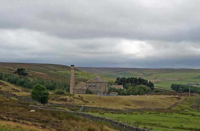
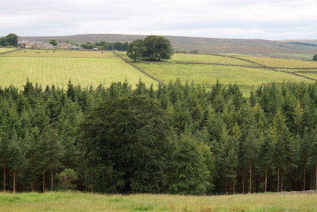
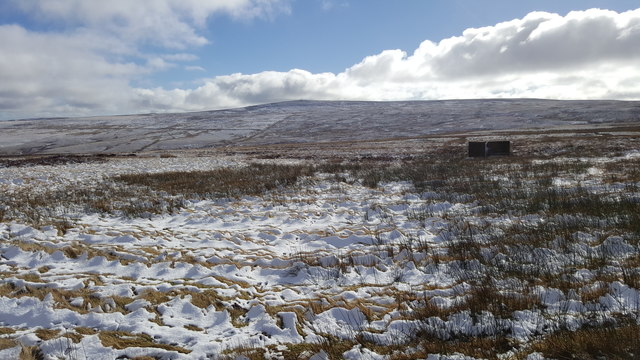
Ramshawsike Plantation is a picturesque woodland located in Durham, England. Situated in the county's northeast region, this plantation covers an approximate area of 200 hectares. It is primarily composed of a mix of deciduous and coniferous trees, creating a diverse and vibrant forest landscape.

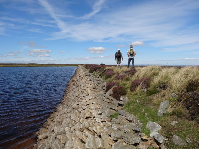
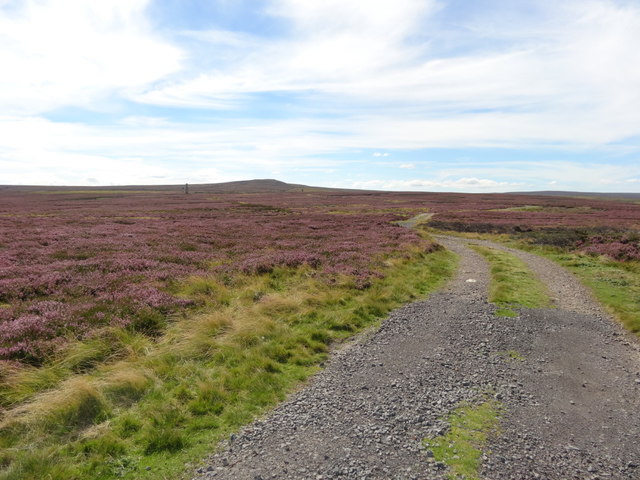
The plantation is known for its natural beauty and is a popular destination for nature enthusiasts, hikers, and wildlife watchers. Its well-maintained trails wind through the woodland, allowing visitors to explore the area and immerse themselves in the peaceful surroundings. The rich biodiversity of Ramshawsike Plantation provides a habitat for various species of mammals, birds, insects, and plants.

The woodland is managed by the local forestry commission, ensuring the preservation and sustainable use of the plantation. Their efforts include tree planting, selective felling, and maintaining the health of the forest ecosystem. This ensures the longevity of Ramshawsike Plantation and its ability to continue providing recreational opportunities for visitors.

In addition to its natural beauty, the plantation offers educational programs and guided tours for schools and community groups. These initiatives aim to raise awareness about conservation and the importance of forests in maintaining a healthy environment.

Ramshawsike Plantation is conveniently located near several towns and villages, making it easily accessible for both locals and tourists. Its serene atmosphere and tranquil setting make it an ideal destination for those seeking a peaceful retreat or a connection with nature.

If you have any feedback on the listing, please let us know in the comments section below.

Ramshawsike Plantation Images

Images are sourced within 2km of 54.817675/-2.0896821 or Grid Reference NY9446. Thanks to Geograph Open Source API. All images are credited.

Gate in fence on Bolt's Law A public footpath passes through the gate. The trig point might be thought to be at the highest point of the hill but at 540 m it is in fact one metre lower than another location on Bolt's Law, roughly half a kilometre to the south-west, behind the camera position.
Gate in fence on Bolt's Law
A public footpath passes through the gate. The trig point might be thought to be at the highest point of the hill but at 540 m it is in fact one metre lower than another location on Bolt's Law, roughly half a kilometre to the south-west, behind the camera position.
Heather moorland south of Bolt's Law trig point The foreground moorland runs away towards the valley and slopes of the Stanhope Burn. The distant hill is Collier Law.
Heather moorland south of Bolt's Law trig point
The foreground moorland runs away towards the valley and slopes of the Stanhope Burn. The distant hill is Collier Law.
Presser Pumping Station near the top of Bale Hill Consett Water Company established in 1859 merged and became the Weardale and Consett Water Company in 1902. Some time late in the 19th or early 20th century one of the two former companies had taken over the engine house of closed Derwent Lead Mines and developed this Grade II Listed pumping house to supply water to Consett. It is reported that they started paying rent to the estate in 1902 and the rent in 1911 was £360.
Presser Pumping Station near the top of Bale Hill
Consett Water Company established in 1859 merged and became the Weardale and Consett Water Company in 1902. Some time late in the 19th or early 20th century one of the two former companies had taken over the engine house of closed Derwent Lead Mines and developed this Grade II Listed pumping house to supply water to Consett. It is reported that they started paying rent to the estate in 1902 and the rent in 1911 was £360.
View to East High House Farm from Bale Hill
Grouse Butt and Moorland
Sikehead Dam
Sikehead Dam
Sikehead reservoir and Bolt's Law
Track towards Sikehead Dams
View from the road over fields of Boltshope Park These fields are amongst the last cultivated land before the road ascends onto Moorland
View from the road over fields of Boltshope Park
These fields are amongst the last cultivated land before the road ascends onto Moorland
Footpath to Cuthbert's Hill crossing the moor road
Road over Hunstanworth Moor
Sheep grazing at Boltshope Park
Sheep grazing at Boltshope Park Although clearly not in the same grid square, Bolt's Law hill and the chimneys from the old mine workings on the opposite side of the valley can be seen.
Sheep grazing at Boltshope Park
Although clearly not in the same grid square, Bolt's Law hill and the chimneys from the old mine workings on the opposite side of the valley can be seen.
Grouse butt on Hunstanworth Moor
Grouse butt on Hunstanworth Moor This peak of Bolt's Law is on the horizon
Grouse butt on Hunstanworth Moor
This peak of Bolt's Law is on the horizon
Road near St. Cuthberts Hill on Hunstanworth Moor
Road entering Townfield Looking south-eastward.
Road entering Townfield
Looking south-eastward.
Road at Haining's Plantation Looking south-westward.
Road at Haining's Plantation
Looking south-westward.
Show me another place!

Ramshawsike Plantation is located at Grid Ref: NY9446 (Lat: 54.817675, Lng: -2.0896821)

Unitary Authority: County Durham

Police Authority: Durham

What 3 Words

///hairstyle.overused.lawfully. Near Stanhope, Co. Durham

Nearby Locations

Ramshawsike Plantation

Related Wikis

Ramshaw, Consett

Ramshaw is a small village in County Durham, in England. It is situated to the south of Hunstanworth, a few miles west of Consett. Lead mining was an important...

Townfield

Townfield is a village in County Durham, in England. It is situated just to the south of Hunstanworth and part of that parish, about 10 miles (16 km) west...

Beldon Burn

Beldon Burn is a headwater stream of the River Derwent in Northumberland and County Durham, England.It rises at Quickcleugh Moss as the Quickcleugh Burn...

Hunstanworth

Hunstanworth is a village in County Durham, England. It is situated approximately 10 miles to the west of Consett, south-west of the village of Blanchland...

Baybridge, Northumberland

Baybridge is a small village in Northumberland, England, just to the west of Blanchland and on the border with County Durham. It is situated to the west...

Blanchland

Blanchland is a village in Northumberland, England, on the County Durham boundary. The population of the civil parish at the 2011 census was 135.Set beside...

Blanchland Abbey

Blanchland Abbey at Blanchland, in the English county of Northumberland, was founded as a premonstratensian priory in 1165 by Walter de Bolbec II, and...

Lintzgarth

Lintzgarth is a village in the civil parish of Stanhope, in County Durham, England. It is situated to the west of Rookhope. The Lintzgarth smeltmill was...

Nearby Amenities

Located within 500m of 54.817675,-2.0896821
Boltshope
Place: locality
Lat/Long: 54.8163457/-2.093343
Barrier: cattle_grid
Lat/Long: 54.8183103/-2.0937726
Historic: mine
Lat/Long: 54.8141767/-2.0850418
Barrier: entrance
Lat/Long: 54.8190039/-2.096924
Hunting Stand
Hunting Stand: grouse_butt
Lat/Long: 54.8142124/-2.0943412
Power: pole
Lat/Long: 54.8149975/-2.0834105
Power: pole
Lat/Long: 54.8146892/-2.0842843
Power: pole
Lat/Long: 54.8158205/-2.0938705
Power: pole
Lat/Long: 54.815727/-2.0925616
Power: pole
Lat/Long: 54.8156474/-2.0914122
Power: pole
Lat/Long: 54.8155624/-2.0901744
Power: pole
Lat/Long: 54.8154736/-2.0889795
Power: pole
Lat/Long: 54.8153816/-2.0877591
Power: pole
Lat/Long: 54.8153028/-2.0865239
Power: pole
Lat/Long: 54.815207/-2.0852767
Power: pole
Lat/Long: 54.8147317/-2.0843138
Power: pole
Lat/Long: 54.816526/-2.0829767
Power: pole
Lat/Long: 54.8159202/-2.0827594
The data included in this document is from www.openstreetmap.org. The data is made available under ODbL.

Have you been to Ramshawsike Plantation?

Leave your review of Ramshawsike Plantation below (or comments, questions and feedback).