Badminton Plantation
Wood, Forest in Gloucestershire Cotswold
England
Badminton Plantation

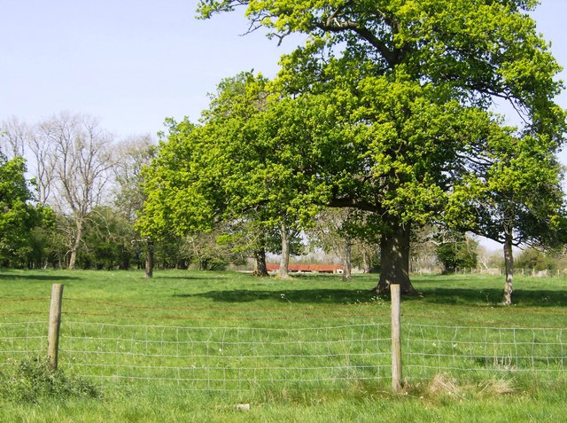
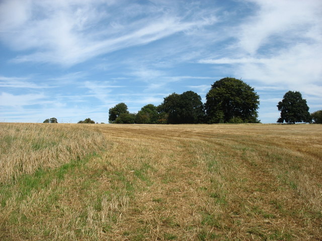
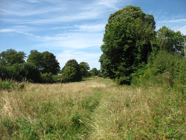
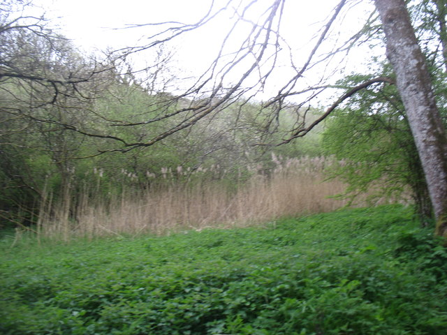
Badminton Plantation is a picturesque woodland located in Gloucestershire, England. Spread across an area of approximately 500 acres, it is nestled within the scenic landscape of the Cotswolds. This enchanting woodland is part of the larger Badminton Estate, which is renowned for its historical significance and vast natural beauty.
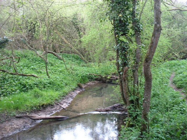
The plantation predominantly consists of a mix of native broadleaf trees, including oak, beech, ash, and birch. These majestic trees create a dense canopy, casting a tranquil shade over the forest floor. Bluebells and wildflowers carpet the ground during the spring, adding a burst of color to the woodland.
Badminton Plantation is home to a diverse range of wildlife, making it a haven for nature enthusiasts. Visitors may spot roe deer, foxes, squirrels, and an array of bird species, including woodpeckers and owls. The plantation also supports a rich insect population, with butterflies and dragonflies fluttering through the air.
The woodland offers several walking trails, allowing visitors to explore its natural wonders at their own pace. These paths wind through the ancient trees, offering glimpses of breathtaking vistas and secluded spots. It is not uncommon to stumble upon hidden ponds and streams, adding to the tranquility of the surroundings.
Badminton Plantation serves as a recreational haven for locals and tourists alike. Whether it is a peaceful walk, a picnic amidst nature, or simply a moment of solitude, this woodland offers a serene escape from the hustle and bustle of everyday life.
If you have any feedback on the listing, please let us know in the comments section below.
Badminton Plantation Images
Images are sourced within 2km of 51.710906/-2.0868487 or Grid Reference SO9401. Thanks to Geograph Open Source API. All images are credited.


Badminton Plantation is located at Grid Ref: SO9401 (Lat: 51.710906, Lng: -2.0868487)
Administrative County: Gloucestershire
District: Cotswold
Police Authority: Gloucestershire
What 3 Words
///sand.tailwind.hopefully. Near Coates, Gloucestershire
Nearby Locations
Related Wikis

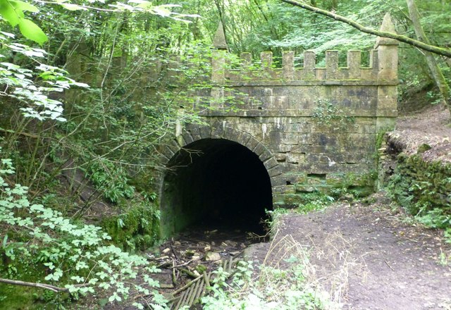
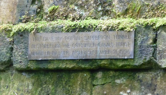
Sapperton Canal Tunnel
The Sapperton Canal Tunnel is a tunnel on the Thames and Severn Canal near Cirencester in Gloucestershire, England. With a length of 3,817 yards (3,490...

Sapperton Railway Tunnel
The Sapperton Railway Tunnel is a railway tunnel near Sapperton, Gloucestershire in the United Kingdom. It carries the Golden Valley Line from Stroud to...

Daneway Banks SSSI
Daneway Banks (grid reference SO937034) is a 17-hectare (42-acre) biological Site of Special Scientific Interest in Gloucestershire, notified in 1954 and...

St Kenelm's Church, Sapperton, Gloucestershire
St Kenelm's Church is a historic church in Sapperton, Gloucestershire in the care of The Churches Conservation Trust. It is listed Grade I on the National...

Sapperton Valley
Sapperton Valley (grid reference SO935035) is a 3.7-hectare (9.1-acre) nature reserve near Chalford in the Stroud district of Gloucestershire, England...

Siccaridge Wood
Siccaridge Wood (grid reference SO935035) is a 26.6-hectare (66-acre) nature reserve in Gloucestershire. The site is listed in the ‘Stroud District’ Local...

Frampton Mansell
Frampton Mansell is a small English village 5 miles (8 km) east-south-east of Stroud, Gloucestershire, in the parish of Sapperton. It lies off the A419...

Daneway House
Daneway House is a grade I listed house in the parish of Bisley-with-Lypiatt but close to Sapperton in Gloucestershire, England.The house was built in...
Nearby Amenities
Located within 500m of 51.710906,-2.0868487Have you been to Badminton Plantation?
Leave your review of Badminton Plantation below (or comments, questions and feedback).