Ullen Wood

Wood, Forest in Gloucestershire Cotswold

England

Ullen Wood

Crickley Hill Car Park
Crickley Hill Car Park Credit: Matthew Chadwick

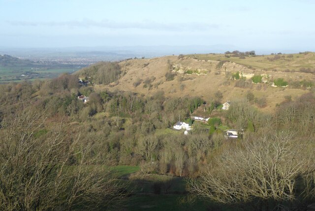
Ullen Wood is a picturesque woodland located in the county of Gloucestershire, England. Spanning over 100 acres, this enchanting forest is known for its diverse range of flora and fauna, making it a popular destination for nature enthusiasts and hikers.

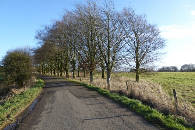
The woodland is predominantly composed of ancient deciduous trees, such as oak, beech, and ash, which provide a stunning backdrop throughout the year. In spring, the forest floor is adorned with a vibrant carpet of bluebells and primroses, creating a breathtaking sight. The summer months bring an abundance of birdlife, including woodpeckers, owls, and songbirds, filling the air with their melodious tunes.

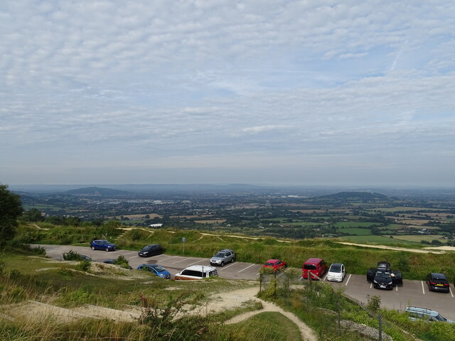
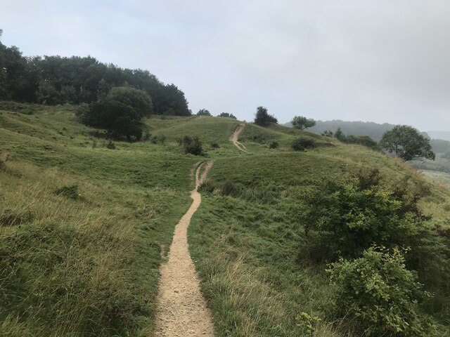
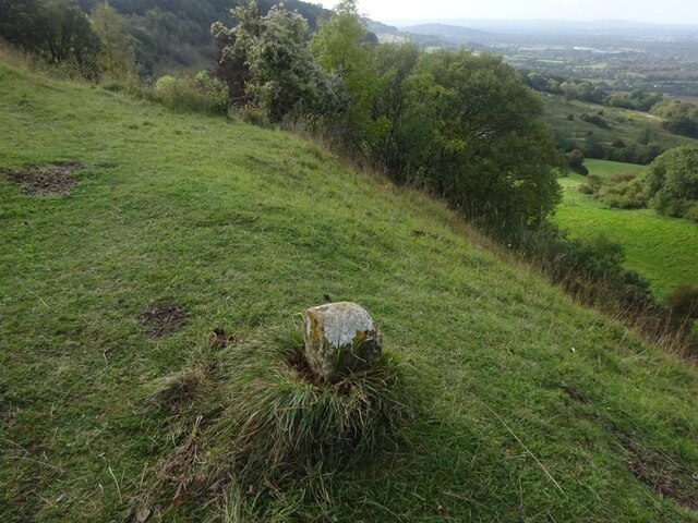
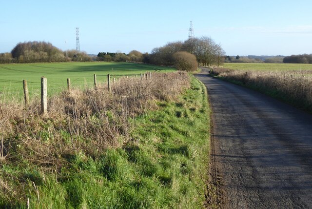
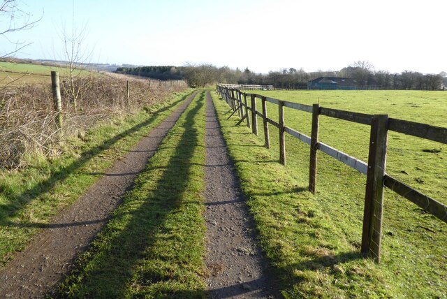
Ullen Wood is also home to a variety of wildlife, including deer, foxes, badgers, and squirrels. Visitors may be lucky enough to spot these creatures while exploring the woodland trails, which wind their way through the forest and offer stunning views of the surrounding countryside.

For those looking to immerse themselves in nature, Ullen Wood offers a tranquil and peaceful atmosphere. The woodland is managed by the Woodland Trust, an organization dedicated to the preservation and conservation of forests, ensuring that its natural beauty remains intact for future generations to enjoy.

Aside from its natural wonders, Ullen Wood also offers educational programs and workshops, allowing visitors to learn about the importance of woodland ecosystems and conservation efforts. Overall, Ullen Wood is a haven for nature lovers, offering a serene escape from the hustle and bustle of everyday life.

If you have any feedback on the listing, please let us know in the comments section below.
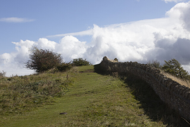
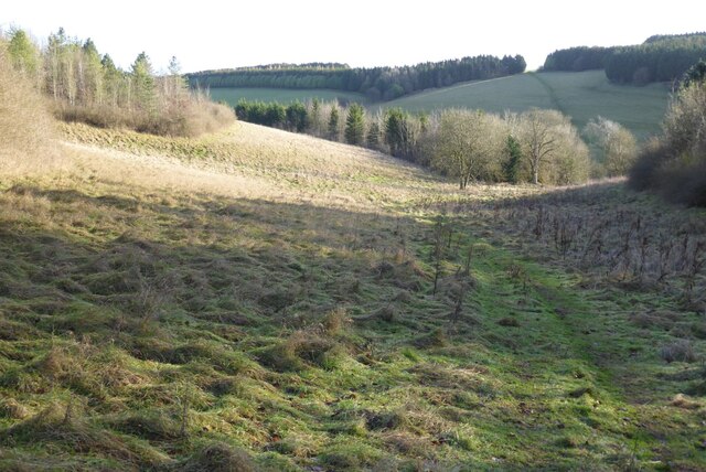
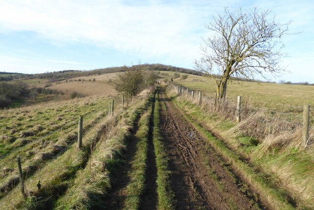
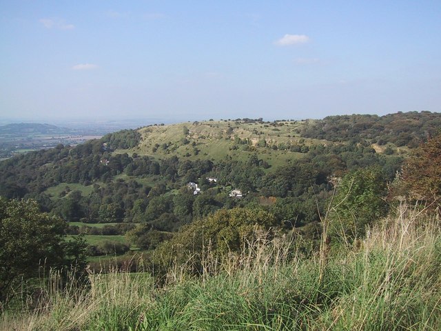
Ullen Wood Images

Images are sourced within 2km of 51.844925/-2.0880652 or Grid Reference SO9416. Thanks to Geograph Open Source API. All images are credited.

Crickley Hill Car Park
Rough land by the Cotswold Way
Disused quarry
Disused quarry
Crickley Hill
Crickley Hill
Boundary Stone, Barrow Wake, Birdlip The boundary between Cowley Parish to the SE (including Birdlip) and Badgeworth (NE) runs along the lip of a very steep escarpment. The inscription would have been C M 1857 like others along the same ridge. See <a title="https://www.geograph.org.uk/discuss/index.php?&action=vthread&forum=11&topic=32582" href="https://www.geograph.org.uk/discuss/index.php?&action=vthread&forum=11&topic=32582">Link</a>

Inscription: ?85?

Milestone Society National ID: GL_BADCOW03pb
Boundary Stone, Barrow Wake, Birdlip
The boundary between Cowley Parish to the SE (including Birdlip) and Badgeworth (NE) runs along the lip of a very steep escarpment. The inscription would have been C M 1857 like others along the same ridge. See Link Inscription: ?85? Milestone Society National ID: GL_BADCOW03pb
Crickley Hill Crickley Hill viewed from the Wake Barrow viewpoint. The Malvern Hills are on the distant horizon.
Crickley Hill
Crickley Hill viewed from the Wake Barrow viewpoint. The Malvern Hills are on the distant horizon.
Minor country road No through road to Birdlip Radio Station.
Minor country road
No through road to Birdlip Radio Station.
Beech trees Beech trees near Birdlip Radio Station.
Beech trees
Beech trees near Birdlip Radio Station.
The Gloucestershire Way The Gloucestershire Way from a track approaching Rushwood Kennels.
The Gloucestershire Way
The Gloucestershire Way from a track approaching Rushwood Kennels.
The Gloucestershire Way The Gloucestershire Way crossing a field between forestry and entering the valley above Coberley known as Coldwell Bottom.
The Gloucestershire Way
The Gloucestershire Way crossing a field between forestry and entering the valley above Coberley known as Coldwell Bottom.
Coldwell Bottom The Gloucestershire Way long distance footpath follows this path above the valley on the right which is called Coldwell Bottom.
Coldwell Bottom
The Gloucestershire Way long distance footpath follows this path above the valley on the right which is called Coldwell Bottom.
Path and gate above Coldwell Bottom The Gloucestershire Way follows this right of way above Coldwell Bottom.
Path and gate above Coldwell Bottom
The Gloucestershire Way follows this right of way above Coldwell Bottom.
Coldwell Bottom View across Coldwell Bottom to the Churn valley beyond, from the Gloucestershire Way.
Coldwell Bottom
View across Coldwell Bottom to the Churn valley beyond, from the Gloucestershire Way.
Gloucestershire Way Gloucestershire Way with Coldwell Bottom below on the left.
Gloucestershire Way
Gloucestershire Way with Coldwell Bottom below on the left.
A junction of paths The right of way on the left passing through the gate is the route of the Gloucestershire Way, alternatively there is a right of way on the right which eventually rejoins the Gloucestershire Way.
A junction of paths
The right of way on the left passing through the gate is the route of the Gloucestershire Way, alternatively there is a right of way on the right which eventually rejoins the Gloucestershire Way.
A junction of rights of way Continuing along this right of way passes Cuckoopen Barn Farm.  The path on the left, out of view is the route of the Gloucestershire Way.  This is almost exactly the same view as when I was last here almost fourteen years ago to the day <a href="https://www.geograph.org.uk/photo/653006">SO9515 : Footpath junction near Coberley</a>.
A junction of rights of way
Continuing along this right of way passes Cuckoopen Barn Farm. The path on the left, out of view is the route of the Gloucestershire Way. This is almost exactly the same view as when I was last here almost fourteen years ago to the day SO9515 : Footpath junction near Coberley.
The Gloucestershire Way The Gloucestershire Way to the west of Coberley and above Coldwell Bottom which is out of view on the left.
The Gloucestershire Way
The Gloucestershire Way to the west of Coberley and above Coldwell Bottom which is out of view on the left.
Dowman's Farm Dowman's Farm in the village of Coberley.
Dowman's Farm
Dowman's Farm in the village of Coberley.
Show me another place!

Ullen Wood is located at Grid Ref: SO9416 (Lat: 51.844925, Lng: -2.0880652)

Administrative County: Gloucestershire

District: Cotswold

Police Authority: Gloucestershire

What 3 Words

///exhaled.zebra.purchaser. Near Shurdington, Gloucestershire

Nearby Locations

Ullen Wood

Related Wikis

National Star College

The National Star College (previously known as the Star Centre) is an independent specialist further education college for people with physical disabilities...

The Air Balloon, Birdlip

The Air Balloon is a road junction and former pub Birdlip, Gloucestershire, England. The junction is on the A417 at a significant congestion point. The...

Ullenwood

Ullenwood is a village in the Coberley civil parish, near Cheltenham in Gloucestershire. It is the site of a formerly secret civil defence bunker intended...

Crickley Hill and Barrow Wake

Crickley Hill and Barrow Wake (grid reference SO929161 & grid reference SO931154) is a 56.8-hectare (140-acre) biological and geological Site of Special...

Nearby Amenities

Located within 500m of 51.844925,-2.0880652
Power: pole
Lat/Long: 51.8434749/-2.0946141
Material: wood
Power: pole
Lat/Long: 51.8441611/-2.0941359
Barrier: cattle_grid
Lat/Long: 51.8455429/-2.0946051
Parking
Access: yes
Fee: no
Parking: layby
Lat/Long: 51.8459458/-2.0869888
Barrier: stile
Foot: yes
Lat/Long: 51.8440399/-2.0861944
Barrier: stile
Foot: yes
Lat/Long: 51.8415946/-2.0875498
Power: pole
Lat/Long: 51.8462634/-2.0821734
Power: pole
Lat/Long: 51.8460869/-2.0831524
Power: pole
Lat/Long: 51.845584/-2.0837599
Power: pole
Lat/Long: 51.845381/-2.0845351
Niggerley Cottages
Power: pole
Transformer: distribution
Voltage Primary: 11000
Lat/Long: 51.8457887/-2.0847657
Material: wood
Power: pole
Lat/Long: 51.8462468/-2.0850058
Power: pole
Lat/Long: 51.8462294/-2.0862168
Location Transition: yes
Power: pole
Lat/Long: 51.8476983/-2.0865454
Power: pole
Lat/Long: 51.8468897/-2.0869759
Power: pole
Lat/Long: 51.8462145/-2.087346
Material: wood
Power: pole
Lat/Long: 51.8462054/-2.0885812
Material: wood
Power: pole
Lat/Long: 51.846188/-2.0898284
Material: wood
Power: pole
Lat/Long: 51.8457754/-2.0909496
Material: wood
Power: pole
Lat/Long: 51.8447673/-2.0937092
Power: pole
Lat/Long: 51.8461047/-2.0945317
Material: wood
Power: pole
Lat/Long: 51.8457568/-2.0933032
Material: wood
Power: pole
Lat/Long: 51.8454138/-2.0920862
Material: wood
Power: pole
Lat/Long: 51.8450389/-2.093495
Mini Roundabout
Direction: clockwise
Lat/Long: 51.8442924/-2.0946416
The data included in this document is from www.openstreetmap.org. The data is made available under ODbL.

Have you been to Ullen Wood?

Leave your review of Ullen Wood below (or comments, questions and feedback).