Clunter Wood

Wood, Forest in Lancashire

England

Clunter Wood

Boundary stone on Todmorden Road Marks the division of the old Littleborough Urban District and the Borough of Todmorden. Now the local authorities are Rochdale and Calderdale respectively. Or, in tribal terms, the boundary between Lancashire and Yorkshire.
Boundary stone on Todmorden Road Credit: michael ely

Clunter Wood is a picturesque woodland area located in the county of Lancashire, England. Covering an area of approximately 100 acres, the wood is a popular destination for nature enthusiasts and outdoor adventurers alike.

Situated in the heart of Lancashire, Clunter Wood is known for its diverse and thriving ecosystem. The wood is home to a wide variety of flora and fauna, including ancient oaks, beech trees, and an array of wildflowers that bloom throughout the year. The forest floor is covered in a lush carpet of mosses and ferns, creating a serene and tranquil atmosphere.

Visitors to Clunter Wood can enjoy a network of well-maintained footpaths and trails that wind through the forest, allowing for leisurely walks or more adventurous hikes. The wood is also a haven for birdwatchers, with numerous species of birds, including woodpeckers, owls, and songbirds, calling the area home.

For those seeking a break from the hustle and bustle of daily life, Clunter Wood offers a peaceful retreat. The wood provides a welcome escape from the noise and pollution of urban areas, providing visitors with a chance to reconnect with nature and enjoy the simple pleasures of the great outdoors.

Overall, Clunter Wood is a hidden gem in Lancashire, offering a serene and enchanting experience for all who visit.

If you have any feedback on the listing, please let us know in the comments section below.
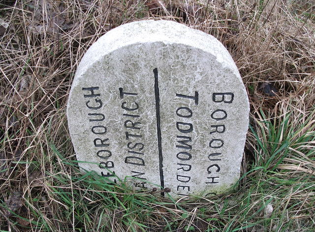
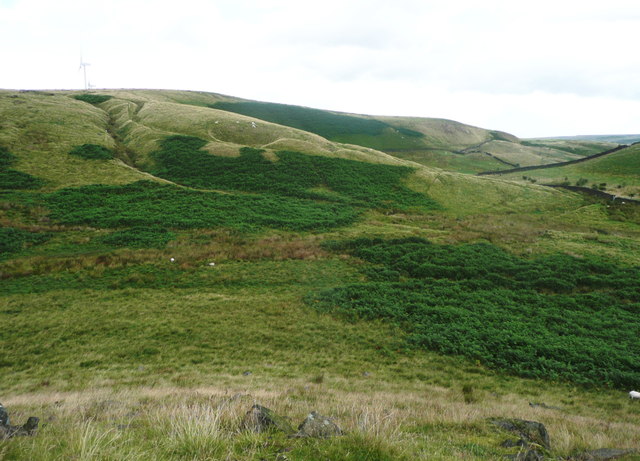
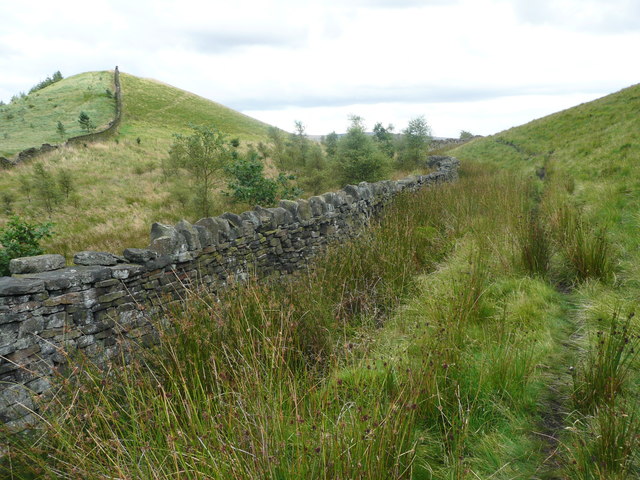
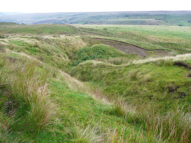
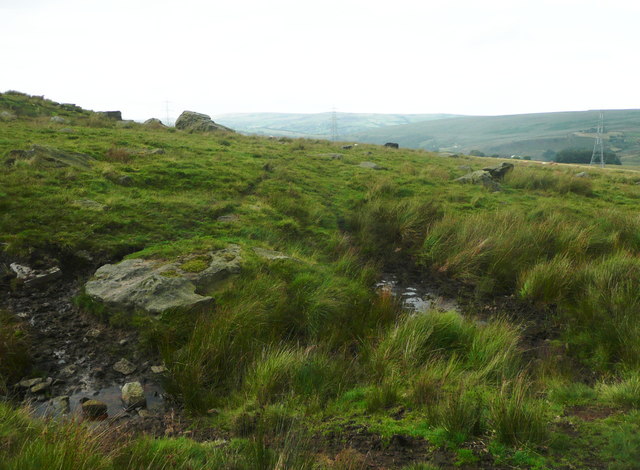
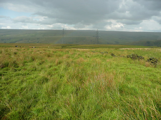
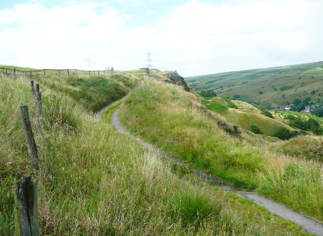
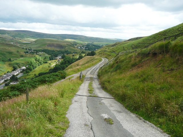
Clunter Wood Images

Images are sourced within 2km of 53.683512/-2.0949544 or Grid Reference SD9320. Thanks to Geograph Open Source API. All images are credited.

Boundary stone on Todmorden Road Marks the division of the old Littleborough Urban District and the Borough of Todmorden. Now the local authorities are Rochdale and Calderdale respectively. Or, in tribal terms, the boundary between Lancashire and Yorkshire.
Boundary stone on Todmorden Road
Marks the division of the old Littleborough Urban District and the Borough of Todmorden. Now the local authorities are Rochdale and Calderdale respectively. Or, in tribal terms, the boundary between Lancashire and Yorkshire.
Longlees Lock, Rochdale Canal Lock no 36 and the start of the summit pound.
Longlees Lock, Rochdale Canal
Lock no 36 and the start of the summit pound.
Light Hazzles Farm
Light Hazzles Farm
Shore Moor Crook Hill Wind Farm on Shore Moor.
Shore Moor
Crook Hill Wind Farm on Shore Moor.
A6033 at Steanor Bottom Toll House
View from Todmorden Road near Summit The hillside is 'access land', and also a footpath goes across the view, climbing towards the right. There are spoil heaps from quarries on the skyline. It looks to be a nice area to explore some time.
View from Todmorden Road near Summit
The hillside is 'access land', and also a footpath goes across the view, climbing towards the right. There are spoil heaps from quarries on the skyline. It looks to be a nice area to explore some time.
The breached dam of Low Slack Reservoir This reservoir is shown on the 1851 six-inch map and the caption includes "To supply the Rochdale Reservoir". The 1893 1:2500 map shows it just as it is today. Does anyone know what happened?
The breached dam of Low Slack Reservoir
This reservoir is shown on the 1851 six-inch map and the caption includes "To supply the Rochdale Reservoir". The 1893 1:2500 map shows it just as it is today. Does anyone know what happened?
View from Cuckoo Hill, Littleborough A path climbs up Allenden Hill, which is 50m higher than Cuckoo Hill, but does not have a proper summit.
View from Cuckoo Hill, Littleborough
A path climbs up Allenden Hill, which is 50m higher than Cuckoo Hill, but does not have a proper summit.
Path along the edge of the moor, Littleborough The area on the left side of the hill is Pasture House Plantation, although there are not many trees at present. It is part of what used to be Calderbrook Moor but was enclosed by 1850.
Path along the edge of the moor, Littleborough
The area on the left side of the hill is Pasture House Plantation, although there are not many trees at present. It is part of what used to be Calderbrook Moor but was enclosed by 1850.
The infant Owler Clough, next to the Rochdale Way
The Rochdale Way crossing a stream near Ferny Hill This is where the rain started, banishing thoughts of taking photographs of the rocks.
The Rochdale Way crossing a stream near Ferny Hill
This is where the rain started, banishing thoughts of taking photographs of the rocks.
Not quite on the Rochdale Way, Walsden After passing the Ferny Hill rocks I lost the footpath, so headed for the intake wall and picked my way through the rushes. The shower of rain has finished here and is crossing the valley in the distance.
Not quite on the Rochdale Way, Walsden
After passing the Ferny Hill rocks I lost the footpath, so headed for the intake wall and picked my way through the rushes. The shower of rain has finished here and is crossing the valley in the distance.
The Pennine Bridleway and Reddyshaw Scout, Walsden A 'scout' is the top of a very steep hillside, giving a view over the valley. The lumpy hills below might be spoil from the construction of the railway tunnel.
The Pennine Bridleway and Reddyshaw Scout, Walsden
A 'scout' is the top of a very steep hillside, giving a view over the valley. The lumpy hills below might be spoil from the construction of the railway tunnel.
The Pennine Bridleway joining the driveway to Reddyshore Farm, Walsden The bridleway on Reddyshaw Scout Gate comes in from the left, and from the junction the driveway is an adopted highway, at least as far as the Rochdale boundary.
The Pennine Bridleway joining the driveway to Reddyshore Farm, Walsden
The bridleway on Reddyshaw Scout Gate comes in from the left, and from the junction the driveway is an adopted highway, at least as far as the Rochdale boundary.
Boundary stone, Calderbrook Road, Todmorden / Littleborough This is similar to the stone at the boundary on the main road.
Boundary stone, Calderbrook Road, Todmorden / Littleborough
This is similar to the stone at the boundary on the main road.
Road closure, Calderbrook Road, Walsden This seems rather unnecessary, as you would have to get through a locked barrier to reach this point from Littleborough. However the defective road is in two council areas; this part is in Calderdale.
Road closure, Calderbrook Road, Walsden
This seems rather unnecessary, as you would have to get through a locked barrier to reach this point from Littleborough. However the defective road is in two council areas; this part is in Calderdale.
Quarry tracks on the hillside below Light Hazzles Quarry, Littleborough The industrial area in the foreground is on the site of Red Lees Chemical Works
Quarry tracks on the hillside below Light Hazzles Quarry, Littleborough
The industrial area in the foreground is on the site of Red Lees Chemical Works
Road subsidence, Calderbrook Road, Walsden There is more subsidence in the Littleborough part of the road.
Road subsidence, Calderbrook Road, Walsden
There is more subsidence in the Littleborough part of the road.
Show me another place!

Clunter Wood is located at Grid Ref: SD9320 (Lat: 53.683512, Lng: -2.0949544)

Unitary Authority: Calderdale

Police Authority: West Yorkshire

What 3 Words

///limp.cartoons.nurtures. Near Walsden, West Yorkshire

Related Wikis

Summit Tunnel

Summit Tunnel in England is one of the world's oldest railway tunnels. It was constructed between 1838 and 1841 by the Manchester and Leeds Railway Company...

Summit Tunnel fire

The Summit Tunnel fire occurred on 20 December 1984, when a dangerous goods train caught fire while passing through the Summit Tunnel on the railway line...

Walsden

Walsden (; WOLZ-dən) is a large village in the civil parish of Todmorden in the Metropolitan Borough of Calderdale, West Yorkshire, England. It was historically...

Walsden railway station

Walsden railway station (; WOLZ-dən) serves the village of Walsden, Todmorden in West Yorkshire, England, on the edge of the Pennines. It is served by...

Calderbrook

Calderbrook ( KAWL-dər-bruuk) is a village within the Metropolitan Borough of Rochdale, in Greater Manchester, England. It was originally part of the township...

Todmorden Unitarian Church

Todmorden Unitarian Church is a Unitarian church located in Honey Hole Road, Todmorden, West Yorkshire, England (grid reference SD935239). Built in honour...

Dobroyd Castle

Dobroyd Castle is an important historic building above the town of Todmorden, West Yorkshire, England. It was built for John Fielden, local mill owner...

Mankinholes

Mankinholes is a hamlet in the Metropolitan Borough of Calderdale, in West Yorkshire, England. It is situated in the Pennines and the nearest town is Todmorden...

Nearby Amenities

Located within 500m of 53.683512,-2.0949544
Seamark Type: gate
Waterway: lock_gate
Lat/Long: 53.6842841/-2.0914287
Seamark Type: gate
Waterway: lock_gate
Lat/Long: 53.6879495/-2.0954143
Seamark Type: gate
Waterway: lock_gate
Lat/Long: 53.6854151/-2.0931567
Seamark Type: gate
Waterway: lock_gate
Lat/Long: 53.6852598/-2.0928806
Seamark Type: gate
Waterway: lock_gate
Lat/Long: 53.6840959/-2.0912525
Bus Stop
Rochdale Road
Bench: no
Bin: no
Bus: yes
Local Ref: 45018948
Naptan AtcoCode: 450018948
Naptan Bearing: NW
Naptan CommonName: Rochdale Road
Naptan Crossing: Allescholes Road
Naptan Indicator: Stop 45018948
Naptan PlusbusZoneRef: LEEDS
Naptan ShortCommonName: Allescholes Road
Naptan Street: Rochdale Road
Naptan Verified: no
Public Transport: platform
Shelter: no
Source: naptan_import
Tactile Paving: no
Lat/Long: 53.6869257/-2.0976522
Bus Stop
Rochdale Road Allescholes Road
Bus: yes
Local Ref: 45018949
Naptan AtcoCode: 450018949
Naptan Bearing: SE
Naptan CommonName: Rochdale Road Allescholes Road
Naptan Crossing: Allescholes Road
Naptan Indicator: Stop 45018949
Naptan PlusbusZoneRef: LEEDS
Naptan ShortCommonName: Allescholes Road
Naptan Street: Rochdale Road
Naptan Verified: no
Public Transport: platform
Source: naptan_import
Lat/Long: 53.6868633/-2.0969858
Bus Stop
Rochdale Road
Bus: yes
Local Ref: 45018950
Naptan AtcoCode: 450018950
Naptan Bearing: NW
Naptan CommonName: Rochdale Road
Naptan Crossing: Dean Royd Road
Naptan Indicator: Stop 45018950
Naptan PlusbusZoneRef: LEEDS
Naptan ShortCommonName: Dean Royd Road
Naptan Street: Rochdale Road
Naptan Verified: no
Public Transport: platform
Source: naptan_import
Lat/Long: 53.6847082/-2.0943766
Bus Stop
Rochdale Road
Bus: yes
Local Ref: 45018951
Naptan AtcoCode: 450018951
Naptan Bearing: SE
Naptan CommonName: Rochdale Road
Naptan Crossing: Dean Royd Road
Naptan Indicator: Stop 45018951
Naptan PlusbusZoneRef: LEEDS
Naptan ShortCommonName: Dean Royd Road
Naptan Street: Rochdale Road
Naptan Verified: no
Public Transport: platform
Source: naptan_import
Lat/Long: 53.6845647/-2.0940129
Bus Stop
Rochdale Road
Bus: yes
Local Ref: 45018952
Naptan AtcoCode: 450018952
Naptan Bearing: NW
Naptan CommonName: Rochdale Road
Naptan Crossing: Top o The Close Road
Naptan Indicator: Stop 45018952
Naptan PlusbusZoneRef: LEEDS
Naptan ShortCommonName: Top O The Close Rd
Naptan Street: Rochdale Road
Naptan Verified: no
Public Transport: platform
Shelter: yes
Source: naptan_import
Lat/Long: 53.6835232/-2.0925419
Bus Stop
Rochdale Road
Bus: yes
Local Ref: 45018953
Naptan AtcoCode: 450018953
Naptan Bearing: E
Naptan CommonName: Rochdale Road
Naptan Crossing: Bottomley Road
Naptan Indicator: Stop 45018953
Naptan PlusbusZoneRef: LEEDS
Naptan ShortCommonName: Bottomley Road
Naptan Street: Rochdale Road
Naptan Verified: no
Public Transport: platform
Source: naptan_import
Lat/Long: 53.6835146/-2.0920119
Bus Stop
Rochdale Road
Bus: yes
Local Ref: 45018954
Naptan AtcoCode: 450018954
Naptan Bearing: NW
Naptan CommonName: Rochdale Road
Naptan Crossing: Top O The Close Road
Naptan Indicator: Stop 45018954
Naptan Landmark: Stone House Bridge
Naptan PlusbusZoneRef: LEEDS
Naptan ShortCommonName: Stone House Bridge
Naptan Street: Rochdale Road
Naptan Verified: no
Public Transport: platform
Source: naptan_import
Lat/Long: 53.6825182/-2.0902686
Bus Stop
Rochdale Road
Bus: yes
Local Ref: 45018955
Naptan AtcoCode: 450018955
Naptan Bearing: SW
Naptan CommonName: Rochdale Road
Naptan Crossing: Top O The Close Road
Naptan Indicator: Stop 45018955
Naptan Landmark: Stone House Bridge
Naptan PlusbusZoneRef: LEEDS
Naptan ShortCommonName: Stone House Bridge
Naptan Street: Rochdale Road
Naptan Verified: no
Public Transport: platform
Source: naptan_import
Lat/Long: 53.6824735/-2.0899656
Crossing
Lat/Long: 53.6823315/-2.0899079
Crossing
Bicycle: yes
Horse: yes
Segregated: no
Lat/Long: 53.6819949/-2.0894625
Ford: yes
Lat/Long: 53.6845528/-2.0879169
Turning Circle
Lat/Long: 53.6828919/-2.0918231
Turning Circle
Lat/Long: 53.6828044/-2.0917022
Railway: crossing
Lat/Long: 53.6871061/-2.0963833
Railway: crossing
Lat/Long: 53.6871269/-2.096334
The data included in this document is from www.openstreetmap.org. The data is made available under ODbL.

Have you been to Clunter Wood?

Leave your review of Clunter Wood below (or comments, questions and feedback).