Clennell Wood

Wood, Forest in Northumberland

England

Clennell Wood

Clennel Street Clennell Street was an important trading route that was used for many centuries linking Morpeth with Kelso. This view is taken soon after leaving Alwinton.
<span class="nowrap"><a title="http://www.border-roads.org/the-roads/clennell-street/map1/" rel="nofollow ugc noopener" href="http://www.border-roads.org/the-roads/clennell-street/map1/">Link</a><img style="margin-left:2px;" alt="External link" title="External link - shift click to open in new window" src="https://s1.geograph.org.uk/img/external.png" width="10" height="10"/></span>
Clennel Street Credit: Russel Wills

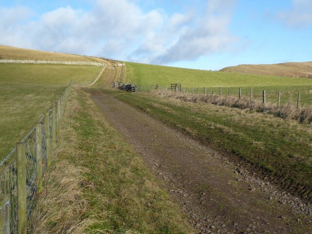
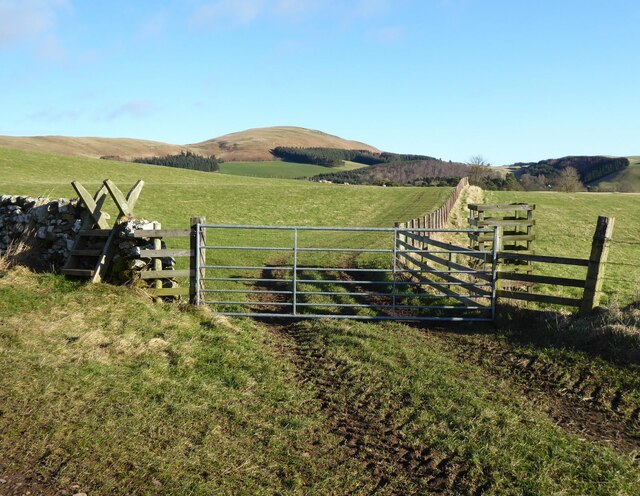
Clennell Wood is a picturesque forest located in the county of Northumberland, England. Covering an area of approximately 3,000 acres, it is one of the largest and most diverse woodlands in the region. The wood is situated within the Northumberland National Park, which adds to its scenic beauty and natural surroundings.

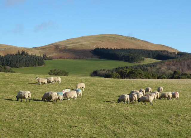
The woodland is primarily composed of mixed deciduous and coniferous trees, providing a rich and vibrant habitat for a variety of wildlife. Ancient oaks, beeches, and birch trees dominate the landscape, while spruces and firs add a touch of evergreen charm. The forest floor is adorned with a carpet of bluebells and wildflowers during springtime, creating a magical atmosphere for visitors.

Clennell Wood offers an array of recreational activities for nature enthusiasts and outdoor adventurers. There are numerous walking trails and paths that wind through the woodland, offering opportunities for leisurely strolls or more challenging hikes. The forest is also a popular spot for mountain biking, with designated trails catering to all skill levels.

Wildlife enthusiasts will be delighted by the diverse fauna found within Clennell Wood. Red squirrels, roe deer, and various bird species, including woodpeckers and owls, are commonly spotted throughout the area. The wood is also home to the rare pearl-bordered fritillary butterfly, which thrives in the wildflower meadows.

Conveniently located near the village of Alwinton, Clennell Wood offers a tranquil escape from the hustle and bustle of city life. Its natural beauty, diverse ecosystem, and range of outdoor activities make it a popular destination for both locals and tourists seeking to immerse themselves in the enchanting Northumberland countryside.

If you have any feedback on the listing, please let us know in the comments section below.

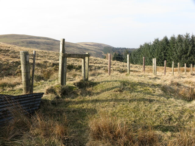
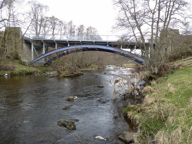
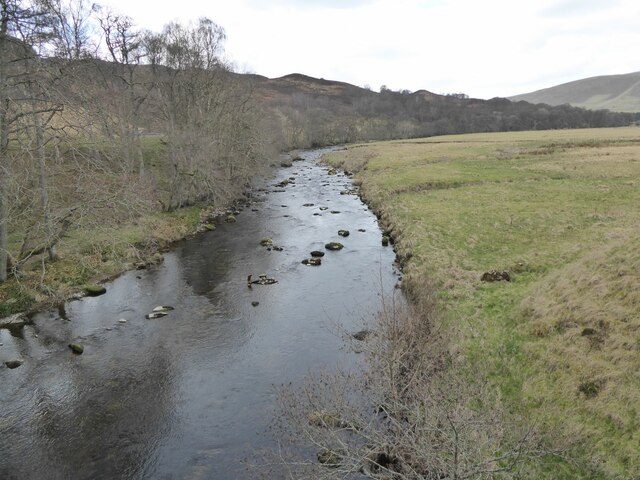
Clennell Wood Images

Images are sourced within 2km of 55.360154/-2.1092845 or Grid Reference NT9307. Thanks to Geograph Open Source API. All images are credited.

Clennel Street Clennell Street was an important trading route that was used for many centuries linking Morpeth with Kelso. This view is taken soon after leaving Alwinton.
<span class="nowrap"><a title="http://www.border-roads.org/the-roads/clennell-street/map1/" rel="nofollow ugc noopener" href="http://www.border-roads.org/the-roads/clennell-street/map1/">Link</a><img style="margin-left:2px;" alt="External link" title="External link - shift click to open in new window" src="https://s1.geograph.org.uk/img/external.png" width="10" height="10"/></span>
Clennel Street
Clennell Street was an important trading route that was used for many centuries linking Morpeth with Kelso. This view is taken soon after leaving Alwinton. LinkExternal link
Leaving Clennel Street heading towards Clennel Through sheep pastures.
Silverton Hill above the coniferous forest.
Leaving Clennel Street heading towards Clennel
Through sheep pastures. Silverton Hill above the coniferous forest.
Sheep in pasture above Clennel Silverton Hill in the background.
Sheep in pasture above Clennel
Silverton Hill in the background.
The River Alwin At Clennel.
The footbridge links to a public footpath.
The River Alwin
At Clennel. The footbridge links to a public footpath.
Clennell Street Identified on William Roy's 18th century map as the 'Road from Morpeth to Kelso', the origins of this cross-border track are far more ancient, with evidence of Iron Age and Bronze Age activity along the route. Close to this spot there is evidence of two Romano-British settlements as well as a cross dyke. For a selection of detailed free to download walking routes in the area visit <span class="nowrap"><a title="www.cheviotwalks.co.uk" rel="nofollow ugc noopener" href="http://www.cheviotwalks.co.uk">Link</a><img style="margin-left:2px;" alt="External link" title="External link - shift click to open in new window" src="https://s1.geograph.org.uk/img/external.png" width="10" height="10"/></span>
Clennell Street
Identified on William Roy's 18th century map as the 'Road from Morpeth to Kelso', the origins of this cross-border track are far more ancient, with evidence of Iron Age and Bronze Age activity along the route. Close to this spot there is evidence of two Romano-British settlements as well as a cross dyke. For a selection of detailed free to download walking routes in the area visit LinkExternal link
Fence near Uplaw Knowe This fence, which lies adjacent to Clennell Street, also acts as a boundary fence for the nearby plantation. The two hills in the background are, to the right, Green Side, and to the left Lord's Seat. For a selection of detailed free to download walking routes in the area visit <span class="nowrap"><a title="www.cheviotwalks.co.uk" rel="nofollow ugc noopener" href="http://www.cheviotwalks.co.uk">Link</a><img style="margin-left:2px;" alt="External link" title="External link - shift click to open in new window" src="https://s1.geograph.org.uk/img/external.png" width="10" height="10"/></span>
Fence near Uplaw Knowe
This fence, which lies adjacent to Clennell Street, also acts as a boundary fence for the nearby plantation. The two hills in the background are, to the right, Green Side, and to the left Lord's Seat. For a selection of detailed free to download walking routes in the area visit LinkExternal link
Cairn marking summit of Lord's Seat This small cairn marks the 392 metre high top of Lord's Seat. When the first edition of the Ordnance Survey Six-Inch map of the area was published in 1866, this cairn was not marked on it suggesting that this is a much later addition to the landscape rather than a shepherd's cairn like many others in the area. This is the same cairn as is shown in my photo at <a title="https://www.geograph.org.uk/photo/1307376" href="https://www.geograph.org.uk/photo/1307376">Link</a> although in the 13 years since that photo was taken the cairn has reduced in size. For a selection of detailed free to download walking routes in the area visit <span class="nowrap"><a title="www.cheviotwalks.co.uk" rel="nofollow ugc noopener" href="http://www.cheviotwalks.co.uk">Link</a><img style="margin-left:2px;" alt="External link" title="External link - shift click to open in new window" src="https://s1.geograph.org.uk/img/external.png" width="10" height="10"/></span>
Cairn marking summit of Lord's Seat
This small cairn marks the 392 metre high top of Lord's Seat. When the first edition of the Ordnance Survey Six-Inch map of the area was published in 1866, this cairn was not marked on it suggesting that this is a much later addition to the landscape rather than a shepherd's cairn like many others in the area. This is the same cairn as is shown in my photo at Link although in the 13 years since that photo was taken the cairn has reduced in size. For a selection of detailed free to download walking routes in the area visit LinkExternal link
Sheepfold alongside the Hosedon Burn Sheepfolds in this neck of the woods are called sheep stells and are invariably circular in construction. This particular one, which now seems to have fallen into disuse, was shown on the first edition of the Ordnance Survey Six-Inch map of the area published in 1866 indicating that it is now over 150 years old. For a selection of detailed free to download walking routes in the area visit <span class="nowrap"><a title="www.cheviotwalks.co.uk" rel="nofollow ugc noopener" href="http://www.cheviotwalks.co.uk">Link</a><img style="margin-left:2px;" alt="External link" title="External link - shift click to open in new window" src="https://s1.geograph.org.uk/img/external.png" width="10" height="10"/></span>
Sheepfold alongside the Hosedon Burn
Sheepfolds in this neck of the woods are called sheep stells and are invariably circular in construction. This particular one, which now seems to have fallen into disuse, was shown on the first edition of the Ordnance Survey Six-Inch map of the area published in 1866 indicating that it is now over 150 years old. For a selection of detailed free to download walking routes in the area visit LinkExternal link
Fine lime kiln beside the track to Park House Overlooking the River Coquet.
Fine lime kiln beside the track to Park House
Overlooking the River Coquet.
Low Alwinton kilns Well maintained or beautifully restored they were built about 1827 by the Selby family and had ceased to work by 1866.
Low Alwinton kilns
Well maintained or beautifully restored they were built about 1827 by the Selby family and had ceased to work by 1866.
Alwinton Bridge over the River Coquet 'A good-looking steel-arch bridge about half a mile south of the village, it replaced an earlier bridge when the road was widened. Painted in attractive colours the bridge blends well with the surrounding countryside.' 
<span class="nowrap"><a title="https://www.bridgesonthetyne.co.uk/alwinton.html" rel="nofollow ugc noopener" href="https://www.bridgesonthetyne.co.uk/alwinton.html">Link</a><img style="margin-left:2px;" alt="External link" title="External link - shift click to open in new window" src="https://s1.geograph.org.uk/img/external.png" width="10" height="10"/></span>
Constructed in 1937 with steel arch and stone abutments.
Alwinton Bridge over the River Coquet
'A good-looking steel-arch bridge about half a mile south of the village, it replaced an earlier bridge when the road was widened. Painted in attractive colours the bridge blends well with the surrounding countryside.' LinkExternal link Constructed in 1937 with steel arch and stone abutments.
The River Coquet upstream from Alwinton Bridge The river loops around the Angry Haugh.
The River Coquet upstream from Alwinton Bridge
The river loops around the Angry Haugh.
The Church of St Michael & All Angels, Alwinton
Ordnance Survey 1GL Bolt This OS Bolt can be found on a buttress of St Michael's Church. It marks a point 153.927m above mean sea level.
Ordnance Survey 1GL Bolt
This OS Bolt can be found on a buttress of St Michael's Church. It marks a point 153.927m above mean sea level.
Rose and Thistle, Alwinton
Footpath leading to Old Rookland
View towards Clennell Hall Great tree patterns
View towards Clennell Hall
Great tree patterns
Footpath back to Alwinton
Show me another place!

Clennell Wood is located at Grid Ref: NT9307 (Lat: 55.360154, Lng: -2.1092845)

Unitary Authority: Northumberland

Police Authority: Northumbria

What 3 Words

///tuck.worldwide.rotate. Near Rochester, Northumberland

Nearby Locations

Cote Law Clennell Wood

Related Wikis

Clennell Hall

Clennell Hall is an historic manor house, now operated as a country hotel, situated at Clennell, near Alwinton, Northumberland, England. It is a Grade...

Clennell, Northumberland

Clennell is a small village and as Clennel, a former civil parish, now in the parish of Alwinton, in Northumberland, England. It is about 1 mile (1.6 km...

Alwinton

Alwinton (previously named "Allenton" and sometimes still referred to as this) is a village and former parish in Northumberland, England. Alwinton is named...
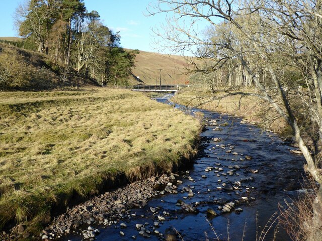
River Alwin

The River Alwin is a short, steep upland river that drains the Kidland Forest on the southern flanks of the Cheviot Hills, in the Northumberland National...

Nearby Amenities

Located within 500m of 55.360154,-2.1092845
Clennell Hall Country House
Addr City: Clennell
Addr Postcode: NE65 7BG
Phone: +44 1669 650377
Tourism: hotel
Website: https://www.clennellhallcountryhouse.com/
Lat/Long: 55.3584898/-2.113509
Bar
Clennall Hall
Addr Postcode: NE65 7BG
Website: http://www.clennellhall.co.uk/
Wifi: free
Lat/Long: 55.3583998/-2.1135174
Restaurant
Clennall Hall
Addr Housename: Clennal Hall Hotel
Cuisine: regional
Lat/Long: 55.3582918/-2.1134655
Clennell hall hotel
Addr City: Clennell
Addr County: Northumberland
Addr Postcode: NE65 7BG
Fhrs Id: 288214
Shop: convenience
Lat/Long: 55.3582351/-2.1142261
Cote Law
Place: locality
Lat/Long: 55.3605917/-2.1065637
Power: pole
Lat/Long: 55.3574241/-2.1145849
Barrier: cattle_grid
Lat/Long: 55.3573275/-2.1134194
Man Made: tower
Tower Type: communication
Lat/Long: 55.3620783/-2.1144264
Post Box
Ref: NE65 170
Lat/Long: 55.3580872/-2.1140518
Direction: SSW
Generator Method: photovoltaic
Generator Output Electricity: yes
Generator Solar Modules: 14
Generator Source: solar
Generator Type: solar_photovoltaic_panel
Location: roof
Power: generator
Lat/Long: 55.3591548/-2.1065567
Entrance: main
Lat/Long: 55.3583192/-2.1136428
The data included in this document is from www.openstreetmap.org. The data is made available under ODbL.

Have you been to Clennell Wood?

Leave your review of Clennell Wood below (or comments, questions and feedback).